Pictures of the Week 2010-18
Hello All,
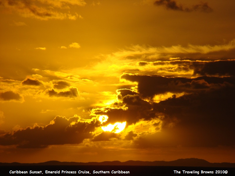
Out of Fort Lauderdale the ship maintained a south easterly-heading through the Florida Straits before entering the Old Bahamas Channel, which lies between the north eastern shores of Cuba and the Great Bahamas Bank. We paralleled the Cuban coastline for most of the day and were treated to a lovely golden sunset to round off our first day at sea.
Out of Fort Lauderdale the ship maintained a south easterly-heading through the Florida Straits before entering the Old Bahamas Channel, which lies between the north eastern shores of Cuba and the Great Bahamas Bank. We paralleled the Cuban coastline for most of the day and were treated to a lovely golden sunset to round off our first day at sea.
During the evening hours our
course was altered to the south to transit the Windward Passage. This passage
is the stretch of water which lies between the eastern most region of Cuba and
northwest Haiti. It is 43 nautical miles wide and has a depth of around 5,600
feet. Once clear of the passage, our course was set south westerly towards the
western tip of Hispaniola. Hispaniola is the second most populated island of
the Antilles and lies between Cuba & Puerto Rico. Christopher Columbus
arrived there in 1492 and eventually founded the first Spanish colony of the
New World on the island. Hispaniola or “Ayiti” which is an indigenous name that
means “Land of High Mountains” comprises two countries, Haiti & the Dominican
Republic. Once abeam Cape Dame Marie the ship was set on a south easterly
heading bound for Aruba.
Our early morning hours were spent getting our exercise by walking around the ship on the Promenade Deck followed by a healthy breakfast. We loved all the fresh fruit choices.
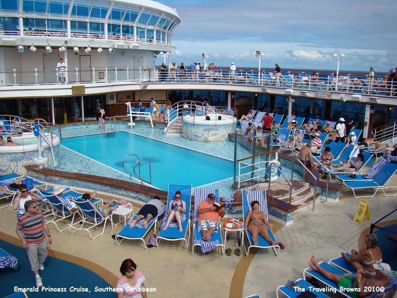
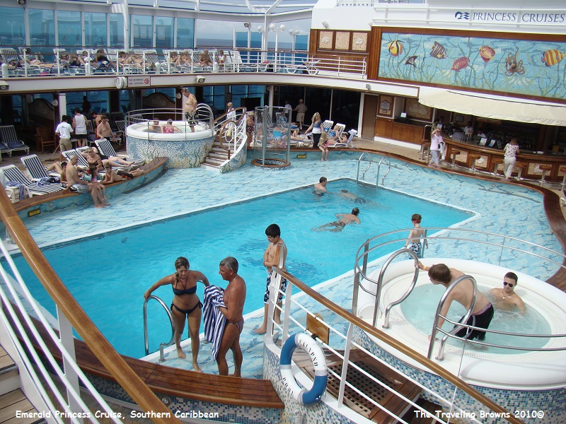
People were relaxing around the pools during the daytime while at sea--swimming, sunbathing, playing cards, reading, and dining. It is a great way to just kick back. The warm tropical air is pretty amazing in the month of November.
Our early morning hours were spent getting our exercise by walking around the ship on the Promenade Deck followed by a healthy breakfast. We loved all the fresh fruit choices.
People were relaxing around the pools during the daytime while at sea--swimming, sunbathing, playing cards, reading, and dining. It is a great way to just kick back. The warm tropical air is pretty amazing in the month of November.
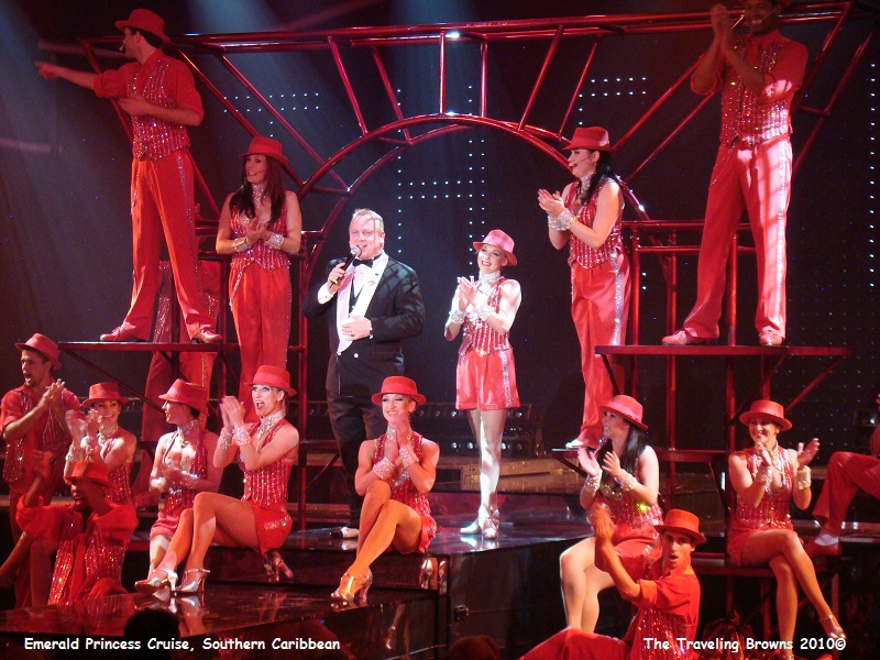
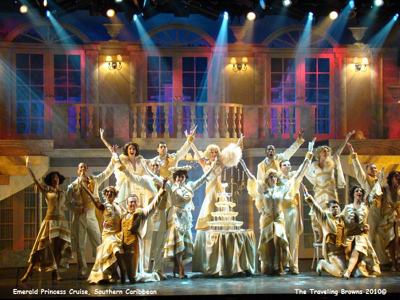
Many choices were available
during the evening after dining, including but not limited to a production show
in the theater, taking your chances in the casino, a movie under the stars,
dancing in one of the many lounges, etc. We generally took in the variety show
in the main theater. They included dancing and singing with beautiful
costuming, and provided new and different entertainment each night.
After two days at sea our
first port of call was Oranjestad, Aruba. Aruba has a fascinating history--one
that has been colored by warring European colonizers, a boom-and-bust economy,
and the creation of a new language. The unique language, Papiamento, is
something of which Arubians are especially proud. It is a unique combination of
Portuguese, Spanish, Dutch, English, African and Indian words. It is spoken
only on the Dutch “ABC” islands of Aruba, Bonaire and Curacao.
Alonso de Ojeda claimed Aruba for the Spanish Crown in 1499. In 1634, near the culmination of their 80-year war with Spain, the Dutch took over the island. Aruba is part of the Dutch Commonwealth and had its “Status Aparte” in 1986.
Gold was discovered on the island in 1824 and mined successfully until 1913. As the yield turned meager and mining became unprofitable, the aloe plant became the primary agricultural crop. The island soon became the world’s leading aloe producer. In 1959, tourists discovered Aruba’s perfect beaches and incredibly clear aqua-blue waters, ensuring prosperity for the foreseeable future.
Greeting us for our early morning arrival in Oranjestad were threatening skies. For those of you unfamiliar with rain in the tropics when Mother Nature decides it’s time to rain, it generally pours!
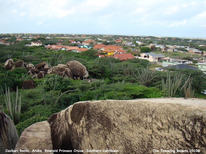
At the dock we caught our bus for the shore excursion we had booked. The first stop was Ayo & Casibari Rocks. These huge boulders rise above the desert landscape giving a panoramic view of the island. They are located amidst cacti and have unusual shapes. There is no plausible explanation yet for the presence of these wind-carved boulder formations in the middle of a mostly flat sandy island.
Alonso de Ojeda claimed Aruba for the Spanish Crown in 1499. In 1634, near the culmination of their 80-year war with Spain, the Dutch took over the island. Aruba is part of the Dutch Commonwealth and had its “Status Aparte” in 1986.
Gold was discovered on the island in 1824 and mined successfully until 1913. As the yield turned meager and mining became unprofitable, the aloe plant became the primary agricultural crop. The island soon became the world’s leading aloe producer. In 1959, tourists discovered Aruba’s perfect beaches and incredibly clear aqua-blue waters, ensuring prosperity for the foreseeable future.
Greeting us for our early morning arrival in Oranjestad were threatening skies. For those of you unfamiliar with rain in the tropics when Mother Nature decides it’s time to rain, it generally pours!
At the dock we caught our bus for the shore excursion we had booked. The first stop was Ayo & Casibari Rocks. These huge boulders rise above the desert landscape giving a panoramic view of the island. They are located amidst cacti and have unusual shapes. There is no plausible explanation yet for the presence of these wind-carved boulder formations in the middle of a mostly flat sandy island.
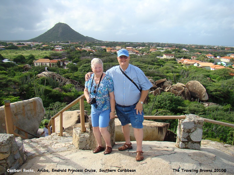
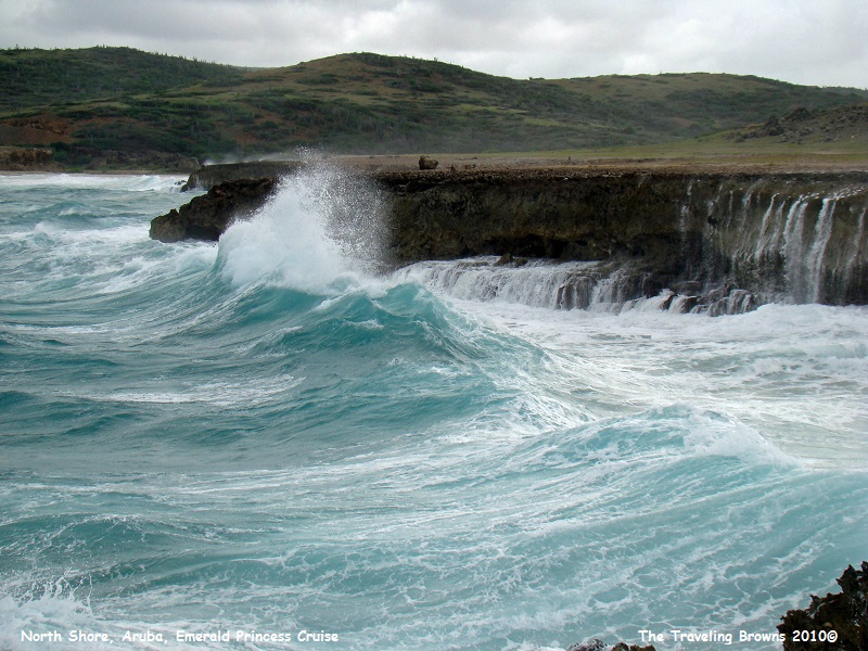
Notice how we are braced in
the following photo. The wind was about to blow us off the rock! The nice thing
was that it was a warm wind.
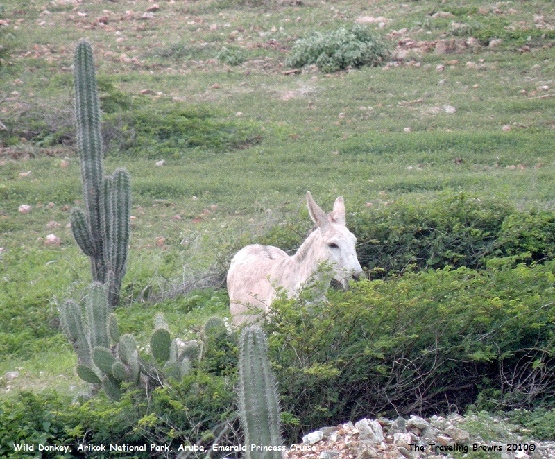
Our excursion next took us
through Arikok National Park. The park is home to spectacular cacti, flora and
fauna that flourish in this desert-like environment. Along with the wind-swept
divi-divi trees, wild donkeys and iguanas also live here.
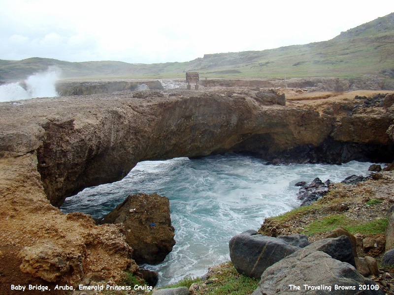
Our tour also went to rock and
coral formations called Natural and Baby Bridges. Natural Bridge fell into the
sea in 2005, but the smaller Baby Bridge remains. They are located on the
windward side of the island where the surf was really pounding the day we
visited.
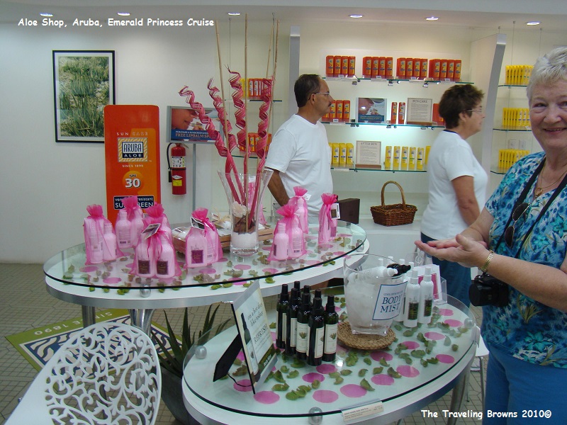
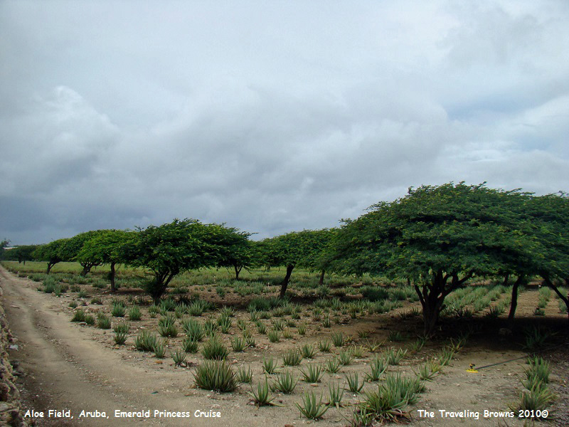
We then traveled to the Aruba
Aloe Factory and were provided a tour of the factory. The tour surprisingly
ended in a shop selling their products--go figure! Surrounding the factory were
fields of aloe plants.
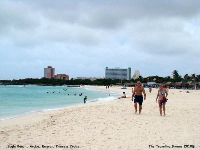
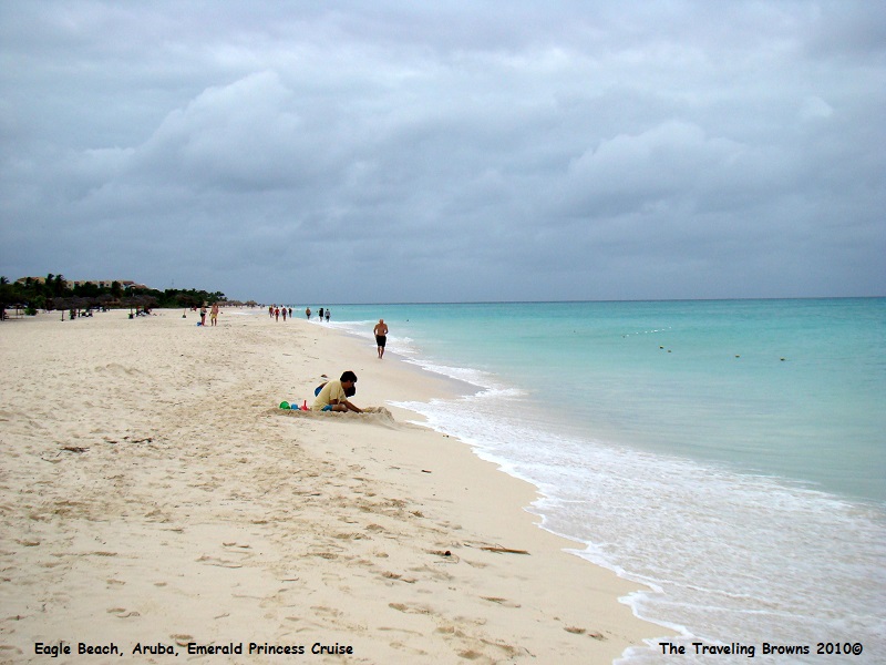
Our last stop on the tour was
Eagle Beach. It lies on the leeward side of the island. We were surprised at
the number of people enjoying the water on such a stormy day. The warm air and
tepid water makes all the difference.
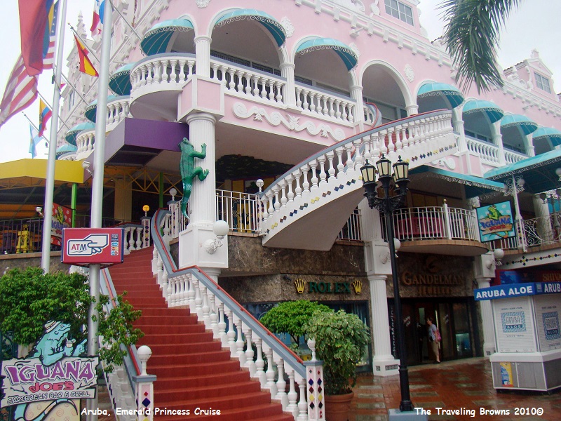
After
our excursion bus arrived back at the dock we had a couple of hours before our
ship was scheduled to cast off. So we decided to chance the weather and walk
into town. The sky was steadily getting darker. We no more than got downtown
when it started to rain. Then the sky opened up and it started pouring buckets.
We did manage to get a couple of photos before it got too bad. Note: very few
people are walking the downtown streets, because it was Sunday and most of the
shops were closed.
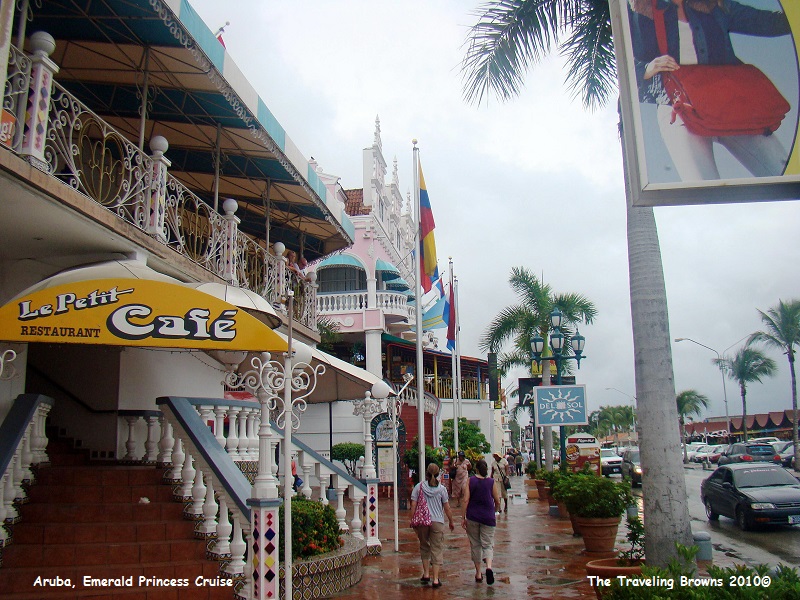
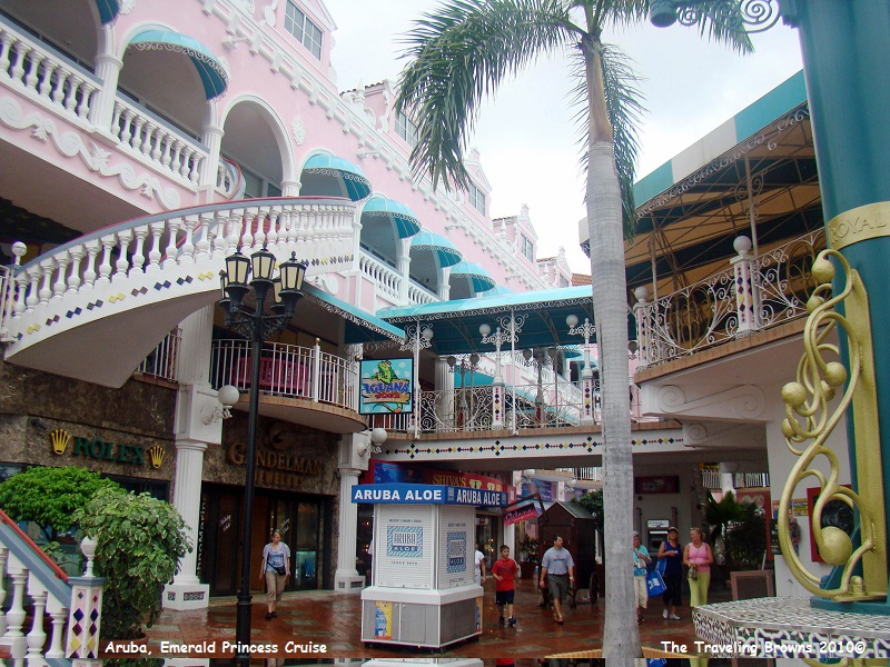
The Dutch love bright colors,
and so do we. It is too bad the weather didn’t cooperate because the photo
opportunities downtown were endless--maybe next time.
After making it back to the
ship we reflected back on the wonderful day we had at our first port of call.
It was fantastic, bad weather and all. We were anxiously looking forward to our
next port of call--Curacao.
Until next time,
Dave & Barb
The Traveling Browns
Until next time,
Dave & Barb
The Traveling Browns
