Pictures of the Week 2008-23
Hello All,
Our next jaunt out of Page, AZ was to the North Rim of Grand Canyon National Park. Some may ask why we didn’t go from the South Rim to the North Rim when we were at the park a while back. As the crow flies it is only ten miles between the lodges on the North and South Rims. However, by road it is over 215 miles between the two! The North Rim is only open from mid May until October. Since it is 1,000 feet higher than the South Rim the road gets closed due to snow in the winter.
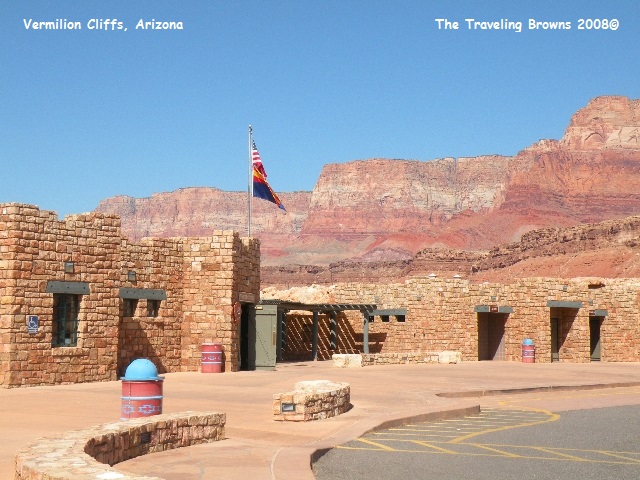
Enroute to the park we stopped for a break at Navajo Bridge Interpretive Center at Marble Canyon, AZ. This is where the first bridge across the Colorado River was completed in 1929. The back drop is the Vermilion Cliffs that stretch for fifty miles. This is some very rugged country.
Our next jaunt out of Page, AZ was to the North Rim of Grand Canyon National Park. Some may ask why we didn’t go from the South Rim to the North Rim when we were at the park a while back. As the crow flies it is only ten miles between the lodges on the North and South Rims. However, by road it is over 215 miles between the two! The North Rim is only open from mid May until October. Since it is 1,000 feet higher than the South Rim the road gets closed due to snow in the winter.
Enroute to the park we stopped for a break at Navajo Bridge Interpretive Center at Marble Canyon, AZ. This is where the first bridge across the Colorado River was completed in 1929. The back drop is the Vermilion Cliffs that stretch for fifty miles. This is some very rugged country.
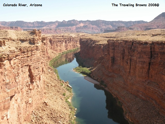
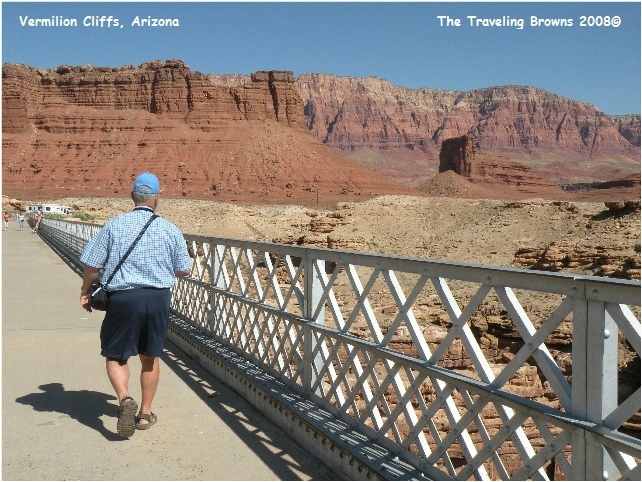
A new bridge has since been
built so the original bridge is now used as an observation walkway for
visitors. Prior to the building of
Navajo Bridge the only place settlers could cross the Colorado River was Lee’s
Ferry about 10 miles away. There was no other easy crossing for hundreds of
miles. Looking at Marble Canyon from the bridge it is easy to see why it was no
easy task to get across the river.
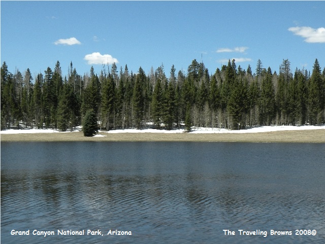
Upon entering Grand Canyon
National Park the road climbed and the terrain changed from a high desert
plateau to Ponderosa Pine forests. It
was truly lovely. There were patches of snow on the ground and the Aspen had not yet leafed out.
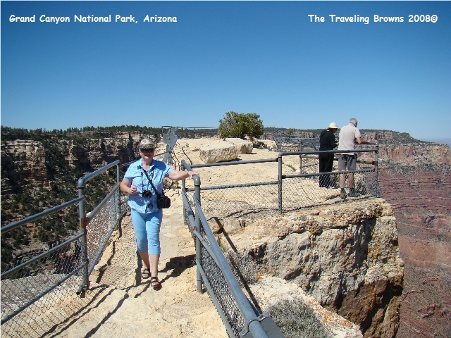
We stopped at all the viewpoints and hiked some
of the trails on the rim. A trail we
thoroughly enjoyed was called the Cape Royal Trail. It was a fairly easy walk on a paved trail
that provided outstanding views of the canyon, Angels Window, and the Colorado
River.
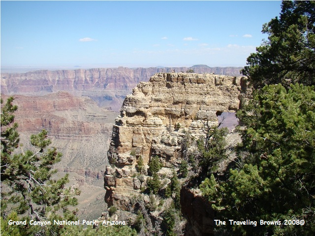
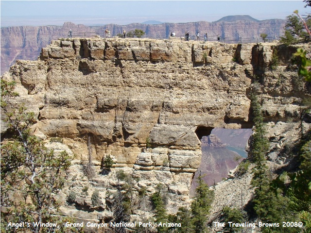
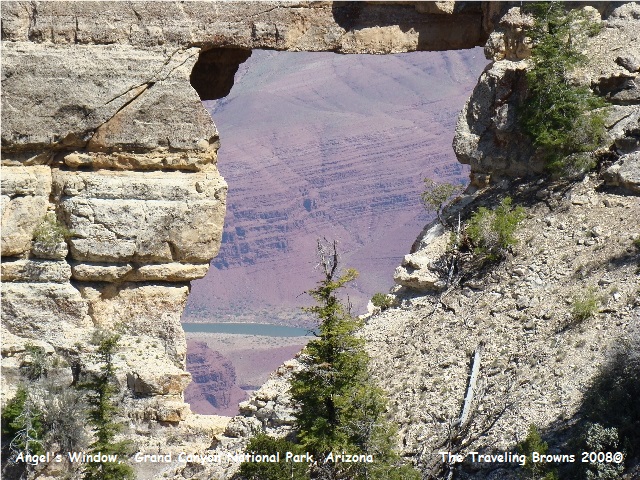
The trail ends on a narrow
rock formation after passing over Angels Window. There are sheer drop offs on both sides of
the trail. Wonderful scenic views, but a
little spooky for those of us who don’t like heights!
After returning to the RV and a good nights
sleep we were off and running again. Our
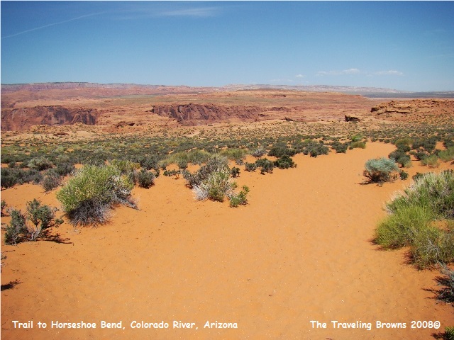
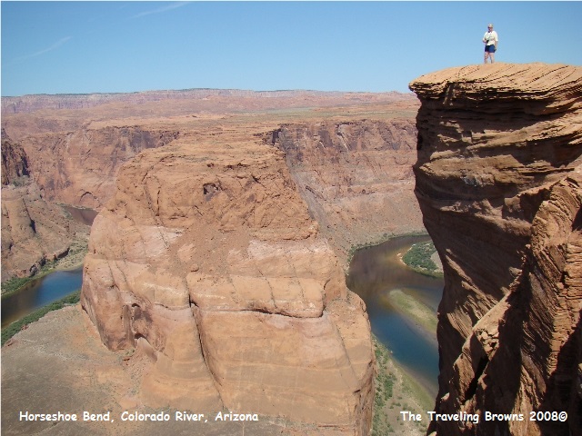
next trek was to Horseshoe Bend. The
hike into the bend is not real long, but it is on a sand trail that goes up and
then back down to the canyon’s edge overlooking the river. Since the best time
to photograph the bend is mid day the 90 degree temperatures took their toll on
us.
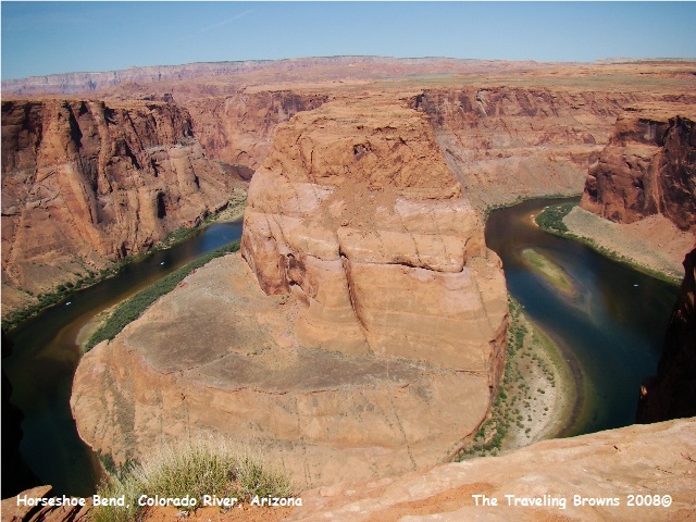
There are many twists and
turns in the Colorado River, but Horseshoe Bend is one amazing twist of nearly
270 degrees!! Capturing this majestic
bend with a camera was a real challenge.
You have to stand on a sheer cliff with no guard rails!!
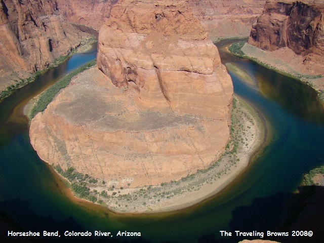
To give you a little perspective of how high up
we are, the three bluish white dots you see (two left & one right) on the
river in this next photo are large triple tube rafts holding twenty passengers
each!! Hard to believe isn’t it.
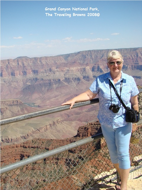
This photo of Barb helps with
perspective also. Without a doubt this
is an awesome awesome place!! If you get
a chance it is worth the hike.
Until next time,
Dave & Barb
The Traveling Browns
Dave & Barb
The Traveling Browns
