2011-46 Pictured Rocks National Lakeshore, Michigan
Hello
All,
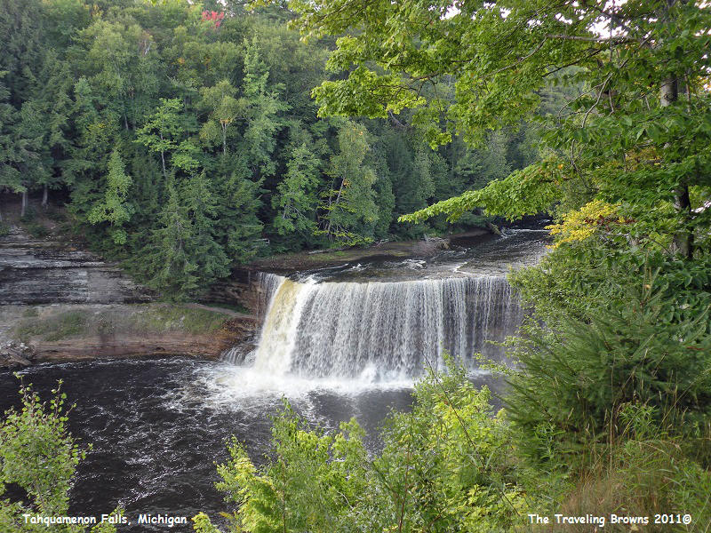
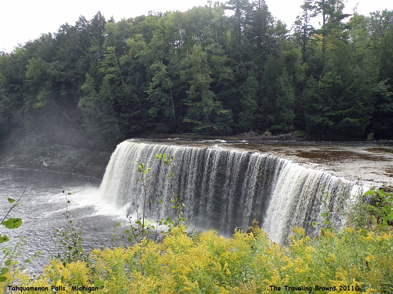
Our next adventure in Michigan’s Upper Peninsula was the Upper Falls at Tahquamenon Falls State Park. The Upper Falls are more than 200 feet across and have a drop of approximately 50 feet. During the late spring runoff, the Tahquamenon River drains as much as 50,000 US gallons of water per second, making the Upper Falls the third most voluminous vertical waterfall east of the Mississippi River, after Niagara Falls and Cohoes Falls, both in New York.
By the time we left the parking lot to walk to the Upper Falls it was mid afternoon. We were in no hurry, as it was a lovely blue sky day with a few white puffy clouds. We casually walked the half-mile distance leading to the river, stopping here and there to take in everything Mother Nature had to offer. It was wonderful with a relaxing temperature of 70 degrees.
When we got our first glimpse of the falls it was very picturesque. There was still a good flow of water going over it for the fall season. We stopped and took a few photos. However, we were a good distance from the falls and were quite high above it.
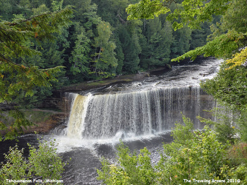
Wanting
closer photos, we hiked another quarter mile down the trail till we came to about
100 stairs that went down to an observation point just above the falls—perfect.
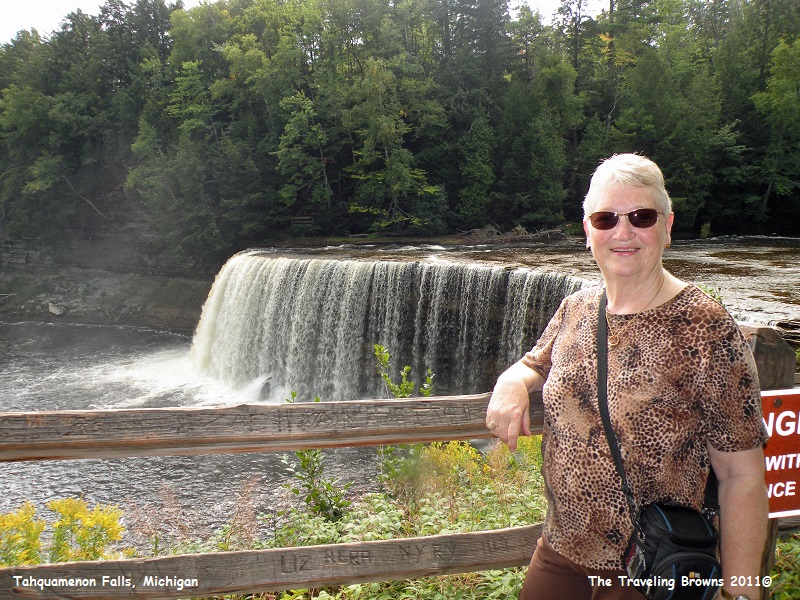
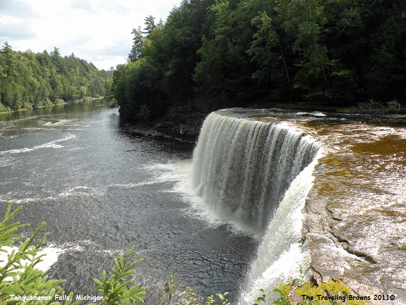
We followed the stairs down to the large observation deck which stretched along
the river quite a ways. We were like kids in a candy store snapping photos from
the many different angles. We surely do enjoy our little adventures.
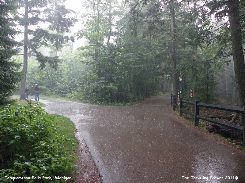
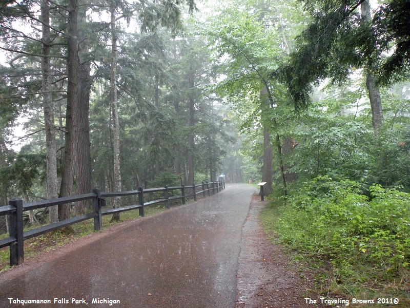
In
our enthusiasm we failed to notice that our blue sky day was suddenly filling
with clouds and they were getting mighty dark. And then it started to sprinkle
a bit. Nothing to worry about though right—wrong! Thunder started cracking first
in the distance, and then much closer, and it began raining. We climbed up the
stairs to the path and started working our way back to the car. At first we
went from tree to tree in an attempt to stay dry. But, as the rain started
getting worse we put the cameras in the cases, tucked our tails between our
legs and made a beeline for the car. To say we got soaked would be an
understatement, but as we say, “We made a memory.”
After
a good night’s sleep we were off and running the next morning. Our target
destination was the town of Munising, Michigan, located on the south shore of
Lake Superior. We had three things in mind for our visit to the area--tour
Picture Rocks National Lakeshore; check out Munising Falls; and sample a pasty
(pronounced pass-tee).
Friends of ours who visited the area earlier in the month had advised us that an afternoon boat trip to Pictured Rocks would have better lighting for photos than the morning boat trips. That was perfect, as it gave us all morning to explore the area then have a pasty for lunch before catching an afternoon tour boat. Driving from the motel to Munising we stopped here and there to check things out.
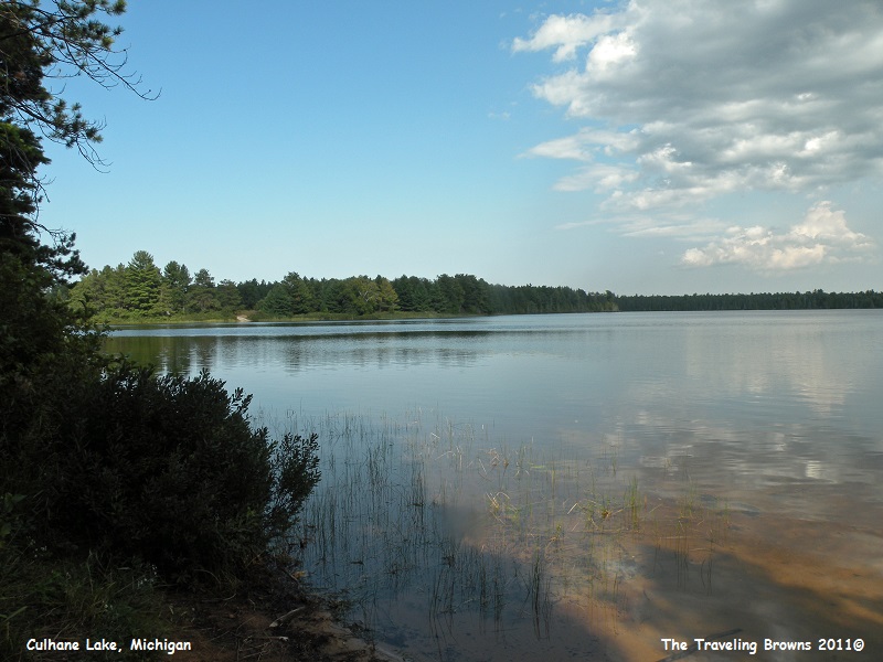
We explored side roads to see what they offered. You never know what you can find just wandering around. Here’s a shot taken at a lake we came upon named Culhane Lake.
Friends of ours who visited the area earlier in the month had advised us that an afternoon boat trip to Pictured Rocks would have better lighting for photos than the morning boat trips. That was perfect, as it gave us all morning to explore the area then have a pasty for lunch before catching an afternoon tour boat. Driving from the motel to Munising we stopped here and there to check things out.
We explored side roads to see what they offered. You never know what you can find just wandering around. Here’s a shot taken at a lake we came upon named Culhane Lake.
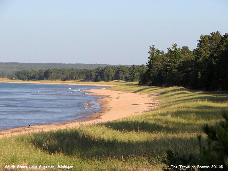
And
this is a sandy beach on the south shore of Lake Superior. We were learning
that much of Lake Superior’s shoreline is rocky, so beautiful beaches like this
are not common.
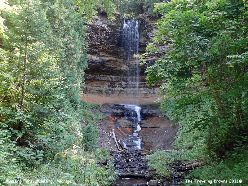
We
stopped and hiked into Munising Falls. It was a bit disappointing as there
wasn’t much water flowing in the creek on this mid-September day. Bet it would
be much more spectacular in the springtime.
Arriving
in Munising just before noon we were hungry. A brochure we picked up stated
that a place called Muldoon’s Pasties & Gifts had been voted #1 in the
Upper Peninsula for their hot and delicious pasties. That sounded good to us so
we searched them out.
Pasties originated as a meal for the miners of Cornwall, England, and later Michigan’s Upper Peninsula. A pasty is a pie that is made without the benefit of a pan to shape it. Pasty is the English word for pie. Muldoon’s pasties are Cornish meat pasties made with potato, ground beef, onion, rutabaga and carrot, baked in a piecrust without the pan. Vegetarian and apple pasties were also available.
They were an irregular shape but sort of looked like a chicken pot pie that had the tin removed after being place upside down on a plate. We found them to be tasty and quite filling.
We didn’t take any photos of them so if you are interested you can Google “pasty” and read all about them. Be careful not to Google “pastie” as your search might result in a whole different topic!
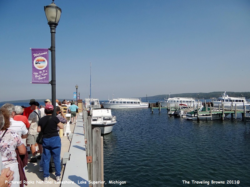
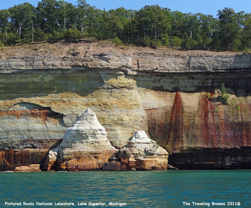
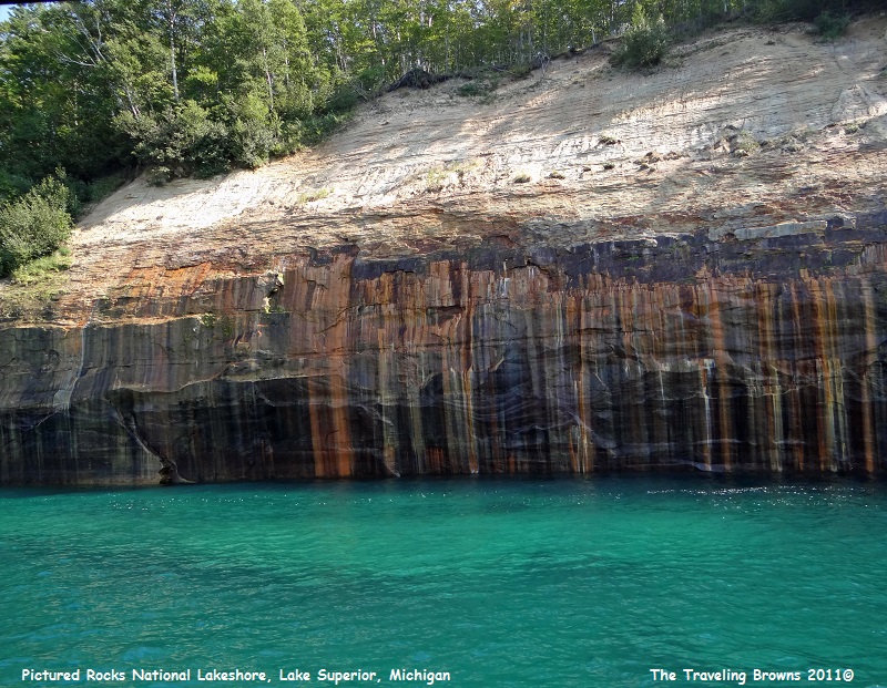
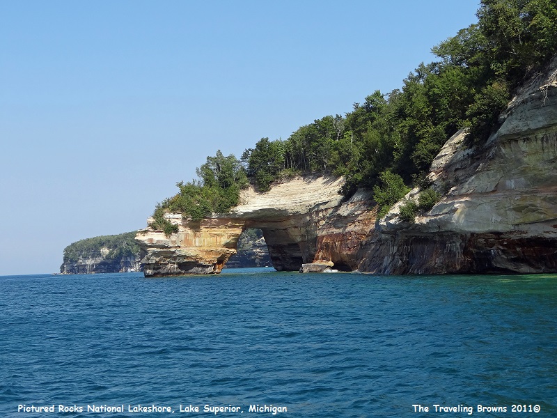
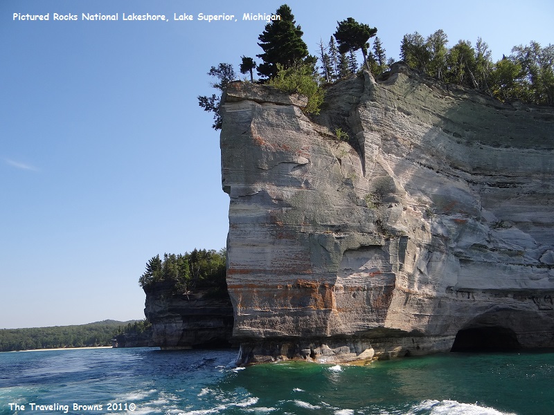
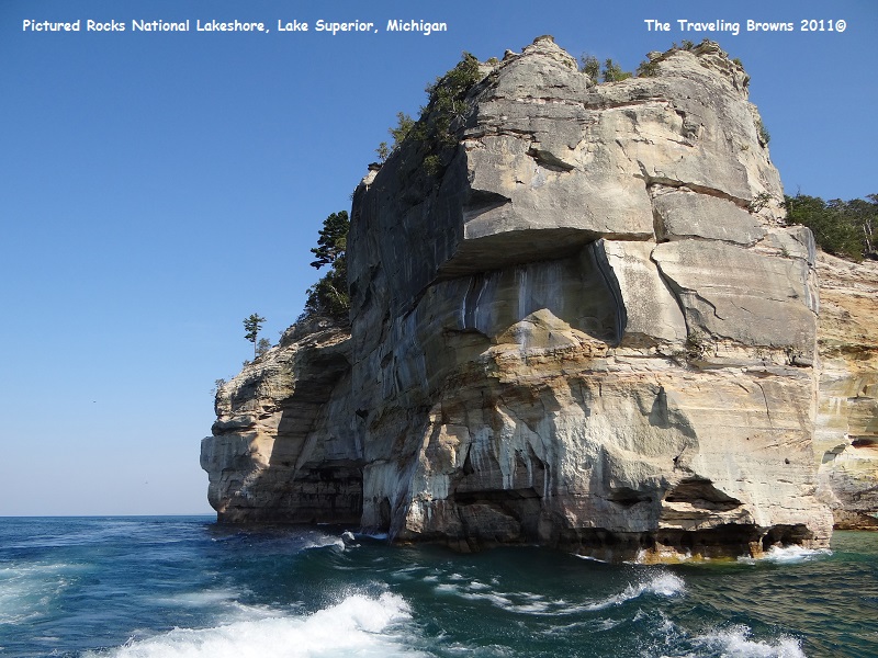
Our main adventure of the day was taking a tour boat along Pictured Rocks National Lakeshore. The U.S. Congress made Pictured Rocks the first officially designated National Lakeshore in the United States in 1966. It is governed by the National Park Service and extends for 42 miles along the shore covering 73,236 acres.
Pictured Rocks National Lakeshore got its name from the lakeshore’s geographic features of various colored sandstone cliffs that tower over 200 feet from the Lake Superior waters. The cliffs are comprised of colorful weathered sandstone and are an ongoing work of art created by Mother Nature. Trace minerals seep from the cracks of the sandstone leaving distinct color stains from different minerals. Then with the help of wind, wave action from storms, snow, and other weather elements, the rocks are eroded and sculpted into various forms.
We boarded our tour boat at the Munising Pier for the 3- hour scenic cruise of the national lakeshore. Although the tours operate rain or shine we were blessed with a beautiful day and calm water.
Pasties originated as a meal for the miners of Cornwall, England, and later Michigan’s Upper Peninsula. A pasty is a pie that is made without the benefit of a pan to shape it. Pasty is the English word for pie. Muldoon’s pasties are Cornish meat pasties made with potato, ground beef, onion, rutabaga and carrot, baked in a piecrust without the pan. Vegetarian and apple pasties were also available.
They were an irregular shape but sort of looked like a chicken pot pie that had the tin removed after being place upside down on a plate. We found them to be tasty and quite filling.
We didn’t take any photos of them so if you are interested you can Google “pasty” and read all about them. Be careful not to Google “pastie” as your search might result in a whole different topic!
Our main adventure of the day was taking a tour boat along Pictured Rocks National Lakeshore. The U.S. Congress made Pictured Rocks the first officially designated National Lakeshore in the United States in 1966. It is governed by the National Park Service and extends for 42 miles along the shore covering 73,236 acres.
Pictured Rocks National Lakeshore got its name from the lakeshore’s geographic features of various colored sandstone cliffs that tower over 200 feet from the Lake Superior waters. The cliffs are comprised of colorful weathered sandstone and are an ongoing work of art created by Mother Nature. Trace minerals seep from the cracks of the sandstone leaving distinct color stains from different minerals. Then with the help of wind, wave action from storms, snow, and other weather elements, the rocks are eroded and sculpted into various forms.
We boarded our tour boat at the Munising Pier for the 3- hour scenic cruise of the national lakeshore. Although the tours operate rain or shine we were blessed with a beautiful day and calm water.
It
was a fantastic day on the water as we slowly cruised along the fifteen miles
of cliffs. The different shapes and colors of the rocks were awe-inspiring.
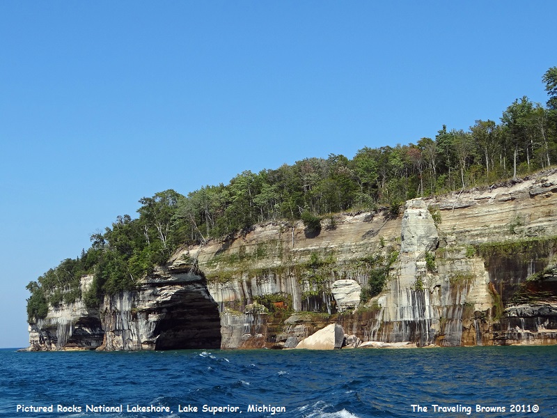
Our
captain maneuvered the boat close to the cliffs so that we could really
appreciate the many varied colors of rock. That, combined with the changing
colors of the water from shades of blue to amazing turquoise and green, made for
some wonderful photo opportunities.
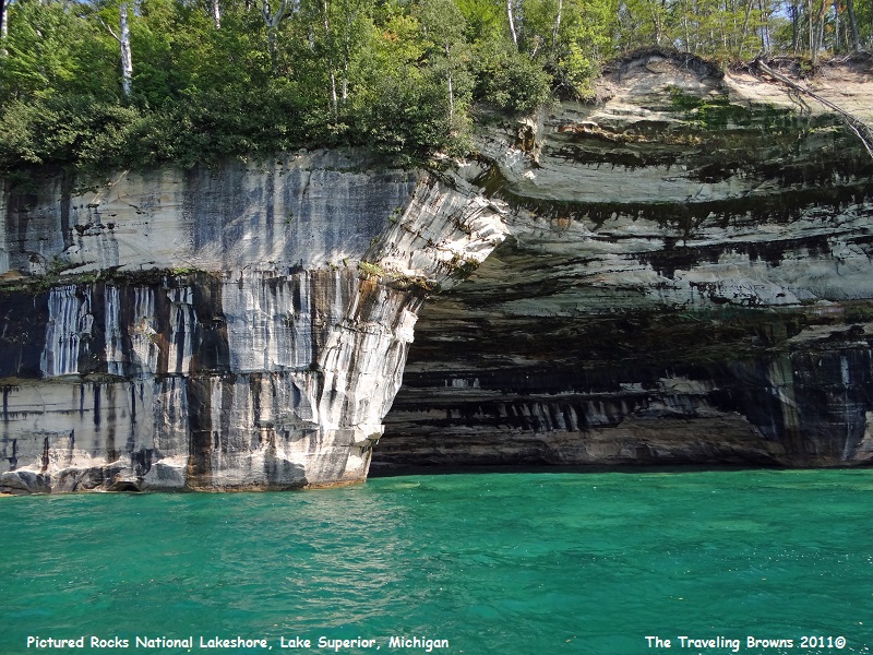
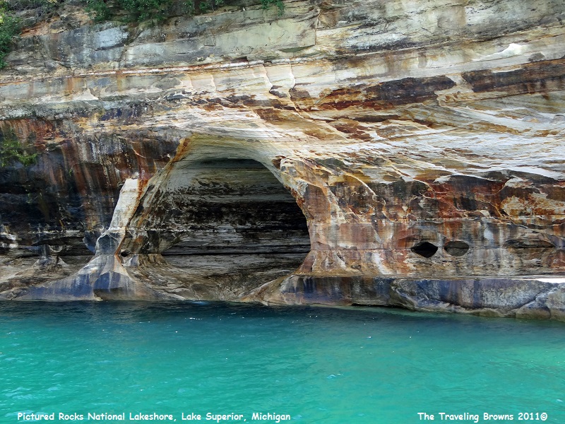
In
our eye this arch made for a very scenic photo.
Some of the massive
rock cliffs jutting out into the lake were pretty amazing also. And, it was
always a surprise cruising around them as you never knew what was on the other
side.
If
you are ever in this neck of the woods we highly recommend you consider taking
a boat ride to Pictured Rocks. It is a very enjoyable way to spend an
afternoon.
Until next time,
Dave & Barb
The Traveling Browns
Until next time,
Dave & Barb
The Traveling Browns
