2013-1 Winter, Idaho
Hello All,
This is the first write-up of our 2013 adventures. We spent most of the 2012-13 winter months getting settled into our new digs. Can’t say it was fun unpacking boxes and putting stuff away. But, it was one of those tasks that had to be done.
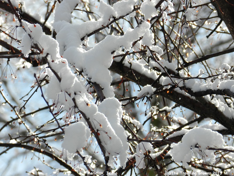
Our small backyard has four mature trees in it. At this point we don’t have a clue as to what species they are. One of the trees, after dropping its leaves, is loaded with red berries on the branches. Robins flock to the tree and eat the berries.
In mid-January we woke up to a few inches of snow. It was a snow that stuck to everything. Here is a shot of the snow that stuck to the tree that had the berries. As you can see most of the berries have been stripped off.
This is the first write-up of our 2013 adventures. We spent most of the 2012-13 winter months getting settled into our new digs. Can’t say it was fun unpacking boxes and putting stuff away. But, it was one of those tasks that had to be done.
Our small backyard has four mature trees in it. At this point we don’t have a clue as to what species they are. One of the trees, after dropping its leaves, is loaded with red berries on the branches. Robins flock to the tree and eat the berries.
In mid-January we woke up to a few inches of snow. It was a snow that stuck to everything. Here is a shot of the snow that stuck to the tree that had the berries. As you can see most of the berries have been stripped off.
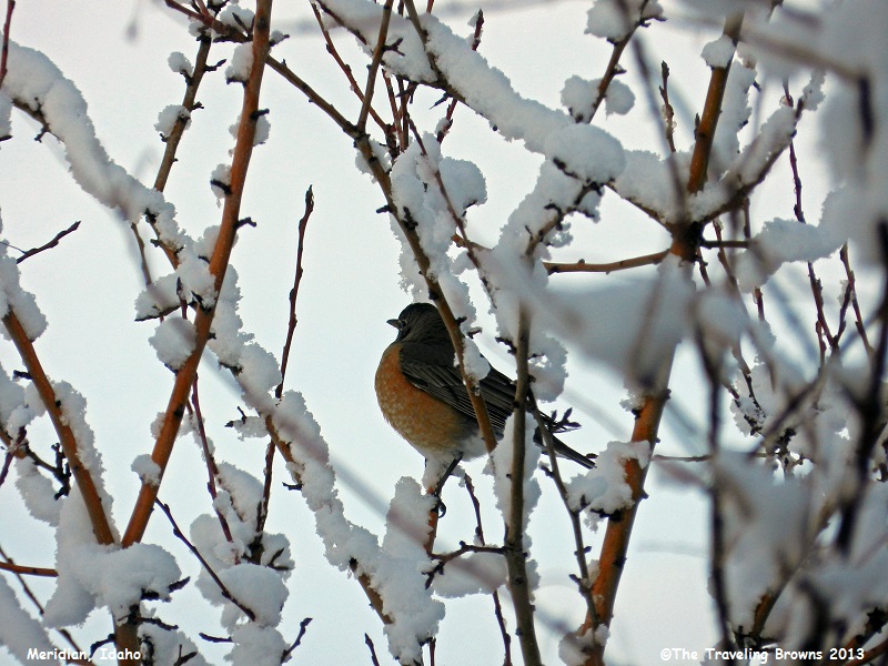
This Robin is all puffed up
trying to stay warm. It is probably trying to figure out what happened to the
beautiful weather of the proceeding day.
After a few days the weather
cleared up but remained cold. Since we had been stuck working in the house for
a couple of months we decided to take a winter scenic drive up into the
mountains north of Boise.
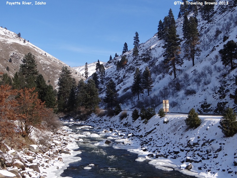
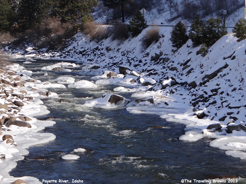
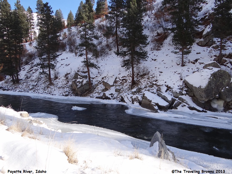
We followed Idaho-55 north paralleling the Payette River. The principal tributaries of the Payette River are the North and South Forks. The North Fork drains about 950 square miles, beginning north of McCall, ID. The South Fork drains about 1,200 square miles, originating on the west side of the Sawtooth Wilderness beneath the 10,211-foot Mount Payette.
The river was running freely with ice along the edges and snow down to its banks. It made for some lovely winter photos in our eyes.
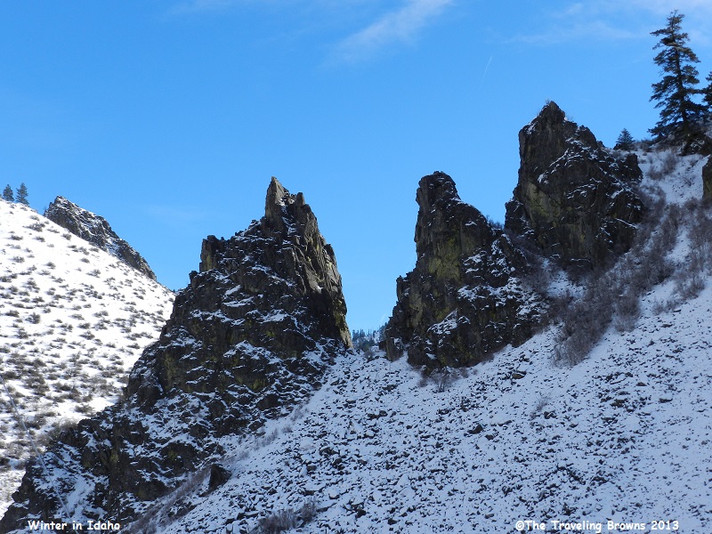
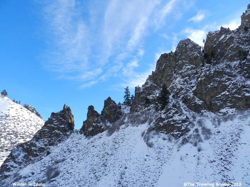
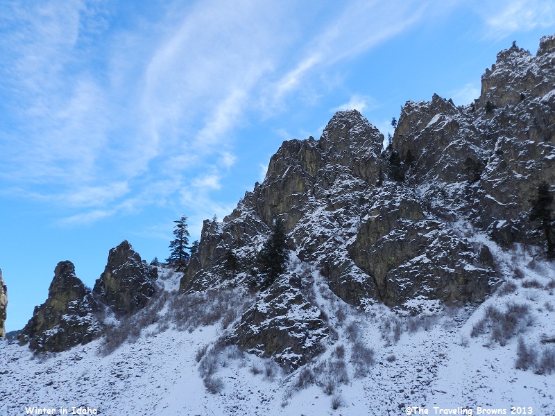
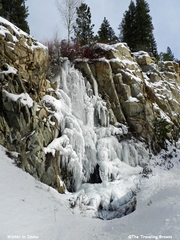
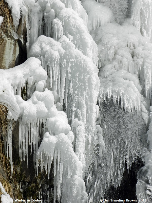
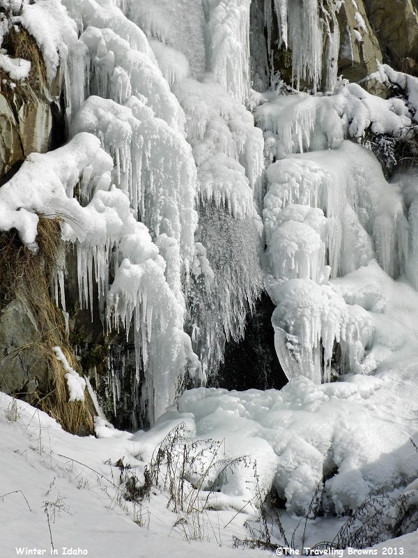
Near the village of Banks the
two main forks of the Payette River come together. We chose to turn east on
Idaho-17 at Banks and follow the South Fork of the river up towards the
Sawtooth Wilderness area. The road started winding up up up. There were some
neat rock formations dressed in their first bit of a white winter coat.
Frozen springs made for
awesome ice formations.
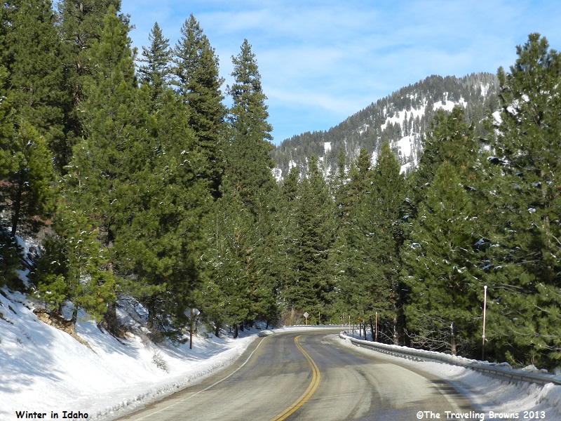
Near the village of Lowman,
Idaho-17 ends when it intersects with Idaho-21, which is the Ponderosa Pines
Scenic Byway. We continued east towards the mountain town of Stanley, ID.
The road was good with the exception of a few wet spots.
The road was good with the exception of a few wet spots.
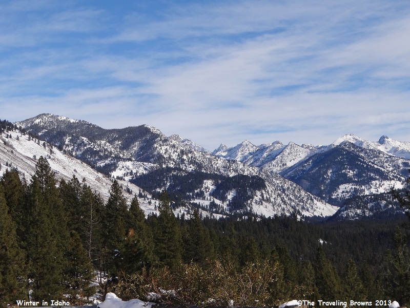
Most of the pull-offs were not plowed at this
time of year which made taking photos a bit of a challenge. Every now and then
we would slow down and Miss Barb would snap a photo out the car window. Here
are a couple of shots looking towards the Sawtooth Wilderness area.
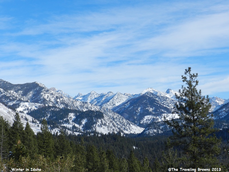
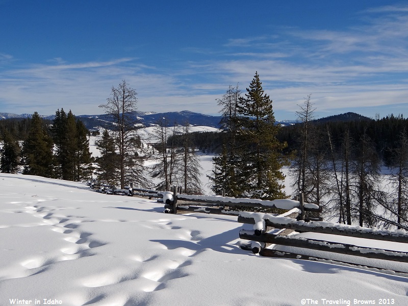
One pull-off that was plowed
was at a popular cross country ski area. We found it quite scenic with a snow
covered little valley and the Sawtooth Mountain Range in the background. The
sun wasn’t exactly working with us for shooting photos so we had to be a bit
creative.
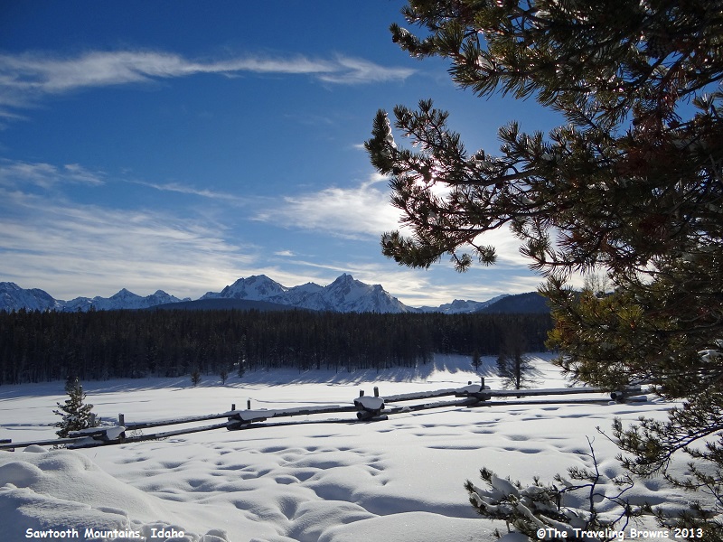
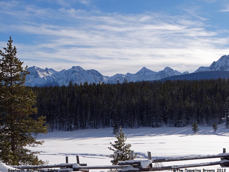
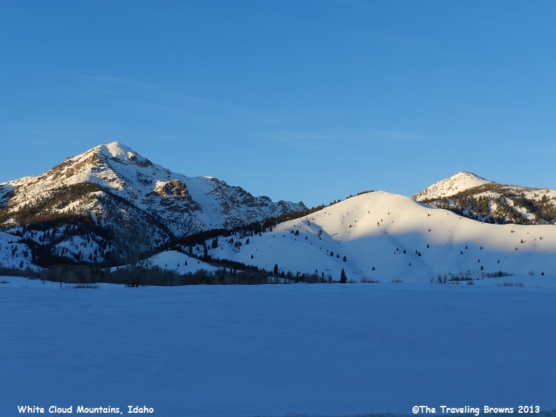
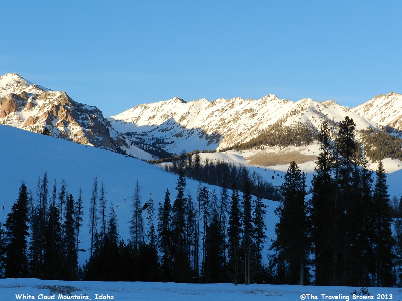
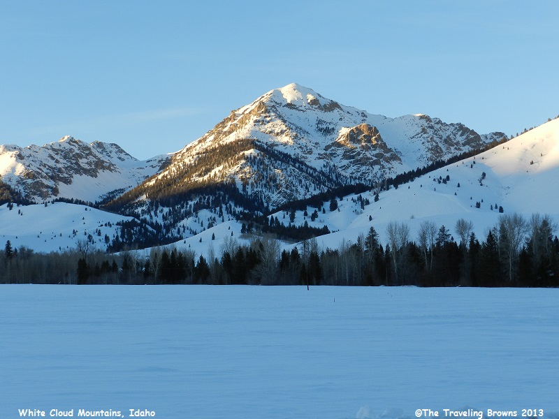
We continued on into Stanley
where we turned south on Idaho-75 towards Sun Valley. By this time of day the
sun was getting low in the sky. The White Cloud Mountains loomed to our east
and the Sawtooth Range to our west. We snapped a few photos of the White Clouds
with their peaks sticking up into the sun. They are not as spectacular as the
Sawtooths but still quite lovely in their own way.
It was late at night before we
arrived back at home. Our 359 mile loop drive was awesome and exhausting. It is
an extremely scenic part of the country--winter or summer. However, we would
recommend making it a two-day trip. Spending a night in Stanley would be a lot
smarter. But, we have never claimed to be real smart! Hope you will ride along
with us on our next adventure.
Until next time,
Dave & Barb
The Traveling Browns
Until next time,
Dave & Barb
The Traveling Browns
