2013-8 Red, Losee, & Casto Canyons, Utah
Hello All,
While the national parks of Utah are awesome, sometimes we find other unique areas that are off the beaten paths of the hordes of people. So, before departing southwest Utah we decided to share with you a number of other interesting areas in this part of the state. We hope you will enjoy riding along with us.
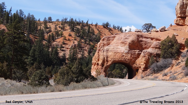
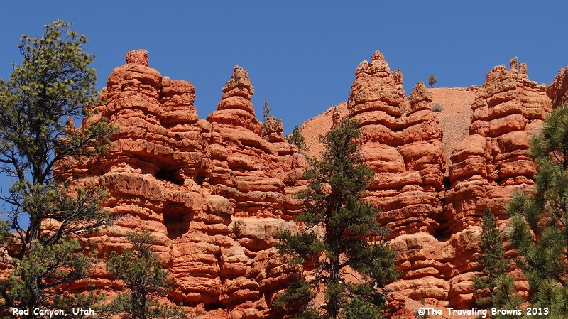
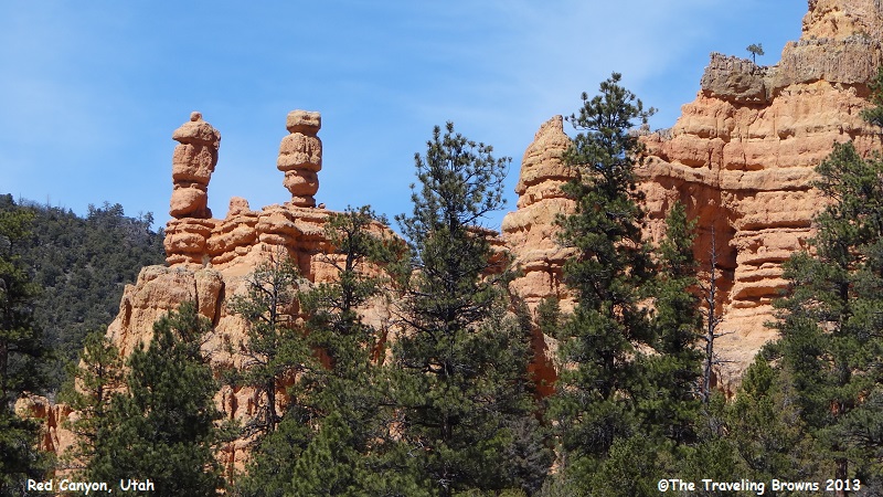
If you travel between Zion and Bryce Canyon National Parks on Utah Highway 12, you will pass through such a place--and it happens to be one of our favorites. It is a shallow valley in the Paunsaugunt Plateau, surrounded by exposed orange and red sandstone, named Red Canyon. Located within the Dixie National Forest, the rocks are eroded into the familiar pinnacles, spires, columns, and hoodoos of this part of the state. Formations line both sides of the highway for about 4 miles. There are biking and hiking trails through the canyon and numerous paved places to pull off and park. However, most visitors scurry on to Bryce without ever checking it out. The old adage comes into play “slow down and take time to smell the roses.”
If you miss the sign on the highway identifying Red Canyon you will know you are there by the hole in the rock the highway passes through.
While the national parks of Utah are awesome, sometimes we find other unique areas that are off the beaten paths of the hordes of people. So, before departing southwest Utah we decided to share with you a number of other interesting areas in this part of the state. We hope you will enjoy riding along with us.
If you travel between Zion and Bryce Canyon National Parks on Utah Highway 12, you will pass through such a place--and it happens to be one of our favorites. It is a shallow valley in the Paunsaugunt Plateau, surrounded by exposed orange and red sandstone, named Red Canyon. Located within the Dixie National Forest, the rocks are eroded into the familiar pinnacles, spires, columns, and hoodoos of this part of the state. Formations line both sides of the highway for about 4 miles. There are biking and hiking trails through the canyon and numerous paved places to pull off and park. However, most visitors scurry on to Bryce without ever checking it out. The old adage comes into play “slow down and take time to smell the roses.”
If you miss the sign on the highway identifying Red Canyon you will know you are there by the hole in the rock the highway passes through.
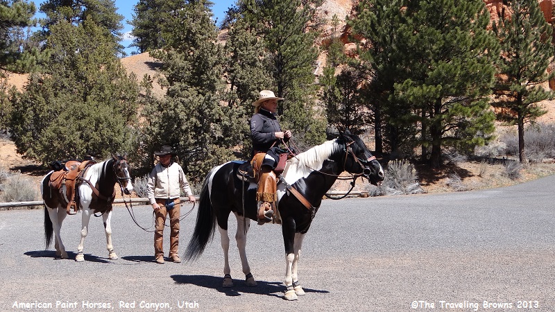
These folks were from British
Columbia, Canada. They travel to Utah in the winter months and explore the
canyons and national parks by horseback. Wow, is that awesome or what! After
spending a few days riding in Bryce Canyon they were exploring Red Canyon when
we ran into them. It was fun and most interesting talking with them. Their
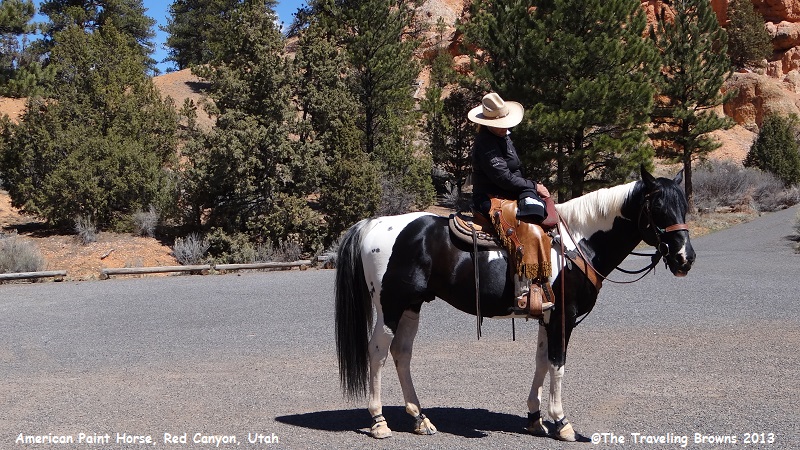
beautiful horses are known as “American Paints.” By having a huge horse trailer
with living quarters in it the couple can go to an area and spend days checking
it out. If you were an avid horse person what fun this would be.
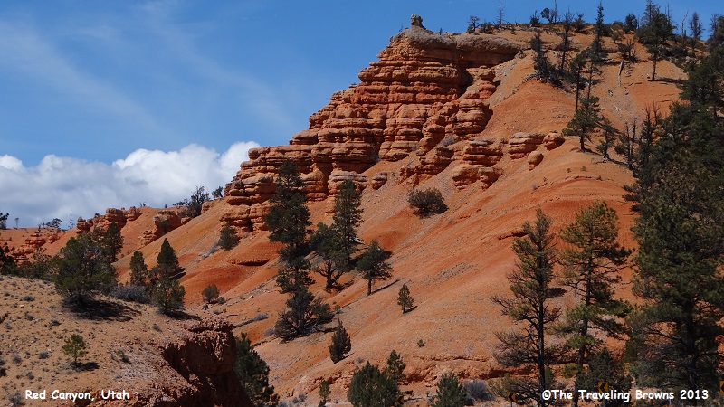
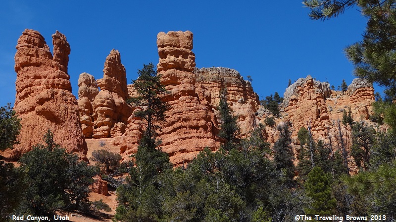
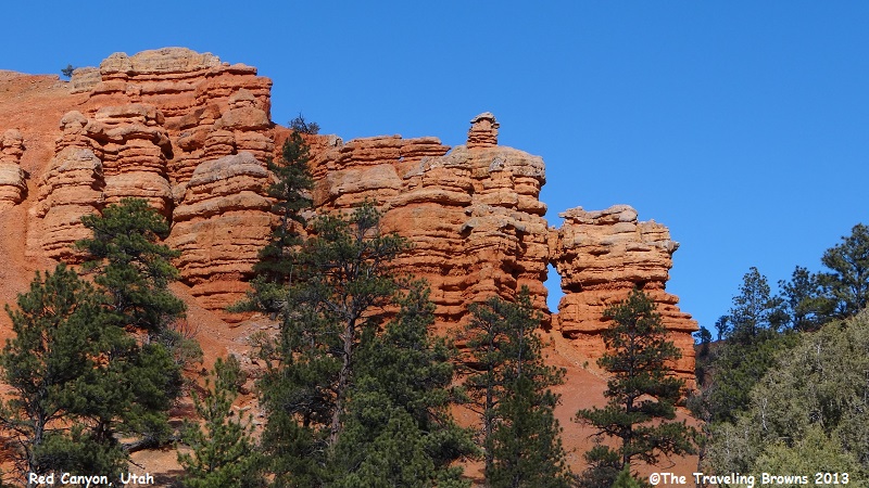
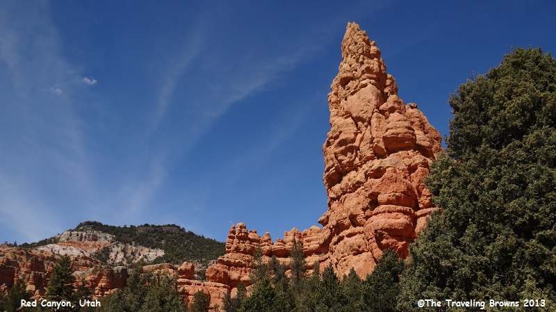
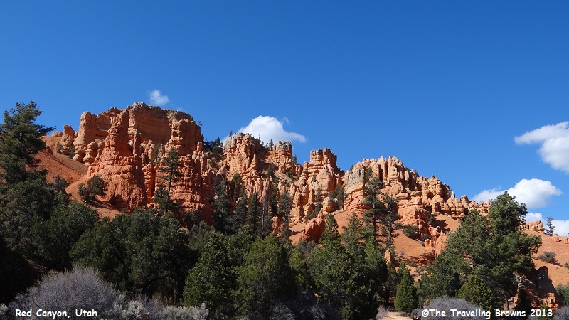
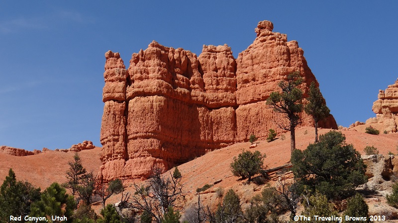
Here are a few more shots
taken at Red Canyon. We took trails into areas with different photo
opportunities. It is an easy area to explore because it is all right along the
highway.
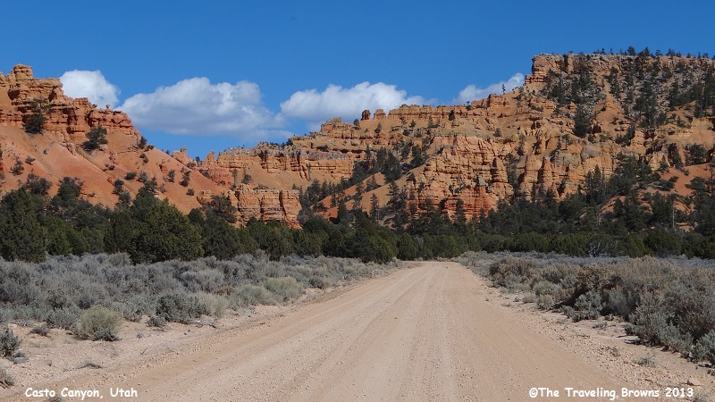
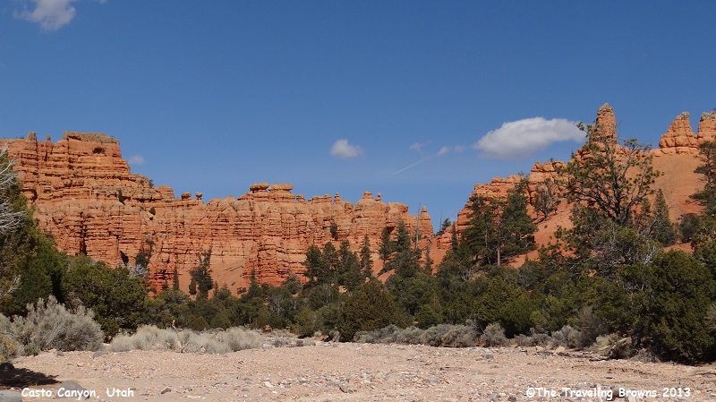
Other large canyons within the
Dixie National Forest are Losee Canyon and Casto Canyon. We ventured onto
unpaved roads to explore both of these. It was neat in that we pretty much had
them all to ourselves. On a rare occasion we would come across a rancher in a
pickup pulling a cattle or horse trailer. Here is a shot taken heading into Casto
and Losee Canyons.
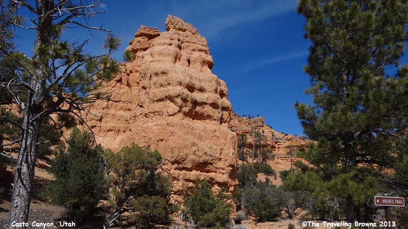
This is the Arches Trailhead. It is named for
the 15 small arches found along the trail as it loops through a small red rock
cove and then to the top of the cliffs. At less than a mile this easy to
moderate trail is an exciting family hike for all ages.
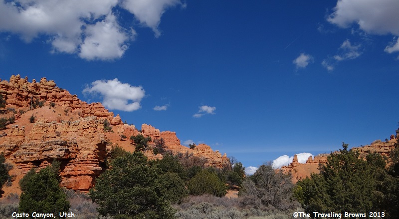
A more ambitious hike or mountain
bike ride is possible by taking the Losee Canyon Trail that travels along this
wash bed with both sides lined with stunning red rock formations. A round trip
is possible by following the trail to Cassidy Trail to Red Canyon Trailhead,
then down the Red Canyon Bike Trail and then up the Casto/Losee Road back to
this starting point. This loop is approximately 15 miles round trip.
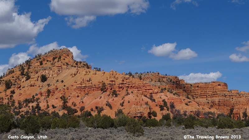
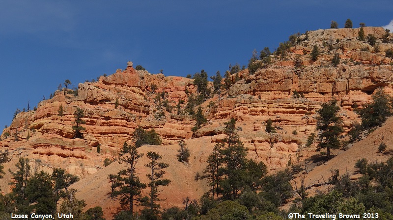
Here are a few parting shots
taken at Losee and Casto Canyons. You can spend a lot of time enjoying the area
no matter what your age—so don’t go whizzing on by in your car!
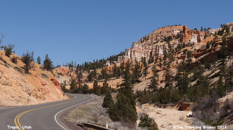
Tropic is a tiny town along
Utah Scenic Byway 12. It has a population around 500 and was founded in 1891. This
shot was taken along the byway just north of town.
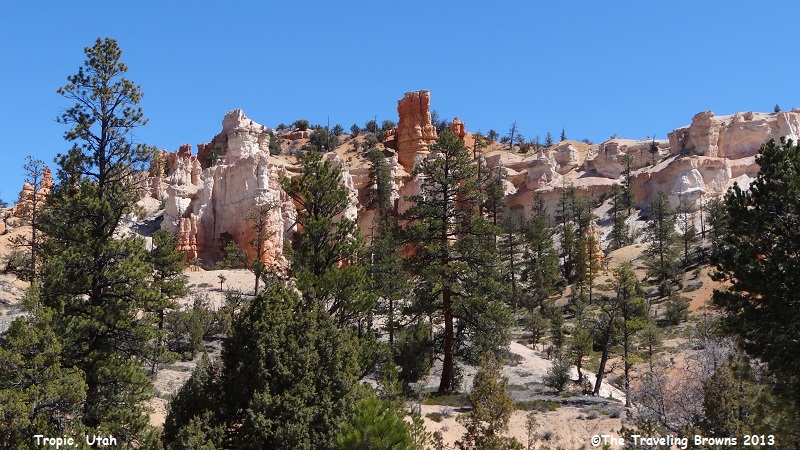
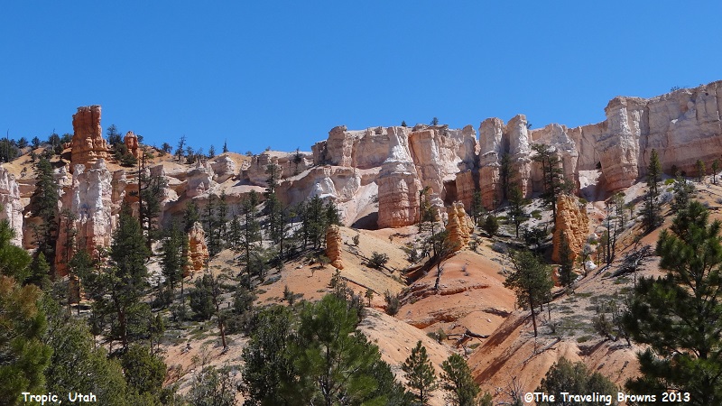
We like the area because there
are more white color tones in the rocks. In our eyes it makes for some
enjoyable photos.
In our next write up we’ll
share the adventures we had on the return trip home. We’ll see you on down the
road.
Until next time,
Dave & Barb
The Traveling Browns
Until next time,
Dave & Barb
The Traveling Browns
