2014-24 Leslie Gulch, High Desert of Eastern Oregon
Hello All,
Our next adventure will take us on a roundtrip drive from our home in Idaho to Leslie Gulch, Oregon, and back. It made for a long but enjoyable day.
Both Miss Barb and I spent much of our younger years in the state of Oregon. When a friend of ours asked if we had ever been to Leslie Gulch, we looked at each other and then replied, “…we’ve never heard of it before.” He went on to explain that it was an area with some amazing rock formations. It perked our interest and we decided that we would have to check it out some day.
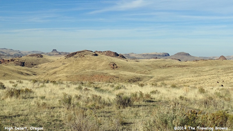
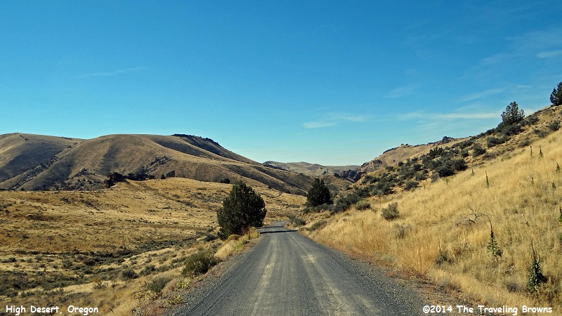
In early October on a beautiful sunny day, we decided the time had come and we set out to explore Leslie Gulch. It is located in Malheur County in eastern Oregon, near the Idaho border. From U.S. Highway 95 in Idaho, we spotted the sign and turned west on a gravel road, following it for 24 miles to the gulch. Most of the gulch is a Wilderness Study Area managed by the U.S. Bureau of Land Management (BLM). It is a good gravel road through “open range” country for ranchers in the high desert of Oregon. So as not to beat the car to pieces, we slowed down, sat back, and enjoyed the ride. We found the rolling hills to be quite lovely.
Our next adventure will take us on a roundtrip drive from our home in Idaho to Leslie Gulch, Oregon, and back. It made for a long but enjoyable day.
Both Miss Barb and I spent much of our younger years in the state of Oregon. When a friend of ours asked if we had ever been to Leslie Gulch, we looked at each other and then replied, “…we’ve never heard of it before.” He went on to explain that it was an area with some amazing rock formations. It perked our interest and we decided that we would have to check it out some day.
In early October on a beautiful sunny day, we decided the time had come and we set out to explore Leslie Gulch. It is located in Malheur County in eastern Oregon, near the Idaho border. From U.S. Highway 95 in Idaho, we spotted the sign and turned west on a gravel road, following it for 24 miles to the gulch. Most of the gulch is a Wilderness Study Area managed by the U.S. Bureau of Land Management (BLM). It is a good gravel road through “open range” country for ranchers in the high desert of Oregon. So as not to beat the car to pieces, we slowed down, sat back, and enjoyed the ride. We found the rolling hills to be quite lovely.
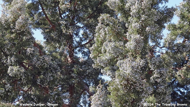
As we worked our way through the grasslands we passed an occasional western juniper tree. The gnarled, twisted juniper is regarded by most land managers as an out-of-control desert pest—even though it is native to the area. It is a tough plant and a member of the cypress family, living in excess of 600 years. It is similar to cedar and redwood and since it is impervious to rot and insects it offers decades of durability. The western juniper is ranked as the fourth longest-lived tree species in the world, with the oldest specimen attaining 2,675 years.
Biologists say it has spread across 9 million acres of eastern and central Oregon in the past 130 years. The problem is, it uses more than its share of precious water and is crowding out other plants and wildlife species.
Since 2005, BLM crews have cut, burned, and thinned the junipers. The goal is to nudge parts of the high desert back into a sagebrush-dominated ecosystem that provides habitat for sage grouse and room for quaking aspen, bitterbrush, mountain grasses, and other species that the juniper has elbowed out.
And were the junipers ever loaded with berries! Birds eat the berries and spread the seed.
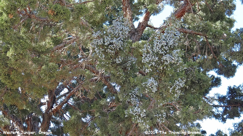
Don’t believe we have ever seen junipers with this many berries. Some limbs of the trees were covered with them.
Upon reaching Leslie Gulch, we learned that is was named after the Silver City, Idaho pioneer by the name of Hiram Leslie. While exploring the gulch in 1882 he was struck and killed by lightning—not the greatest way to get something named after you! The gravel road continues through the gulch for eight miles before ending at Lake Owyhee, providing the only access to the gulch within the state of Oregon.
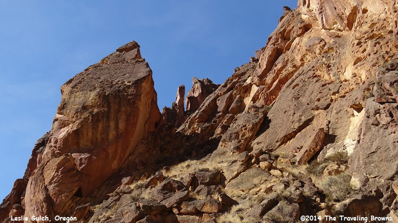
The most striking features of Leslie Gulch are the diverse and often stark, towering and colorful geologic formations. The Leslie Gulch Tuff (consolidated volcanic ash), makes up the bulk of these formations. It is a rhyolite ash that erupted from the Mahogany Mountain caldera (a large volcanic depression which encompasses Leslie Gulch) in a series of violent explosions about 15.5 million years ago. Much of the material fell back into the volcano as a gaseous deposit of fine ash and rock fragments up to 1,000 feet thick. About 100,000 years later, volcanic eruptions from the Three Fingers caldera, located several miles to the northeast, deposited another layer of rhyolite tuff in Leslie Gulch.
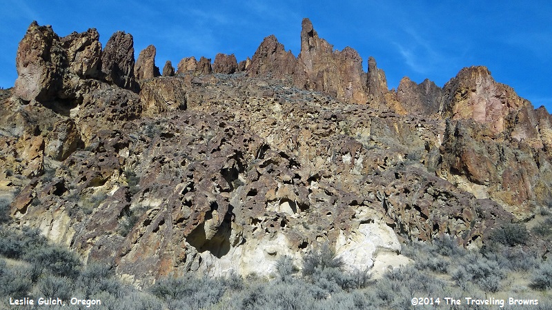
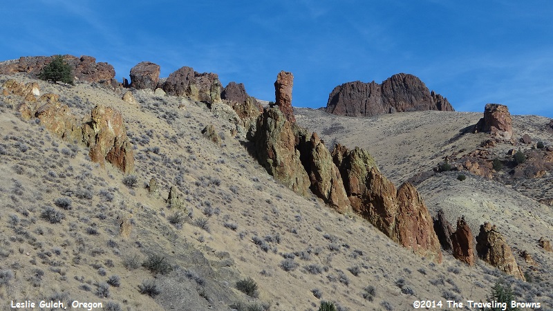
As we proceeded further into the gulch the terrain really changed. Check out the amazing ridgeline in the following photo.
The most striking features of Leslie Gulch are the diverse and often stark, towering and colorful geologic formations. The Leslie Gulch Tuff (consolidated volcanic ash), makes up the bulk of these formations. It is a rhyolite ash that erupted from the Mahogany Mountain caldera (a large volcanic depression which encompasses Leslie Gulch) in a series of violent explosions about 15.5 million years ago. Much of the material fell back into the volcano as a gaseous deposit of fine ash and rock fragments up to 1,000 feet thick. About 100,000 years later, volcanic eruptions from the Three Fingers caldera, located several miles to the northeast, deposited another layer of rhyolite tuff in Leslie Gulch.
As we proceeded further into the gulch the terrain really changed. Check out the amazing ridgeline in the following photo.
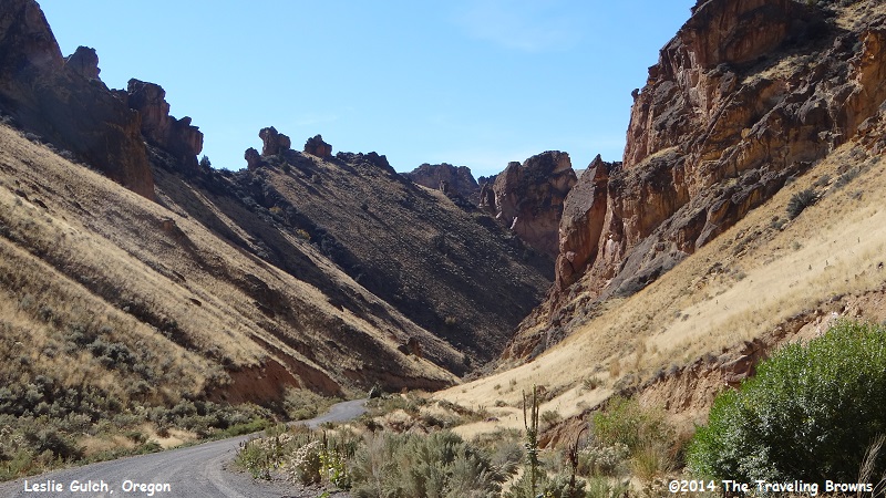
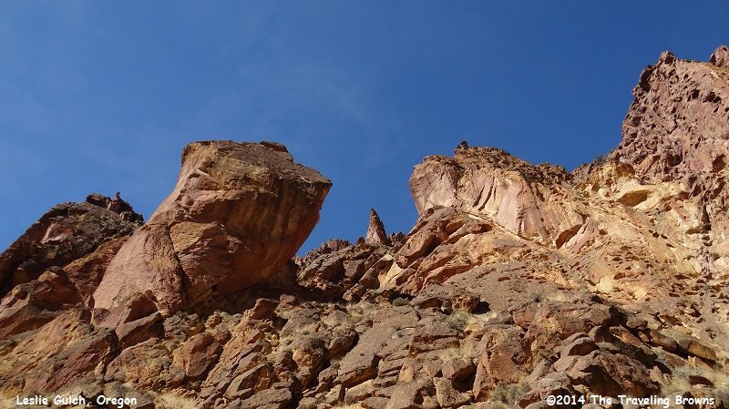
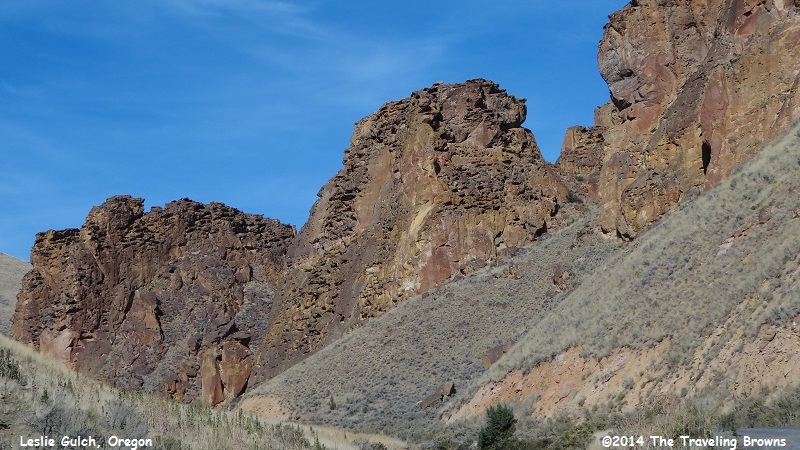
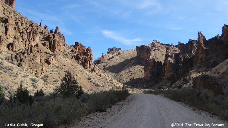
Following the winding road through and around the towering globs of volcanic deposits was awesome.
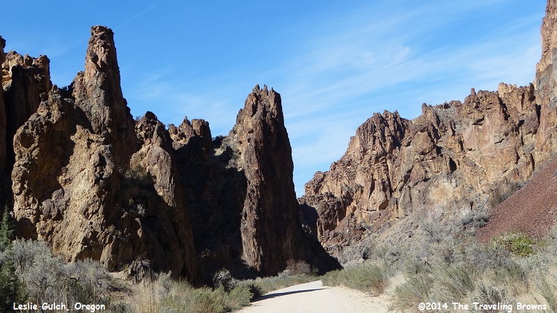
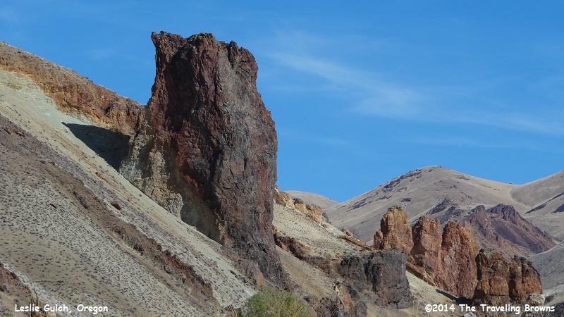
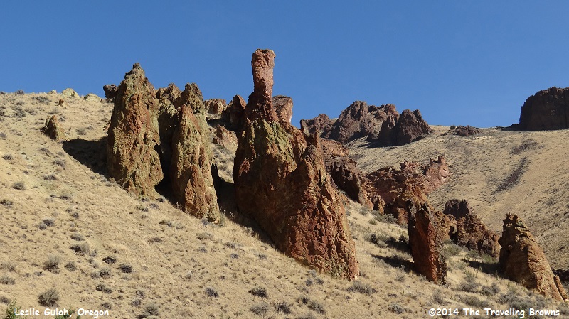
In the heart of the gulch the rugged terrain shoots up on both sides of the road.
In earlier times bighorn sheep roamed the rugged landscape. However, they vanished due to excessive hunting by pioneers and disease brought in with their domestic livestock. In 1965, 17 California bighorn sheep were reintroduced into Leslie Gulch. The herd has expanded to over 200 animals. Mule deer, Rocky Mountain elk, coyotes, bobcats, bats, and many reptiles, including rattlesnakes, also live in Leslie Gulch.
California quail, chukar, northern flickers, white-throated swifts, and raptors thrive in the area in addition to numerous song birds. It is truly a unique landscape.
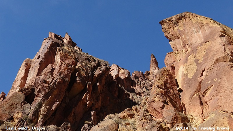
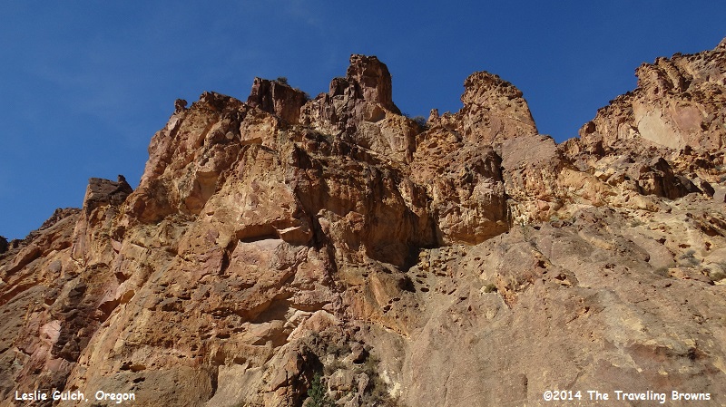
In some areas the rock is honeycombed into unusual formations.
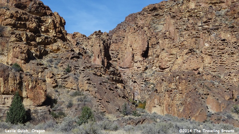
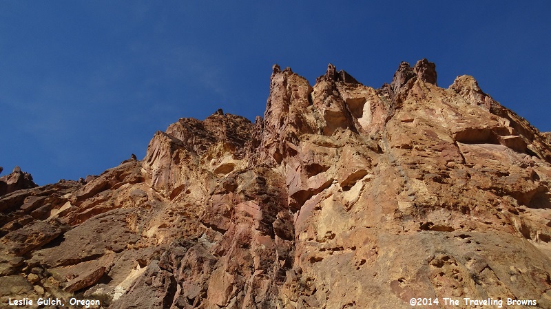
In this shot we have backed off to demonstrate just how massive these formations are.
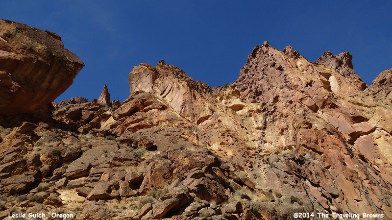
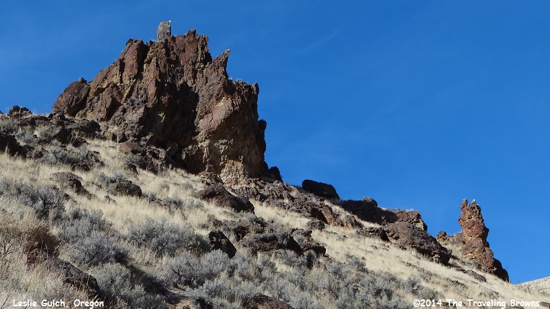
As you break out of the heart of the gulch you enter an area where volcanic deposits are more spread out. These deposits have eroded into some amazing stand alone sculptured pieces. They are not necessarily beautiful—just really different works of art by Mother Nature.
It was an enjoyable day in a very remote part of our country. We think another trip to the area is in order for us. We would like to visit in the springtime when the grasses are green and the wildflowers are in bloom.
We hope you enjoyed a small sampling of the 980 photos we shot this day. Our next adventure will take us to Arches National Park in Utah. As always you are invited to tag along with us.
Until next time,
Dave & Barb
The Traveling Browns
We hope you enjoyed a small sampling of the 980 photos we shot this day. Our next adventure will take us to Arches National Park in Utah. As always you are invited to tag along with us.
Until next time,
Dave & Barb
The Traveling Browns
