2014-27 Canyonlands National Park, Utah
Hello All,
During our four-day stay in Moab, Utah, we also explored Canyonlands National Park. This was our first visit to the park and we were excited to see what it had to offer.
Canyonlands preserves 527 square miles of wilderness at the heart of the geological feature known as the Colorado Plateau. Few people knew of these remote lands and rivers when President Lyndon B. Johnson established the national park in 1964. Only American Indians, cowboys, river explorers, and prospectors had dared enter this rugged corner of southeastern Utah. Today the park remains largely untamed with few paved roads, limited services, and rough trails. Free flowing rivers are still cutting their paths through the sedimentary rock. At center stage are two canyons carved by the Green and Colorado Rivers. These two rivers have carved two prominent canyons within the Colorado Plateau. And, the many washes flowing into the rivers have resulted in hundreds of additional canyons, mesas, buttes, fins, arches, and spires. The park is known as “a wilderness of rock.”
Canyonlands park is divided into four districts: the “Island in the Sky,” “the Needles,” “the Maze,” and “the Rivers.” We found the Park Service’s division of districts to be confusing and misleading. In our eyes, a more accurate way of describing the layout of the park would be three districts: the Island in the Sky, The Needles, and The Maze. All are separated by the Green and/or Colorado Rivers. But, no one asked for our opinion, so we will move on.
There are no roads (paved or unpaved) that will take you directly from one district to another within the park. While these districts may look close on a map, traveling between them requires two to six hours by car outside the park to a road that will lead into a another district.
An easy way to picture the layout of the park is to draw a large square on a piece of paper. From the upper right corner draw a line to the center of the square. Now do the same thing from the upper left corner of the square. The line on the left represents the Green River and the line on the right represents the Colorado River. Where the two lines meet is the confluence of the two rivers. From where the two lines meet in the middle of the square draw a line straight down to the bottom of the square. In essence you have drawn a Y in the square. The Island in the Sky section is the northern section of the park within the V portion of the Y. The Maze is the western section to the left of the Y, and The Needles is the eastern section—all are separated by a major river with no bridges.
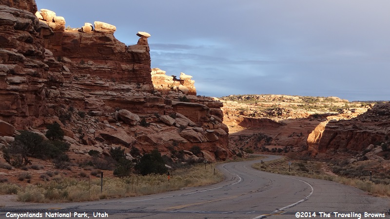
Our first destination within Canyonlands National Park was Island in the Sky. It is about a 40-minute drive out of Moab, and the road is paved all the way. It is the easiest section of the park to reach and therefore the most visited. There is a visitor center there with drinking water and restrooms. No food or fuel service is available. We highly recommend carrying food and water and have a full tank of fuel when visiting sections of this remote wilderness park.
The Island in the Sky Mesa rests on sheer sandstone cliffs that are over 1,000 feet above the surrounding terrain. There is a 34-mile scenic drive that allows you to explore the entire mesa top. Every overlook offers a different perspective on the park’s spectacular landscape. We found it to be spectacular. All of the photos within this write-up were taken while at the Island in the Sky district of the park.
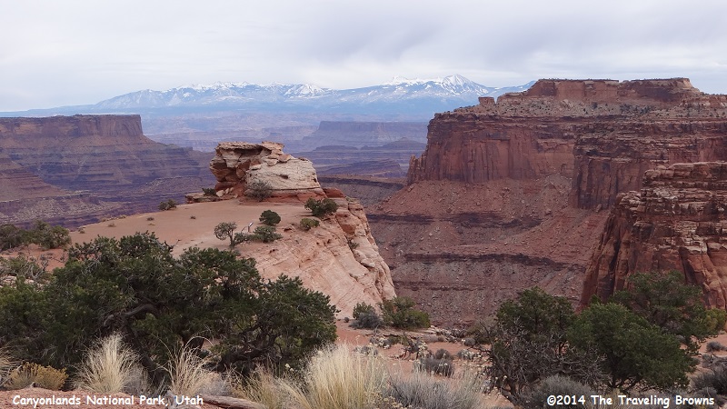
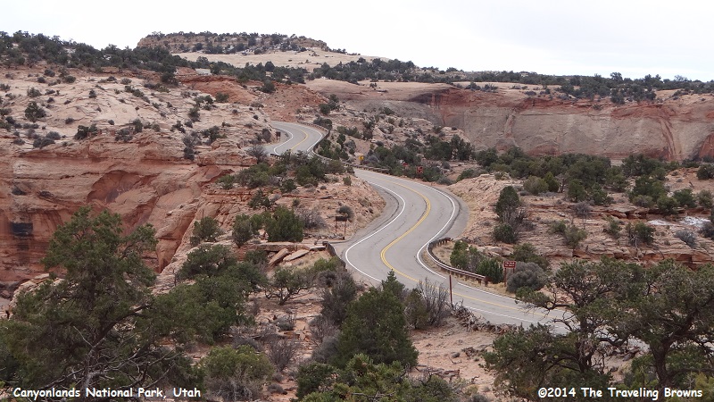
This photo was taken across the road from the visitor center. As you can see the weather wasn’t the best—but, not too bad for the third week in November.
During our four-day stay in Moab, Utah, we also explored Canyonlands National Park. This was our first visit to the park and we were excited to see what it had to offer.
Canyonlands preserves 527 square miles of wilderness at the heart of the geological feature known as the Colorado Plateau. Few people knew of these remote lands and rivers when President Lyndon B. Johnson established the national park in 1964. Only American Indians, cowboys, river explorers, and prospectors had dared enter this rugged corner of southeastern Utah. Today the park remains largely untamed with few paved roads, limited services, and rough trails. Free flowing rivers are still cutting their paths through the sedimentary rock. At center stage are two canyons carved by the Green and Colorado Rivers. These two rivers have carved two prominent canyons within the Colorado Plateau. And, the many washes flowing into the rivers have resulted in hundreds of additional canyons, mesas, buttes, fins, arches, and spires. The park is known as “a wilderness of rock.”
Canyonlands park is divided into four districts: the “Island in the Sky,” “the Needles,” “the Maze,” and “the Rivers.” We found the Park Service’s division of districts to be confusing and misleading. In our eyes, a more accurate way of describing the layout of the park would be three districts: the Island in the Sky, The Needles, and The Maze. All are separated by the Green and/or Colorado Rivers. But, no one asked for our opinion, so we will move on.
There are no roads (paved or unpaved) that will take you directly from one district to another within the park. While these districts may look close on a map, traveling between them requires two to six hours by car outside the park to a road that will lead into a another district.
An easy way to picture the layout of the park is to draw a large square on a piece of paper. From the upper right corner draw a line to the center of the square. Now do the same thing from the upper left corner of the square. The line on the left represents the Green River and the line on the right represents the Colorado River. Where the two lines meet is the confluence of the two rivers. From where the two lines meet in the middle of the square draw a line straight down to the bottom of the square. In essence you have drawn a Y in the square. The Island in the Sky section is the northern section of the park within the V portion of the Y. The Maze is the western section to the left of the Y, and The Needles is the eastern section—all are separated by a major river with no bridges.
Our first destination within Canyonlands National Park was Island in the Sky. It is about a 40-minute drive out of Moab, and the road is paved all the way. It is the easiest section of the park to reach and therefore the most visited. There is a visitor center there with drinking water and restrooms. No food or fuel service is available. We highly recommend carrying food and water and have a full tank of fuel when visiting sections of this remote wilderness park.
The Island in the Sky Mesa rests on sheer sandstone cliffs that are over 1,000 feet above the surrounding terrain. There is a 34-mile scenic drive that allows you to explore the entire mesa top. Every overlook offers a different perspective on the park’s spectacular landscape. We found it to be spectacular. All of the photos within this write-up were taken while at the Island in the Sky district of the park.
This photo was taken across the road from the visitor center. As you can see the weather wasn’t the best—but, not too bad for the third week in November.
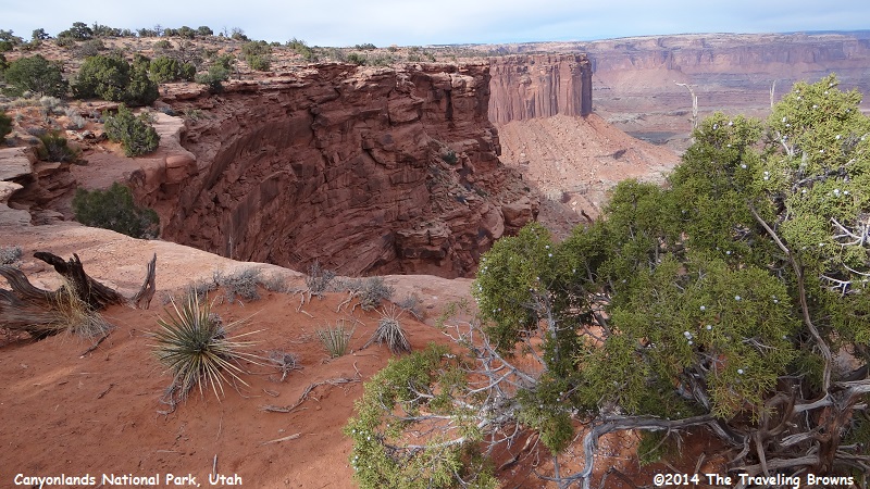
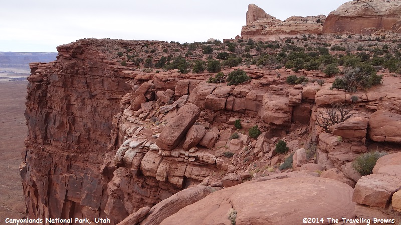
We included this photo to emphasize that it is not a place for small children or pets. The raven on the sign post is a bonus.
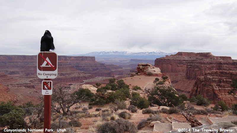
This photo illustrates the danger involved with the area. A pet running loose and jumping over the dead junipers in the foreground could find themselves falling hundreds of feet down the sheer cliff. This is awesome country that commands respect.
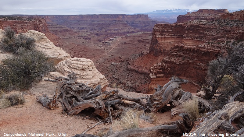
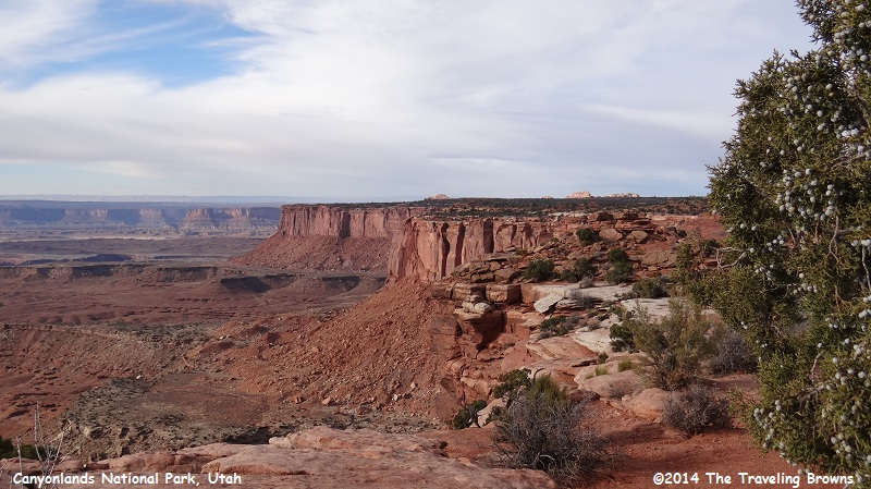
As we traveled the scenic drive it wound around the mesa top to numerous viewpoints.
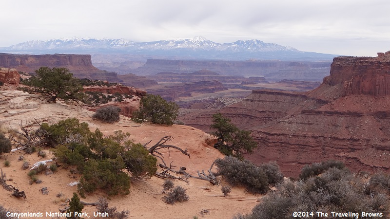
Here are a couple of scenic views from Buck Canyon Overlook.
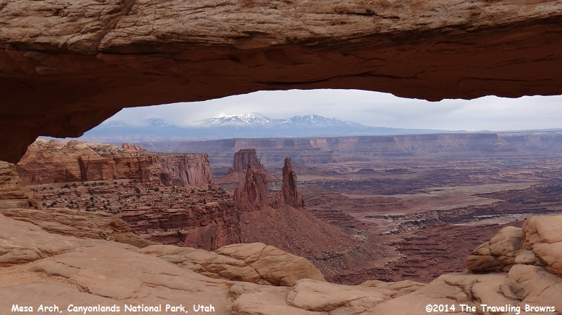
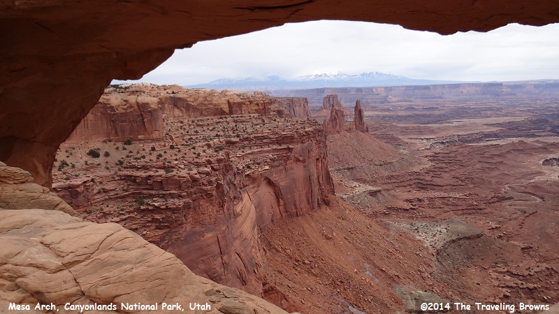
We hiked into Mesa Arch. It is a short ½-mile hike. However, much of the trail is sand, which can make for slow going. Since we are slow anyway it didn’t affect us much. In our eyes the arch was well worth the hike into it.
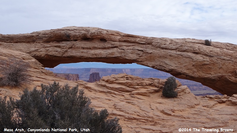
Mesa Arch is a popular place to get photos of the sun rising over the mountains in the background. Right behind Miss Barb in the next photo is a sheer drop off.
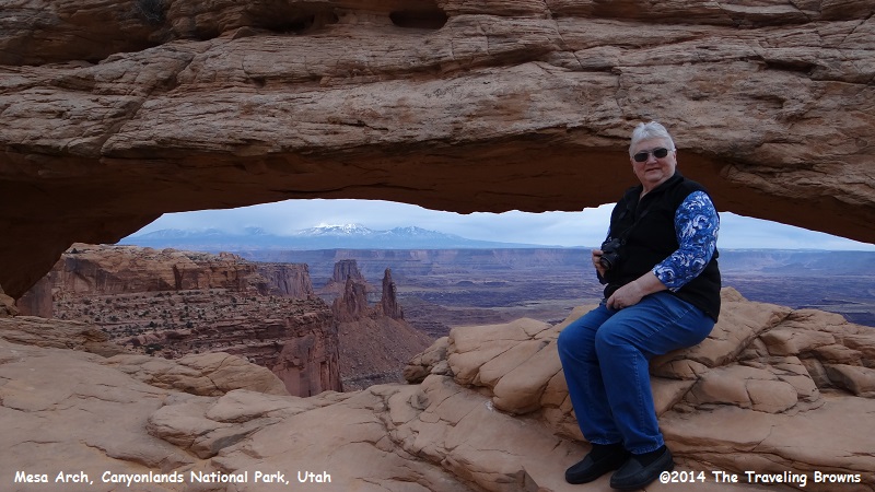
In the next photos looking under the arch you can see the canyon floor below as well as the mountains in the distance.
In May 1869, Major John Wesley Powell set out on a remarkable mission to explore the uncharted canyons and waters of the Green and Colorado Rivers. Powell, a geology professor and one-armed Civil War veteran, began the journey with nine novice oarsmen and four wooden boats. He ended the journey three months later with two boats, six men and detailed knowledge of a unique landscape that would capture national attention. Powell described the Canyonlands in his journal as a “strange, weird, and grand region” of naked rocks with “cathedral-shaped buttes, towering hundreds of thousands of feet, cliffs that cannot be scaled, and canyon walls that shrink the river into insignificance.”
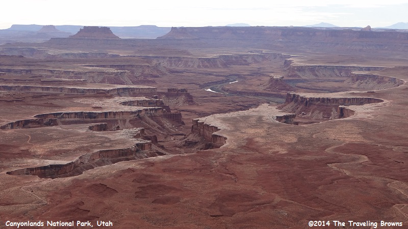
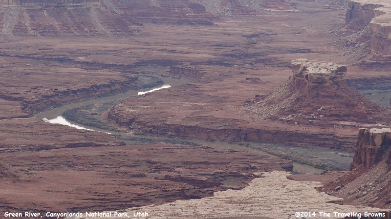
From the Green River Overlook you can get a picture of just how immense and rugged this area is. We are taking the photos from the top of the Island in the Sky mesa at 6,000 feet. The flat area in the following photos is 1,000 feet below us.
From the Green River Overlook you can get a picture of just how immense and rugged this area is. We are taking the photos from the top of the Island in the Sky mesa at 6,000 feet. The flat area in the following photos is 1,000 feet below us.
You will also see a dirt road on the left side of the photos. Park visitors with 4-wheel-drive vehicles or mountain bikes can experience Canyonlands’ wilderness on this 100-mile backcountry road. Recommended driving time is two days. We would love to make this trip!!
The next two photos will help with perspective from where we are snapping photos down to the flat area below.
The flat area below really is not flat as you can see in this photo. There are ridges and washes along with unusual rock formations.
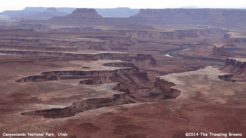
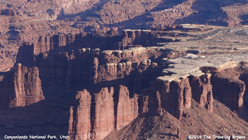
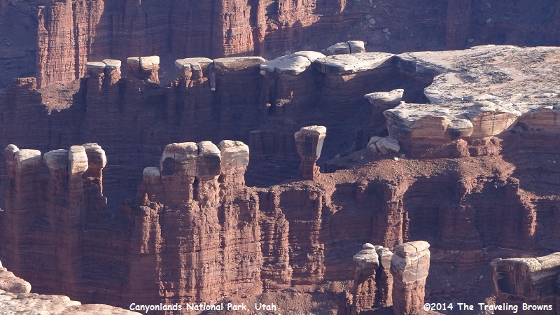
In this close-up shot you can see the Green River flowing through the canyon. The butte on the right is Turks Head. It was named by John Wesley Powell for its resemblance to a Turkish turban. White rim sandstone acts as a protective cap rock on buttes and spires throughout the park.
Here is another shot of Turks Head.

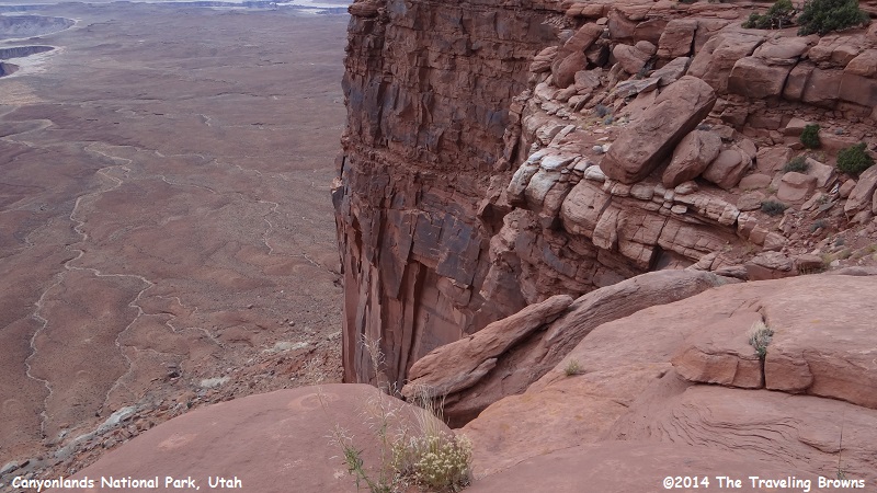
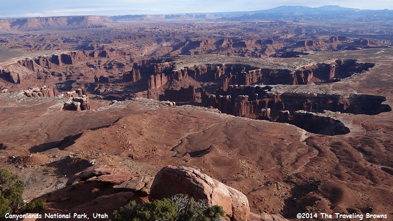
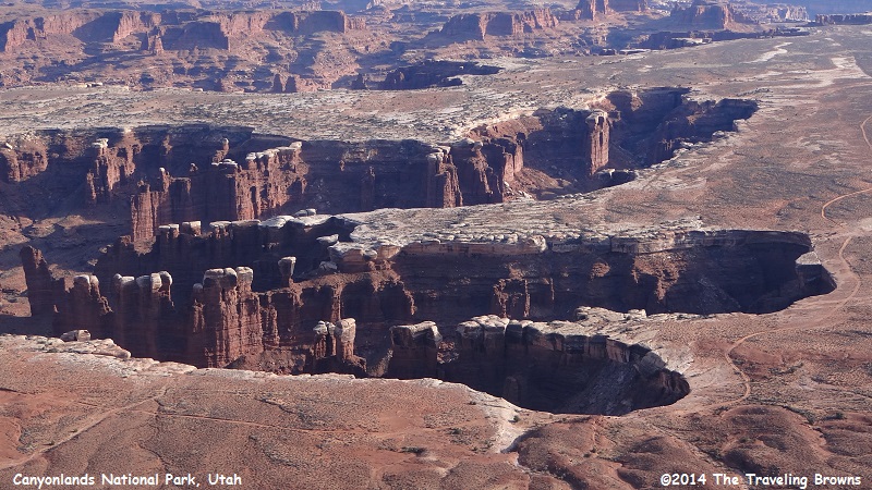
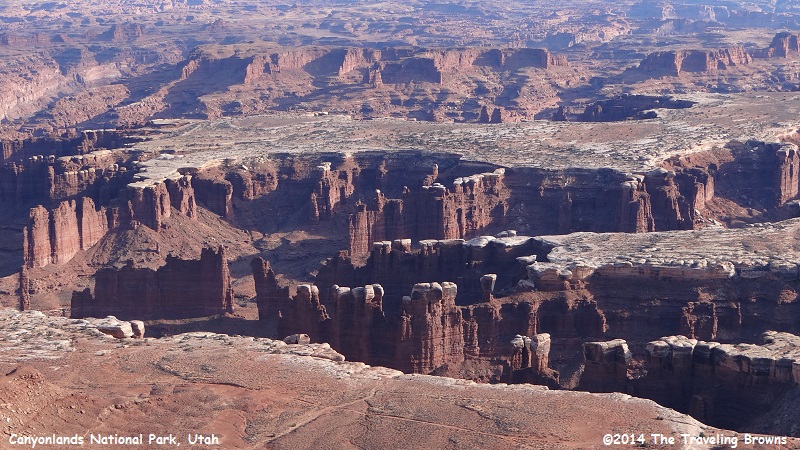
Our next stop was at Grand Viewpoint Overlook at an elevation of 6,080 feet. The Colorado River Canyon below is so deeply cut into the landscape that the river is no longer visible. The white rim sandstone layer, that forms a sharply defined rim above the lower level canyons, lies about 1,300 feet below where we shot this photo.
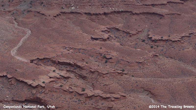
Human activities have changed the face of Canyonlands. Livestock grazing in the late 19th century altered plant communities. The roads and seismic lines you see in the following photo were constructed in the 1950s in search for uranium and oil. Mining and grazing activities eventually ceased with the creation of Canyonlands National Park, but the impacts are still visible today.
Desert plants endure poor soil, infrequent rain, intense heat, and strong winds. Annual precipitation is less than 10 inches. Because of these challenges, seeds only germinate once every few years. This means that desert plant communities recover very slowly from any disturbance.
Desert plants endure poor soil, infrequent rain, intense heat, and strong winds. Annual precipitation is less than 10 inches. Because of these challenges, seeds only germinate once every few years. This means that desert plant communities recover very slowly from any disturbance.
It is hard to believe that the white rim sandstone caps are made of ancient coastal sand dunes. We live in an ever changing world—although it is occurring very slowly.
With the sun getting lower on the horizon we started working our way off the Island in the Sky Mesa. It was truly an enjoyable day.
Our next adventure will take us into the Needles District of Canyonlands National Park. We hope you will consider riding along with us while exploring that area.
Until next time,
Dave & Barb
The Traveling Browns
Until next time,
Dave & Barb
The Traveling Browns
