2011-44 Crisp Point Lighthouse, Lake Superior, Michigan
Hello
All,
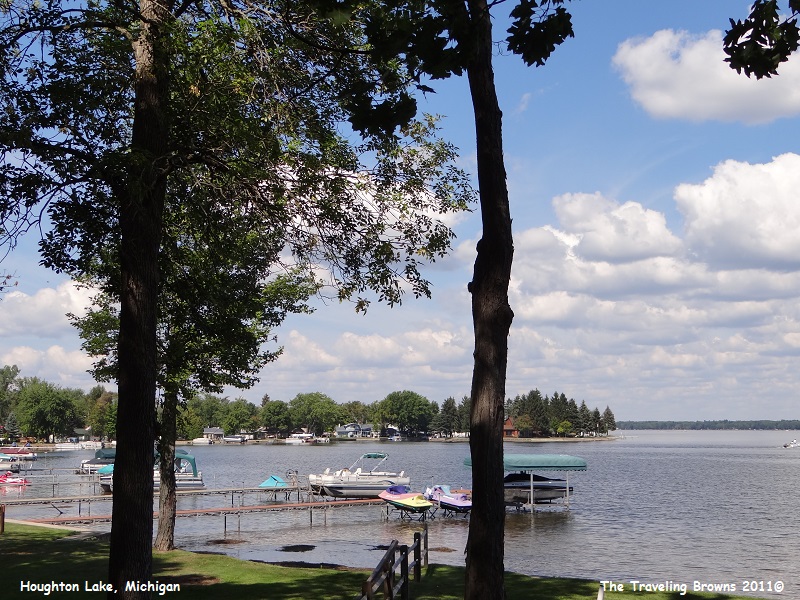
Out of Nappanee, Indiana, we traveled east and then turned north into Michigan where we worked our way up through the middle of the state. We stopped here and there exploring the various areas. One spot we liked was Houghton Lake in the north central portion of the Lower Peninsula or “mitten of the state.” The lake is quite large and we drove all the way around it. Waterfront properties were well kept and the lots were large and flat. It is an area we would have considered landing had we discovered it earlier in our retirement. However, we imagine they get some cold snowy winters.
Out of Nappanee, Indiana, we traveled east and then turned north into Michigan where we worked our way up through the middle of the state. We stopped here and there exploring the various areas. One spot we liked was Houghton Lake in the north central portion of the Lower Peninsula or “mitten of the state.” The lake is quite large and we drove all the way around it. Waterfront properties were well kept and the lots were large and flat. It is an area we would have considered landing had we discovered it earlier in our retirement. However, we imagine they get some cold snowy winters.
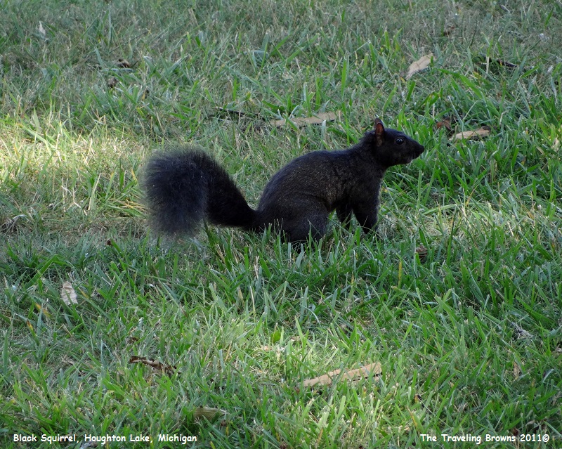
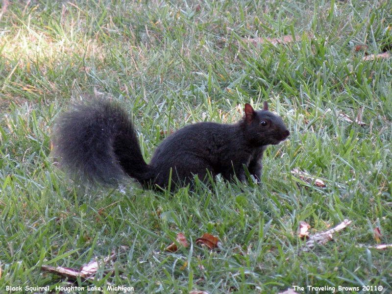
Around the lake was a population of black
squirrels. We’ve seen them before. Now and again we come across a population of
snow white squirrels. They are also quite lovely.
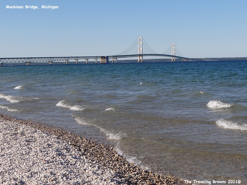
Our next stop was at Mackinaw City at
the northern tip of the Lower Peninsula. This is where the Mackinac Bridge goes
over the Straits of Mackinac to the Upper Peninsula of Michigan. The bridge is known
as the “Big Mac” or “Mighty Mac” to the locals.
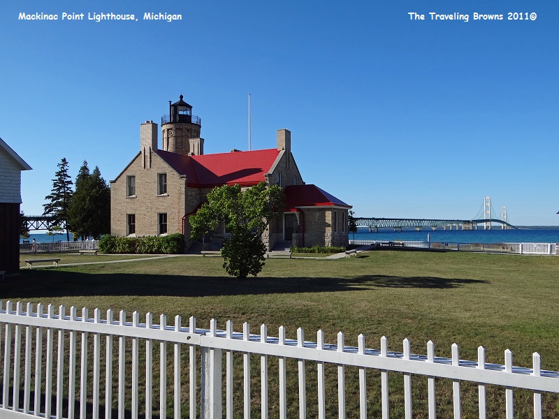
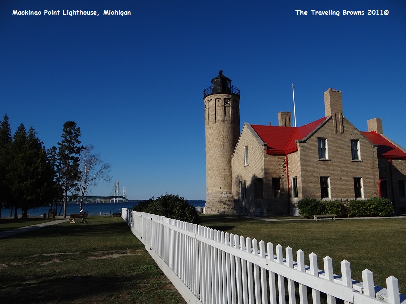
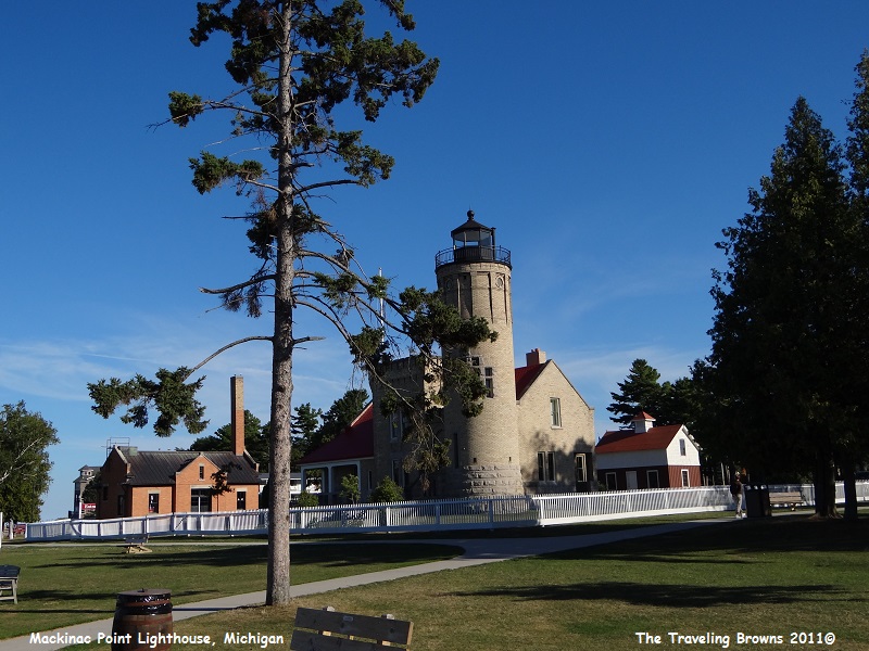
Below is the old
Mackinac Point Lighthouse. This light is opposite the turning point for ships
making the difficult passage through the Straits of Mackinac, one of the
busiest crossroads of the Great Lakes. McGulpin’s Point Light, two miles to the
west, was established in 1856, but it was not visible from all directions. In
1889 Congress appropriated funds for the construction of a steam powered fog
signal here, which went into operation on November 5, 1890. Construction
of the light tower and attached lightkeeper’s dwelling began, and the light was
first displayed October 25, 1892. Heavy iron and brass castings were used
throughout the structure, and the light was visible to ships sixteen miles
away. It operated until 1958. It has now been converted to a museum. As
lighthouses go we found it to be quite elegant.
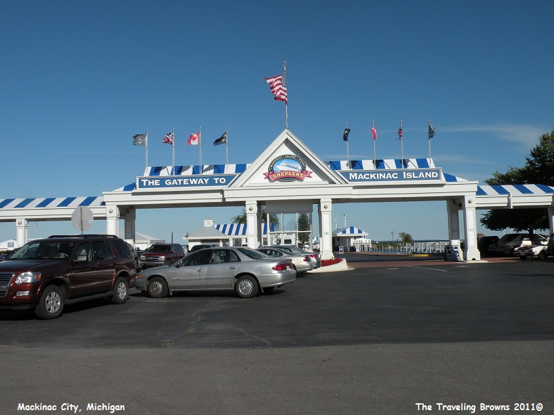
Mackinac City is the gateway to Mackinac
Island, as you can catch ferries from the city over to the island. We didn’t
take the time and we are still kicking ourselves for not taking the ferry to
the island. From all reports it is a pretty neat place. We’ll add it to the
bucket list of things we still would like to accomplish before our number is
called. In the photo below is the entrance to the ferry dock.
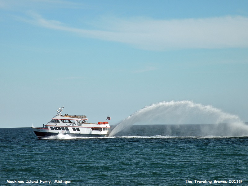
This is one of the ferry boats going to
Mackinac Island. Check out the rooster tail it was shooting out the back!
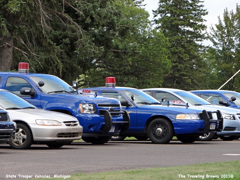
While cruising around Michigan we were
surprised to see that the Michigan State Troopers still use the old “bubble
gum” red light on many of their patrol cars. Since we have a friend that is
retired from the Michigan Troopers we had to snap a few photos and send them to
him for ole time sake.
After getting settled in Sault Ste Marie
for a couple of nights our next destination was Crisp Point Lighthouse located
on a deserted shore of Lake Superior, 37 miles north of Newberry, Michigan.
This was our first venture into the Upper Peninsula or “U P,” as the locals
call it. It’s considered one of the most inaccessible and lonely mainland lighthouses
in the “U P,” yet it can be reached by taking a narrow country
dirt/gravel road through the Lake Superior State Forest.
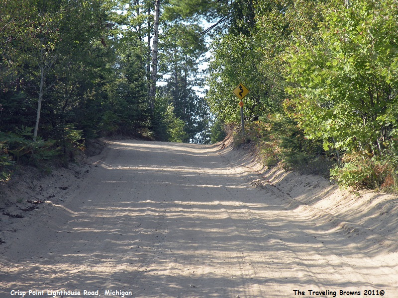
The road is built on the edge of what was and still largely is primeval forest. It is fairly well marked, but felt like it took forever to get there. The last five miles was nothing more than a one lane sand road winding through the trees. And, we knew that this was the only road in and out of the lighthouse, so we’d be driving it the other direction later in the day. But it turned out to be worth it.
The road is built on the edge of what was and still largely is primeval forest. It is fairly well marked, but felt like it took forever to get there. The last five miles was nothing more than a one lane sand road winding through the trees. And, we knew that this was the only road in and out of the lighthouse, so we’d be driving it the other direction later in the day. But it turned out to be worth it.
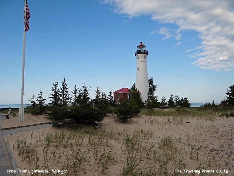
It was such a beautiful day and our
first glimpse of the lighthouse was spectacular with “ole glory” flying in
front of it.
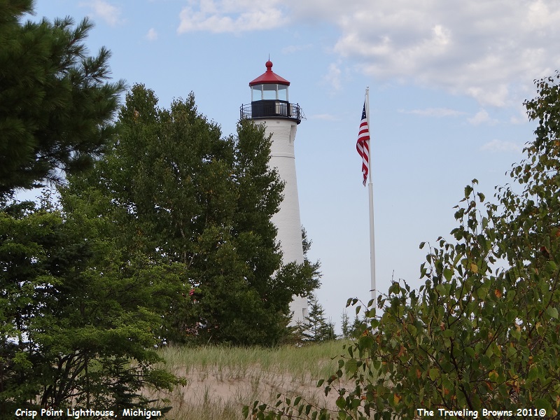
This stately light was activated on
March 5, 1904, at the established Crisp Point Life Saving Station, where
the “Storm Warriors” of Life Saving Station #10 battled the violence of Lake
Superior to save shipwrecked sailors. The Life Saving Station was named for its
first keeper and famed lifesaver Christopher Crisp.
The Life Saving Station consisted of a combination 5-room station house with room for the keeper and surf men, surfboats, and lifesaving equipment. A tall lookout tower stood by the keeper’s house. There were also houses for the surf men and their families. The lighthouse contained a 360-degree red Fourth Order Fresnel lens beaming out light for 15 miles over Lake Superior.
The Light Station was deactivated and abandoned in 1947. Storms damaged the station so badly that is was necessary for the Coast Guard to demolish the buildings in 1965, but they left the Lighthouse tower and service buildings standing.
In February of 1997 the Crisp Point Light was saved from the auction block and purchased by the local county. A group of citizens got together and formed the Crisp Point Historical Society. They leased the land from the county and began major preservation of the shoreline and lighthouse. Their rehabilitation work and projects are ongoing to date. They are presently searching for the original Fresnel light that was removed long ago.
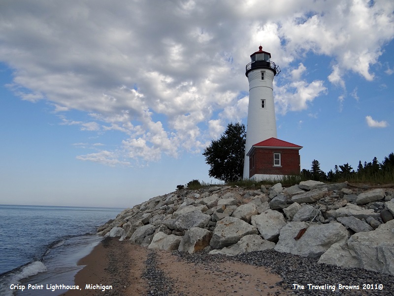
You can see in the following photo where
they have beefed up the shoreline to protect the lighthouse from the rage of
Lake Superior storms. There were a handful of other folks in this lovely
peaceful setting picking up agates from the edge of the surf.
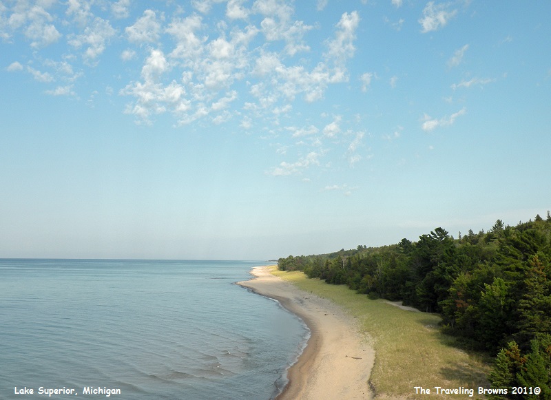
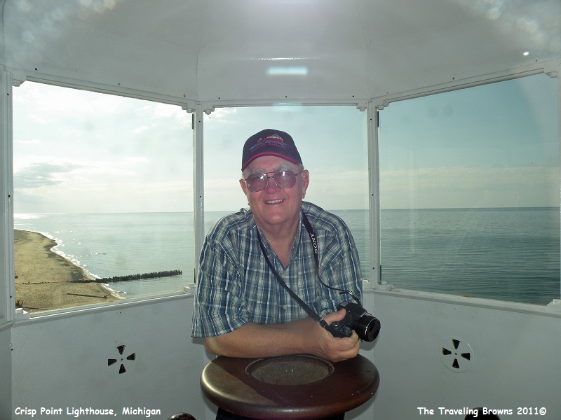
We climbed up into the light tower where
we were provided a lovely view of the shoreline.
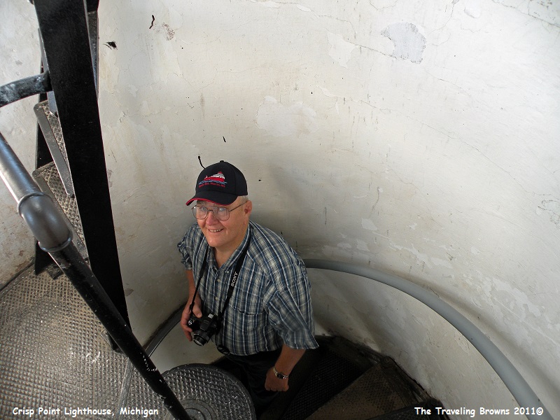
Miss Barb climbed through the hatch out
onto the catwalk around the light where she snapped this photo of Dave still
inside.
We enjoyed our first adventure into the
Upper Peninsula of Michigan. The next day we ventured to Tahquamenon Falls but
we’ll talk about it in our next little blurb.
Until next time,
Dave & Barb
The Traveling Browns
Until next time,
Dave & Barb
The Traveling Browns
