2013-22 Glacier National Park, Montana & Waterton Lakes National Park, Canada
Hello All,
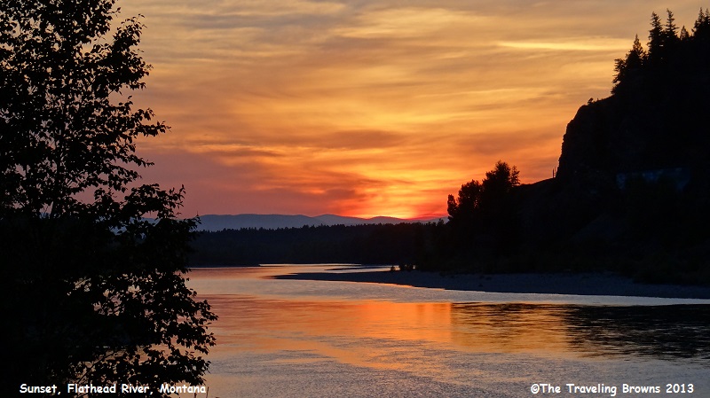
After the full day within Glacier National Park we talked about in our last write-up we returned to our home away from home for the night. On the drive back there was a spectacular sunset over the Flathead River, but due to traffic we were unable to stop and photograph it. We marked the area in our minds and would check it out the following day.
Early the next morning we were off and running back to Glacier National Park. Once we entered the park we decided to take Inside North Fork Road instead of the Going-to-the-Sun Road. It followed the North Fork of the Flathead River. This would allow us to explore the north western portion of the park. This 42-mile back country gravel road was slow going and single lane in many areas. But, we were in no hurry and enjoyed the slow pace.
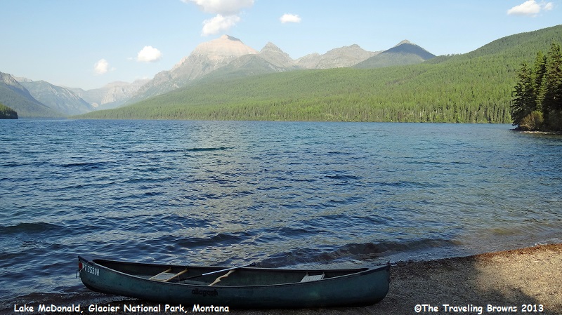
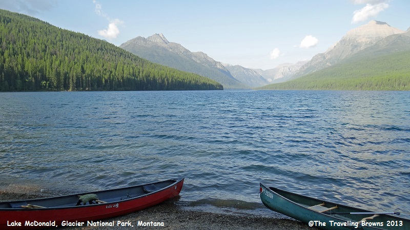
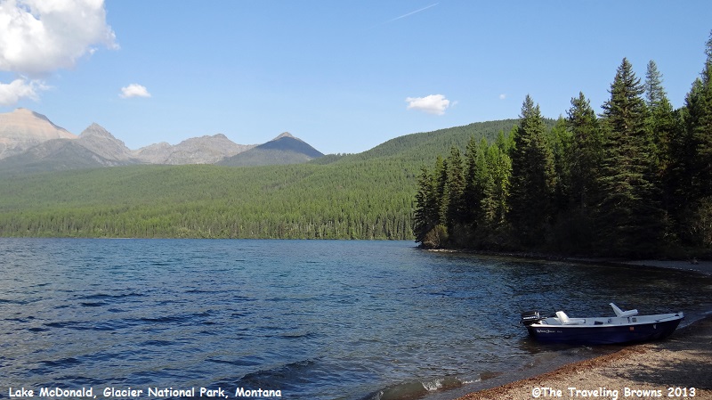
One of our first stops was at Lake McDonald. At ten miles long and nearly 500 feet deep, it is the largest lake in the park. It is a direct result of glacial carving. As you can see in the following photos Lake McDonald is surrounded by lush green forests.
After the full day within Glacier National Park we talked about in our last write-up we returned to our home away from home for the night. On the drive back there was a spectacular sunset over the Flathead River, but due to traffic we were unable to stop and photograph it. We marked the area in our minds and would check it out the following day.
Early the next morning we were off and running back to Glacier National Park. Once we entered the park we decided to take Inside North Fork Road instead of the Going-to-the-Sun Road. It followed the North Fork of the Flathead River. This would allow us to explore the north western portion of the park. This 42-mile back country gravel road was slow going and single lane in many areas. But, we were in no hurry and enjoyed the slow pace.
One of our first stops was at Lake McDonald. At ten miles long and nearly 500 feet deep, it is the largest lake in the park. It is a direct result of glacial carving. As you can see in the following photos Lake McDonald is surrounded by lush green forests.
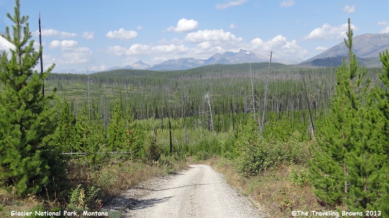
However, it wasn’t long on our
roadtrip before we got into forests that had suffered from destructive bark
beetles. We understand it is Mother Nature at work, but a forest of dead trees
doesn’t make for great photos! On the bright side however, the forests were
beginning to recover with new growth as seen in the following photo.
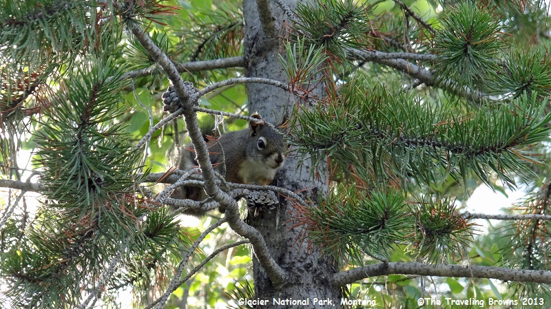
Aside from a few critters
along the road there was very little to take a photo of. This squirrel was
keeping an eye on us.
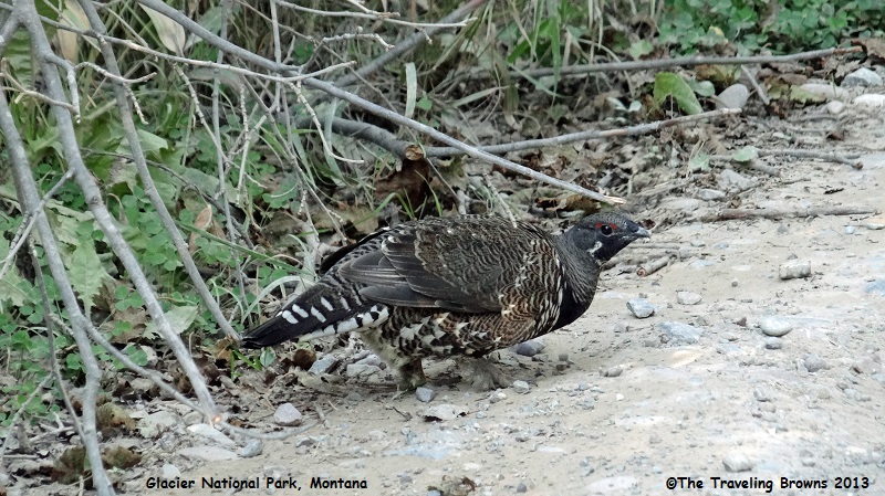
And this spruce grouse was
foraging alongside the road.
We spent the entire day
following the Inside North Fork Road till it ended. Then we backtracked a few
miles to a bridge that crossed over the river and then followed the Outside
North Fork Road back towards Kalispell.
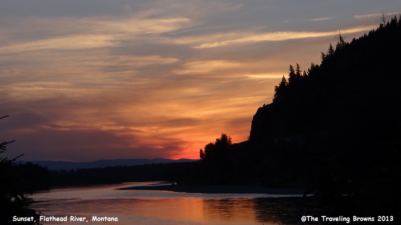
Since it was late in the day, we stopped at the place we had previously marked in our minds and waited to see if there was going to be a nice sunset. It was a place where the Flathead River turned and lined up with where the sun was setting this time of year. You could look down the river for about a mile with the setting sun reflecting in it. In our eyes it was kind of neat. And, it did not disappoint.
Since it was late in the day, we stopped at the place we had previously marked in our minds and waited to see if there was going to be a nice sunset. It was a place where the Flathead River turned and lined up with where the sun was setting this time of year. You could look down the river for about a mile with the setting sun reflecting in it. In our eyes it was kind of neat. And, it did not disappoint.
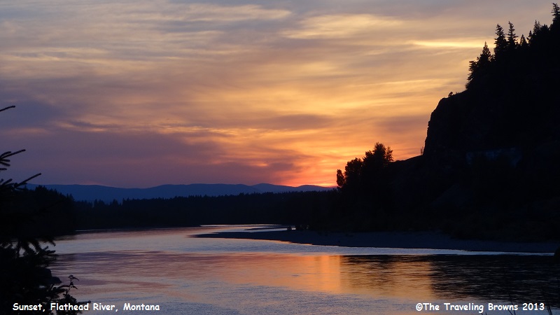
It seemed to just keep getting
better and better as the sun set. As we’ve said before, it doesn’t take much to
excite us.
Early the next morning we were
off to Glacier National Park again. This time we took the Going-to-the-Sun Road
up and over the continental divide and then out of the east gate of the park.
We then turned north heading for Canada and Waterton Lakes National Park.
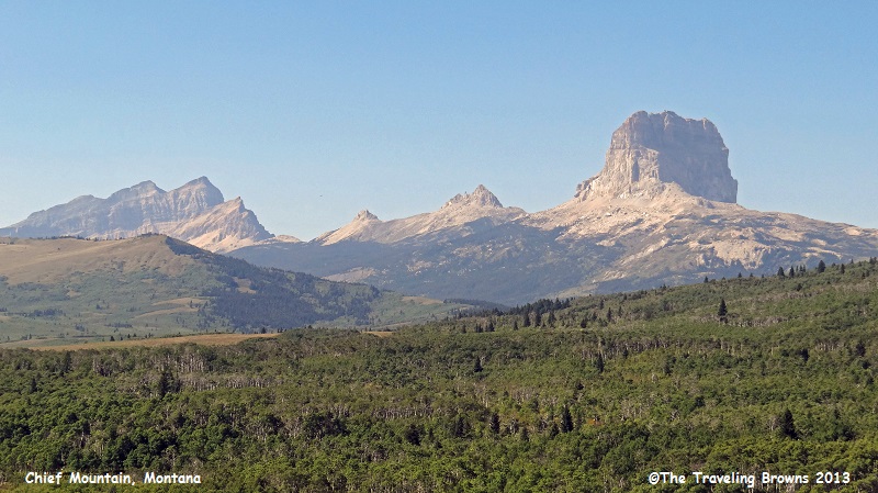
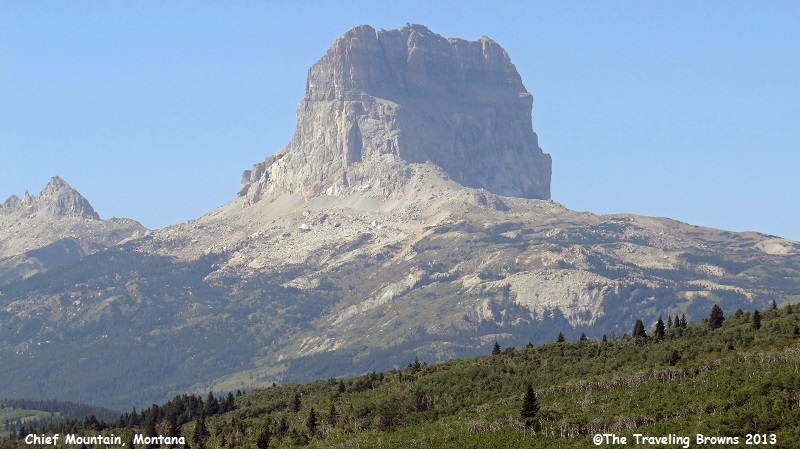
As we traveled on the western edge of the Great Plains from Montana into Canada we could see 9,080’ Chief Mountain to the west. This mountain has been sacred to Native American tribes for hundreds of years. The Blackfoot name for the mountain is Ninaiistako. The mountain was first seen by white explorers in the late 18th century and was known as Kings Peak on maps produced in the United Kingdom in 1795. Meriwether-Lewis, co-leader of the Lewis and Clark Expedition, saw the mountain in 1805 and called it Tower Mountain. The name was changed in the late 19th century in reflection of the Blackfeet naming of the mountain which was Great Chief. When Glacier National Park was created in 1910, the summit and most prominent eastern slopes of the mountain were located within the park, leaving only the lower slopes within Blackfeet jurisdiction. The northwestern enemy of the Blackfeet, the Nakoda, called the mountain Huga Baha (Chief Hill).
The eastern face of the mountain rises over 1,500 vertical feet and the easiest route on this section is rated class 4 by mountaineers. The rock is also primarily sedimentary and provides poor anchor points, which in turn is a contributing factor to the difficulty rating. Three explorers, including a Blackfoot Indian, climbed the difficult eastern face in 1892. This was the first known ascent of the peak by white explorers.
Here are a couple of shots of the eastern face of Chief Mountain.
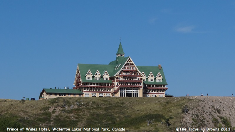
One of the first things you
notice after entering Waterton Lakes National Park is the majestic Prince of
Wales Hotel overlooking Upper Waterton Lake. Constructed between 1926 and 1927,
the hotel was built by the American Great Northern Railway, to lure American
tourists north of the border during the prohibition era. The hotel was named
after the Prince of Wales (later King Edward VIII), in a transparent attempt to
entice him to stay in the hotel on his 1927 Canadian tour, but the Prince
stayed at a nearby ranch instead.
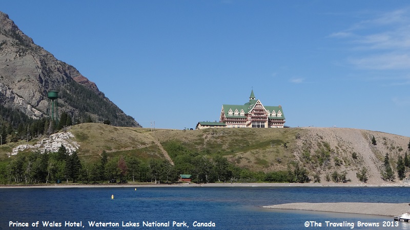
It is a spectacular hotel with
an awesome view of the lake.
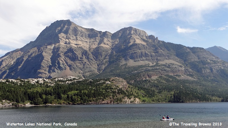
Waterton Lake is composed of
two bodies of water, connected by a shallow channel known locally as the
Bosporus. The two parts are referred to as Lower Waterton Lake, and Upper
Waterton Lake, the latter of which is crossed at the tip by the Canada-United
States border. It was Canada’s fourth national park, formed in 1895, and
contains 195 square miles of rugged mountains and wilderness. Waterton-Glacier
International Peace Park was created by the US and Canada in 1932, and in 1976
it was designated an International Biosphere Reserve. Later, in 1995, it was
inscribed as a World Heritage Site by UNESCO.
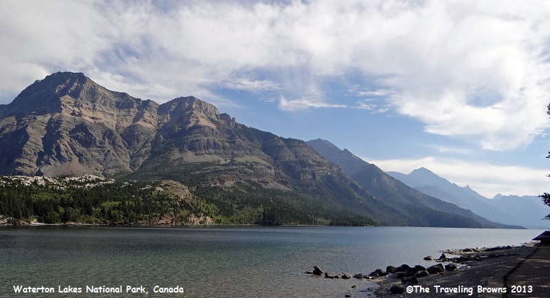
We walked the shore of the lake enjoying the scenic beauty.
We walked the shore of the lake enjoying the scenic beauty.
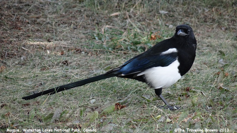
There was a friendly magpie
along the shore so we spent some time photographing it. These guys with their
coal black eyes in black feathers with contrasting white feathers and iridescent
feathers on their backs are extremely hard to photograph. They are a challenge
but we did manage to get a few good ones.
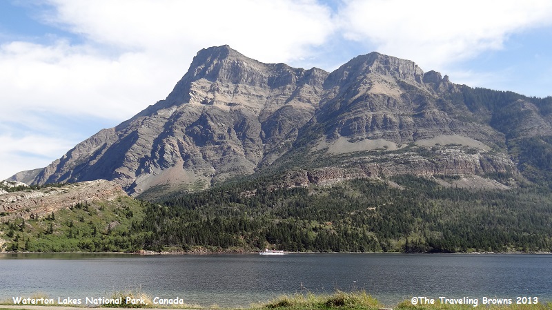
In the distance in this photo
you can see the tour boat “International” returning from a cruise around the
lake. We regret that in all the times we have been to the park we have never
taken the cruise--seems like our timing is never right. Next time we will have
to make it happen and spend the night in Waterton Village.
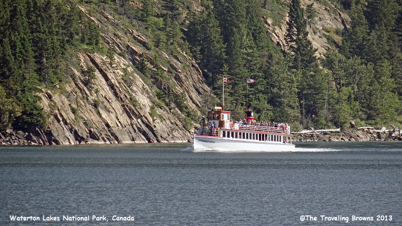
This is a closer photo of the
vintage boat. It has been in service since 1927. What a great cruise this would
be. It goes from Canada into the US and back in the scenic Rocky Mountains.
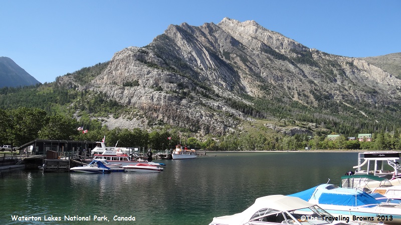
This is the harbor where the
International ties up. Folks disembarking the boat all expressed what a
wonderful trip it was.
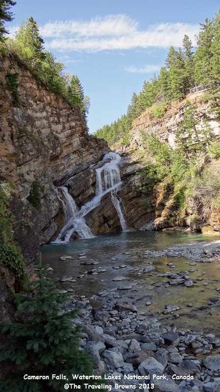
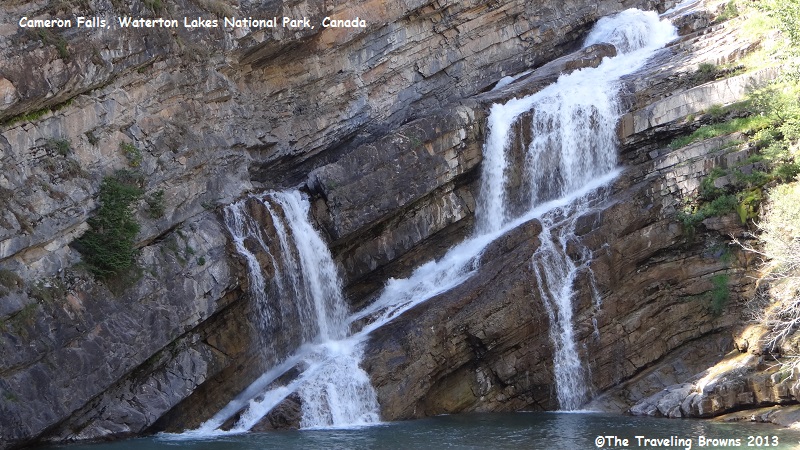
Our final stop in the park was
at Cameron Falls. It is our favorite of the many waterfalls we have
photographed in our travels. Not the tallest or largest by any means, it is
just unique the way it flows through the uplifted rock. And, it is some of the
oldest rock in the entire Canadian Rocky Mountain range. The Precambrian
bedrock dates back 1.5 billion years.
Cameron Falls also has the distinction of being the only falls we know of that has flowed red. In 2010, a phenomenal natural spectacle occurred. The falls ran red after a heavy rain in the mountains far away washed sediment into the stream. A lucky photographer was in the right place at the right time and captured the event. A copy of his photograph is posted at the falls—it was awesome!
Cameron Falls also has the distinction of being the only falls we know of that has flowed red. In 2010, a phenomenal natural spectacle occurred. The falls ran red after a heavy rain in the mountains far away washed sediment into the stream. A lucky photographer was in the right place at the right time and captured the event. A copy of his photograph is posted at the falls—it was awesome!
In our next write-up we will
continue on our adventure to the north into the Canadian Rocky Mountains. Our
focus will be on Banff National Park. Hope you can ride along with us.
Until next time,
Dave & Barb
The Traveling Browns
Until next time,
Dave & Barb
The Traveling Browns
