2011-48 Lake Superior, Minnesota
Hello
All,
Since it had been a number of years since we had been in the “Land of 10,000 Lakes,” and it was our first time in this part of Minnesota, we decided to hang around the Duluth area for a few days. We chose the little town of Cloquet, which is southwest of Duluth, as our temporary base of operations.
Our initial plan was to drive all the way around Lake Superior. Arriving in Duluth completed our trek along the southern shore of the lake. From Duluth we would follow MN-61 along the western shoreline of the lake all the way into Thunder Bay, Canada. We would continue on Trans Canada Highways 11 & 17 around the northern portion of the lake. However, a major forest fire in northeast Minnesota was threatening to shut down MN-61 near the US/Canada border. Staying in Cloquet a few days would give us time to see the local area and then see what developed with the fire situation.
Here are a few facts about Lake Superior that you may or may not know:
It contains ten percent of all the fresh water on planet Earth. It covers 82,000 square kilometers or 31,700 square miles. The average depth is 147 meters or 483 feet. There have been about 350 shipwrecks recorded on the lake. By surface area, it is the largest lake in the world. It contains as much water as all the other Great Lakes combined, plus three extra Lake Erie’s. There is a small outflow from the lake into Lake Huron, but it takes almost two centuries for the water to be completely replaced. There is enough water in Lake Superior to cover all of North and South America with water a foot deep. It was formed during the last glacial retreat, making it one of the earth’s youngest major features at only about 10,000 years old. The deepest point in the lake is 405 meters or 1,333 feet. There are 78 different species of fish that call the lake home. The maximum wave ever recorded on the lake was 9.45 meters or 31 feet high. In the summer the sun sets more than 35 minutes later on the western shore than on the southeastern edge. Some of the world’s oldest rocks, formed about 2.7 billion years ago, can be found on the Ontario shoreline of the lake. And, it rarely freezes over completely, and then usually just for a few hours.
Well, that’s probably way more information than you ever wanted to know about the lake. But, you must admit it is one fascinating body of water. Exploring the entire southern shoreline just whet our appetites to see more of the lake.
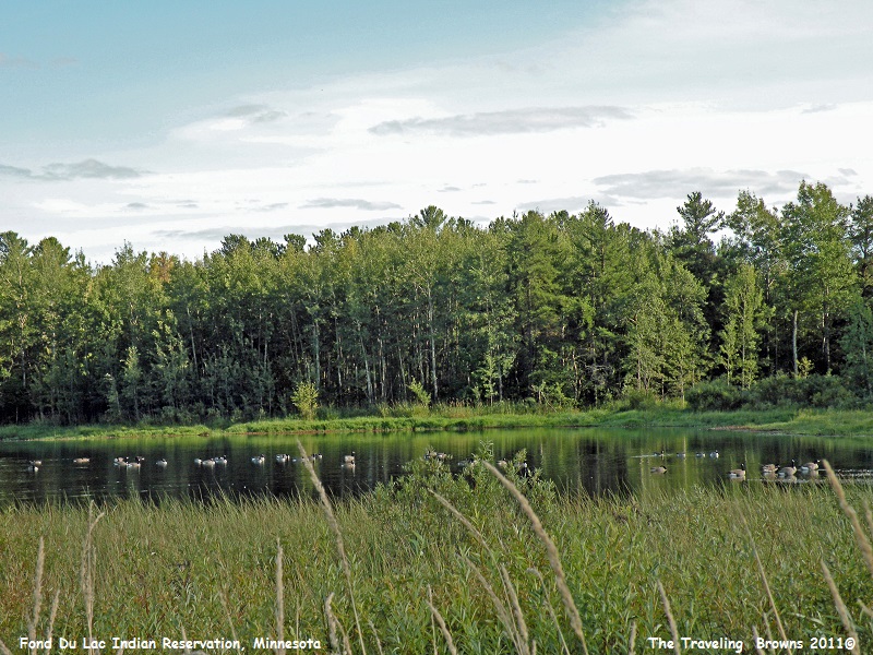
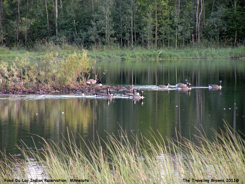
A portion of the Fond du Lac Indian Reservation lies within the little town of Cloquet. Driving through the reservation we saw many flocks of Canadian geese that appeared to be gathering for their migration south. One evening we stopped at a small pond and snapped a few photos. There was just something that seemed peaceful and serene about the setting.
Since it had been a number of years since we had been in the “Land of 10,000 Lakes,” and it was our first time in this part of Minnesota, we decided to hang around the Duluth area for a few days. We chose the little town of Cloquet, which is southwest of Duluth, as our temporary base of operations.
Our initial plan was to drive all the way around Lake Superior. Arriving in Duluth completed our trek along the southern shore of the lake. From Duluth we would follow MN-61 along the western shoreline of the lake all the way into Thunder Bay, Canada. We would continue on Trans Canada Highways 11 & 17 around the northern portion of the lake. However, a major forest fire in northeast Minnesota was threatening to shut down MN-61 near the US/Canada border. Staying in Cloquet a few days would give us time to see the local area and then see what developed with the fire situation.
Here are a few facts about Lake Superior that you may or may not know:
It contains ten percent of all the fresh water on planet Earth. It covers 82,000 square kilometers or 31,700 square miles. The average depth is 147 meters or 483 feet. There have been about 350 shipwrecks recorded on the lake. By surface area, it is the largest lake in the world. It contains as much water as all the other Great Lakes combined, plus three extra Lake Erie’s. There is a small outflow from the lake into Lake Huron, but it takes almost two centuries for the water to be completely replaced. There is enough water in Lake Superior to cover all of North and South America with water a foot deep. It was formed during the last glacial retreat, making it one of the earth’s youngest major features at only about 10,000 years old. The deepest point in the lake is 405 meters or 1,333 feet. There are 78 different species of fish that call the lake home. The maximum wave ever recorded on the lake was 9.45 meters or 31 feet high. In the summer the sun sets more than 35 minutes later on the western shore than on the southeastern edge. Some of the world’s oldest rocks, formed about 2.7 billion years ago, can be found on the Ontario shoreline of the lake. And, it rarely freezes over completely, and then usually just for a few hours.
Well, that’s probably way more information than you ever wanted to know about the lake. But, you must admit it is one fascinating body of water. Exploring the entire southern shoreline just whet our appetites to see more of the lake.
A portion of the Fond du Lac Indian Reservation lies within the little town of Cloquet. Driving through the reservation we saw many flocks of Canadian geese that appeared to be gathering for their migration south. One evening we stopped at a small pond and snapped a few photos. There was just something that seemed peaceful and serene about the setting.
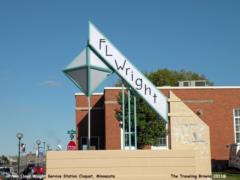
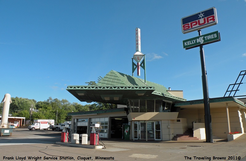
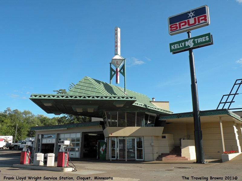
Cloquet
is also home to the R.W. Lindholm Service Station. You ask, what is so special
about a service station? The answer is, it is the one and only gas station
designed by architect Frank Lloyd Wright. It is listed on the National Register
of Historic Places. Even more surprising to us was the fact that it is still in
operation today.
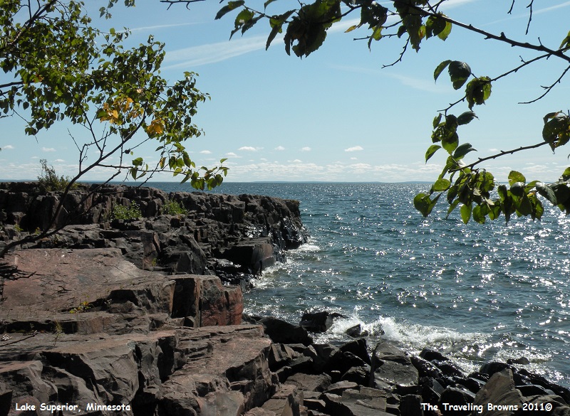
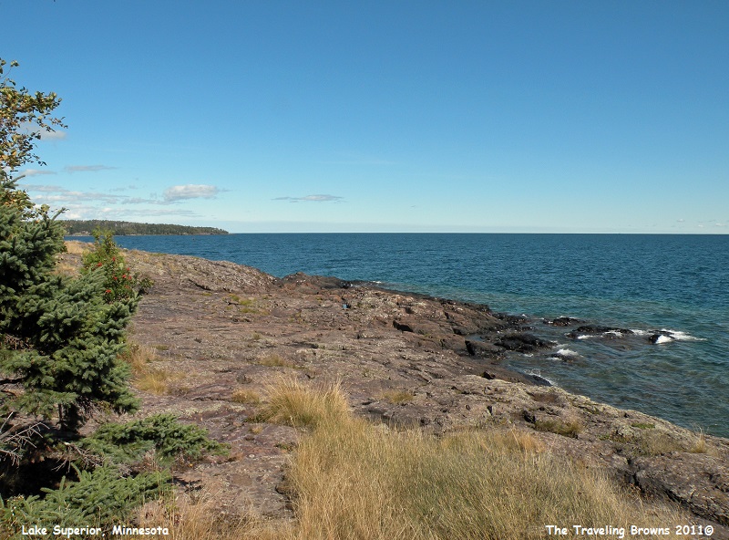
Our
first day trip out of Cloquet was up the west shoreline of Lake Superior to Two
Harbors, Minnesota. After passing through Duluth you soon find yourself in the
country. We stopped at every opportunity to check out different views along the
shoreline. Once again the ruggedness of the area was amazing--nothing even
remotely resembling a sandy beach.
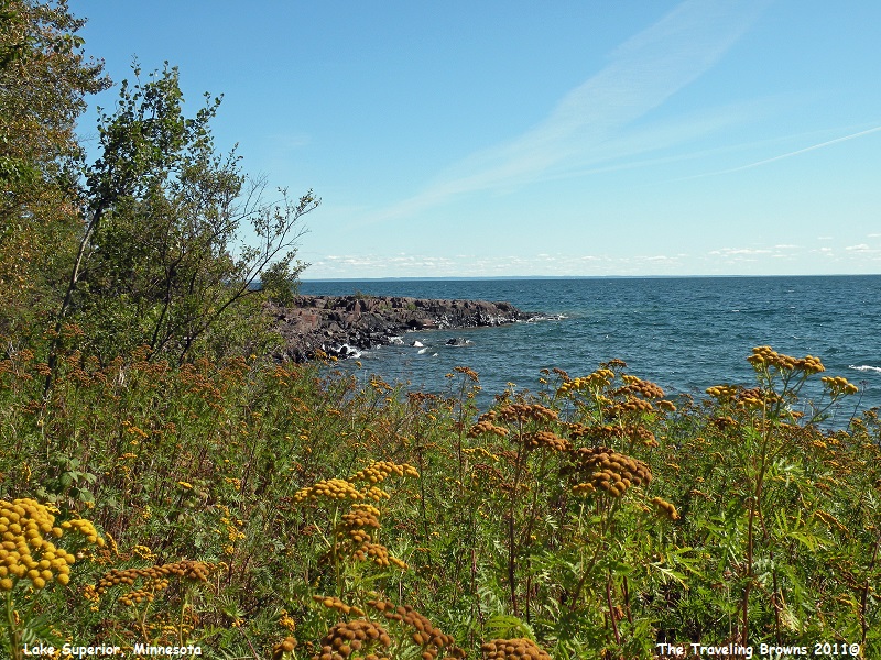
Even
the weeds and bushes were new to us. An example would be the plant in the
following photo with yellow and brown pods. It was a variety that we haven’t
come across before.
Check
out the burls on these two trees. The tree on Miss Barb’s left had between eight and
ten of them. We thought it was an interesting quirk of nature.

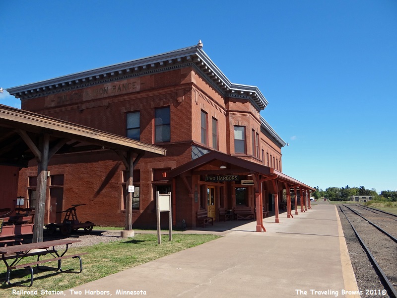
The
little town of Two Harbors owes its very existence to the Duluth and Iron Range
(D&IR) Railroad, established in 1883 to transport iron ore from the
Vermilion Range for shipping to steel mills via the Great Lakes. The railroad
chose Agate Bay, renamed Two Harbors in 1888, for a terminus because it was
relatively close to the mines, but more importantly, because of the clay bottom
bay, rare along rocky Lake Superior shores.
Besides over 8,000,000 tons of iron ore annually, the D&IR Railroad was transporting freight and passengers by 1907, necessitating the construction of a depot. The railroad built and established its headquarters and corporate offices in the two-story brick depot in the following photo. It served passenger and freight needs until the 1960s. It is now a museum.
Besides over 8,000,000 tons of iron ore annually, the D&IR Railroad was transporting freight and passengers by 1907, necessitating the construction of a depot. The railroad built and established its headquarters and corporate offices in the two-story brick depot in the following photo. It served passenger and freight needs until the 1960s. It is now a museum.
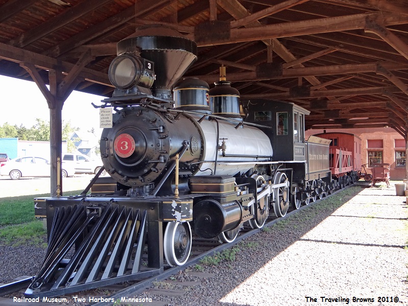
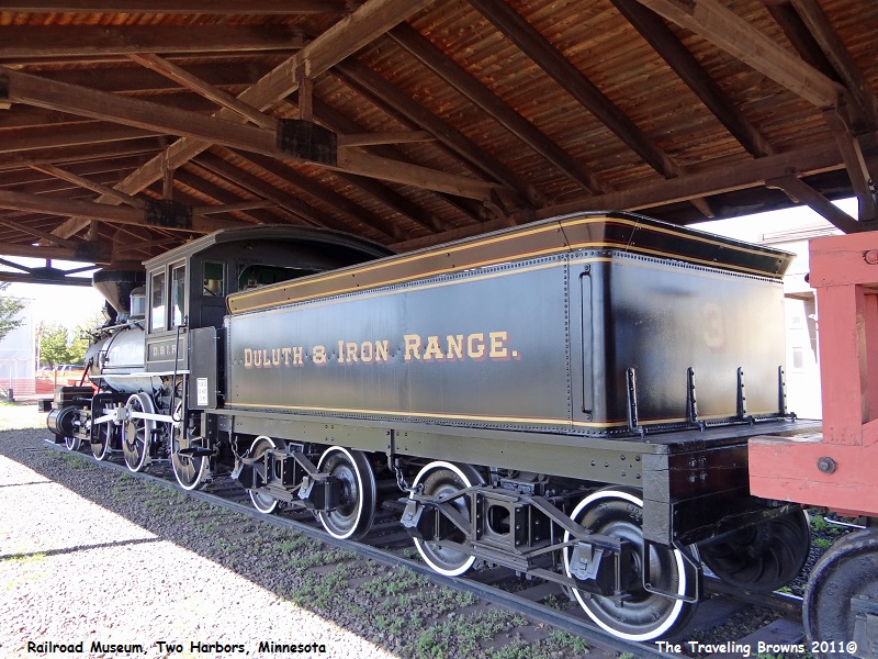
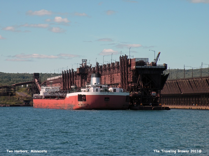
To
this day iron ore is still brought in from the mines by train for loading onto
ships. Train cars carrying the ore pellets are maneuvered onto specially built
docks where the ore is dumped into large holding bins. Once a lake freighter or
“laker” is tied up next to the dock, chutes are lowered into the various holds
of the ship. Gates are then opened allowing the ore to gravity fill the ship’s
holds. Probably the most famous laker was the SS Edmund Fitzgerald popularized
by the song “The Wreck of the Edmund Fitzgerald.” In the following photos a
laker is tied up next to one of the ore loading docks.
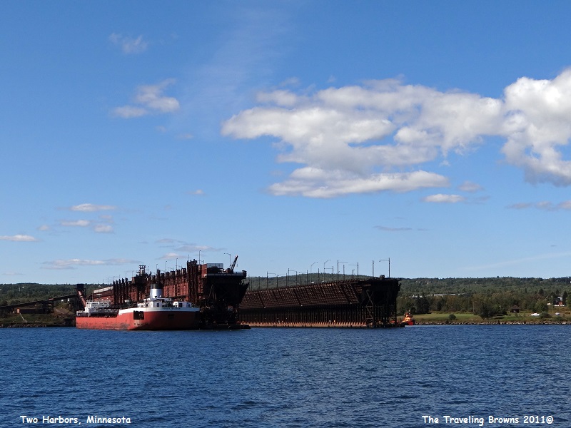
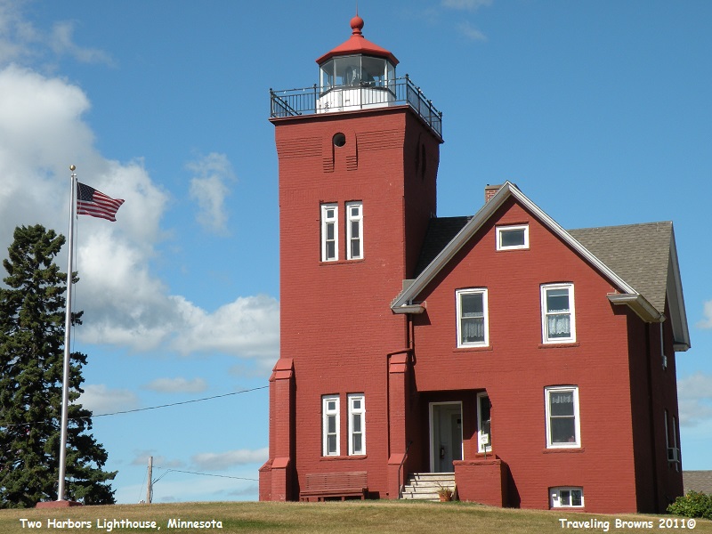
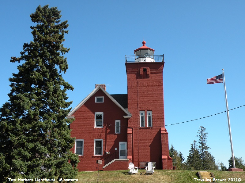
After
the Minnesota Mining Company began shipping iron ore through the Two Harbors
ore docks in 1884, this port far surpassed Duluth in importance. The increased
traffic in ore boats, combined with commercial fishing, made navigation
extremely hazardous. Many ships went aground or were dashed to bits along the
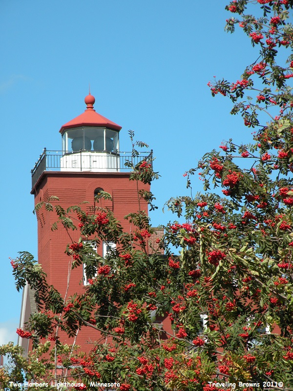
foggy, rocky shoreline of Lake Superior. The Two Harbors Light Station
completed in 1892 alleviated the danger.
It was equipped with a Fourth Order Fresnel lens, consisting of glass prisms surrounding a light source. The central prism magnified the light, while those above and below refracted it into a single beam. The volatility of kerosene, which originally powered the light source, dictated the design of the keeper’s house. The two-story main house is constructed of walls two bricks thick. The walls of the adjoining light tower are three bricks thick, making the wall between these structures five bricks thick. This gave added protection should the kerosene explode.
It was equipped with a Fourth Order Fresnel lens, consisting of glass prisms surrounding a light source. The central prism magnified the light, while those above and below refracted it into a single beam. The volatility of kerosene, which originally powered the light source, dictated the design of the keeper’s house. The two-story main house is constructed of walls two bricks thick. The walls of the adjoining light tower are three bricks thick, making the wall between these structures five bricks thick. This gave added protection should the kerosene explode.
We
thoroughly enjoyed checking the sites out in and around the Duluth area. There
were more interesting places than we have room to share. In our next writing
we’ll advise on the status of the fire blocking our projected route around the
lake.
Until next time,
Dave & Barb
The Traveling Browns
Until next time,
Dave & Barb
The Traveling Browns
