Pictures of the Week 2010-6
Hello All,
Departing Glendive, MT, we drove northwest on MT-200S to Circle where we turned west on MT-200 to Lewistown. This part of Montana is known as the Missouri River Country.
We found that along this stretch of highway there is a whole lot of nothing! It was very sparsely populated with only an occasional ranch house way off in the distance. You had better like isolation if you live in this part of the prairie. There were no trees, crops, or much in the way of livestock.
We did learn that the famed Montana Dinosaur Trail encompasses this area of the state. Near Fort Peck is where one of the most complete Tyrannosaurus rex skeletons was found in 1997. There are many active paleontology field digs ongoing throughout this part of the state.
To the north, paralleling MT-200, the Missouri River flows from west to east. Fort Peck Dam on the river is the world’s largest hydraulic earth-filled dam. Another time we would like to come back and explore the Fort Peck Lake area more thoroughly. The lake boasts over 1500 miles of shoreline and contains many wildlife refuges.
From Lewistown we continued west on MT-200 to Great Falls. This part of Montana is known as Russell Country--named after Charles M. Russell, the celebrated cowboy artist. Approaching Great Falls the terrain started to change and there were huge rolling wheat fields that go for miles. Still not much in the way of trees however. We decided to hang our hats here for a couple of days of exploring.
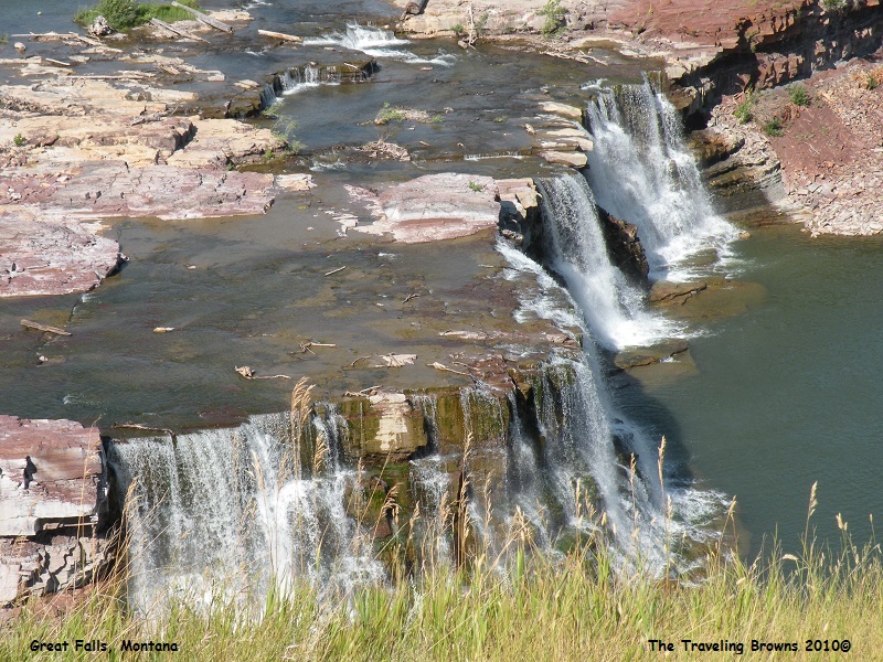
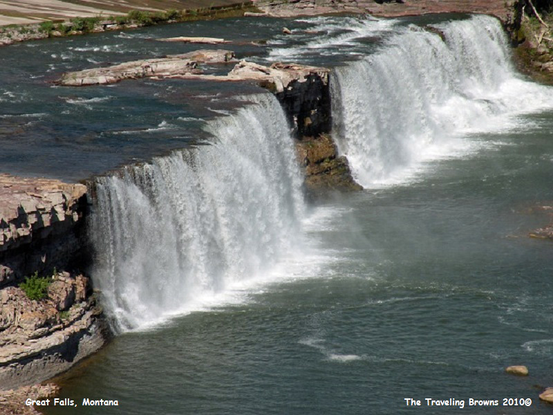
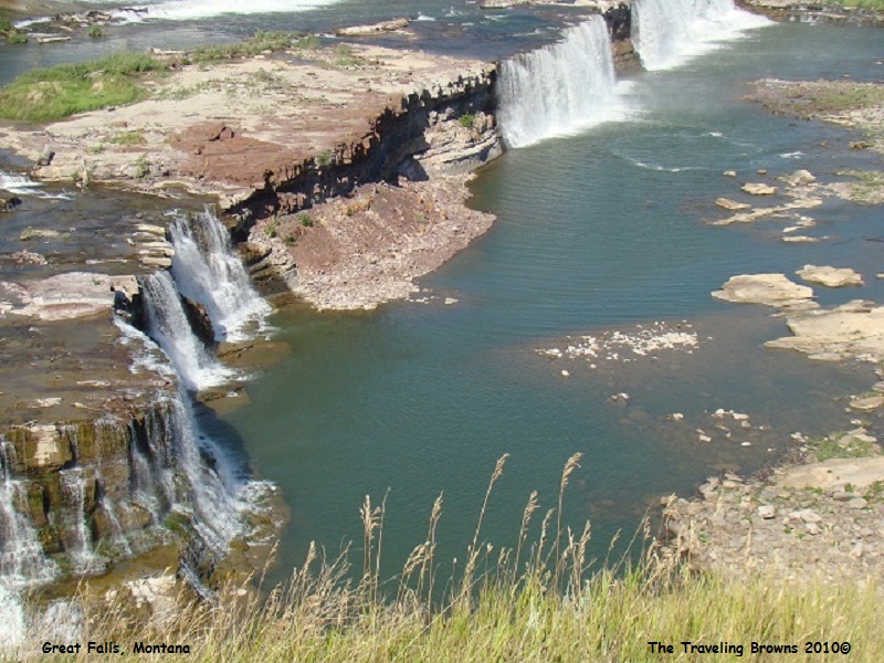
Our first item of business was to visit the five famed great falls in the area. They are named Great Falls, Rainbow Falls, Colter Falls, Black Eagle Falls, and Crooked Falls. To say we were somewhat disappointed would be an understatement. The scenic beauty of the falls has been greatly reduced by industrial ventures and hydroelectric projects encompassing them. Coulter Falls is now under the waters of Rainbow Reservoir. It is such a shame that this area along the river was not preserved in its natural state for mankind to enjoy throughout time. We did our best to get some good photos of the falls by using some creative techniques to avoid the manmade structures surrounding them.
Departing Glendive, MT, we drove northwest on MT-200S to Circle where we turned west on MT-200 to Lewistown. This part of Montana is known as the Missouri River Country.
We found that along this stretch of highway there is a whole lot of nothing! It was very sparsely populated with only an occasional ranch house way off in the distance. You had better like isolation if you live in this part of the prairie. There were no trees, crops, or much in the way of livestock.
We did learn that the famed Montana Dinosaur Trail encompasses this area of the state. Near Fort Peck is where one of the most complete Tyrannosaurus rex skeletons was found in 1997. There are many active paleontology field digs ongoing throughout this part of the state.
To the north, paralleling MT-200, the Missouri River flows from west to east. Fort Peck Dam on the river is the world’s largest hydraulic earth-filled dam. Another time we would like to come back and explore the Fort Peck Lake area more thoroughly. The lake boasts over 1500 miles of shoreline and contains many wildlife refuges.
From Lewistown we continued west on MT-200 to Great Falls. This part of Montana is known as Russell Country--named after Charles M. Russell, the celebrated cowboy artist. Approaching Great Falls the terrain started to change and there were huge rolling wheat fields that go for miles. Still not much in the way of trees however. We decided to hang our hats here for a couple of days of exploring.
Our first item of business was to visit the five famed great falls in the area. They are named Great Falls, Rainbow Falls, Colter Falls, Black Eagle Falls, and Crooked Falls. To say we were somewhat disappointed would be an understatement. The scenic beauty of the falls has been greatly reduced by industrial ventures and hydroelectric projects encompassing them. Coulter Falls is now under the waters of Rainbow Reservoir. It is such a shame that this area along the river was not preserved in its natural state for mankind to enjoy throughout time. We did our best to get some good photos of the falls by using some creative techniques to avoid the manmade structures surrounding them.
During June and July 1805, the
Corps of Discovery expedition traveled around the five falls of the Missouri.
They began the chore by finding cottonwood trees to make wheels (or trucks),
upon which the canoes were pulled over the eighteen-mile portage route that
Captain Clark had mapped.
In twelve days the men made four trips back and forth across the windy, cactus-filled prairie. On July 4th, 1805, the portage was completed. The men celebrated Independence Day by firing their guns and drinking the last of the whiskey they had brought with them. This was one of the most difficult parts of the journey the expedition encountered.
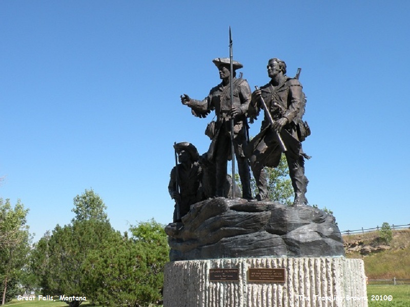
Our next stop was at the Lewis and Clark National Historic Trail Interpretive Center where we snapped this photo of the statue honoring the men & women of the Corps of Discovery expedition. We found the interpretive center to be well done and very informative.
In twelve days the men made four trips back and forth across the windy, cactus-filled prairie. On July 4th, 1805, the portage was completed. The men celebrated Independence Day by firing their guns and drinking the last of the whiskey they had brought with them. This was one of the most difficult parts of the journey the expedition encountered.
Our next stop was at the Lewis and Clark National Historic Trail Interpretive Center where we snapped this photo of the statue honoring the men & women of the Corps of Discovery expedition. We found the interpretive center to be well done and very informative.
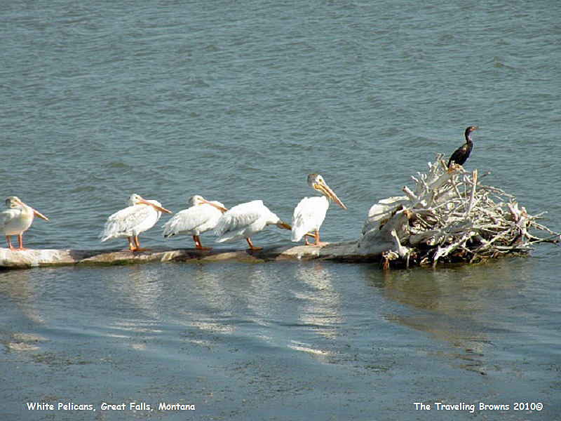
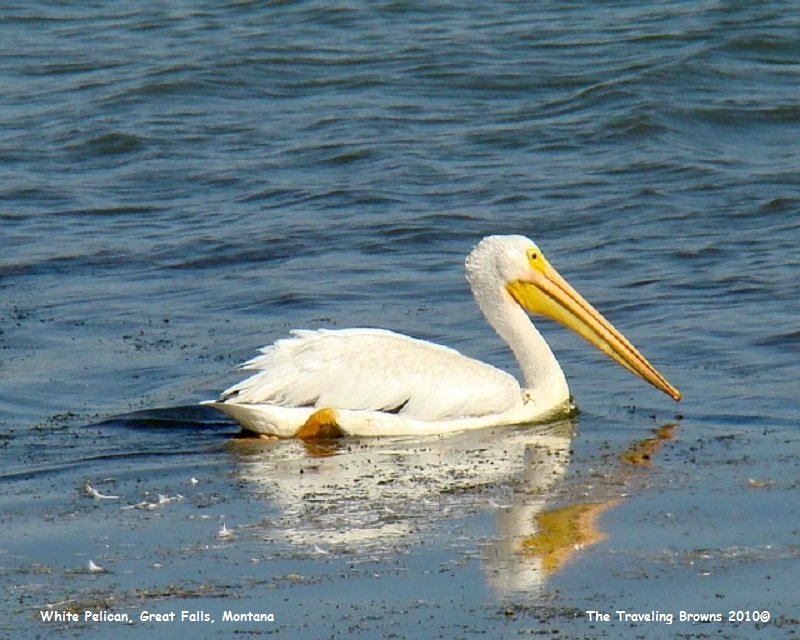
While exploring sites along the Missouri River
we came across a group of White Pelicans sunning themselves on a log. We have
taken many photos of Brown Pelicans but this was our first opportunity at the white
birds. We have seen them on numerous occasions but they were very skittish and
we never got close enough for good photos. This group posed for us and went
about their business for about an hour close to the river bank.
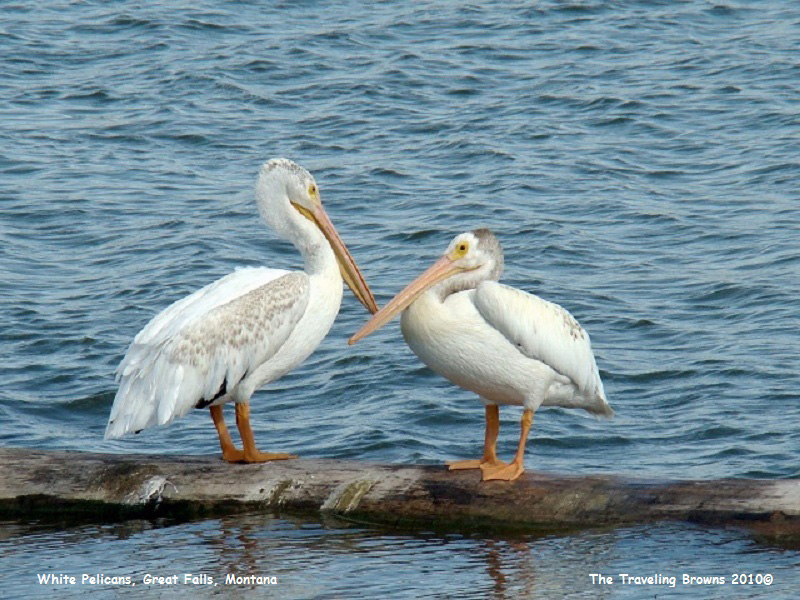

Just in case you are having
trouble differentiating the sex of White Pelicans, the following photo will
allow you to distinguish between the female and the male…hee, hee, hee.

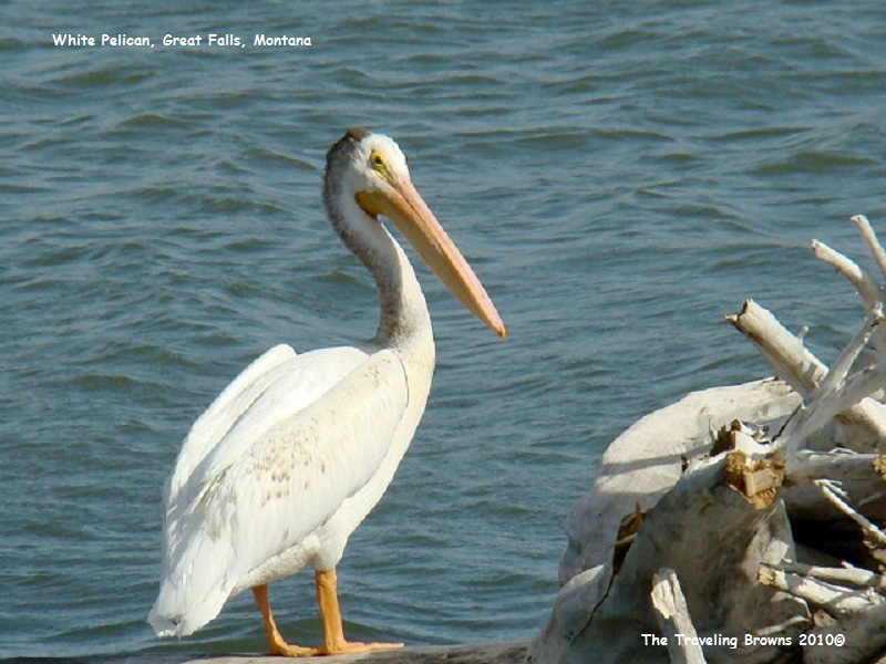
After giving us the
opportunity to photograph them they finally started moving on.
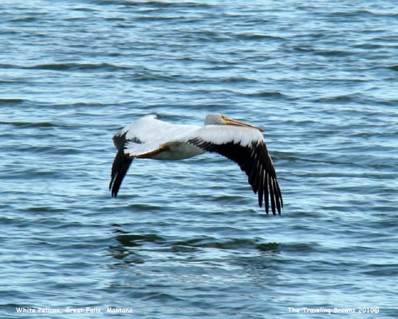
And when they started to fly
we were amazed at just how much black they had on their wings. We thoroughly
enjoyed the opportunity to observe and photograph them. It was a wonderful
experience.
Departing Great Falls we chose
to stay on MT-200 to Missoula rather than following the Interstate highways.
Every mile that we covered as we climbed up into the Rocky Mountains became
more and more scenic--a stark contrast to the many days previously traveling
across the prairies.
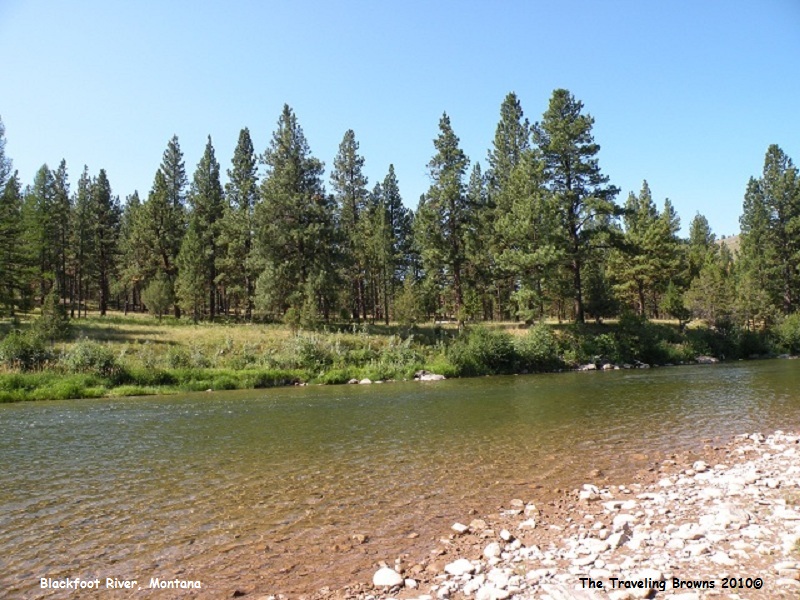
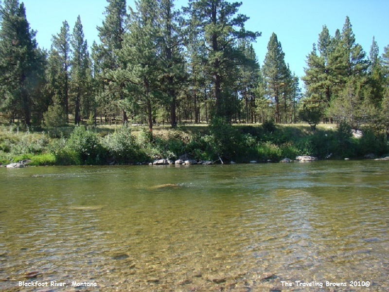
We stopped for a picnic lunch beside the crystal clear water of the Blackfoot River. It was a blue sky day and we could smell the fragrance of the evergreen trees in the air. What a wonderful way to take a break, kickback, and relax.
We stopped for a picnic lunch beside the crystal clear water of the Blackfoot River. It was a blue sky day and we could smell the fragrance of the evergreen trees in the air. What a wonderful way to take a break, kickback, and relax.
At Missoula we jumped on I-90
westbound through the Idaho panhandle to Spokane, Washington, where we stopped
for three days.
Until next time,
Dave & Barb
The Traveling Browns
Until next time,
Dave & Barb
The Traveling Browns
