2013-21 Flathead Lake & Glacier National Park, Montana
Hello All,
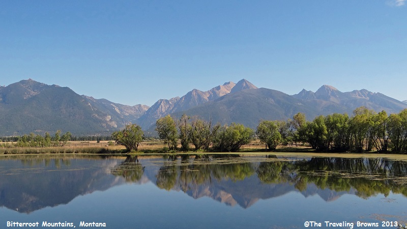
Continuing our voyage to the north on U.S. 93 we traveled into the beautiful state of Montana. You might guess the state name is derived from an Indian word. But in fact, it is derived from a Spanish word meaning mountain. And wow, does it ever have mountains! The western third of Montana contains 77 named ranges that are part of the Rocky Mountains. The state is also unofficially known as “Big Sky Country.” We would have to agree with this unofficial assessment. Spectacular mountains and clear blue skies were on hand for our mid-September visit.
Around midday our belly buttons started playing tag with our backbones so we pulled over at a wayside and Miss Barb whipped up some peanut butter and jelly sandwiches. It is a staple we carry with us when traveling. You never know when you might be between civilized areas and need some quick nourishment.
While at the wayside we snapped a few photos of the pond with mountains in the background.
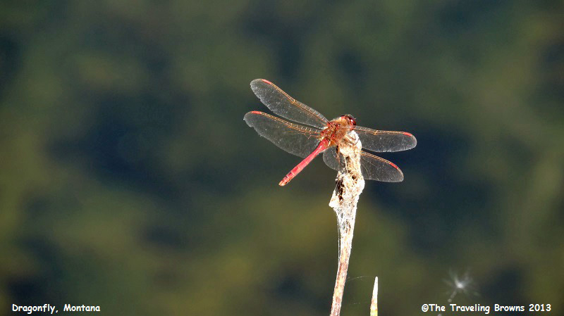
But what really fascinated us
were the pink dragonflies around the pond. We’ve come across a lot of
dragonflies but pink ones were new to us.
Did you know that dragonflies are among the fastest flying insects in the world? They can fly backwards, change direction in mid-air, and hover for up to a minute. They are major predators that eat mosquitoes and other small insects like flies, ants, and wasps. That’s all good in our eyes! We approve of anything that has mosquitoes, flies, ants and wasps on their diet.
Did you know that dragonflies are among the fastest flying insects in the world? They can fly backwards, change direction in mid-air, and hover for up to a minute. They are major predators that eat mosquitoes and other small insects like flies, ants, and wasps. That’s all good in our eyes! We approve of anything that has mosquitoes, flies, ants and wasps on their diet.
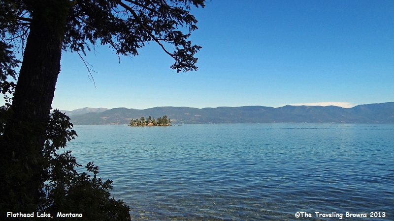
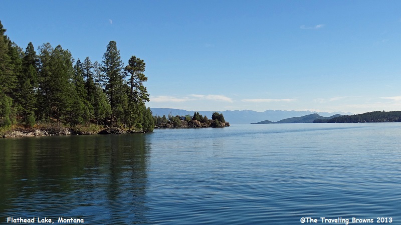
Later in the day we stopped
and snapped a few photos of Flathead Lake. With a surface area of 197 square
miles, it is the largest natural freshwater lake west of the Mississippi River
in the contiguous United States. Once known as “Salish Lake,” this body of
water takes its name from the Salish (Flathead) Indians who live at the
southern end of the lake on the Flathead Indian Reservation.
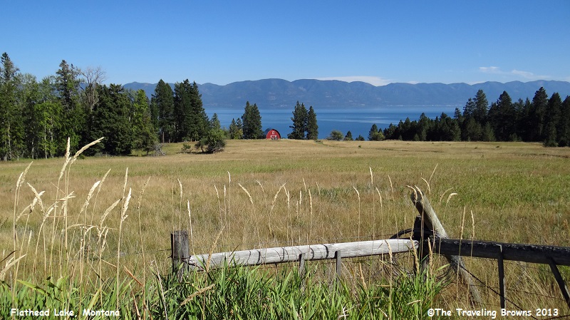
The lake is bordered on its
eastern shore by the Mission Mountains and on the west by the Salish Mountains.
Flathead Valley was formed by the glacial damming of the Flathead River and
sustains a remarkably mild climate for a region located this far north and
inland. The mild climate allows for cherry orchards on the eastern shore and
vineyards for wine production on the western shore. Unfortunately for us,
mid-September was past cherry season.
For the next four days we set
up a temporary home base in a motel in Kalispell, MT. It would serve as our
home away from home for visiting nearby national parks.
Early the next morning we were off and running for Glacier National Park. It is a park with pristine forests, alpine meadows, rugged mountains, spectacular lakes, and scenic beauty second to none. If you like to hike and seek wilderness solitude, Glacier is your place. This park has over 700 miles of hiking trails.
We like visiting Glacier during the shoulder season of mid-September as there tends to be less traffic. Of course you have to be ready for the always possible early blast of winter weather. But, generally you are safe during this time of year. The early shoulder season of May can find the roads still closed due to the winter snow pack. Mid June through August is the busy season.
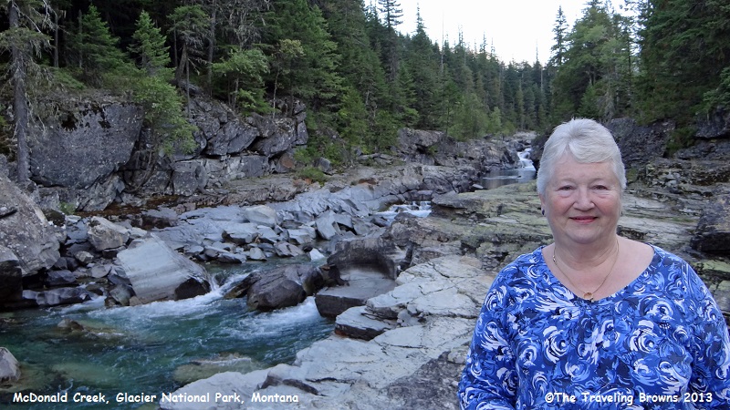
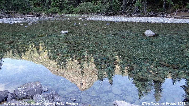
We entered the park through the west entrance and followed the road to the east. Much of the road parallels McDonald Creek, the longest stream inside the park boundary. It is very striking as much of it flows through jagged rocks. We hiked along the edge of the creek and of course snapped a few photos.
Early the next morning we were off and running for Glacier National Park. It is a park with pristine forests, alpine meadows, rugged mountains, spectacular lakes, and scenic beauty second to none. If you like to hike and seek wilderness solitude, Glacier is your place. This park has over 700 miles of hiking trails.
We like visiting Glacier during the shoulder season of mid-September as there tends to be less traffic. Of course you have to be ready for the always possible early blast of winter weather. But, generally you are safe during this time of year. The early shoulder season of May can find the roads still closed due to the winter snow pack. Mid June through August is the busy season.
We entered the park through the west entrance and followed the road to the east. Much of the road parallels McDonald Creek, the longest stream inside the park boundary. It is very striking as much of it flows through jagged rocks. We hiked along the edge of the creek and of course snapped a few photos.
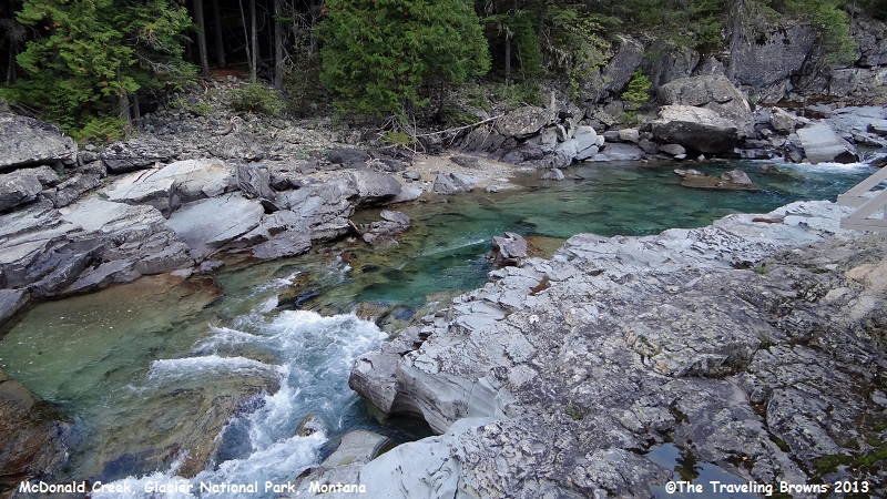
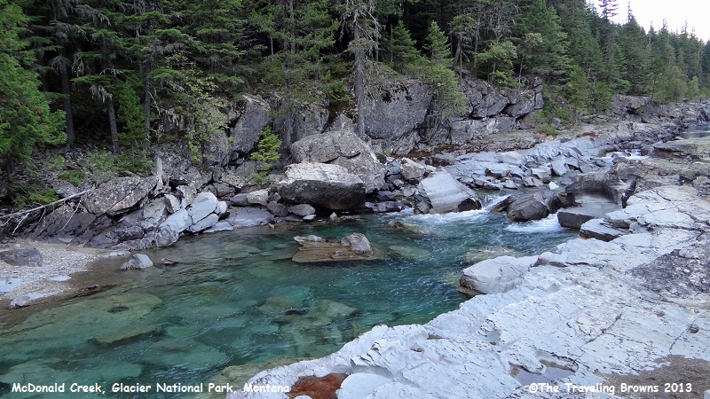
In the calm areas of the creek
we enjoyed shooting photos with the mountains and trees reflected in the water.
Our target destination was the Going-to-the-Sun
Road. Completed in 1933, it is
roughly 50 miles in length. It was the first American road to be designated
both a National Historic Landmark and a National Civil Engineering Landmark. Often
the road isn’t open the full length until the second or third week in June due
to snow. The actual date of opening depends on when spring snow plowing is
completed. Vehicles and vehicle combinations, longer than 21 feet (including
bumpers) or wider than 8 feet (including mirrors) are prohibited on the road.
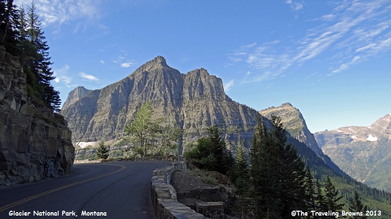
Once we reached the Going-to-the-Sun Road we started following it up and over the Continental Divide. The road is cut right into the mountainside. It had been a number of years since our last visit so it was almost like being there for the first time. We pulled off at many waysides to take it all in.
Once we reached the Going-to-the-Sun Road we started following it up and over the Continental Divide. The road is cut right into the mountainside. It had been a number of years since our last visit so it was almost like being there for the first time. We pulled off at many waysides to take it all in.
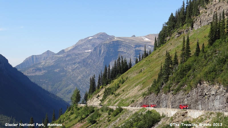
If you have a fear of driving
narrow mountain roads with hairpin curves you can arrange to take a red bus
tour at the park visitor centers. The famous red buses serve as a way to see
the park and to experience the scenic Going-to-the-Sun Road. The vintage buses
have been in operation since the 1930’s.
Scenery along the road is
spectacular. We would pull over and spend 15-20 minutes at each wayside
enjoying it all.
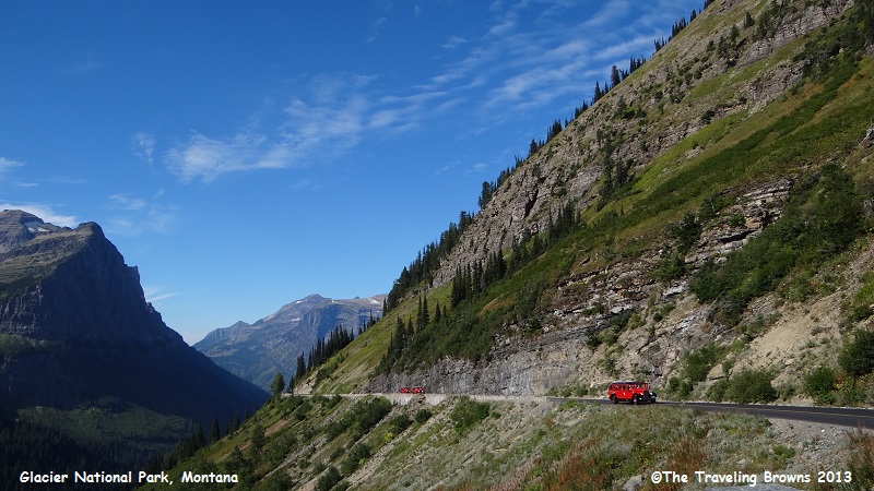
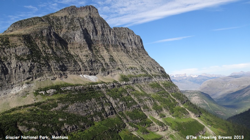
Here we are looking back at the road we had just
traveled up. You can see where the road is cut into the mountainsides. During
the winter months the road is covered with snowdrifts as deep as 60 feet.

This road shot gives you an
idea of what the road itself is like. As mountain roads go it is an easy drive.
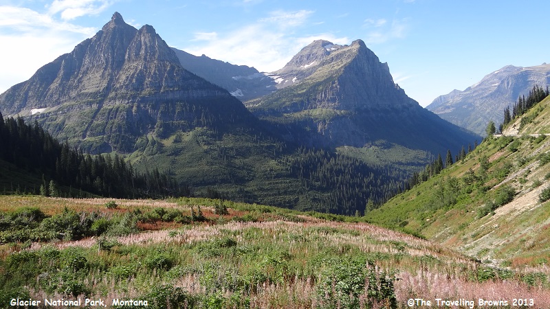
You can see avalanche shoots
on this mountainside. It is truly big country.
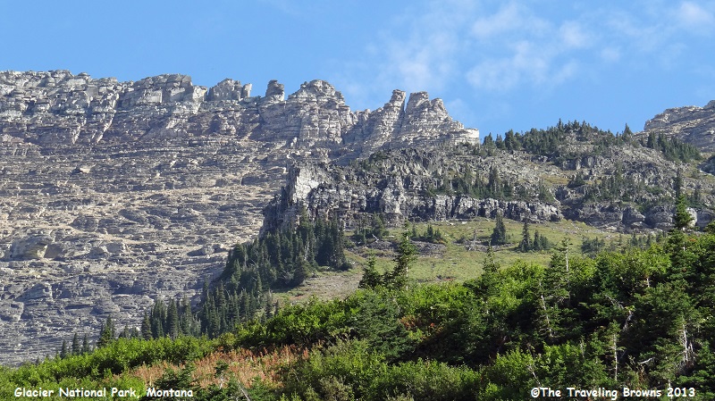
Check out the ruggedness of
this ridge top.
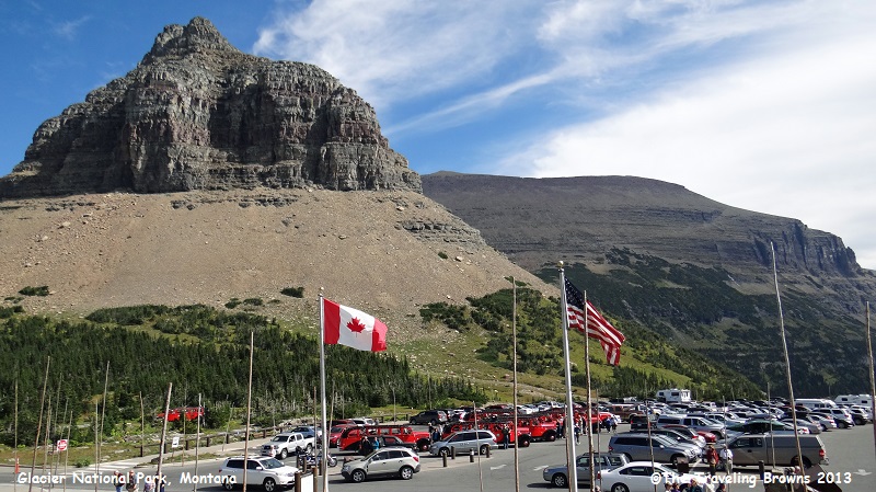
Upon reaching Logan Pass Summit
(6646’) we stopped at the visitor center and took a break. We always liked the
fact that they fly both the U.S. and Canadian flags here. This is done out of
respect because Glacier National Park is part of an International Park with
Canada.
These two countries are protecting this beautiful area of the Rocky Mountain Range. Glacier National Park extends to the Canadian border. On the Canadian side of the border it becomes Waterton Lakes National Park.
In 1932 Waterton Lakes National Park (Alberta, Canada) was combined with Glacier National Park (Montana, United States) to form the world’s first International Peace Park.
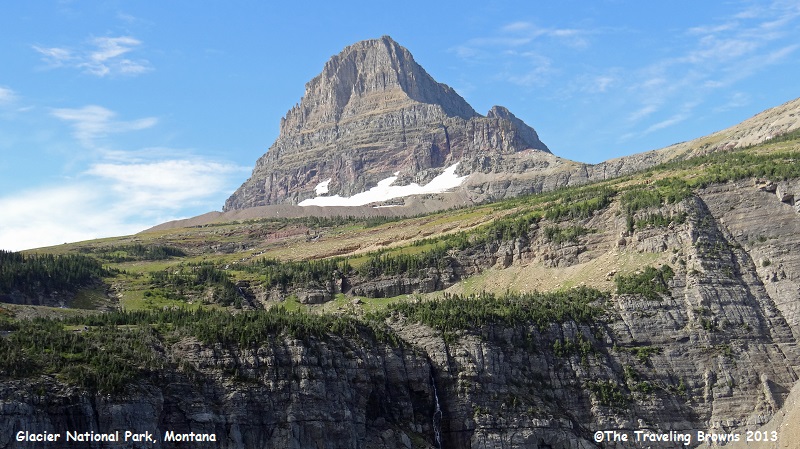
From the Logan Pass Visitor Center
you can see 8760’ Clements Mountain along with other Rocky Mountain peaks.
There are also trails that can
be followed to the peak. If you look closely in the lower left of the following
photo you can see a boardwalk across the boggy high alpine tundra.

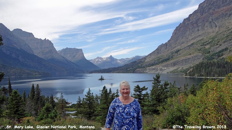
Continuing east on the
Going-to-the-Sun Road we made our last stop for the day at beautiful Saint Mary
Lake. With the wind flowing through the mountain pass the water surface is
almost always rippled. The little rocky outcropping in the middle of the lake
is Goose Island.
We had a lovely day in Glacier
National Park. On our next adventure we will explore other sites within the
park and then cross over into Canada’s Waterton Lakes National Park.
Until next time,
Dave & Barb
The Traveling Browns
Until next time,
Dave & Barb
The Traveling Browns
