2013-15 Sawtooth Mountains, Idaho
Hello All,
Stanley, ID, is not what you would call a metropolis, as the latest census shows a population of only 63 full-time residents. However, the population swells during the summer months to accommodate tourists. During the winter months many Idahoans come to the area to enjoy winter sporting activities.
Fur trappers of the Hudson’s Bay Company discovered the Stanley Basin in the 1820s, but it was mostly avoided due to scarcity of beaver. Captain John Stanley, a Civil War veteran, led a party of prospectors through the area in the 1860s but they found little gold and moved on and discovered the Atlanta lode on the south end of the Sawtooth Mountains. Stanley was not considered a town until 1919 when its streets and lots were surveyed and recorded.
Stanley has about every sort of lodging any group, couple, or family could hope to find. Everything from hotels to motels to cozy cabins and most all of them are rustic log construction. However, you will not find the chains of hotels and motels nor will you find websites for the various accommodations. A single website for the town lists all accommodations and phone numbers for making reservations.
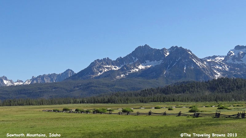
After a good night’s rest and a hot breakfast we were ready to start our adventures. We decided to make Stanley Lake our first destination. It is located about 7 miles west of Stanley just 3 miles off the Ponderosa Pines Scenic Byway. The drive to the turn off went quickly as the scenic beauty of the Sawtooth Mountains is captivating. The Sawtooth Range is part of the Rocky Mountains.
Stanley, ID, is not what you would call a metropolis, as the latest census shows a population of only 63 full-time residents. However, the population swells during the summer months to accommodate tourists. During the winter months many Idahoans come to the area to enjoy winter sporting activities.
Fur trappers of the Hudson’s Bay Company discovered the Stanley Basin in the 1820s, but it was mostly avoided due to scarcity of beaver. Captain John Stanley, a Civil War veteran, led a party of prospectors through the area in the 1860s but they found little gold and moved on and discovered the Atlanta lode on the south end of the Sawtooth Mountains. Stanley was not considered a town until 1919 when its streets and lots were surveyed and recorded.
Stanley has about every sort of lodging any group, couple, or family could hope to find. Everything from hotels to motels to cozy cabins and most all of them are rustic log construction. However, you will not find the chains of hotels and motels nor will you find websites for the various accommodations. A single website for the town lists all accommodations and phone numbers for making reservations.
After a good night’s rest and a hot breakfast we were ready to start our adventures. We decided to make Stanley Lake our first destination. It is located about 7 miles west of Stanley just 3 miles off the Ponderosa Pines Scenic Byway. The drive to the turn off went quickly as the scenic beauty of the Sawtooth Mountains is captivating. The Sawtooth Range is part of the Rocky Mountains.
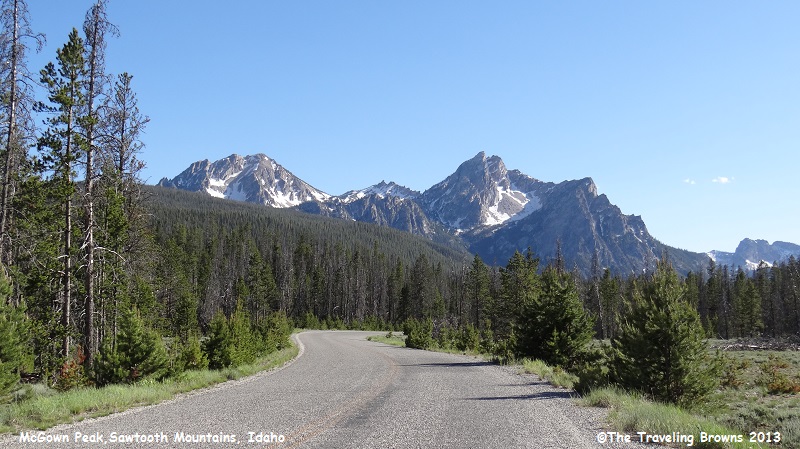
We turned off the highway and proceeded the
three miles into Stanley Lake. In the distance we could see some of the
Sawtooths. The taller peak in the following photo is Mt. McGowan at 9,860’.
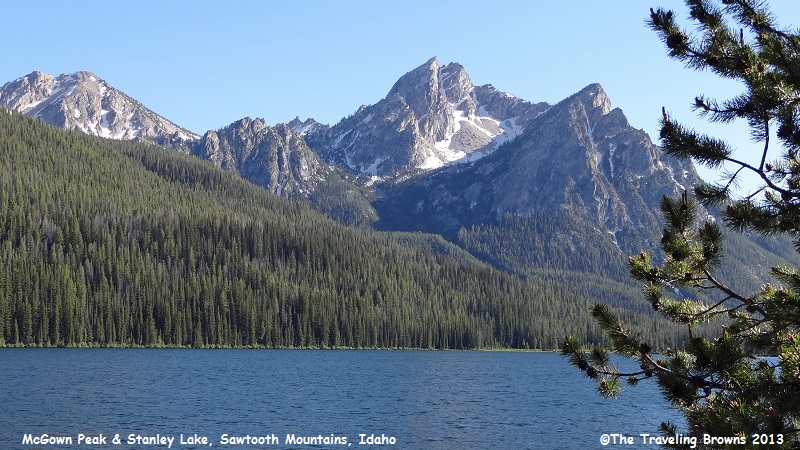
Stanley Lake sits at the base of the mountains.
The surface elevation of
Stanley Lake is 6,513 above sea level. It is definitely what you would call a
high mountain lake. The lake is stunning with Mt. McGown in the background. Too
bad there was a breeze blowing as it would have made for a wonderful reflection
photo.
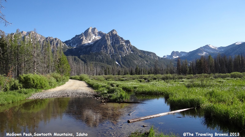
We decided to check out a
gravel road that led to the far end of the lake. We had to ford a slow moving
creek to get there. Before proceeding through it we first checked it out and it
looked to have a good gravel base. We’re pleased to report we made it through
without a problem.
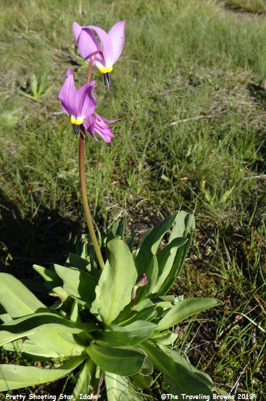
The far end of the lake didn’t
offer anything more spectacular for photos but we did find this beautiful wild
flower. It is called a Pretty Shooting Star and is native to the western United
States.
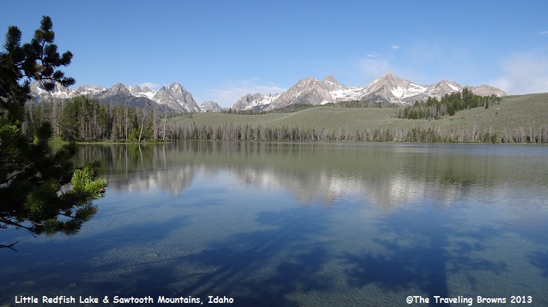
Our next stop was Little
Redfish Lake about 5 miles south of Stanley just off the Sawtooth Scenic Byway.
It is one of the many alpine lakes in the region and has a surface elevation of
6,489 feet above sea level. The lake is named for the brilliant sockeye salmon
that once returned from the Pacific Ocean via the Salmon River. They were in
such massive quantities that the lake shimmered red during the spawning season.
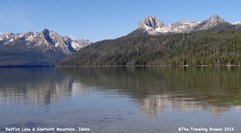
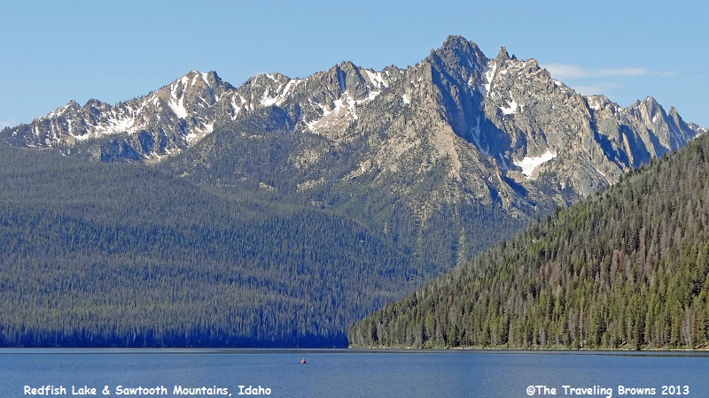
Our next stop was the much
larger Redfish Lake. It too was named for the sockeye salmon spawning into it.
The lake is about 4½ miles long and ¾ miles wide and has been developed with
numerous recreational facilities including campgrounds and a lodge. It is about
100 feet higher than its little sister with a surface elevation of 6,547 feet
above sea level. The lake is a favorite playground for Idahoans.
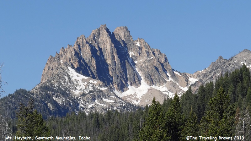
Redfish Lake is also located at the base of the Sawtooths. Mt. Heyburn at 10,229’ is in the center of the following photo. And, the massive rock face on the left of the photo is the Grand Mogul at 9,733’. The lake wraps around the distant point and goes between these two distinctive landmarks.
Redfish Lake is also located at the base of the Sawtooths. Mt. Heyburn at 10,229’ is in the center of the following photo. And, the massive rock face on the left of the photo is the Grand Mogul at 9,733’. The lake wraps around the distant point and goes between these two distinctive landmarks.
Here is a close-up shot of Mt.
Heyburn. You can sure see how the Sawtooth Mountain Range got its name.
And this is the Grand Mogul.
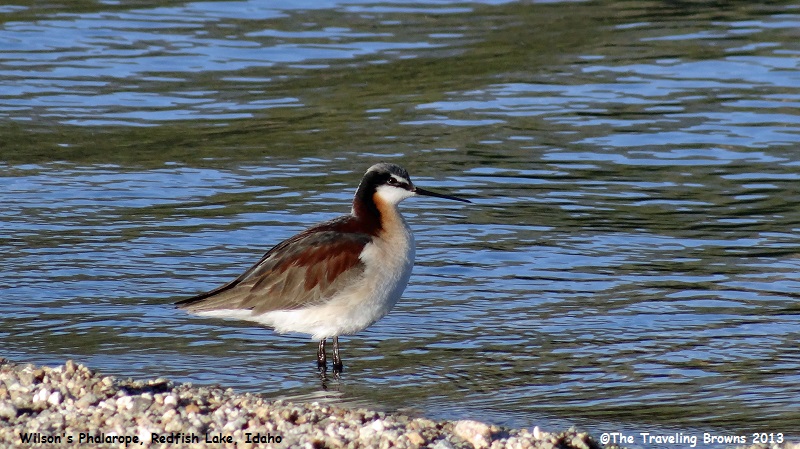
Along shore we snapped photos of this wading
bird. It is a Wilson’s phalarope. It breeds in western Canada and the western
United States. It then migrates during the winter to inland salt lakes near the
Andes in Argentina. Little guy really gets around doesn’t he!
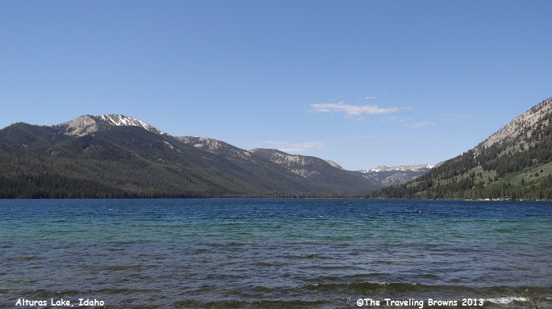
Alturas Lake, located 21 miles
south of Stanley, was our next stop. It is the second largest lake in the
Sawtooth National Recreation Area and has several campgrounds.
There was a pretty stiff breeze blowing but we kind of like this shot of the lake because it shows three distinct colors of the water.
There was a pretty stiff breeze blowing but we kind of like this shot of the lake because it shows three distinct colors of the water.
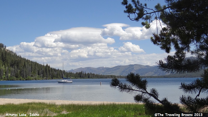
We drove to a different
location on the lake and found a cove where the wind wasn’t blowing. It had a
nice sandy beach and a sailboat anchored out. What more could a couple amateur
photographers ask for. The beautiful clouds being sheared off on top by strong
wind was an added bonus.
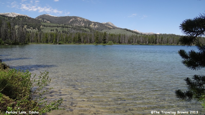
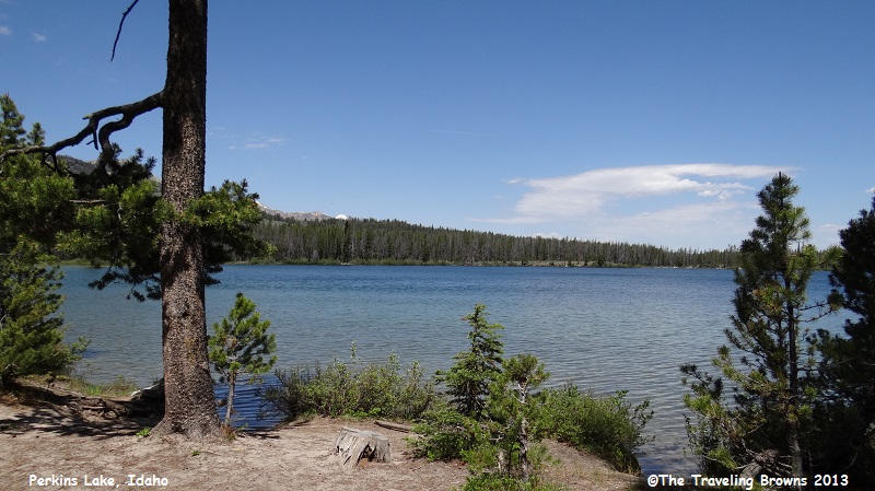
A couple of miles from Alturas Lake is Perkins
Lake. It is a much smaller alpine lake.
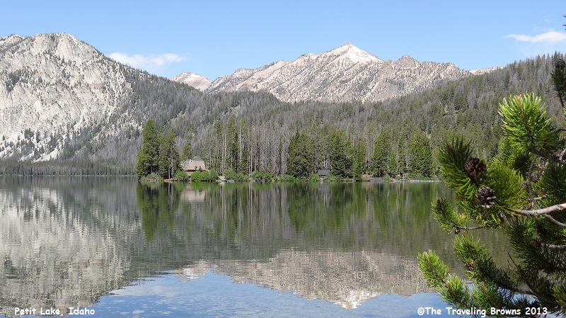
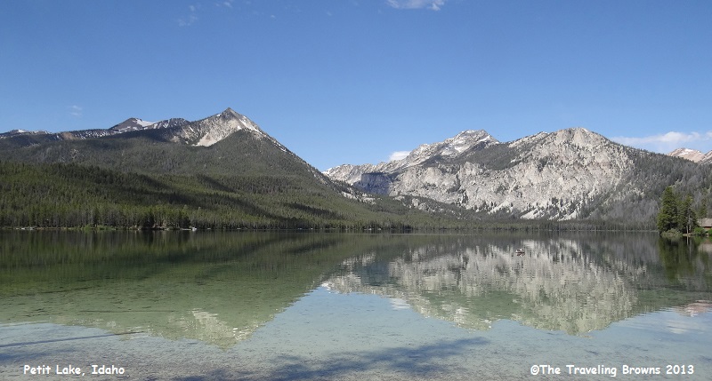
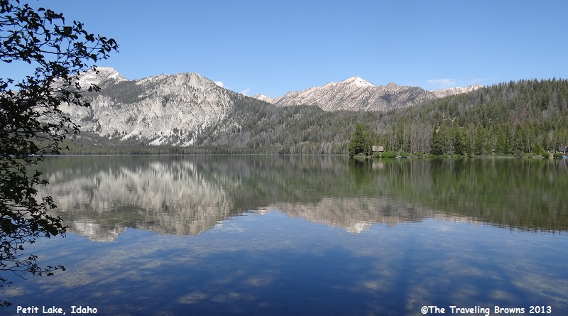
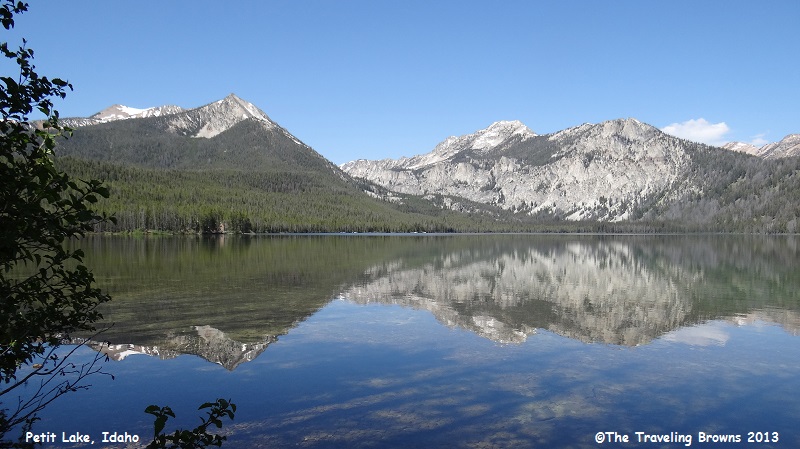
Our favorite stop of the day
was at Petit Lake located about 16 miles south of Stanley. This large alpine
lake is at an elevation of 6,996 feet above sea level. Someone was looking out
for us because shortly after arriving the wind stopped blowing. The lake took
on a mirror effect. We went crazy snapping photo after photo of the reflective
vistas. It really capped off what was an already enjoyable day.
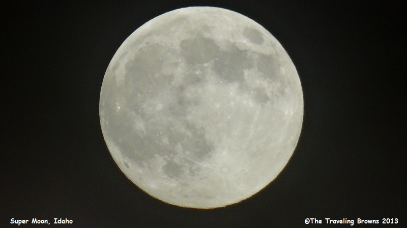
By the time we arrived back
home it was dark and there was a “super moon” in the sky. We snapped a couple
photos of it to celebrate what had been a super roadtrip. Hope you enjoyed
riding along with us.
Our next adventure will find
us heading west into Oregon.
Until next time,
Dave & Barb
The Traveling Browns
Until next time,
Dave & Barb
The Traveling Browns
