2013-9 Bonneville Salt Flats, Utah
Hello All,
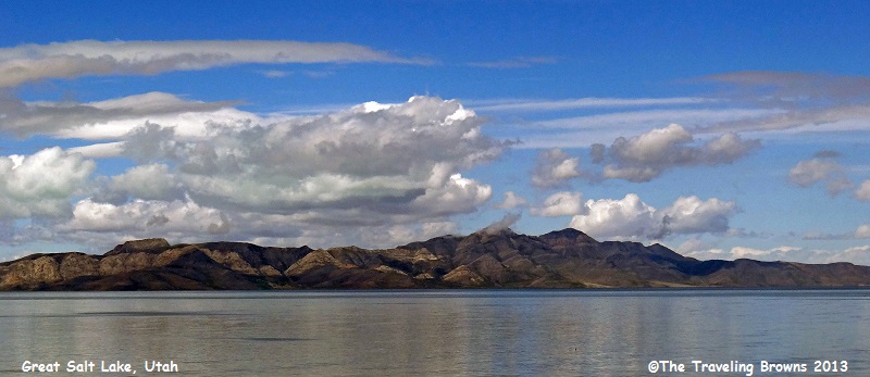
Departing southwest Utah we worked our way over to I-15 northbound to Salt Lake City where we turned westbound on I-80. We made a brief stop at the Great Salt Lake to snap a few photos.
Departing southwest Utah we worked our way over to I-15 northbound to Salt Lake City where we turned westbound on I-80. We made a brief stop at the Great Salt Lake to snap a few photos.
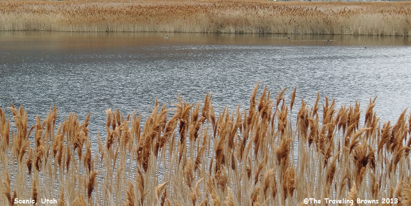
While searching for a good
vantage point for photos we came across this slough lined with reeds and wild
grass that we thought made for nice photos. Since it was early April they still
retained their winter brown and beige colors. As we have said before, it
doesn’t take much to excite us!
About 120 miles west of Salt
Lake City we came across this lake. Do you have any idea what the name of the
lake is? We know you have heard of it.
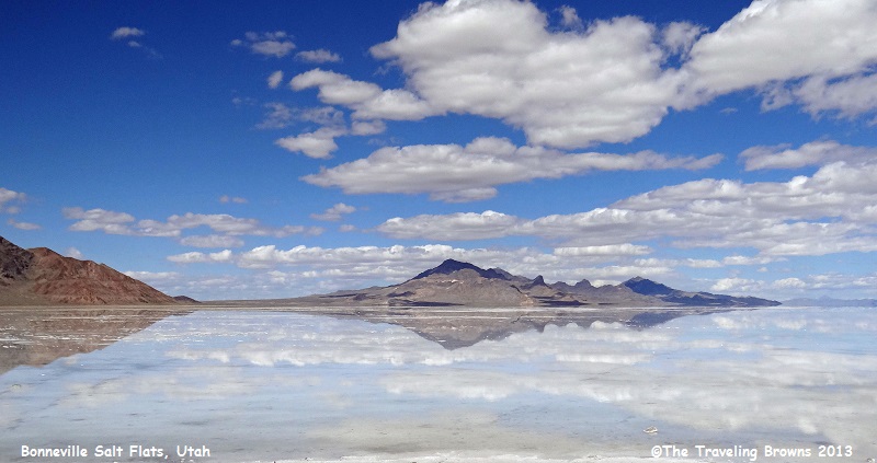
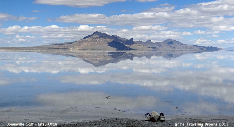
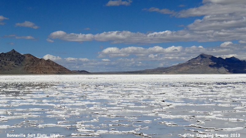
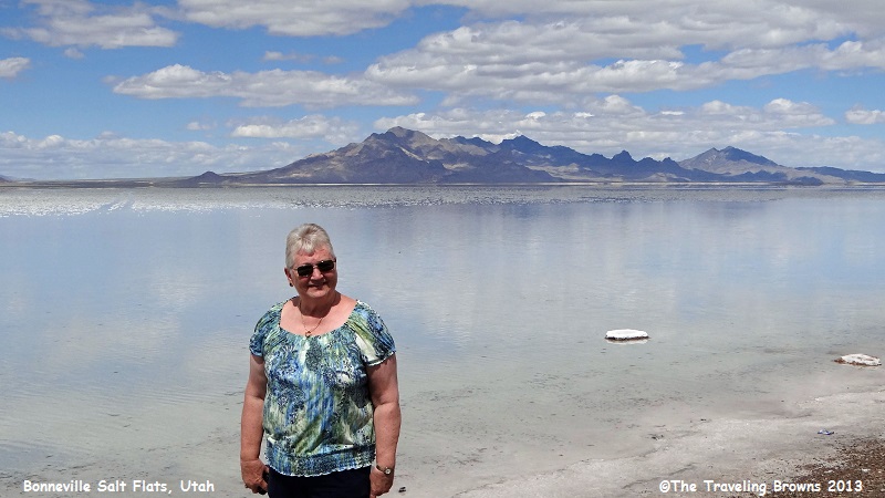
Well, actually it is not a
lake at all. It is the Bonneville Salt Flats. We arrived there after a major
storm went through the area and the rain water covered the salt flats for
miles. The water is only a couple of inches deep. The next three photos demonstrate
just how shallow the water is.
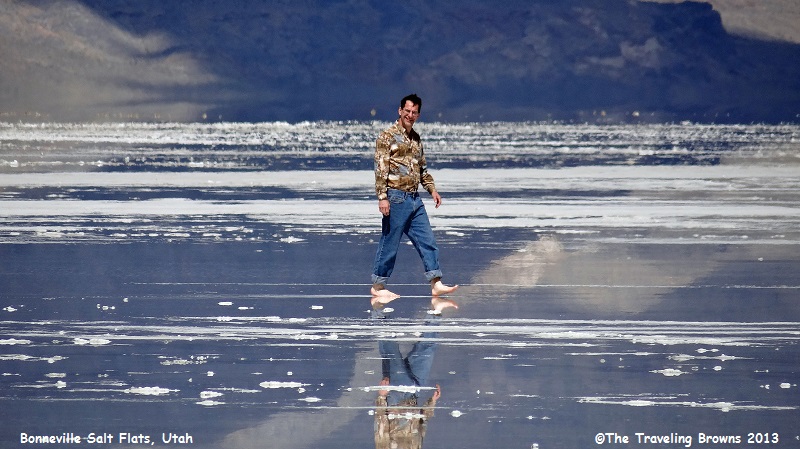
Check out the sneakers on shore in the first photo. In the distance, the owner of them appears to be walking on water.
Check out the sneakers on shore in the first photo. In the distance, the owner of them appears to be walking on water.
You can see him better in the
next two photos.
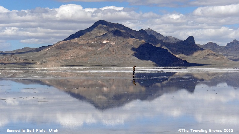
Quite an illusion isn’t it!
Utah’s famous measured mile is
located here well in front of the mountains you see on the horizon in the
following photo. The elevation along the course is approximately 4,218 feet
above sea level. The total length of the course that includes the measured mile
varies from year to year, but for recent runs it has been laid out in a path 80
feet wide and approximately 10 miles long, with a black reference stripe down
the middle. Due to the curvature of the earth it is impossible to see from one
end of the course to the other. The course is prepared by the U.S. Bureau of
Land Management in early summer. Speed trials are scheduled throughout the
summer and fall. They end when rain covers the area with water.
Timing of world land-speed
record runs is under the jurisdiction of the United States Auto Club. World land-speed record times represent an
electronically-timed average of two runs over the measured mile, within a one-hour
time period—one run each direction.
The first world land-speed record on the Bonneville Salt Flats was set on September 3, 1935, by Sir Malcolm Campbell. His speed was 301.13 miles per hour. Craig Breedlove holds the honor of being the first man to go faster than 400, 500, and 600 miles per hour. His record of 600.601, set on November 15, 1965, was finally broken on October 23, 1970, by Gary Gabelich. His new record is 622.407 miles per hour.
Both Gabelich’s rocket engine “Blue Flame” and Breedlove’s jet-powered “Spirit of America” were equipped with specially designed inflatable tires, pre-tested to speeds in excess of 800 miles per hour.
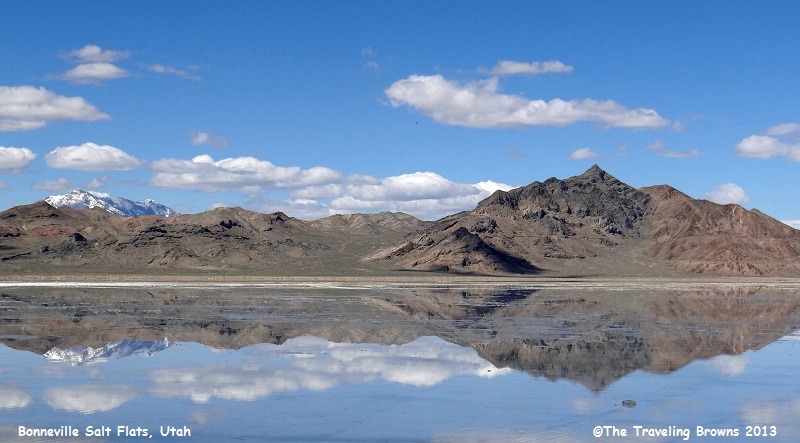
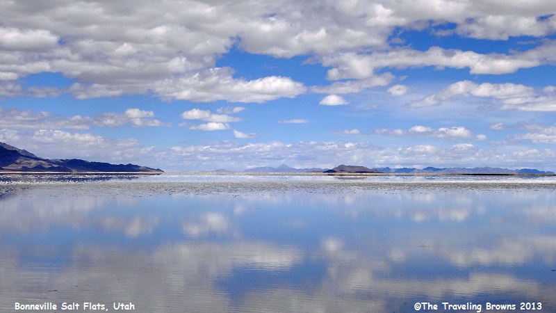
Here are a couple more shots taken at Bonneville Salt Flats. It is a unique landscape.
The first world land-speed record on the Bonneville Salt Flats was set on September 3, 1935, by Sir Malcolm Campbell. His speed was 301.13 miles per hour. Craig Breedlove holds the honor of being the first man to go faster than 400, 500, and 600 miles per hour. His record of 600.601, set on November 15, 1965, was finally broken on October 23, 1970, by Gary Gabelich. His new record is 622.407 miles per hour.
Both Gabelich’s rocket engine “Blue Flame” and Breedlove’s jet-powered “Spirit of America” were equipped with specially designed inflatable tires, pre-tested to speeds in excess of 800 miles per hour.
Here are a couple more shots taken at Bonneville Salt Flats. It is a unique landscape.
Arriving back home we hung
around the house for a couple of weeks before heading out on our next adventure.
We jumped on I-84 and aimed the car towards the Pacific Northwest.
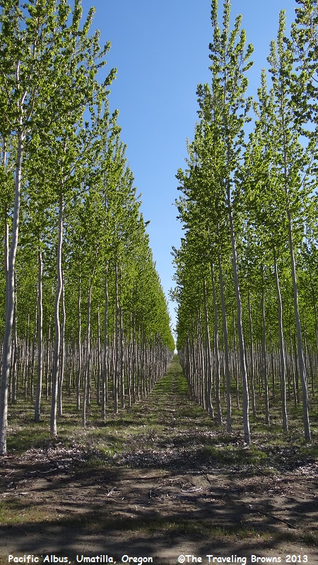
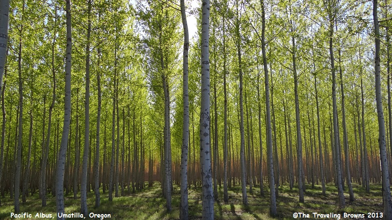
Near Boardman, Oregon, we came across mile after mile of a hybrid poplar tree named a Pacific Albus. The Pacific Albus Plantation has over 24,000 acres of these hardwood trees growing there. Since it was new to us we couldn’t resist stopping and snapping a few photos. Some of the stands were still showing their fall colors.
Near Boardman, Oregon, we came across mile after mile of a hybrid poplar tree named a Pacific Albus. The Pacific Albus Plantation has over 24,000 acres of these hardwood trees growing there. Since it was new to us we couldn’t resist stopping and snapping a few photos. Some of the stands were still showing their fall colors.
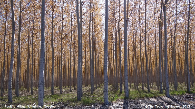
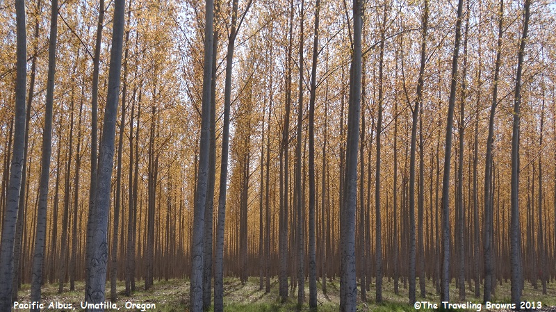
While other stands had
progressed into their spring foliage. In our eyes it made for some unique interesting
photos.

Years ago while touring the
Pacific Northwest in a recreational vehicle Dave spotted a teapot gas station
along the highway. Wanting to check it out we went for miles trying to find a
place where we could turn the rig around and go back. After about 15 miles we
gave up and said we would check it out the next time we traveled through the
area. Over the years we never forgot it and would always look for it when
passing through this part of the country—all to no avail.
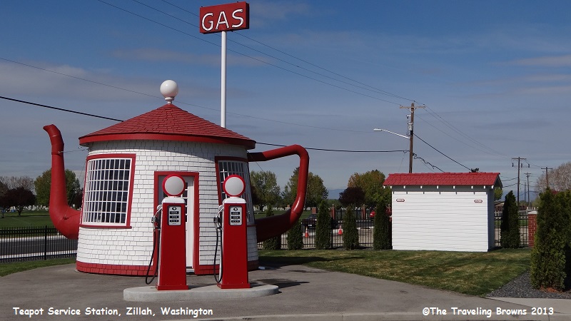
Finally, we got smart and did an internet search. That’s when we learned that it had been moved to protect and preserve it—no wonder we couldn’t spot it again. It is now located in the town of Zillah, Washington. We put the address in our GPS and set off to find it.
The Teapot Service Station was built in 1922 and was located on old state highway 12 near Zillah. It was constructed by Jack Ainsworth to remind others of U.S. Government corruption as a result of the Teapot Dome political scandal.
The Teapot Dome oil reserve in Montana was set aside by President Woodrow Wilson in 1915 for the Navy, which was in the process of converting the power of its ships from coal to oil. It became the subject of a nationwide scandal when President Harding’s Secretary of the Interior, Albert B. Fall, was forced to resign for accepting bribes from oilmen when he leased the federal oil reserves to them. The Teapot Dome scandal was a victory for neither political party in the 1920s. It did become a major issue in the presidential election of 1924, but neither party could claim full credit for divulging the wrongdoing. The concentrated attention of the scandal made it the first true symbol of government corruption in America. Unfortunately, it seems to have become more prevalent over the decades since.
In 2012 the city of Zillah moved the station to its present location, where it is designated as a museum and tourist attraction.
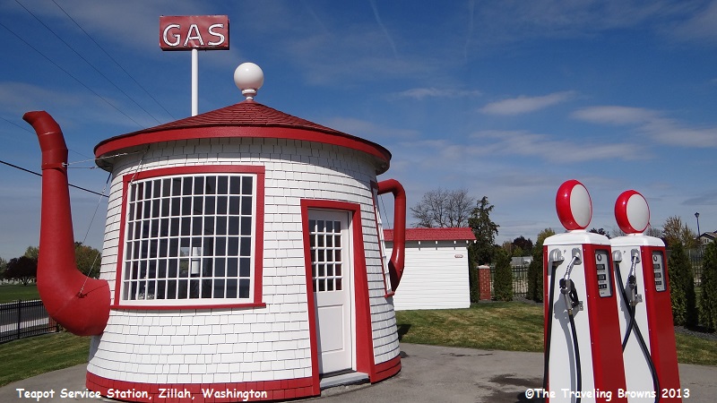
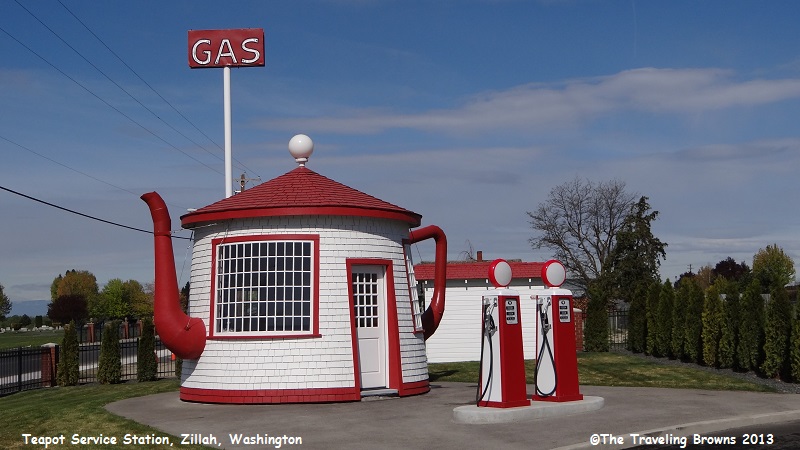
An interesting side note,
during the time it was a working station the spout of the teapot served as a
chimney, and smoke coming out of it during cold weather resembled a steaming teapot.
Even the old outhouses were
preserved and relocated as you can see in the following photo.
Our target destination of this
roadtrip was the Skagit Valley Tulip Festival in northwest Washington--but more
on that later.
Until next time,
Dave & Barb
The Traveling Browns
Until next time,
Dave & Barb
The Traveling Browns
