Pictures of the Week 2008-31
Hello All,
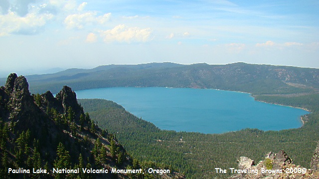
We had a great week visiting with Barb’s sister Anita and husband Bob, and we carried them along on most of our adventures. Our first side trip out of LaPine was to the Newberry National Volcanic Monument. The monument’s most prominent feature is the 500-square mile Newberry Volcano, which dominates the landscape of the area. The volcano caldera may have originally held one large lake, much like Crater Lake, but deposits of pumice and lava divided the crater into two separate bodies of water about 6,200 years ago. Paulina Lake, one of the deepest lakes in Oregon (250 feet) and East Lake (180 feet) are the result. We drove to Paulina Peak, the highest point on the crater rim. From the peak we had a good view of the Cascade Range, the high desert basin and ranges of Eastern Oregon, and the lakes within the caldera and surrounding volcanic and forested landscapes. However, smoke from the 1500 wildfires burning in Northern California put a damper on good quality photos.
We had a great week visiting with Barb’s sister Anita and husband Bob, and we carried them along on most of our adventures. Our first side trip out of LaPine was to the Newberry National Volcanic Monument. The monument’s most prominent feature is the 500-square mile Newberry Volcano, which dominates the landscape of the area. The volcano caldera may have originally held one large lake, much like Crater Lake, but deposits of pumice and lava divided the crater into two separate bodies of water about 6,200 years ago. Paulina Lake, one of the deepest lakes in Oregon (250 feet) and East Lake (180 feet) are the result. We drove to Paulina Peak, the highest point on the crater rim. From the peak we had a good view of the Cascade Range, the high desert basin and ranges of Eastern Oregon, and the lakes within the caldera and surrounding volcanic and forested landscapes. However, smoke from the 1500 wildfires burning in Northern California put a damper on good quality photos.
After a day of rest and recuperation, we headed
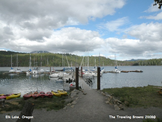
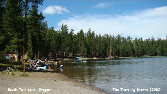
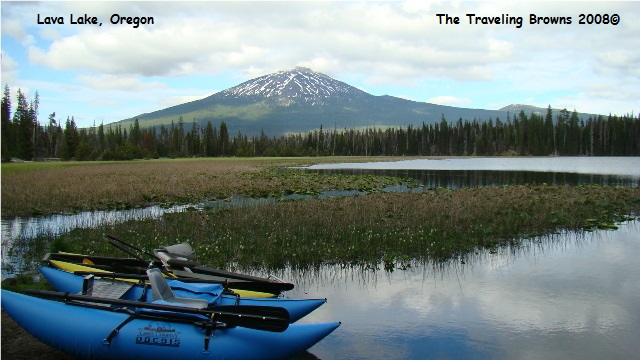
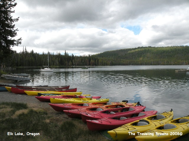
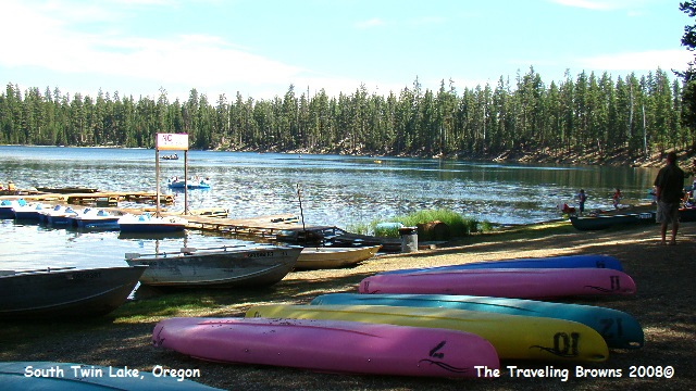
out of LaPine onto the Cascade Lakes Scenic Byway, making stops at Wickiup
Reservoir, Crane Prairie Reservoir, Lava Lake, and Elk Lake. It was obvious
that the campers were taking full advantage of being on beautiful lakes in the
heat of the summer. We observed swimmers, fishermen, boaters, kayakers, and any
other type of activity you might see on a mountain lake heading into the 4th
of July weekend. The lakes vary in size from very large to very small. Some lakes are open to power boats for
fishing and water skiing while motors are prohibited on others. Whatever your interests may be, there were
lakes available to suit your fancy. And,
all were beautiful in their own way.
Our return to LaPine took us by Mt. Bachelor
where Barb skied, both cross-country and downhill, in her youth. The Deschutes
River, running through the national forest, made for a beautiful day's
drive. The Ponderosa Pine forests and
high mountain meadows are so impressive.
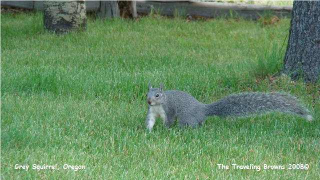
And, this part of the country has big impressive gray squirrels.

Another adventure took us east
following the Outback National Scenic Byway to the high desert basin of Eastern
Oregon. This drive takes you through small towns with tall tales as reminders
of the not so distant past. We made a
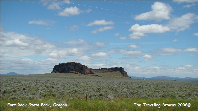
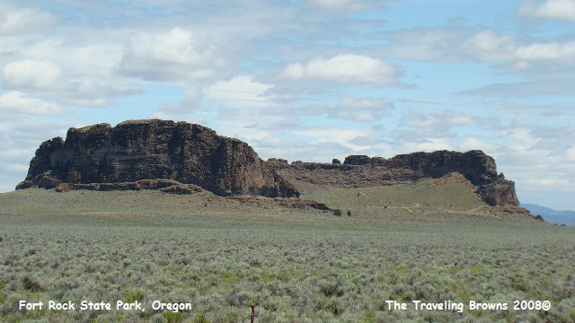
stop at Fort Rock State Park. The
fortress-like rock formation that rises above the sagebrush plains is an
unforgettable sight.
Fort Rock is a giant “Tuft Ring.” More than 100,000 years ago molten rock squeezing its way towards the surface ran into ground water. At that time this area of Oregon was covered by a huge lake. The result--great explosions of steam, lake-bed mud, and billions of glass shards. Wave after wave of this boiling mixture swept outward leaving layers of glassy mud. After each blast, some layers slumped down into the crater. The debris formed a massive ring around a broad crater. Later, the glassy mud of the 6,000-foot wide tuft ring solidified into rock.
At its creation, Fort Rock towered some 400 feet above the floor of the old lakebed. The long gentle slopes of its youth were eroded into tall cliffs full of holes and cracks. Today, about 300 feet tall and smaller in diameter, the rugged crescent is all that remains of the tuft ring. Prevailing southwest winds whipped relentless waves against the fort's perimeter, eroding the gap in the rock we see today.
Have you ever heard the term “Car
Clouting?” It was a new term to us. The
park service is warning visitors that car clouting (theft) can take place in 15
seconds or less. Trailheads, parks and
monuments have become increasingly popular sites for these thieves to work. If
you hike or tent camp they warn you to take all your valuables with you or keep
them hidden in your trunk.
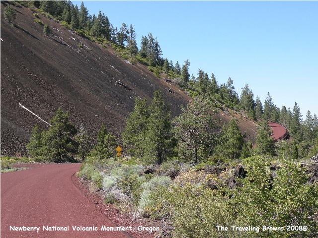
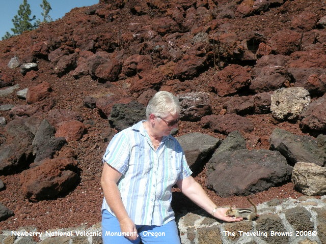
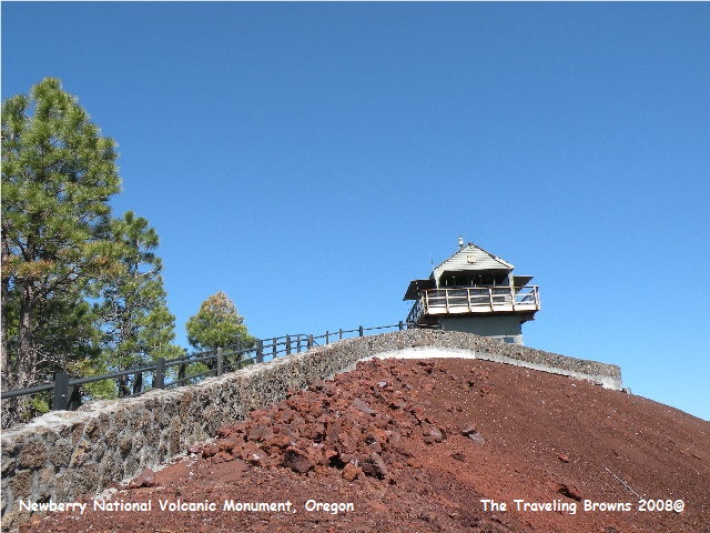
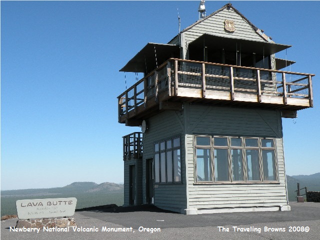
Early one morning we drove to Bend to get the oil changed in the truck. We also got the fuel filters changed. Since there is no sales tax in Oregon it saved us a few bucks! On the drive back to LaPine we decided to see more of the Newberry National Volcanic Monument. Our destination was Lava Butte. This cinder cone sits in the middle of a huge lava flow. There is an 8-percent grade road that wraps around the butte to the top. An active forest fire lookout station is on top. The views are spectacular, although wildfire smoke was still in the area. There were chipmunks at the top that greeted all the visitors, hoping for a tasty morsel or two.
Early one morning we drove to Bend to get the oil changed in the truck. We also got the fuel filters changed. Since there is no sales tax in Oregon it saved us a few bucks! On the drive back to LaPine we decided to see more of the Newberry National Volcanic Monument. Our destination was Lava Butte. This cinder cone sits in the middle of a huge lava flow. There is an 8-percent grade road that wraps around the butte to the top. An active forest fire lookout station is on top. The views are spectacular, although wildfire smoke was still in the area. There were chipmunks at the top that greeted all the visitors, hoping for a tasty morsel or two.
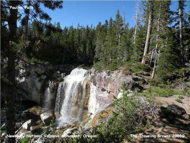
We then drove to Paulina Falls, since we missed
seeing it on our previous trip to the top of the Newberry Volcano. Paulina
Creek is the only surface outlet from Paulina Lake. The dramatic 80 foot
waterfall spills over volcanic cliffs into a canyon and the viewing area is a
short walk in the woods from the parking lot.
After an evening meal with
Nita and Bob, we started packing things away for our morning departure from
LaPine. Since the temperatures were forecasted to be in the upper 90’s east of
the mountains, we made a decision to travel west to the Oregon coast in hopes
of finding some cooler weather. But, more on that adventure later.
Until next time,
Dave & Barb
The Traveling Browns
Until next time,
Dave & Barb
The Traveling Browns
