2011-59 Guadalupe Mountains National Park, Texas & Texas Canyon, Arizona
Hello
All,
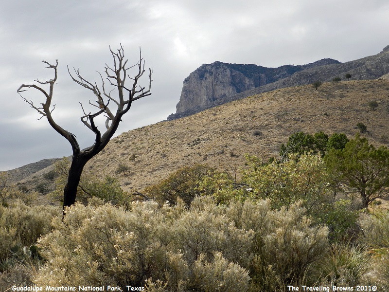
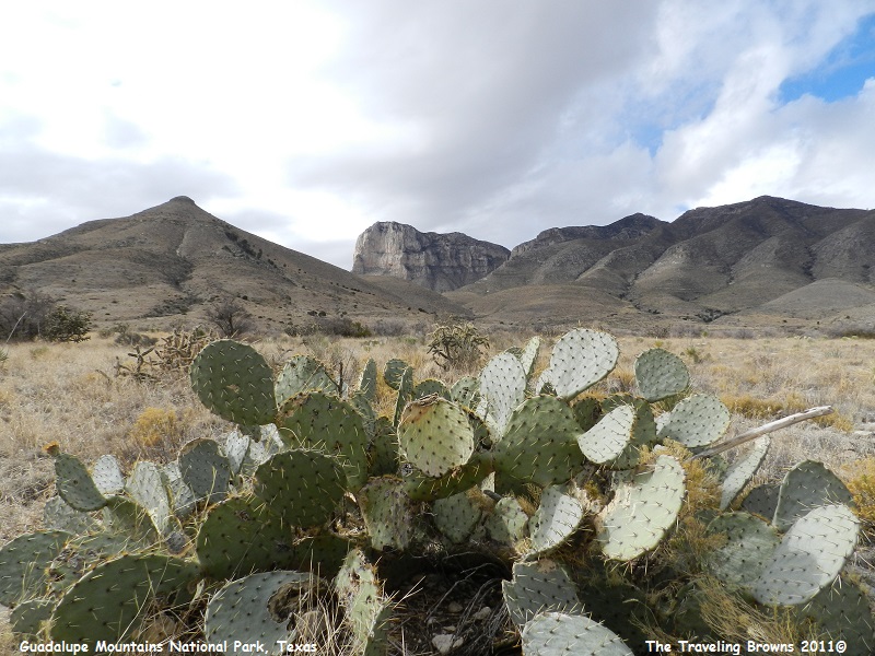
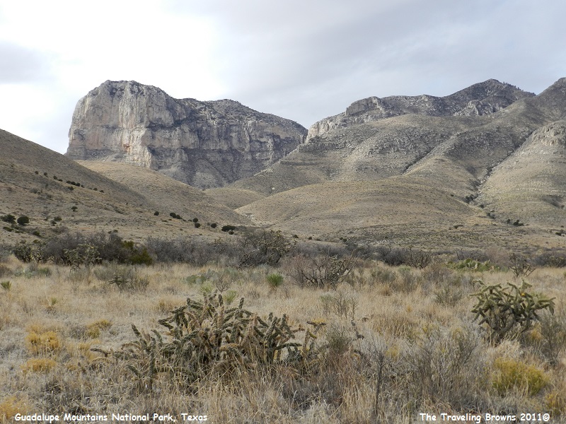
Leaving Carlsbad Caverns National Park we travelled southwest back into Texas and drove through Guadalupe Mountains National Park. Located on the edge of the Chihuahuan Desert it is the world’s premier example of a fossil reef from the Permian Era. The park is known for its extensive hiking and backpacking opportunities in one of the nation’s most pristine wilderness areas. Within the park are over 80 miles of trails for backpacking enthusiasts.
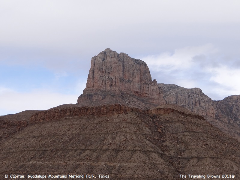
El Capitan lies on the southern end of the Guadalupe Mountain Range. At 8085 feet it is the highest peak in Texas and the best known feature of the park. It is guarded by cliffs on three sides. These cliffs are rarely climbed due to the unstable condition of the rock and sheer nature of the peak. Hikers can climb to the summit by first climbing to the near summit of Guadalupe Peak and then taking a saddle between the two peaks up the backside of El Capitan. Since the weather was turning a bit sour on us we chose not to make the climb—that’s our story and we’re sticking to it!!
Leaving Carlsbad Caverns National Park we travelled southwest back into Texas and drove through Guadalupe Mountains National Park. Located on the edge of the Chihuahuan Desert it is the world’s premier example of a fossil reef from the Permian Era. The park is known for its extensive hiking and backpacking opportunities in one of the nation’s most pristine wilderness areas. Within the park are over 80 miles of trails for backpacking enthusiasts.
El Capitan lies on the southern end of the Guadalupe Mountain Range. At 8085 feet it is the highest peak in Texas and the best known feature of the park. It is guarded by cliffs on three sides. These cliffs are rarely climbed due to the unstable condition of the rock and sheer nature of the peak. Hikers can climb to the summit by first climbing to the near summit of Guadalupe Peak and then taking a saddle between the two peaks up the backside of El Capitan. Since the weather was turning a bit sour on us we chose not to make the climb—that’s our story and we’re sticking to it!!
As
we traveled through the park we snapped a few photos here and there but did not
spend a lot of time at any one location. It is an area that warranted a more
thorough exploration if we had the time.
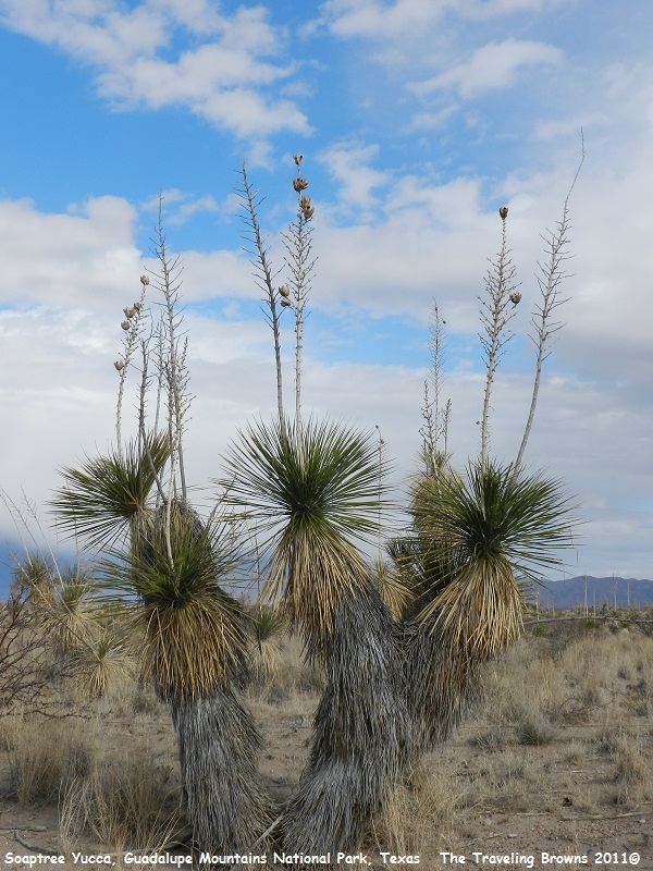
Leaving
the park we traveled into the heart of the Chihuahuan Desert where large
concentrations of Soaptree Yuccas were growing. The Soaptree Yucca is one of
the most characteristic plants of the Chihuahuan Desert. It is an abundant
evergreen, palm-like shrub or small tree growing 10 to 18 feet high. The gray
trunk has a diameter of 6 to 12 inches.
It derives its name from the soapy material in its roots and trunks which made it popular as a substitute for soap by pioneers. Native Americans used the coarse fiber of the leaves for weaving baskets. Cattle enjoy the tender young stalks, and chopped trunks and leaves are still utilized as emergency cattle feed in times of drought.
Soaptree Yuccas grow at elevations between 1500 and 6000 feet. They are found in both the Sonoran and Chihuahuan deserts of west Texas, through central New Mexico to central Arizona, and south into northern Mexico.
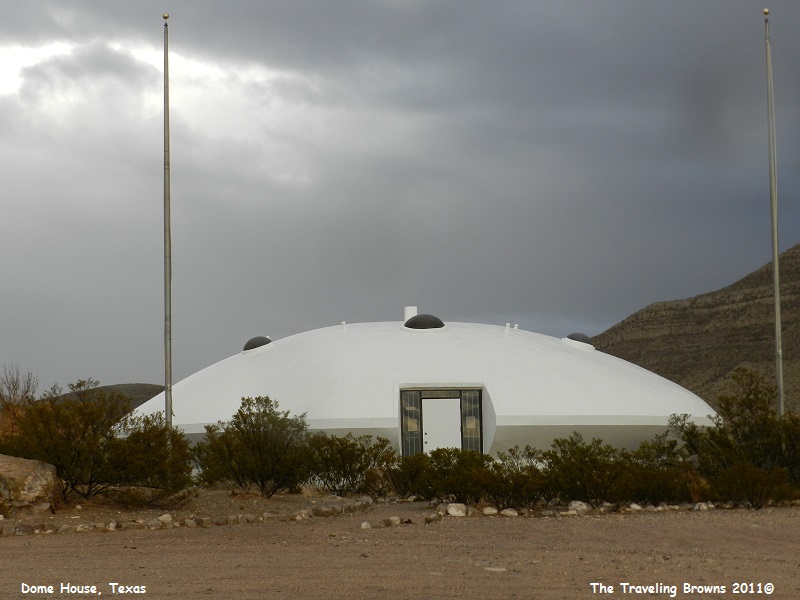
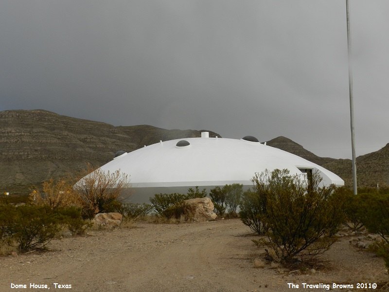
As
we continued to cruise to the west all of a sudden Dave said “did you see that?”
He had spotted what looked like a flying saucer that had landed in the desert!
So we swung the car around and went back to check it out. We never found out if
it was a home or business or what. But, it was interesting and something we
were not expecting to see.
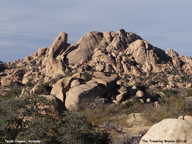
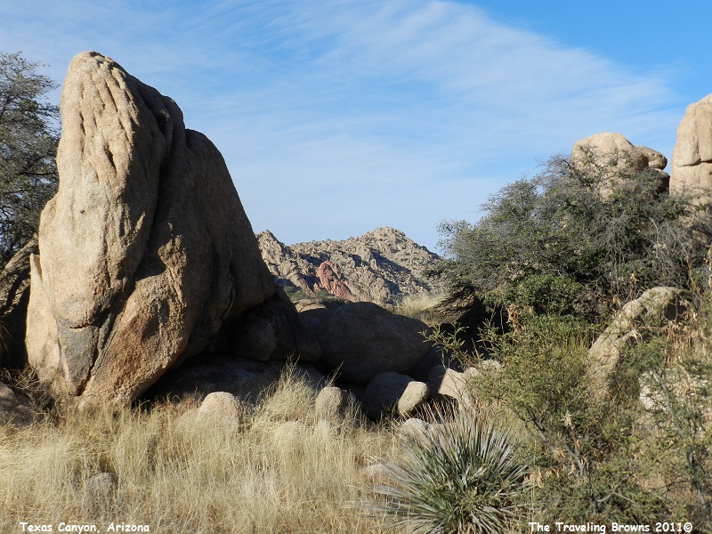
Back
on Interstate 10 westbound we traveled from Texas through New Mexico into
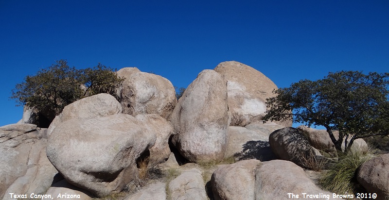
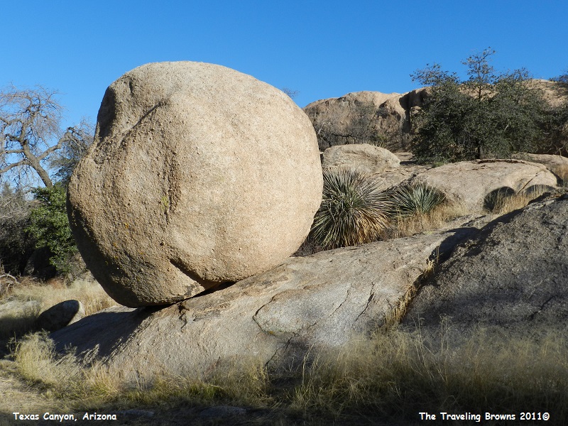
Arizona. About 20 miles east of Benson, AZ we came upon Texas Canyon. It lies
between the Little Dragoon Mountains and the Dragoon Mountains and is known for
giant granite boulders.
The stagecoach route of the Butterfield Overland Mail passed through Texas Canyon from 1858 until the outbreak of the Civil War in 1862 when the stageline suspended operations. The canyon is historically within the range of the Chiricahua Apache Indians, and Cochise made his last stronghold near here in the Dragoon Mountains in the mid-1870s.
In the mid to late 1880s David A. Adams arrived from Texas, soon to be followed by other family members. The family became the namesake of Texas Canyon, as there were “…a bunch of damned Texans up there.” Descendants still live and raise cattle on the old family ranch.
We found the canyon to be fascinating and spent a few hours wandering around exploring and snapping photos.
To
help with perspective those are full grown trees in the following photos.
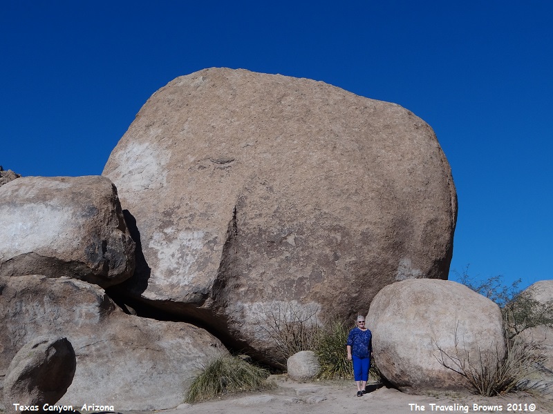
Okay,
still not convinced that these are large rocks--check this photo out with Miss
Barb next to a boulder.
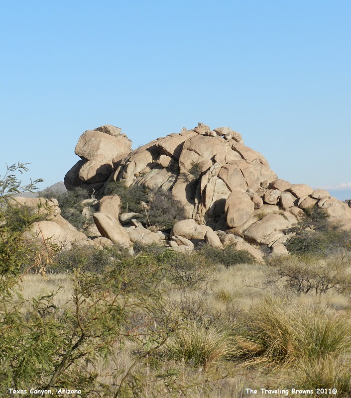
In
our vivid imaginations these rocks kind of reminded us of a giant turtle. Yup,
and those are baby turtles up on the shell of mom! Okay, so we have a warped
imagination between us!
We
truly enjoyed wandering around through the canyon.
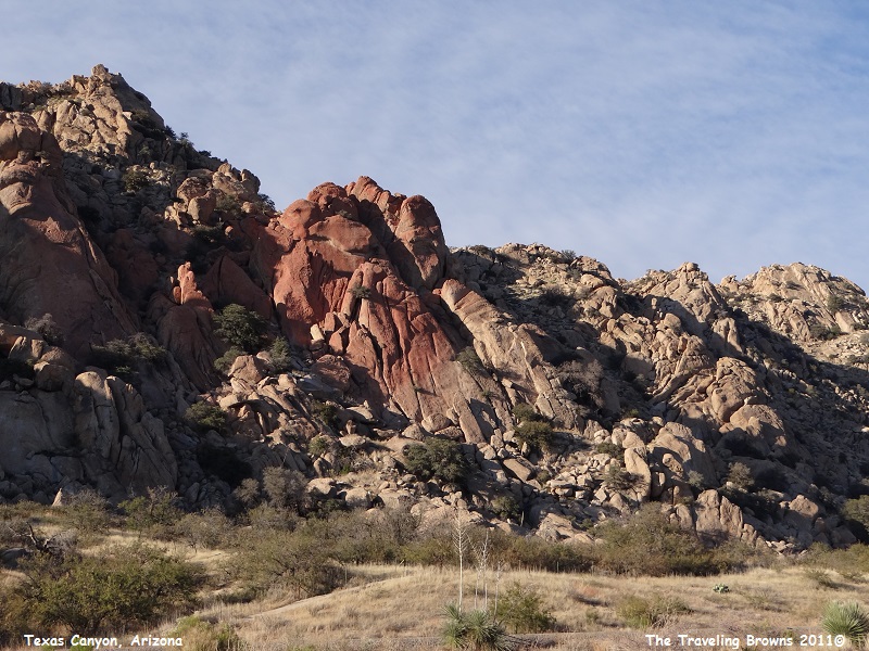
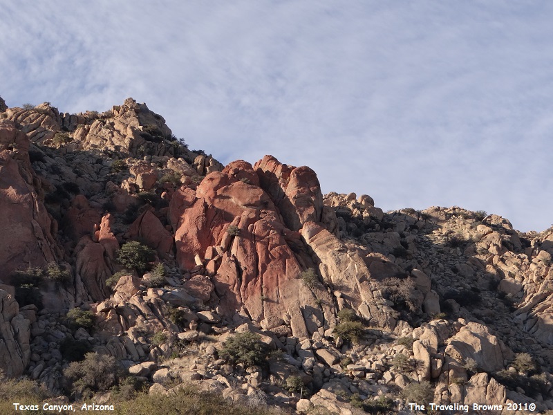
In
some areas the granite rock had a reddish pink color to it. We found it quite
interesting.
Since
many of you may not be as fascinated with unique rocks as we are, we will limit
the number of photos we share of the area in our little blurb. We do recommend
it as an area to check out. And, it is easy to visit. I-10 goes through Texas
Canyon and a rest stop is located there.
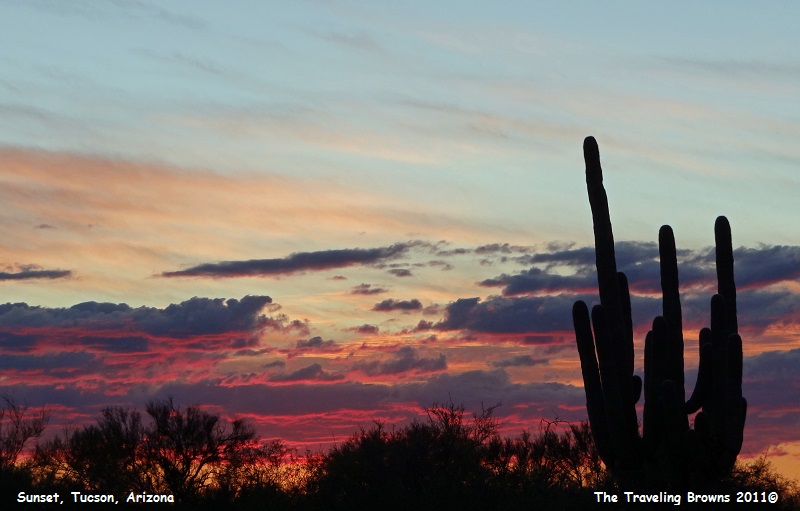
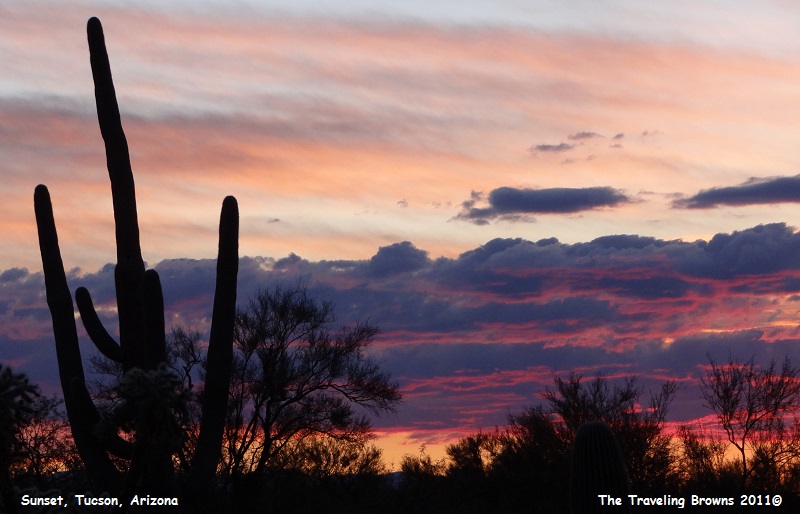
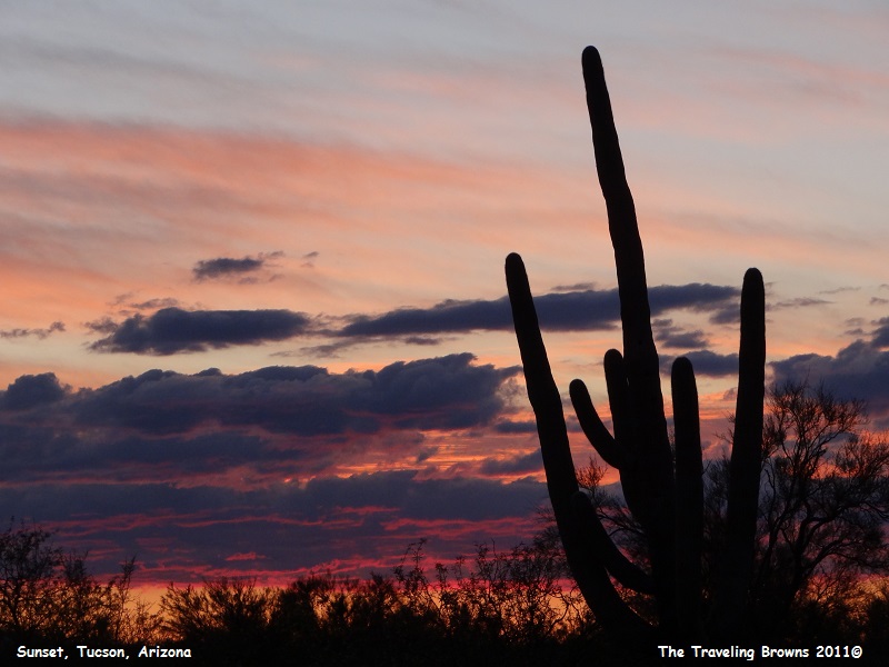
Continuing west on I-10 in Arizona we arrived in Tucson late in the day. It was somewhat cloudy and greeted us with a lovely sunset.
Continuing west on I-10 in Arizona we arrived in Tucson late in the day. It was somewhat cloudy and greeted us with a lovely sunset.
Our
next adventure will take us into Saguaro National Park. We look forward to you
riding along with us.
Until next time,
Dave & Barb
The Traveling Browns
Until next time,
Dave & Barb
The Traveling Browns
