2015-2 Lake Tahoe, Nevada
Hello All,
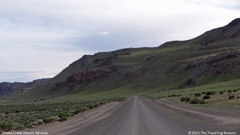
Leaving the small town of Gerlach, Nevada, we travelled into the Smoke Creek Desert. It is an arid region, located in the northwestern part of the state, about 60 miles north of Pyramid Lake. We would travel through the desert and then along the western shore of Pyramid Lake on our return trip back to Reno.
Almost immediately, we discovered that the Smoke Creek Desert is very sparsely populated with virtually no services of any kind. To compound the situation there was no cell phone connectivity. Traveling the gravel roads without road signs made it an interesting challenge. Occasionally we would come to a fork in the road and then make a decision as to which way to go. We surmised that if we were to maintain a basic southerly heading we would eventually find civilization. It was a fascinating experience being in an area that really hadn’t changed much since the days of the pioneers.
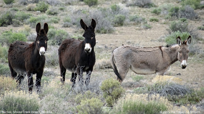
It wasn’t long before we came upon a group of wild burros. There are numerous burros and mustangs running wild throughout Nevada. We like exploring in the springtime, as many of our animal encounters have the added bonus of newborns with them.
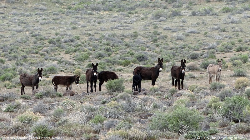
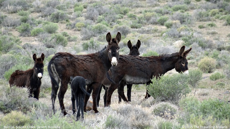
Burros are predominately black with a distinctive white nose patch. However, some are also a gray color.
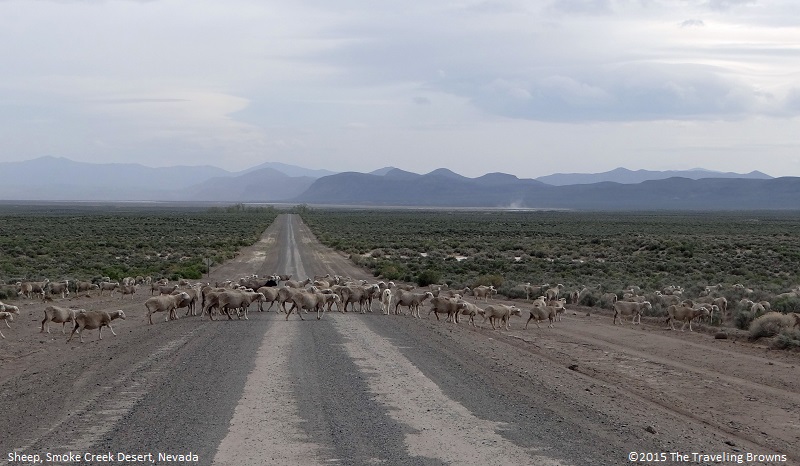
Next, we came upon a huge flock of domestic sheep. We stopped and tried to talk with the shepherd. But, found that his command of English was rather limited. He smiled and we smiled and everyone did a lot of head nodding. It quickly became obvious that he didn’t understand us and we didn’t understand him.
If we were to guess, the flock consisted of between five hundred and a thousand animals. Three dogs assisted the shepherd in controlling the flock. In this photo a small number of them were crossing the road.
If we were to guess, the flock consisted of between five hundred and a thousand animals. Three dogs assisted the shepherd in controlling the flock. In this photo a small number of them were crossing the road.
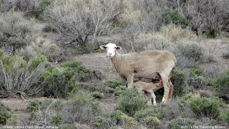
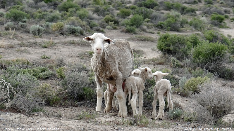
The sheep were newly sheered and interwoven within the sagebrush. A vast majority of them had newly born lambs with them. It was dinner time for this lamb while mom kept a wary eye on us.
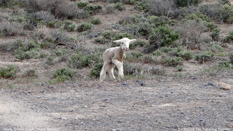
Nothing cuter than a baby lamb! This one seemed to have lost its mom and came right up to the car door. It was “baaaing” all the way. How cute is that!
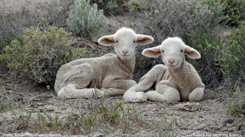
Well maybe two baby lambs would be cuter--big feet, long legs, wrinkled skin, fuzzy heads, and smiling.
This ewe had three youngsters in tow.
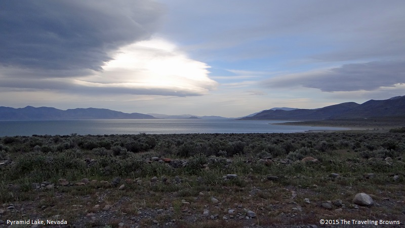
Waving goodbye to the shepherd we continued on our way. There was a fast moving cold front that was forecast to bring stormy weather into this part of the state. By the time we made it to Pyramid Lake it became obvious that the front had caught up with us. Wind of 20 to 30 miles per hour was whipping sand and dust into the air at the northern end of Pyramid Lake giving it an almost surreal look.

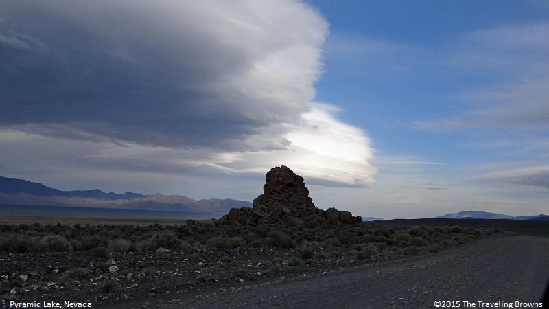
Not wanting to get caught in foul weather we picked up our pace and pushed for our home away from home. We did a pretty good job of staying just ahead of the storm. It looked rather ominous, however, in the sky.
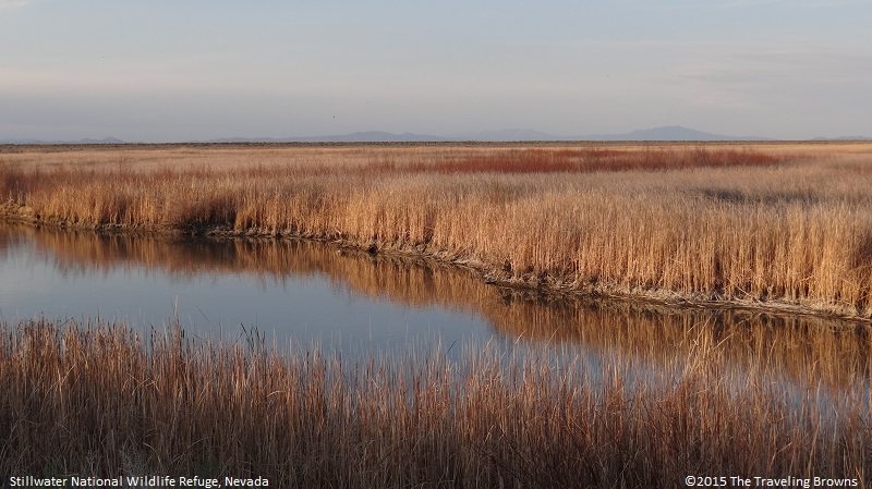
By morning the mountains had a fresh dusting of snow and a mixture of rain and snow was falling in Reno. Weather forecast was not good so we chose to take a couple of days off. None of the shows in the casinos perked our interest so we took in a movie. After two days of holding up in the city, we got a brief window of clear weather between storms. So, we decided to check out the Stillwater National Wildlife Refuge about 60 miles east of Reno near the community of Fallon, Nevada. Established in 1949 the refuge encompasses 79,570 acres of wetlands.
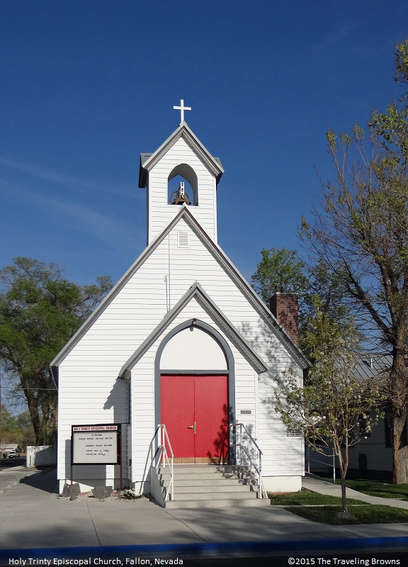
Passing through the small town of Fallon we spotted a cute little white church that we felt the urge to snap a few photos of. It really stood out with its bright red doors.
Passing through the small town of Fallon we spotted a cute little white church that we felt the urge to snap a few photos of. It really stood out with its bright red doors.
Continuing to our destination from Fallon to the refuge was a series of farm roads of which many were laid out on section lines. We would go a mile and then do a ninety degree corner, go another mile and repeat the process, and so on and so forth. We just sat back and enjoyed the ride, as we couldn’t get in a hurry--at least we weren’t stuck in a motel room.
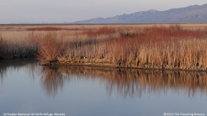
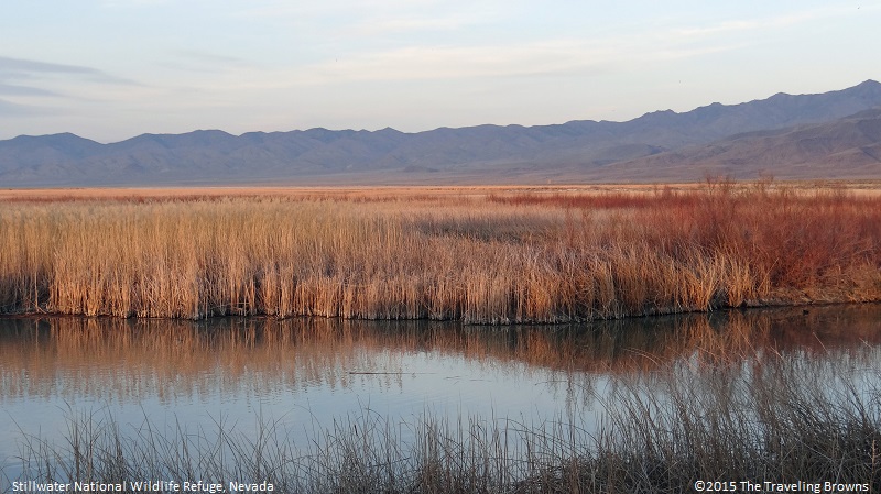
The Stillwater wetlands are well known to birders because of the hundreds of thousands of birds that pass through the area during migration. We thoroughly enjoyed our afternoon visit to the area and found the colors of the marshland grasses to be quite lovely in contrast to the pale blue sky.
The Stillwater wetlands are well known to birders because of the hundreds of thousands of birds that pass through the area during migration. We thoroughly enjoyed our afternoon visit to the area and found the colors of the marshland grasses to be quite lovely in contrast to the pale blue sky.
It is an interesting area that we would love to visit sometime during the peak migratory season. Bet it would be amazing.
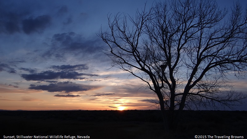
At dusk the wetlands came alive with flying insects and birds pursuing them. We watched them while snapping a few photos of the setting sun. It was an awesome experience.
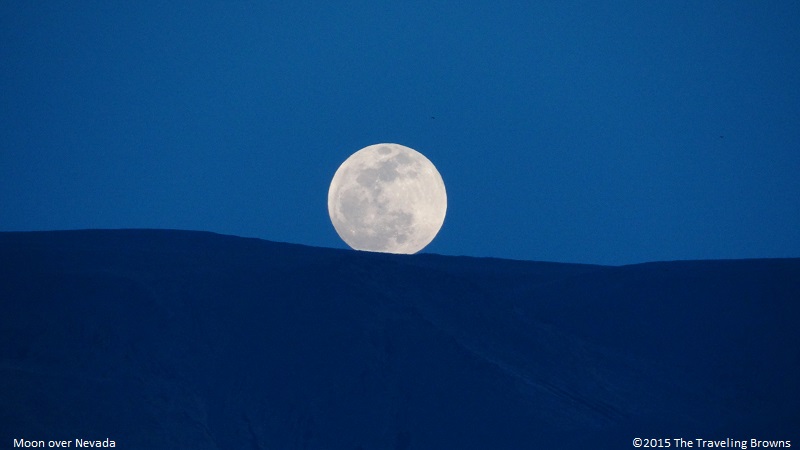
Soon thereafter we pointed the nose of our car towards Reno and were on our way. On the drive we noticed that there was a full moon popping up over the mountains. We snapped a photo of it because it gave the illusion of rolling down the mountain slope. We know it doesn’t take much to perk our interest or imagination!
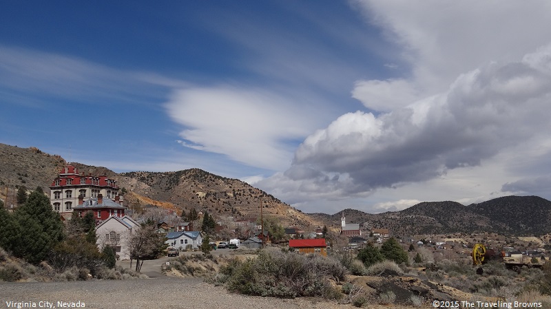
After another day of inclement weather we finally got a bit of a break in the series of storms passing through the area. We anxiously jumped into the car and set our sights on Virginia City, Nevada.
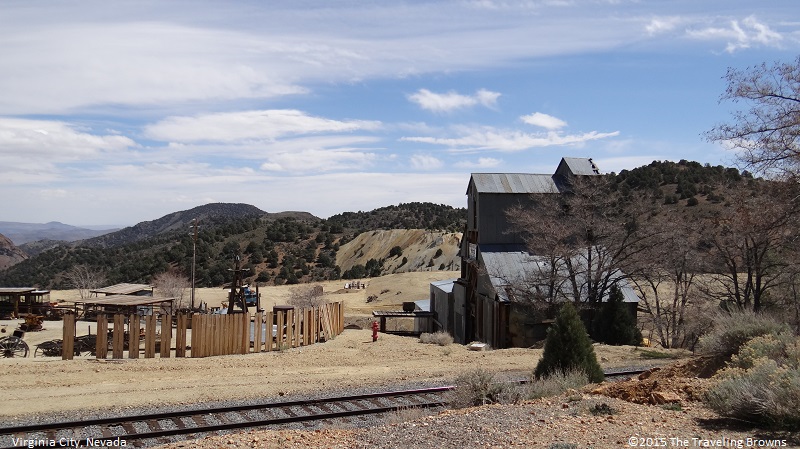
Virginia City grew after the discovery of the nearby Comstock Lode in 1856. The 2½-mile vein of high-grade silver and gold was one of the most important mining discoveries in American history. The city boomed for the next 20 years and helped bring Nevada into the Union in 1864 and the building of San Francisco. At the time of the discovery Nevada was part of the Utah Territory.
Today you will find old mining relics scattered throughout the area along with a number of active mines. It is a fun tourist destination with its history, museums, shops, and saloons. However, it tends to be a landscape photographers nightmare with the people, traffic, and power lines.
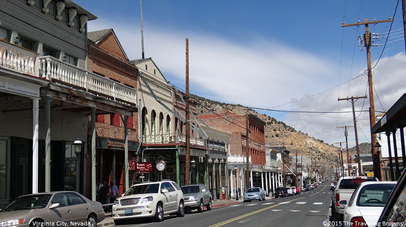
In this shot of Virginia City the large building on the left is the Fourth Ward School. It was built in 1875. The cut stone foundation is anchored in solid granite. Steel rods support the four stories to its foundation. It has fourteen classrooms and two study halls. Built to accommodate 1,025 students and was a grammar/high school combination. Its last class graduated in 1936. Today it gives a true picture of the magnitude of this boom city in the 19th century.
Virginia City grew after the discovery of the nearby Comstock Lode in 1856. The 2½-mile vein of high-grade silver and gold was one of the most important mining discoveries in American history. The city boomed for the next 20 years and helped bring Nevada into the Union in 1864 and the building of San Francisco. At the time of the discovery Nevada was part of the Utah Territory.
Today you will find old mining relics scattered throughout the area along with a number of active mines. It is a fun tourist destination with its history, museums, shops, and saloons. However, it tends to be a landscape photographers nightmare with the people, traffic, and power lines.
In this shot of Virginia City the large building on the left is the Fourth Ward School. It was built in 1875. The cut stone foundation is anchored in solid granite. Steel rods support the four stories to its foundation. It has fourteen classrooms and two study halls. Built to accommodate 1,025 students and was a grammar/high school combination. Its last class graduated in 1936. Today it gives a true picture of the magnitude of this boom city in the 19th century.
Looking down the main street of this old city it is pretty easy to see how this was a fashionable place in the late eighteen hundreds. And, it was kind of in the middle of nowhere!
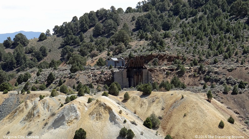
Here are a couple of shots of some of the mines and mining equipment remain scattered around the city center.
Since it was a nice day, from Virginia City we turned our sights towards Lake Tahoe. With a surface elevation of 6,225 feet, it straddles the border between California and Nevada. We would be departing Nevada the following day, that and the fact that another cold front was moving into the area, prompted our decision.
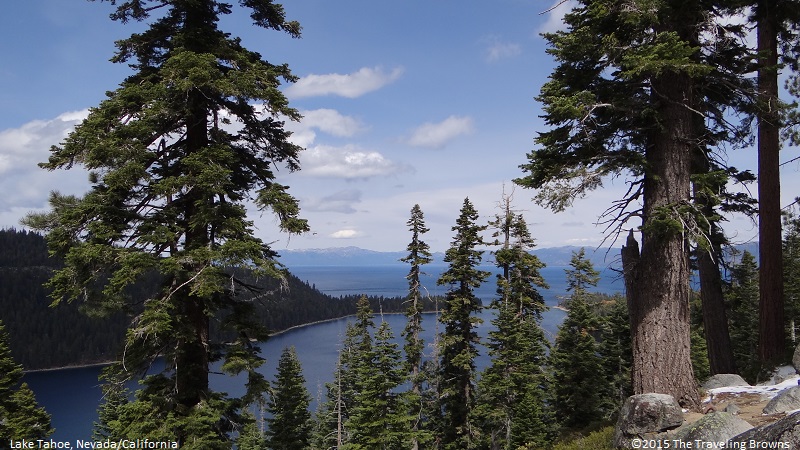
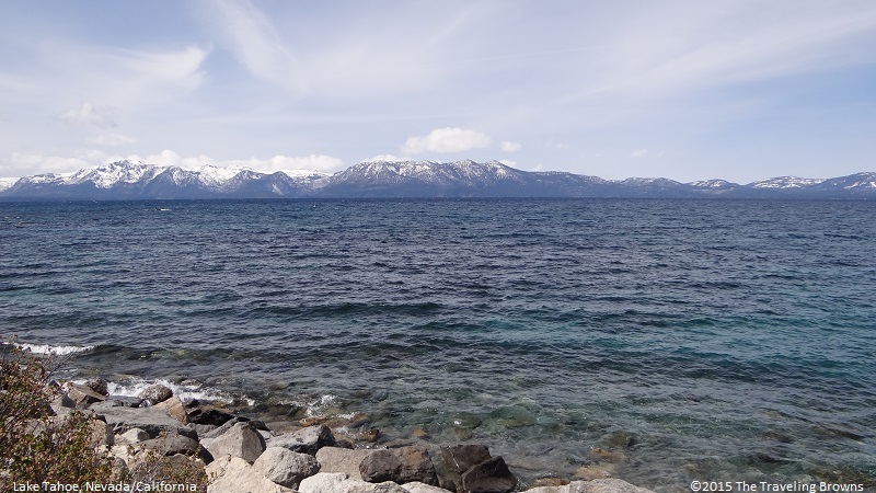
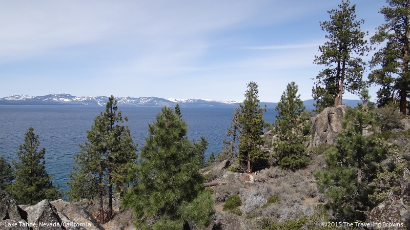
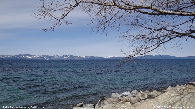
Lake Tahoe is truly a jewel high in the Sierra-Nevada Mountains. With a depth of approximately 1,600 feet it is the third deepest lake in North America. It contains over 39 trillion gallons of water and could cover an area the size of California with fourteen inches of water! Upon arriving at the lake we decided to spend the rest of the day driving completely around it. Along our drive we stopped often to snap photos. Here are a few of the scenes we captured.
Lake Tahoe is truly a jewel high in the Sierra-Nevada Mountains. With a depth of approximately 1,600 feet it is the third deepest lake in North America. It contains over 39 trillion gallons of water and could cover an area the size of California with fourteen inches of water! Upon arriving at the lake we decided to spend the rest of the day driving completely around it. Along our drive we stopped often to snap photos. Here are a few of the scenes we captured.
Sixty-three streams flow into Lake Tahoe. While only one, the Truckee River flows out of it into Pyramid Lake. Unlike most bodies of water in North America, the lake’s water never reaches the ocean.
The lake is so clear that in places objects can be seen clearly 67 feet below the surface.
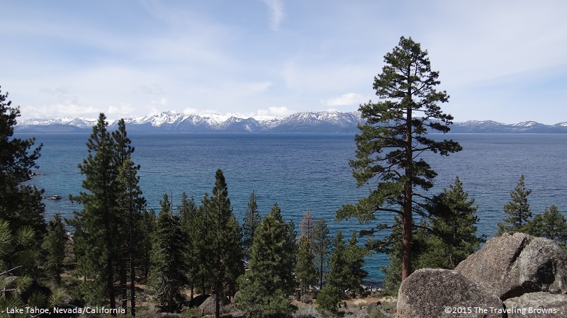
Lake Tahoe’s surface temperature can reach 68F during the summer, while at depths below 600 feet the water remains a chilly 39F. Its extreme depth keeps the water in motion. The warmer surface water constantly mixes with the colder water below, which prevents the lake from freezing.
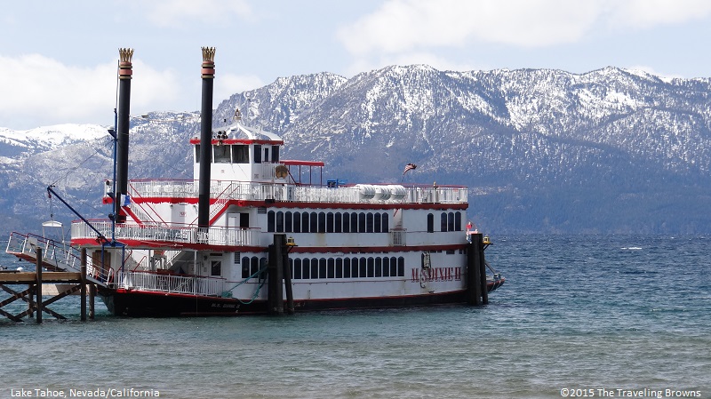
Here is one of a number of paddle-wheelers that operate on Lake Tahoe. They offer excursions on the lake during the warm summer months. Don’t be fooled in thinking that this is just a recent tourist evolution. With only a few rough roads connecting the remote settlements on the lake, boats provided the best means of transportation in the late 1800s. It wasn’t long before large commercial steamboats took to the water. These wood-burning steamboats towed logs to sawmills and ferried passengers and mail to the growing number of lakeside resorts. One steamer, the Tahoe, launched in 1896, became famous for its moonlight cruises where the rich and famous danced till dawn. Able to carry 200 passengers it had all the trimmings of a modern day cruise ship.
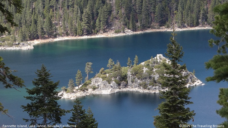
This is beautiful Emerald Bay on the California side of the Lake Tahoe. Within the bay is Fannette Island—the only island in vast Lake Tahoe.
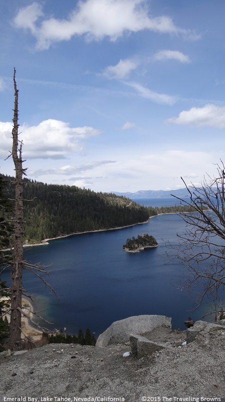
Here is another shot of Fannette Island. Over the years the island has had many different names. And, there are many colorful stories associated with it.
We thoroughly enjoyed our jaunt around Lake Tahoe. It was a fitting conclusion to our time spent exploring the countryside surrounding Reno. Another trip will have to be put on the docket for a summer visit in the near future.
Our next adventure will take us up over the Sierra-Nevada Mountains and then to the coast of California. We would love to have you ride along with us.
Until next time,
Dave & Barb
The Traveling Browns
Our next adventure will take us up over the Sierra-Nevada Mountains and then to the coast of California. We would love to have you ride along with us.
Until next time,
Dave & Barb
The Traveling Browns
