2013-26 Banff & Jasper National Parks, Canada
Hello All,
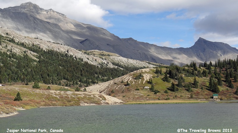
Continuing with our adventures in the Canadian Rockies we moved our home base from Banff National Park into Jasper National Park. Jasper was established in 1907 and is the largest of Canada’s national parks.
Jasper protects 4,200 square miles of wild mountainous wilderness with lakes, waterfalls, and alpine meadows. It’s chock-full of wildlife and home to some of North America’s healthiest populations of grizzly bears, moose, elk, caribou, mule deer, white-tailed deer, mountain goats, bighorn sheep, black bears, coyotes, beavers, grey wolves, mountain lions, and wolverines, to name a few. There are more than 615 miles of hiking trails for both day and overnight trips. And, it provides a number of spectacular mountain drives for folks who are unable to hike the trails. Jasper was declared a UNESCO World Heritage Site in 1984, together with the other national and provincial parks that form the Canadian Rocky Mountain Parks.
Departing Banff Village we drove northwest on Trans-Canada Highway 1 and then turned north onto the Icefield Parkway at Lake Louise. The first 80 miles of the parkway is in Banff National Park. It is not until you travel up and over Sunwapta Pass that you enter Jasper National Park near the Athabasca Glacier and the Columbia Icefield. The parkway parallels the Continental Divide, traversing the rugged landscape of the Canadian Rockies for 130 miles. It ends at the small town of Jasper, which will be our home away from home for the next few days. In this little blurb we will be focusing on the drive along the Icefield Parkway.
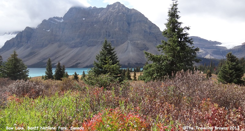
Our first stop along the parkway was at Bow Lake. The overcast sky was forecast to burn off by mid morning. But, it was taking its time in doing so. We snapped a few photos and then moved on down the highway.
Continuing with our adventures in the Canadian Rockies we moved our home base from Banff National Park into Jasper National Park. Jasper was established in 1907 and is the largest of Canada’s national parks.
Jasper protects 4,200 square miles of wild mountainous wilderness with lakes, waterfalls, and alpine meadows. It’s chock-full of wildlife and home to some of North America’s healthiest populations of grizzly bears, moose, elk, caribou, mule deer, white-tailed deer, mountain goats, bighorn sheep, black bears, coyotes, beavers, grey wolves, mountain lions, and wolverines, to name a few. There are more than 615 miles of hiking trails for both day and overnight trips. And, it provides a number of spectacular mountain drives for folks who are unable to hike the trails. Jasper was declared a UNESCO World Heritage Site in 1984, together with the other national and provincial parks that form the Canadian Rocky Mountain Parks.
Departing Banff Village we drove northwest on Trans-Canada Highway 1 and then turned north onto the Icefield Parkway at Lake Louise. The first 80 miles of the parkway is in Banff National Park. It is not until you travel up and over Sunwapta Pass that you enter Jasper National Park near the Athabasca Glacier and the Columbia Icefield. The parkway parallels the Continental Divide, traversing the rugged landscape of the Canadian Rockies for 130 miles. It ends at the small town of Jasper, which will be our home away from home for the next few days. In this little blurb we will be focusing on the drive along the Icefield Parkway.
Our first stop along the parkway was at Bow Lake. The overcast sky was forecast to burn off by mid morning. But, it was taking its time in doing so. We snapped a few photos and then moved on down the highway.
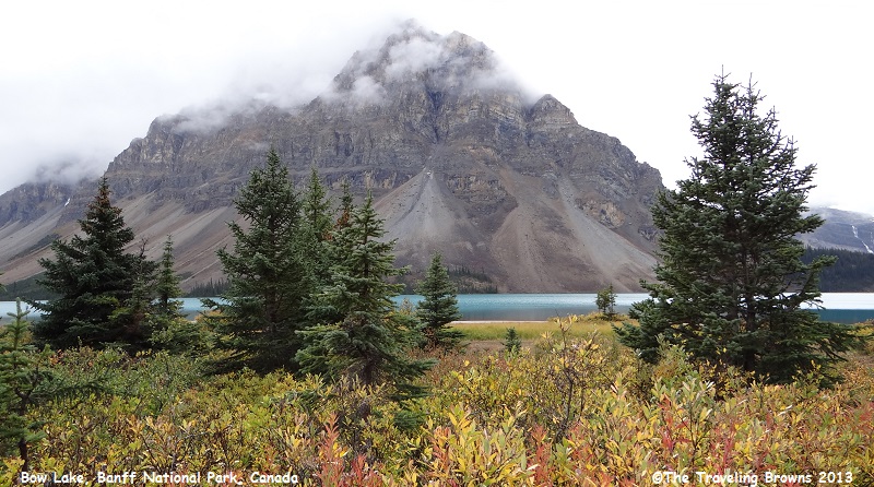
There was a little fall color
showing. But, in this far North Country the leaves go from green to orange to
yellow to brown to “gone” almost in the blink of an eye.
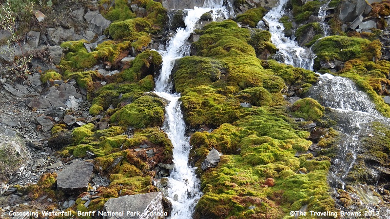
Our next stop was at a small
unnamed cascading waterfall close to the parkway.

What caught our eye was the
moss around the waterfall, more so than the falls itself. It was changing color
from a brilliant green to the more subtle fall color combinations of orange and
brown.
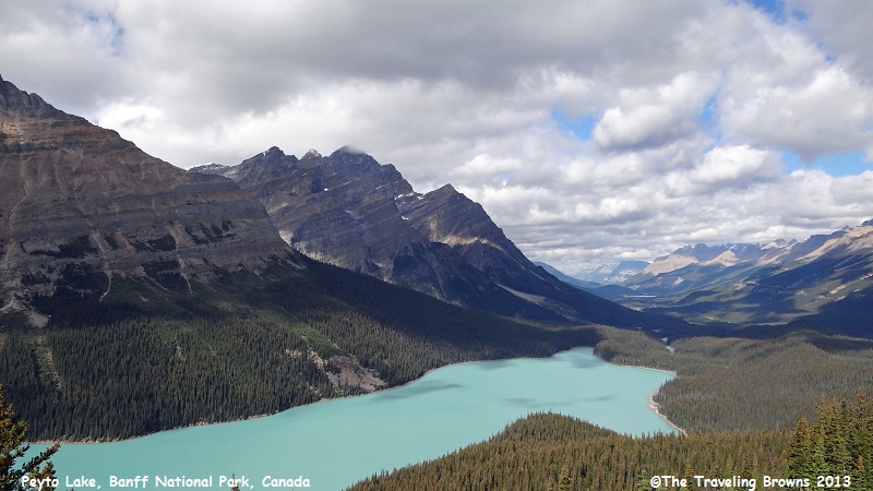
Our next stop within Banff
National Park was beautiful Peyto Lake. From the parking lot it is only a 10 to
15 minute walk up a steep trail to a viewpoint overlooking the lake. This
beautiful lake with its distinctive shape is featured in many travel brochures.
It is popular amongst visitors and well worth the short walk. The valley in the
distance is the route the Icefield Parkway follows.
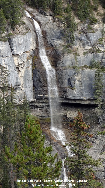
Our last stop in Banff was at
Bridal Veil Falls. This beautiful cascading waterfall has an accumulative drop
of 1200 feet. The highest single drop of the falls is 400 feet.
As we climbed up and over
Sunwapta Pass the clouds were starting to break up a bit. Clouds on the eastern
side of the pass were allowing us to see bits of beautiful blue sky.
Even the rugged western side
of the pass showed signs of improvement.
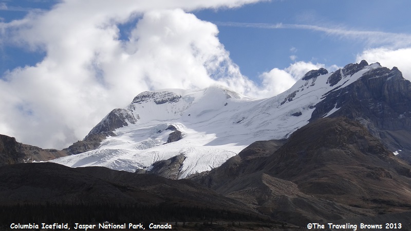
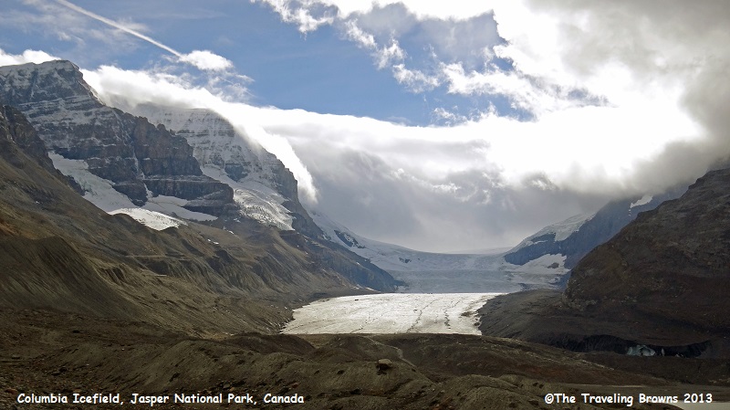
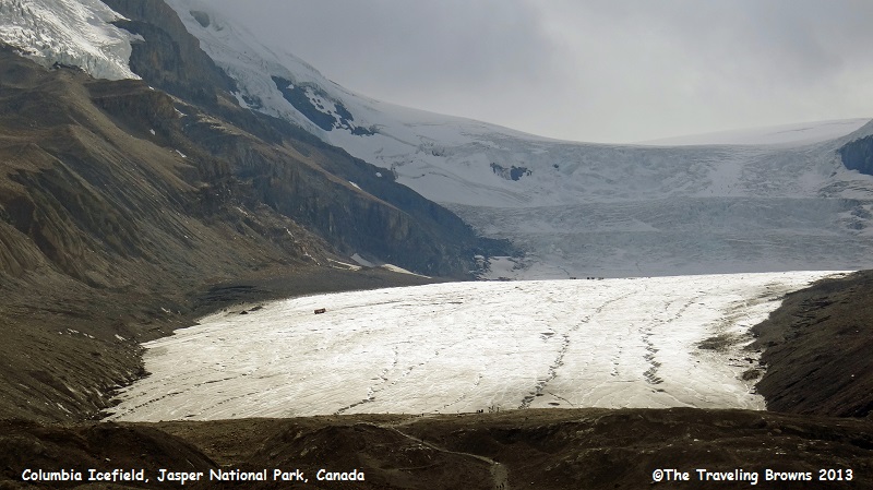
However, Athabasca Glacier and
the Columbia Icefield were still capped with clouds and probably would be for the
remainder of the day. For folks that have never seen a glacier before this one is
pretty easy to access. There is a trail that takes you right up to the face of
the glacier. Or, you can take a motorized vehicle tour from the lodge. These specially
designed vehicles actually travel out on the glacier surface. Tickets can be
purchased at the lodge.
Since we have seen many
glaciers it just made sense for us to move on down the road. There are so many
other sites within Jasper that were of higher priority on our list of places to
visit.
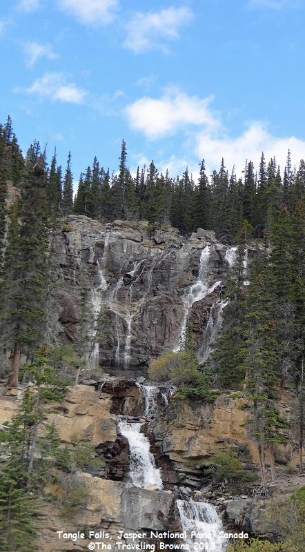
Tangle Falls was our next stop. It is so aptly named as the flow of the falls is just “tangled” as it comes over the ridge top. It then comes together at the lower end of the falls—most unusual.
Tangle Falls was our next stop. It is so aptly named as the flow of the falls is just “tangled” as it comes over the ridge top. It then comes together at the lower end of the falls—most unusual.
It is a spectacular drive. As
we continued following the parkway to the north the scenery just kept getting
better. The 130-mile parkway is truly a jewel within the Canadian Rockies. The
road has wide shoulders and numerous viewpoints. So stopping to take a few
photos is not a problem.
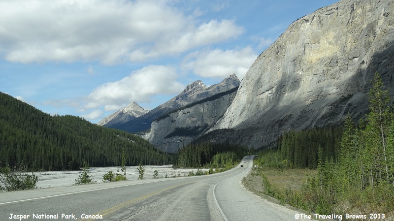
We took our time and stopped
often to take it all in. The views were stunning.
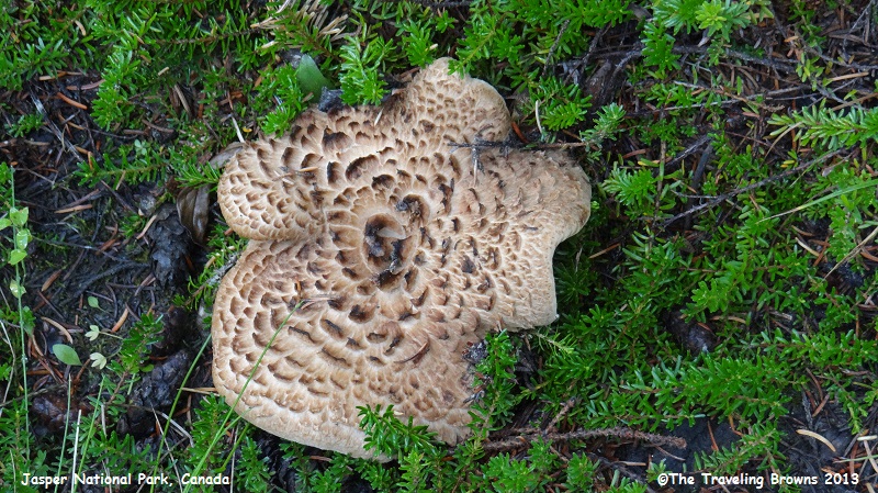
Here is a mushroom that caught
Miss Barbs’ eye at one stop.
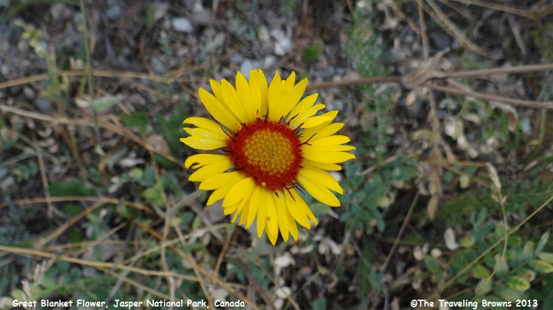
This wildflower was quite lovely. It is a gaillardia and has
the common name of the great blanket flower. It is a
member of the sunflower family. We were surprised to find it blooming in late
September.
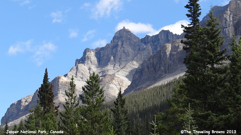
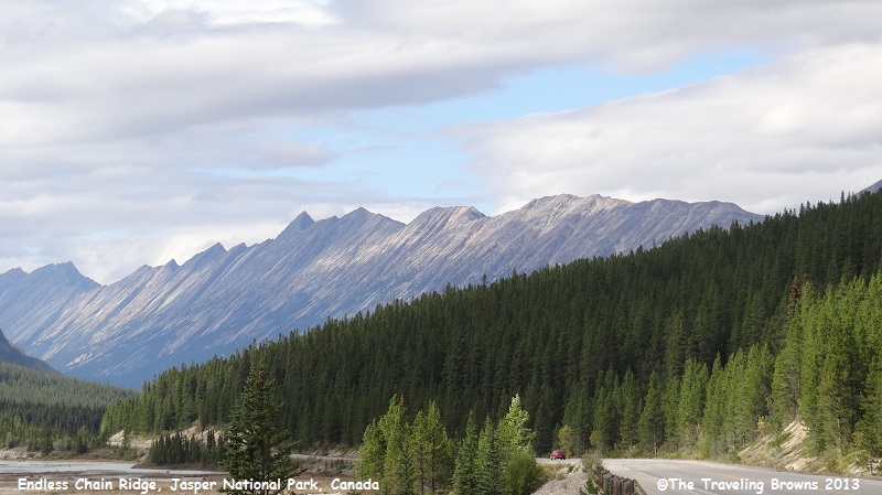
In this photo you can see the
beginning of the Endless Chain Ridge. The ridge stretches along the Sunwapta
and Athabasca River Valleys for over 15 miles. The highest point on the ridge
is 9,407 feet.
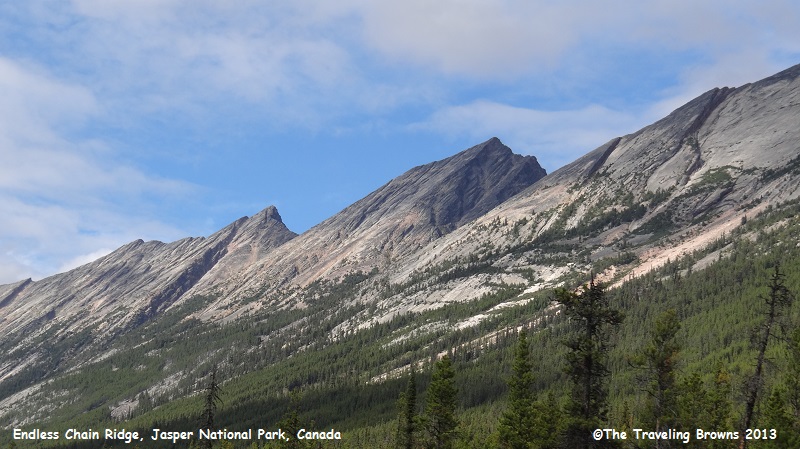
Here is a close up shot of a
portion of the Endless Chain Ridge. It is considered to be a fold mountain
range formed when two of the Earth’s tectonic plates push together. The extreme
pressure forces the edge of one plate upwards.
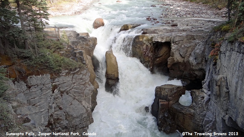
Sunwapta Falls and Gorge near
the end of the Sunwapta River was our next stop. There are great viewpoints for
seeing the falls including a foot bridge that spans the gorge. This 75-foot
crashing waterfall pounds its way on down the canyon. It has worn away the limestone
and created a gorge below the falls.
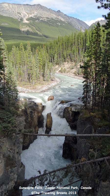
Did you note the fallen trees
across the gorge in the proceeding photograph? This is caused by the shallow
soil layer over the rock in the area. Runoff during winter thaws and storms
washes the soil away exposing the tree root systems. Eventually they can no
longer support themselves and fall. This process of Mother Nature makes for
unusual patterns on the surface as seen in the following photo.

The waterfall is appropriately
named as the Indian word Sunwapta, meaning “turbulent water.”
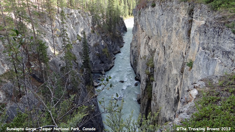
Shortly after the Sunwapta
Gorge the river goes over another waterfall and then flows into the Athabasca
River.
We will pick up with more
adventures in Jasper National Park in our next little blurb. We have a seat
reserved for you if you care to ride along.
Until next time,
Dave & Barb
The Traveling Browns
Until next time,
Dave & Barb
The Traveling Browns
