2011-62 Chiricahua National Monument, Arizona & Davis Mountains, Texas
Hello
All,
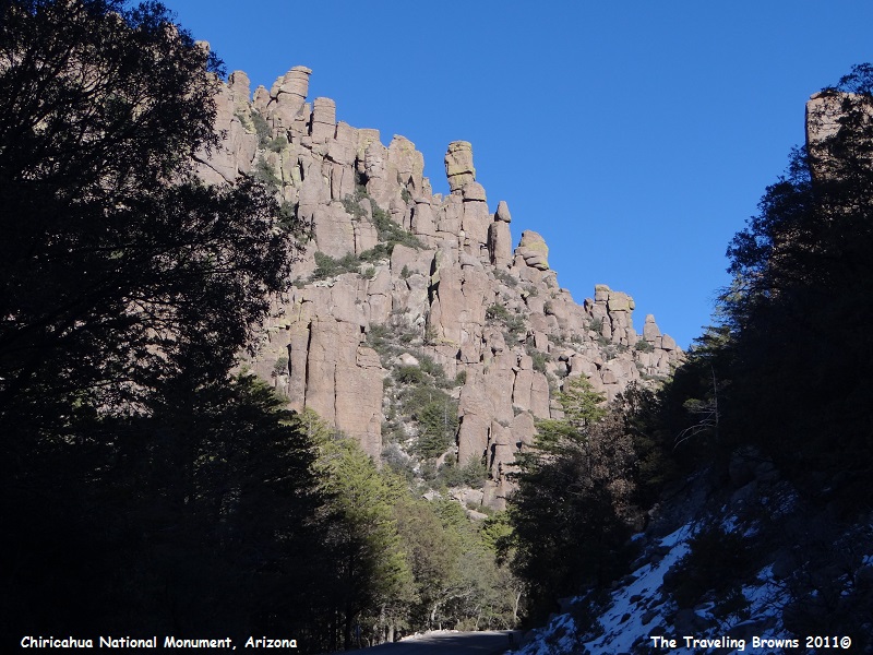
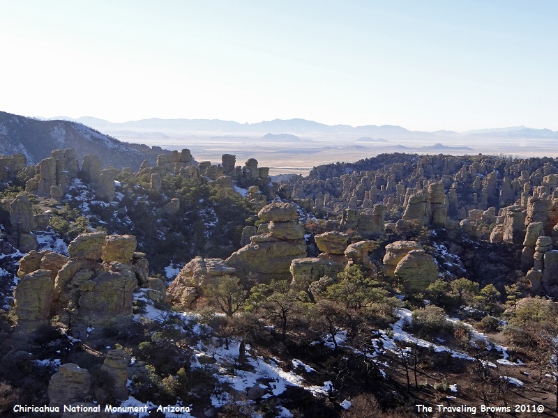
Departing the Phoenix area we jumped on I-10 eastbound and followed it till we came to Wilcox, AZ. We turned south on US-186 and followed it till we came to Chiricahua National Monument, which is located in the southeast corner of Arizona. This was new territory for us and we were anxious to check it out. The monument is famous for its extensive vertical rock formations. Located within the Chiricahua Mountains, it was a stronghold for the Apache Chiricahua Indians in the mid-1800’s.
The Chiricahua Mountains are known as “Islands in the Sky” because they stand like islands between two great deserts—the Sonoran and the Chihuahuan. Two great mountain ranges also converge here—the Sierra Madres and the Rockies. The strategic location of the Chiricahuans and the unusual variety of habitats attract more than 300 species of birds. Nearly all the exotic species that fly north from Mexico can be found here.
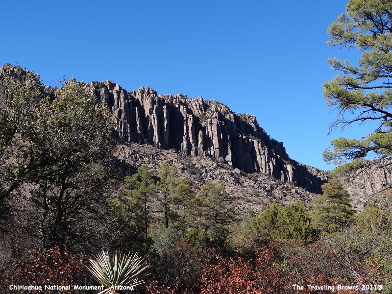
Geologists believe that the monument preserves the remains of an immense volcanic eruption that shook the region some 27 million years ago. The thick white hot ash spewed forth from a nearby caldera, cooled and hardened into rhyolite tuff, laying down almost two thousand feet of dark volcanic ash and pumice, highly siliceous in nature which eventually eroded into the natural features that we see today.
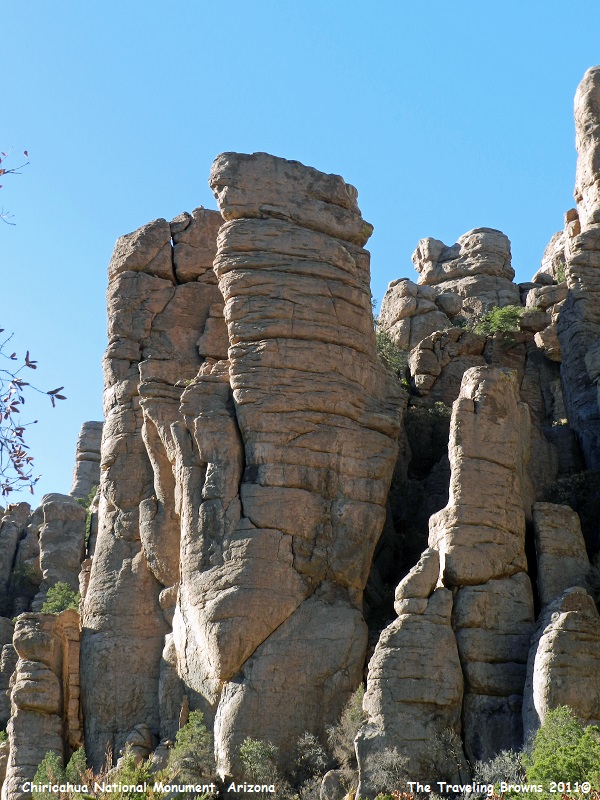
Pulling into the monument we could see that we were in for a treat.
Departing the Phoenix area we jumped on I-10 eastbound and followed it till we came to Wilcox, AZ. We turned south on US-186 and followed it till we came to Chiricahua National Monument, which is located in the southeast corner of Arizona. This was new territory for us and we were anxious to check it out. The monument is famous for its extensive vertical rock formations. Located within the Chiricahua Mountains, it was a stronghold for the Apache Chiricahua Indians in the mid-1800’s.
The Chiricahua Mountains are known as “Islands in the Sky” because they stand like islands between two great deserts—the Sonoran and the Chihuahuan. Two great mountain ranges also converge here—the Sierra Madres and the Rockies. The strategic location of the Chiricahuans and the unusual variety of habitats attract more than 300 species of birds. Nearly all the exotic species that fly north from Mexico can be found here.
Geologists believe that the monument preserves the remains of an immense volcanic eruption that shook the region some 27 million years ago. The thick white hot ash spewed forth from a nearby caldera, cooled and hardened into rhyolite tuff, laying down almost two thousand feet of dark volcanic ash and pumice, highly siliceous in nature which eventually eroded into the natural features that we see today.
Pulling into the monument we could see that we were in for a treat.
There
is an 8-mile paved scenic drive that climbs up into the mountains. It is a
winding road with deep canyons, hairpin curves, and overhanging boulders. Due to
the road’s tight turning radiuses and steep grades it has a set speed limit of
25 mph. Also, only vehicles and RV’s with a combined total length of 29 feet or
under are allowed to take the road. However, in late December we had very
little traffic to contend with.
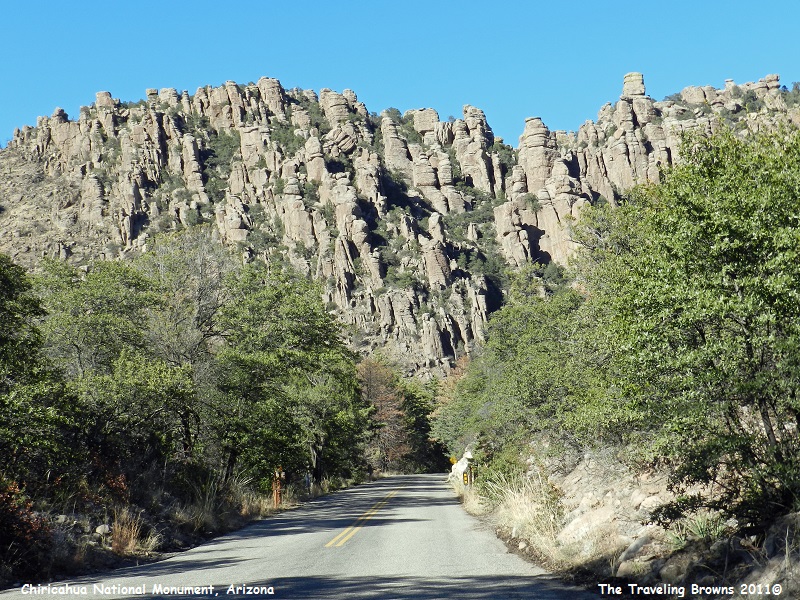
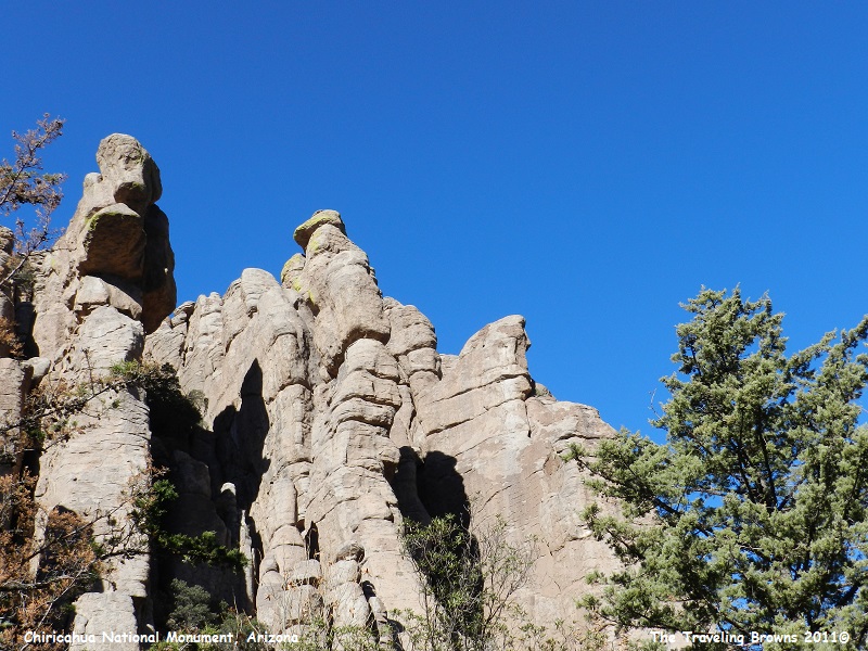
There
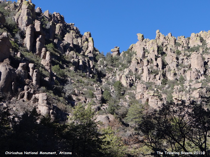
were numerous pullouts where we could stop and snap a couple of photos.
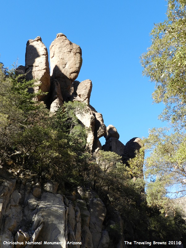
Here
is a little different angle on the same group of rocks.
Yes,
that is snow in the shadows alongside the road. Remember, this was December.
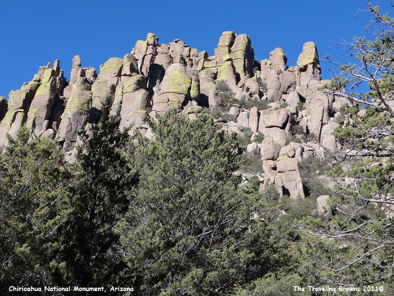
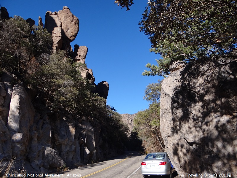
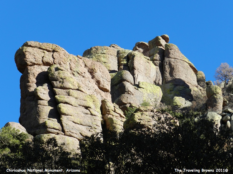
To
help with perspective and to show how large these boulders are check out the
full grown tree on the right side up on top in the following photo.
This
area is known as the “Organ Pipes.”
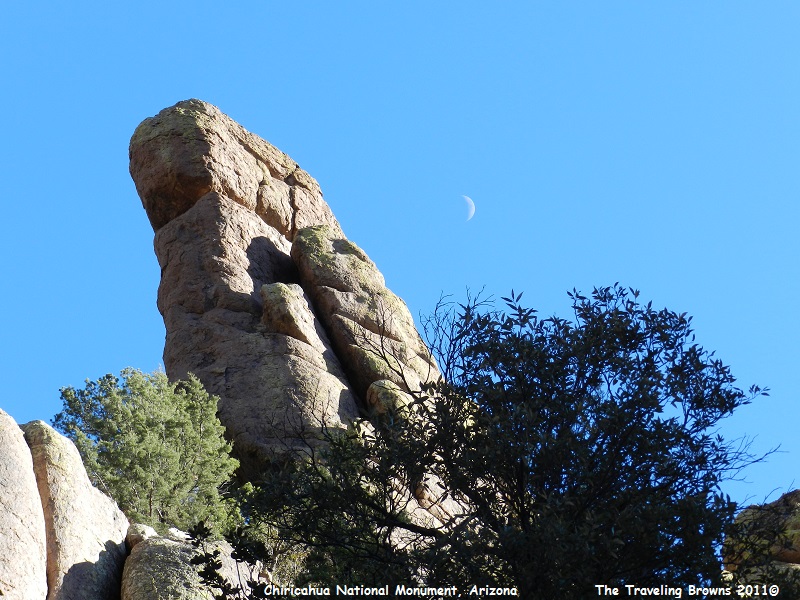
We
kind of liked the following photo with the moon in the sky.
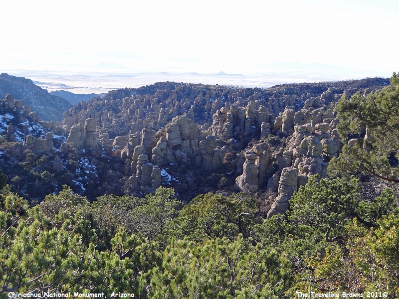
Upon
reaching the top and the end of the paved scenic drive we could look back
towards the desert valley and see the terrain we had climbed up through. It is
a pretty amazing landscape.
Leaving the monument
we backtracked on US-186 to I-10 where we turned eastbound. We followed I-10
into New Mexico and then into West Texas. Upon reaching state highway TX-118 we
turned south and followed it into the Davis Mountains. Once again this was new
territory for us to explore. For the most part there was a whole lot of
nothing. But sometimes that happens.
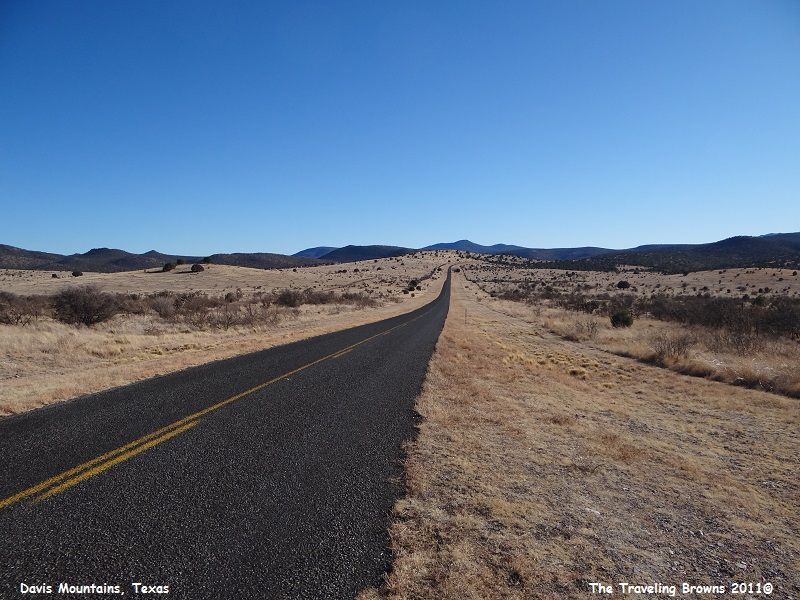
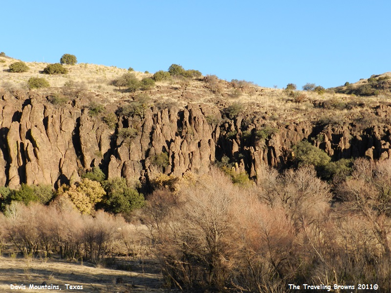
There
was a lot of desolation, rolling hills, and many rock outcroppings.
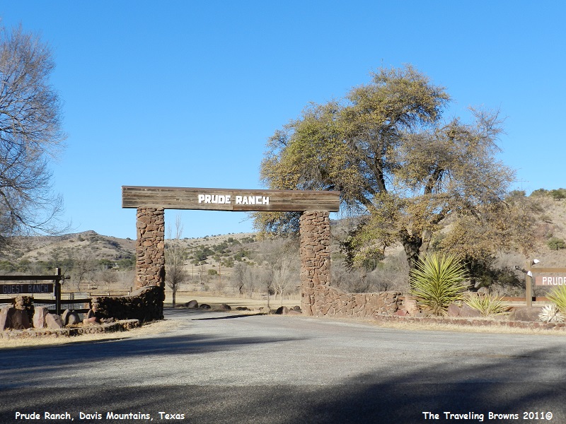
We
did come upon the entrance to the Prude Ranch along the highway. This ranch has
quite a history. Andrew Prude purchased three sections of land here in 1897 and
established the ranch. He moved his wife Ora into a small log house on the
property in 1900. He completed a wooden frame house for their family and added an
additional 1257 acres of land to the ranch in 1902. In 1911 a large 2-story
ranch house was built of adobe bricks and was called the “big house.” By 1920
he had expanded his ranch to 40 sections of land (a section is a square mile).
In 1921 the Prudes started a guest ranch to share the beauty of the land and cool summer months with city dwellers. Early guests arrived on the Southern Pacific Railroad. When a severe drought and the depression of the 1930’s forced Andrew Prude to sell his cattle and most of his land, the Prudes decided to operate the guest ranch fulltime. Soon a new highway was built, and guests traveled here from many locales. New guest houses were built, and a coaching school and rodeo were added, followed by summer camp for boy and girls, and educational programs. The facilities have expanded over the years to accommodate a wide variety of activities. To this day it is still a popular guest ranch. Since we were unable to drive onto the ranch property, we came away from it with only a photo of the main entrance.
In 1921 the Prudes started a guest ranch to share the beauty of the land and cool summer months with city dwellers. Early guests arrived on the Southern Pacific Railroad. When a severe drought and the depression of the 1930’s forced Andrew Prude to sell his cattle and most of his land, the Prudes decided to operate the guest ranch fulltime. Soon a new highway was built, and guests traveled here from many locales. New guest houses were built, and a coaching school and rodeo were added, followed by summer camp for boy and girls, and educational programs. The facilities have expanded over the years to accommodate a wide variety of activities. To this day it is still a popular guest ranch. Since we were unable to drive onto the ranch property, we came away from it with only a photo of the main entrance.
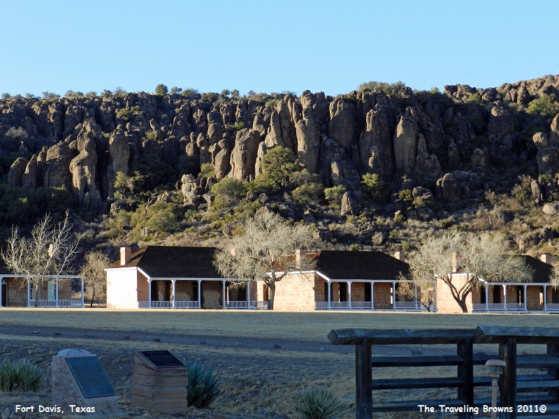
Continuing
on TX-118 southbound we came to the small town of Fort Davis. It was the site
of historic Fort Davis, established in 1854 on the San Antonio-El Paso Road
through West Texas and named after Jefferson Davis, who was then the Secretary
of War for the United States. We visited the old fort and snapped a few photos.
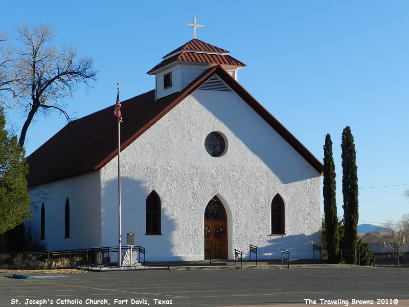
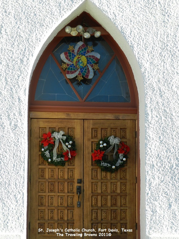
However,
what really got our interest was this simple but beautiful St. Joseph Catholic
Church. Catholic clergy began serving residents of the Fort Davis area about
1872. Father Joseph Hoban was appointed pastor in 1876 and the first St. Joseph
Catholic Church was built in 1879. Father Hoban was followed by circuit-riding
priests who considered St. Joseph’s as the central church of the region. Father
Brocardus Eeken came to Fort Davis in 1892. He and fellow Carmelite Friars
travelled thousands of miles each year, ministering to the 18 churches and
mission stations in the Trans-Pecos and Big Bend areas. A new church was
consecrated in 1899. St. Joseph Catholic Church continues to serve a large and
diverse congregation in the area.
This
writing wraps up our travels for 2011. We ended up with 62 Pictures of the Week
write-ups for the year. That’s 10 more weeks than what there are in a year—no
wonder we got so far behind!
It was a busy year of travel for us. From up and down the Natchez Trace in Tennessee, Alabama & Mississippi, all over China, then to the states of Georgia and Washington with a cruise to Alaska, then beautiful Victoria, Canada to celebrate Canada Day with them, followed by visits to Oregon, Kentucky, Indiana, Michigan, and Minnesota, then a circle drive of Lake Superior, visiting friends in London, Ontario, Canada, and finally traveling through Arkansas, Texas, New Mexico and Arizona for the holidays.
As long as our health holds out we will continue to travel and share our experiences with you. We hope that you enjoy riding along with us. We’ll kick off our 2012 travels in our next little blurb.
Until next time,
Dave & Barb
The Traveling Browns
