Pictures of the Week 2010-16
Hello
All,
Red Lodge, Montana, where we spent the night, is the gateway to Yellowstone National Park via the beautiful Beartooth Highway. The town was officially established in 1884. But, long before the arrival of permanent settlers, this valley was Crow country, serving the Crow Indians each summer as a place to worship, rest, and hunt. It is now a quaint little historic western town with a population of about 2,500 at an elevation of 5,568 feet.
When the Rocky Fork Coal Company opened the area’s first mine in 1887, hundreds of immigrants arrived and dug in. During this boom time it was a lively place with 20 saloons and a burgeoning population. John “Liver Eatin” Johnston lived here then. According to legend, Johnston was a ”giant of a man with a grizzly bear appearance” who earned his name by gouging out and consuming the livers of those who crossed him--a reputation that surely served him well during his stint as the town’s deputy sheriff. Johnston’s log cabin now stands next to the Visitor’s Center in town. In 1897, guests of the Pollard Hotel witnessed the Sundance Kid rob the Red Lodge Bank across the street from the hotel. Buffalo Bill Cody, William Jennings Bryan, Calamity Jane and Frederic Remington are among those on the hotel’s long and colorful guest register.
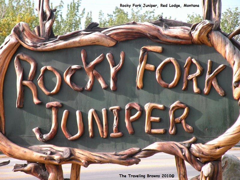
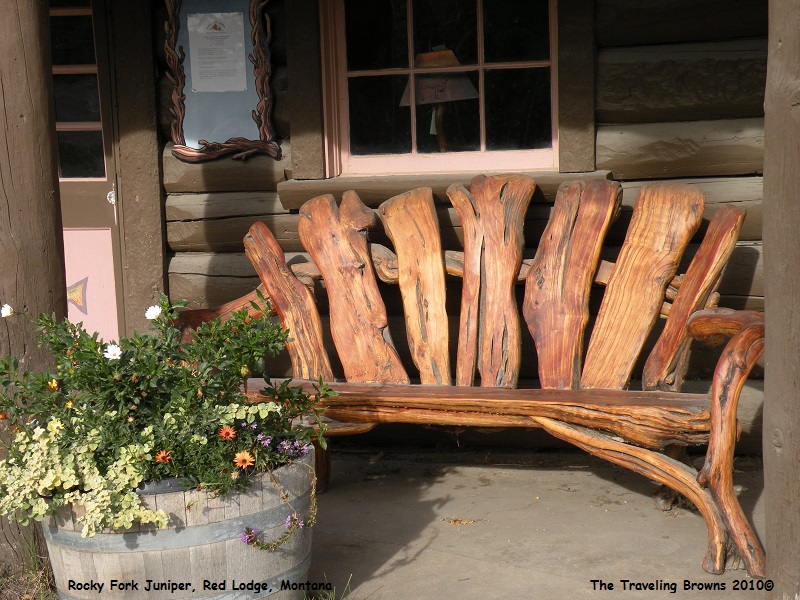
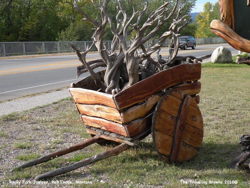
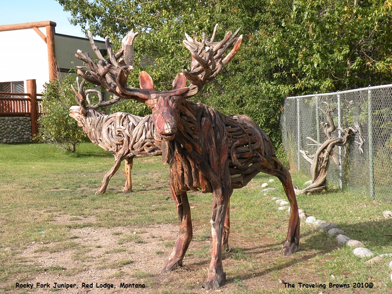
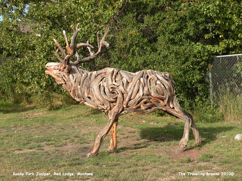
Our travel plans for the day were to head south into Wyoming. But, before leaving town we passed the Rocky Fork Juniper shop which tweaked our curiosity. So we stopped to check it out. Anyone that has seen an old juniper tree growing in the wild knows that it is less than beautiful. It is a gnarly tree that has an irregular twisted trunk and limbs. This shop makes unique furniture and handcrafted lawn ornaments from fallen Rocky Mountain juniper they collect from the surrounding foothills. It is hard to imagine anyone using juniper as a medium for artistic endeavors. Unfortunately, the shop wasn’t open but we did snap a few photos outside.
Red Lodge, Montana, where we spent the night, is the gateway to Yellowstone National Park via the beautiful Beartooth Highway. The town was officially established in 1884. But, long before the arrival of permanent settlers, this valley was Crow country, serving the Crow Indians each summer as a place to worship, rest, and hunt. It is now a quaint little historic western town with a population of about 2,500 at an elevation of 5,568 feet.
When the Rocky Fork Coal Company opened the area’s first mine in 1887, hundreds of immigrants arrived and dug in. During this boom time it was a lively place with 20 saloons and a burgeoning population. John “Liver Eatin” Johnston lived here then. According to legend, Johnston was a ”giant of a man with a grizzly bear appearance” who earned his name by gouging out and consuming the livers of those who crossed him--a reputation that surely served him well during his stint as the town’s deputy sheriff. Johnston’s log cabin now stands next to the Visitor’s Center in town. In 1897, guests of the Pollard Hotel witnessed the Sundance Kid rob the Red Lodge Bank across the street from the hotel. Buffalo Bill Cody, William Jennings Bryan, Calamity Jane and Frederic Remington are among those on the hotel’s long and colorful guest register.
Our travel plans for the day were to head south into Wyoming. But, before leaving town we passed the Rocky Fork Juniper shop which tweaked our curiosity. So we stopped to check it out. Anyone that has seen an old juniper tree growing in the wild knows that it is less than beautiful. It is a gnarly tree that has an irregular twisted trunk and limbs. This shop makes unique furniture and handcrafted lawn ornaments from fallen Rocky Mountain juniper they collect from the surrounding foothills. It is hard to imagine anyone using juniper as a medium for artistic endeavors. Unfortunately, the shop wasn’t open but we did snap a few photos outside.
Departing
Red Lodge we went into Wyoming and took WY-120 southbound towards Thermopolis.
After about 15 miles we turned west on the Chief Joseph Scenic Byway. It is
named after the Native American chief of the Nez Perce Tribe.
Following the Battle of the Big Hole in Idaho in 1877, Chief Joseph fled east through Yellowstone. He and 1,000 members of his tribe ran from the U.S. Calvary, who was trying to force the tribe onto a reservation so that white ranchers could have their lands. The Nez Perce were trying to flee to Canada, which is a 1,800-mile journey, but surrendered after the six-day Battle of the Bear Paw in northwest Montana. The tribe was stopped only 30 miles from their destination, the Canadian border.
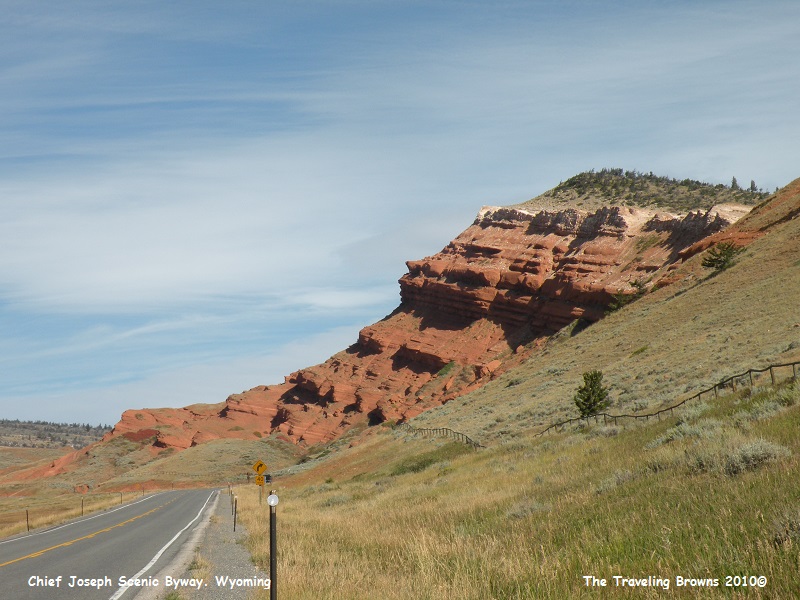
Not long after turning on the scenic byway the road started to climb. We passed some amazing rock formations of many different colors.
Following the Battle of the Big Hole in Idaho in 1877, Chief Joseph fled east through Yellowstone. He and 1,000 members of his tribe ran from the U.S. Calvary, who was trying to force the tribe onto a reservation so that white ranchers could have their lands. The Nez Perce were trying to flee to Canada, which is a 1,800-mile journey, but surrendered after the six-day Battle of the Bear Paw in northwest Montana. The tribe was stopped only 30 miles from their destination, the Canadian border.
Not long after turning on the scenic byway the road started to climb. We passed some amazing rock formations of many different colors.

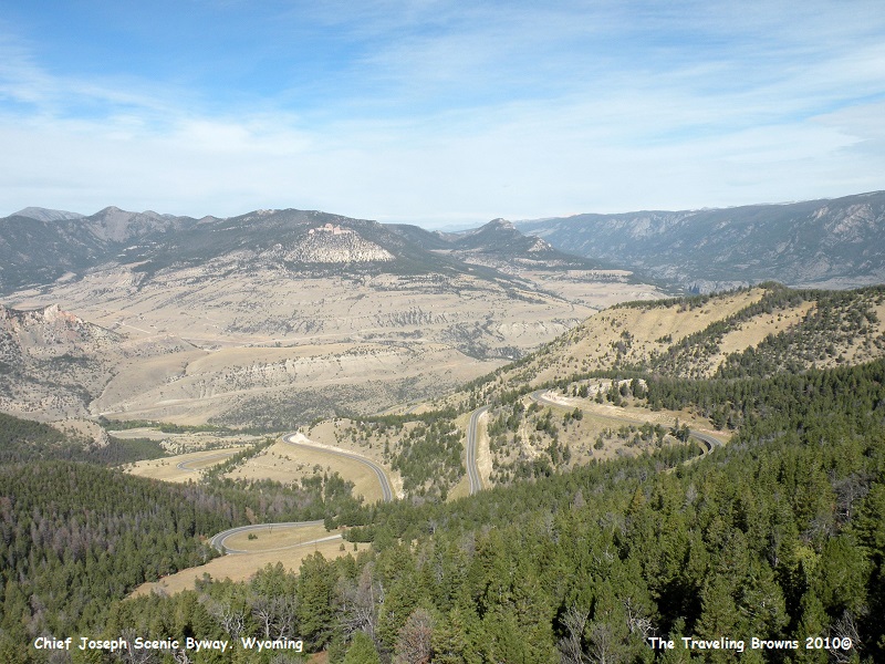
The
road snaked around and continually went up up up! Once we reached the summit of
Dead Indian Pass (8060 feet) we stopped at a scenic viewpoint. The following
photo is of the steep winding road we just drove up.
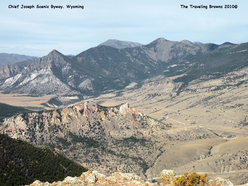
In
the following photo you can see the valley the scenic byway drops down into
from the summit. However, we decided to spin it around rather than proceeding
any farther.
On the way back down
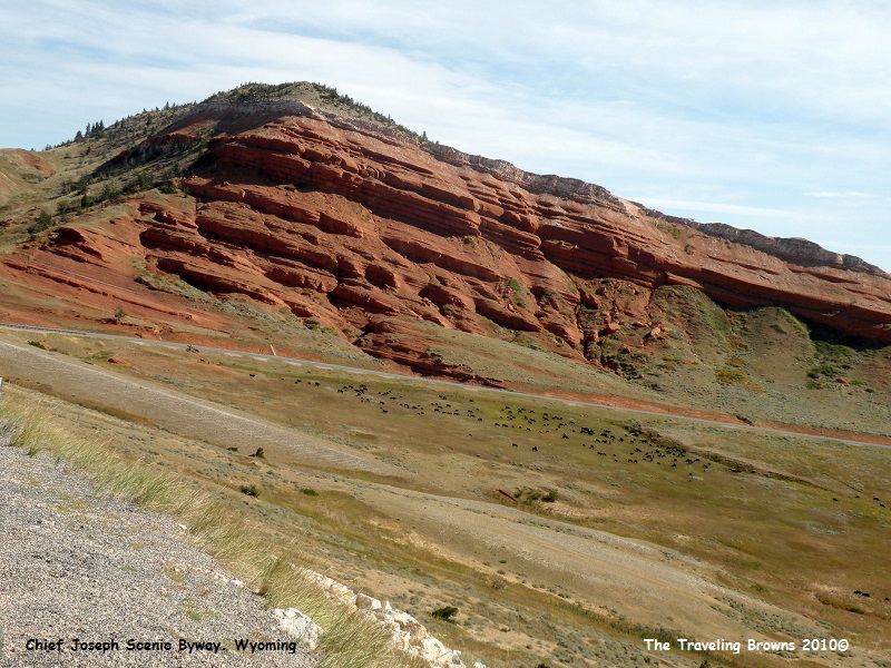
the mountain pass we stopped and took this photo. It is easy to see how steep
the road is. The camera is not tilted. Also note all those black specs in the
photo. That is a herd of cattle that had just been rounded up into an area
known as Two Dots Flats. A group of about six cowboys are beside the road in
the photo.
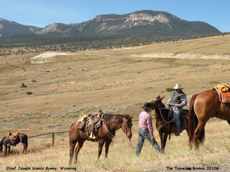
We drove on down to
where the cowboys were and talked with them and asked if we could take their
photo. They were very obliging.
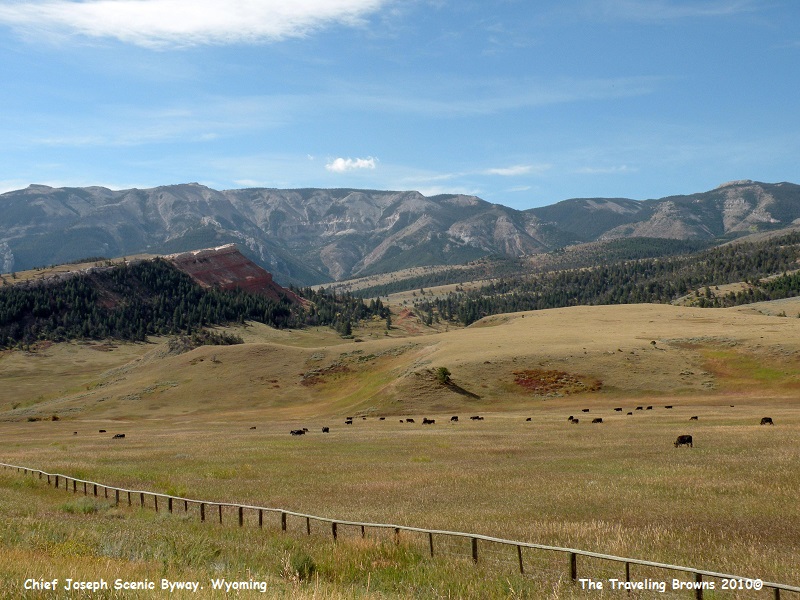
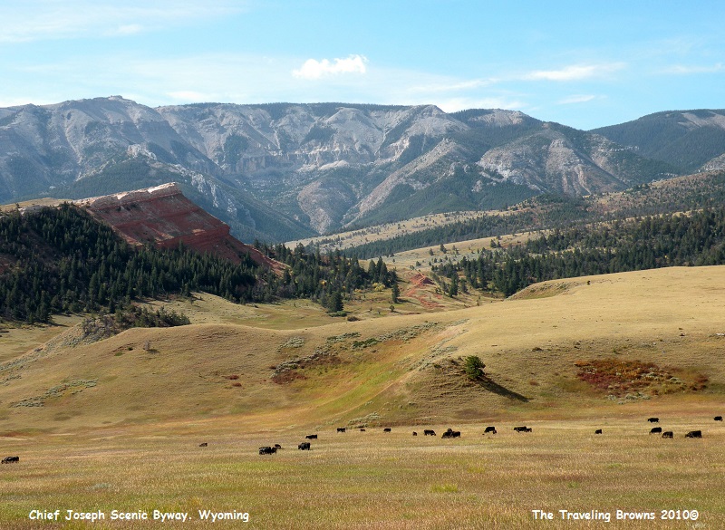
Here
are a couple more shots of the beautiful landscape of the Two Dots Cattle Ranch.
Upon
reaching WY-120 we again turned south, and made a quick stop at Thermopolis, home
of the world’s largest mineral hot springs. It is an interesting place but
since we had visited it a few years back we decided to forge on. Out of
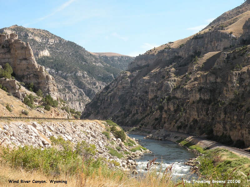
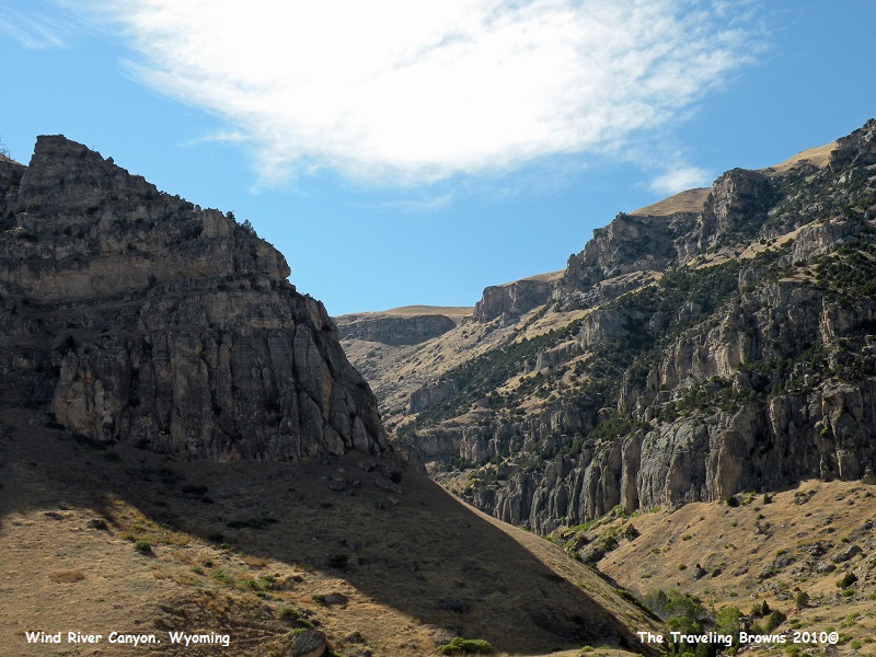
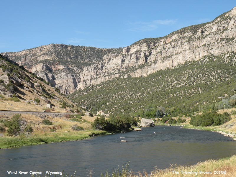
Thermopolis we followed US-20, which took us through Wind River Canyon. It was
an absolutely beautiful drive. The highway, railroad and Wind River are all nestled
into the bottom of the canyon.
We
drove US-20 to I-25 which we followed south to Cheyenne where we hung our hat
for the night. Departing Cheyenne we made a two-day dash for the house. After
five weeks on the road we had traveled 9,112 miles and snapped 3248 photos. It
was time for a rest…
Until next time,
Dave & Barb
The Traveling Browns
Until next time,
Dave & Barb
The Traveling Browns
