2015-1 Pyramid Lake Paiute Reservation, Nevada
Hello All,
In early April we decided to start our 2015 travel season. Our plan was to head southwest to Reno, Nevada, where we would spend a week exploring the surrounding area and then continue west to the California coast, where we would spend the next few weeks traveling south along the coast. Near Santa Barbara we planned to turn inland and check out some of the national parks in the Sierra-Nevada Mountains before exploring Joshua Tree National Park in the Mojave Desert of southeastern California.
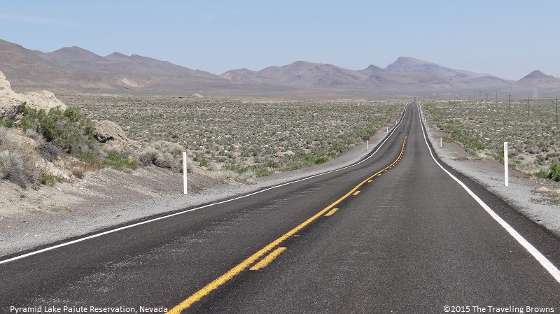
Our day’s ride from our Idaho home to Reno was pleasant. Upon arrival, we checked into a motel which would be home base in the area. Anxious to explore, the next morning we drove northeast with a target destination of Fly Geyser near Gerlach, Nevada--about 150 miles away. Our route took us along the east side of Pyramid Lake, through the Pyramid Lake Paiute Reservation, into the remote Black Creek Desert. We planned to return via the Smoke Creek Desert along the west side of Pyramid Lake--if we could find our way on the remote gravel roads. We knew that Fly Geyser was on private property and there was a good chance that we would not be able to see it, but we hoped for the best. It would be a very enjoyable ride regardless.
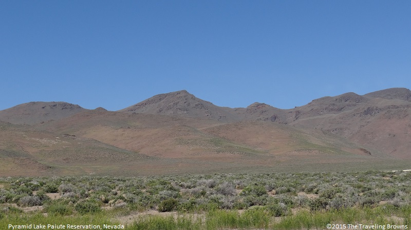
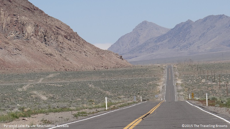
We found the countryside on the Indian reservation to be fascinating. There were landscapes unlike any we’ve seen in the world. Some areas had beautiful gently rolling hills.
In early April we decided to start our 2015 travel season. Our plan was to head southwest to Reno, Nevada, where we would spend a week exploring the surrounding area and then continue west to the California coast, where we would spend the next few weeks traveling south along the coast. Near Santa Barbara we planned to turn inland and check out some of the national parks in the Sierra-Nevada Mountains before exploring Joshua Tree National Park in the Mojave Desert of southeastern California.
Our day’s ride from our Idaho home to Reno was pleasant. Upon arrival, we checked into a motel which would be home base in the area. Anxious to explore, the next morning we drove northeast with a target destination of Fly Geyser near Gerlach, Nevada--about 150 miles away. Our route took us along the east side of Pyramid Lake, through the Pyramid Lake Paiute Reservation, into the remote Black Creek Desert. We planned to return via the Smoke Creek Desert along the west side of Pyramid Lake--if we could find our way on the remote gravel roads. We knew that Fly Geyser was on private property and there was a good chance that we would not be able to see it, but we hoped for the best. It would be a very enjoyable ride regardless.
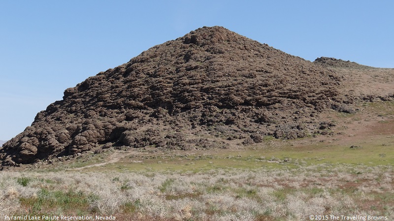
We found the countryside on the Indian reservation to be fascinating. There were landscapes unlike any we’ve seen in the world. Some areas had beautiful gently rolling hills.
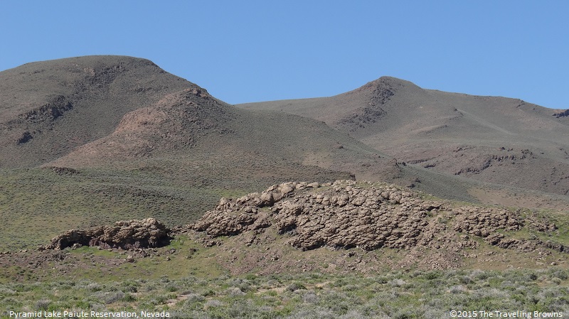
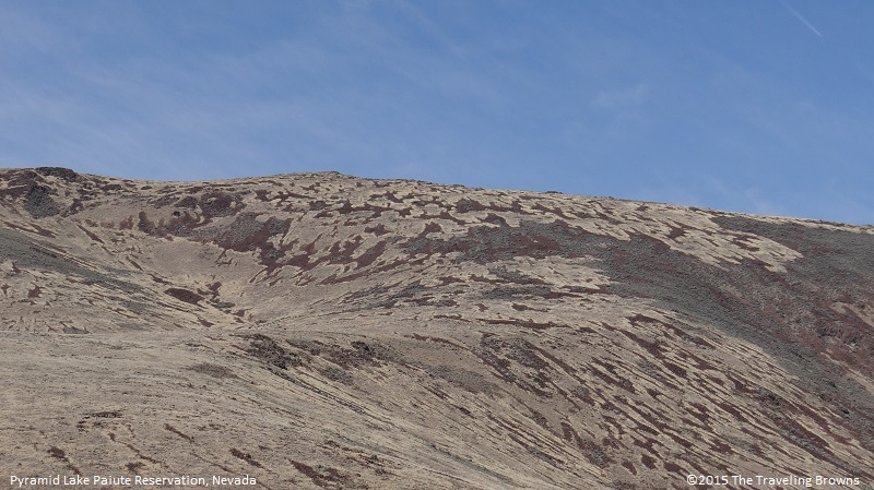
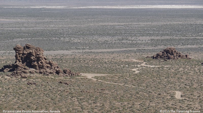
While other areas had hills made of rock formations unlike any other place we have come across in our travels. In our eyes they were truly unique and amazing. Looking at the photo below you might ask “what is so unusual about those hills?”
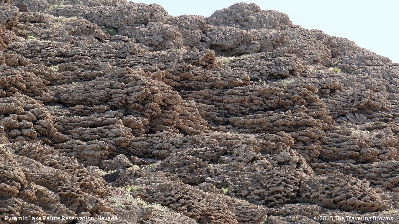
But upon closer inspection they are amazingly unique. Take a closer look.
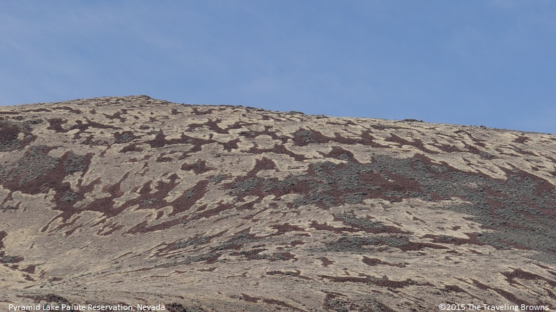
Still can’t see it! Take an even closer look. We have never seen formations like these before.
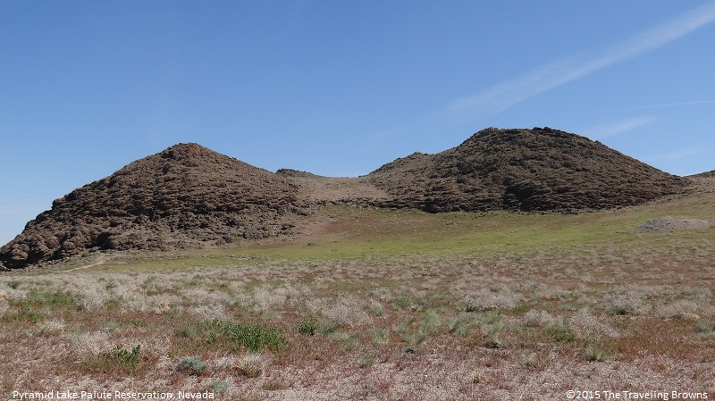
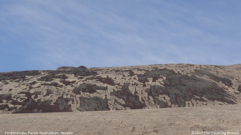
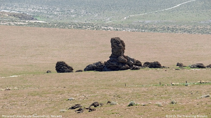
Here is another formation unlike any we have ever seen. We love finding new and unusual landscapes--Mother Nature is amazing.
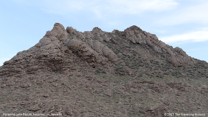
Now take a closer view of this unique work of art.
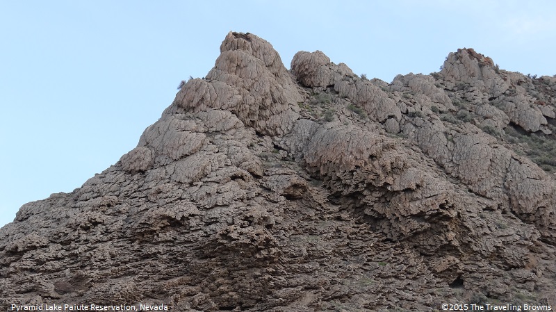
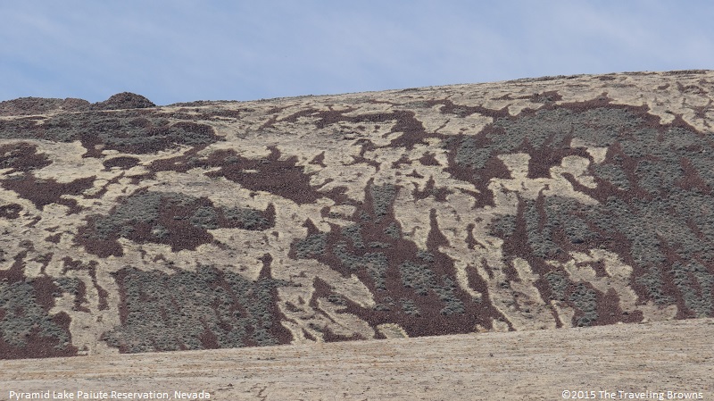
Check these hills out! Miss Barb summed them up quite nicely when she said they looked like they were covered in camouflage. We’ve traveled a lot of miles and have never seen patterns such as these.
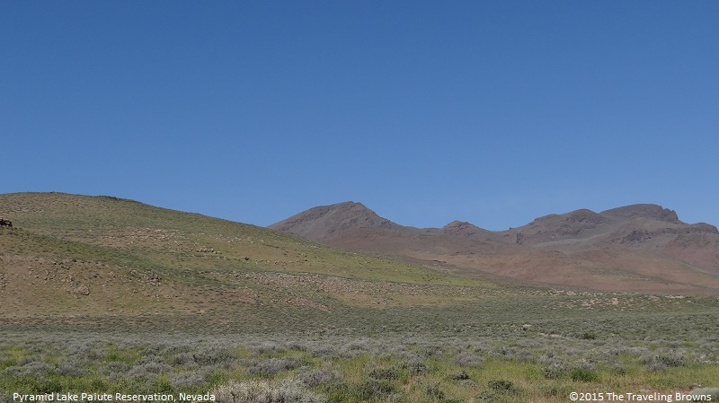
While cruising down the road we found there are a whole lot of areas with very little to see other than the terrain. It is a very sparsely populated area of Nevada.
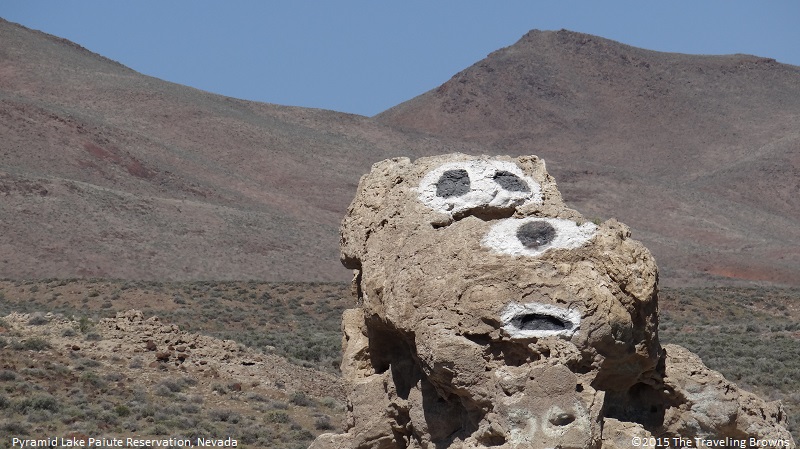
Every now and then there would be an outcropping of rock, which seemed to be out of place with the rest of the landscape.
Someone had taken liberty with this rock. Trust us when we say this is located way out in the middle of nowhere!
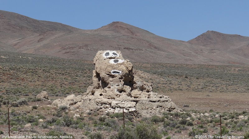
In our eyes it resembled the cartoon character “Snoopy.”
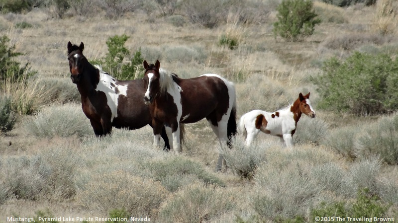
There were groups of wild mustangs throughout the area. They are such majestic animals and come in a variety of colors.
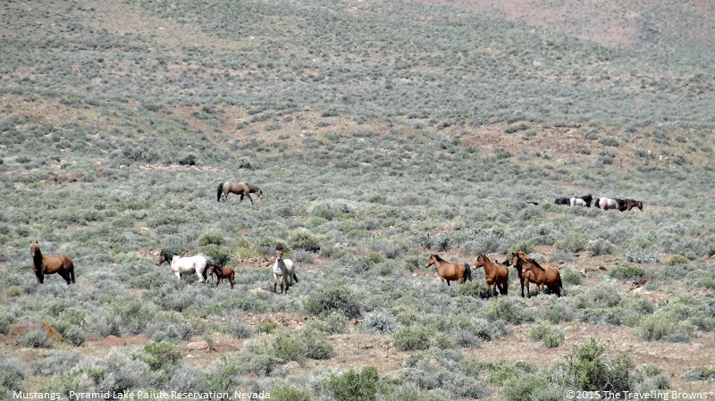
There were a number of spring foals in the herds.
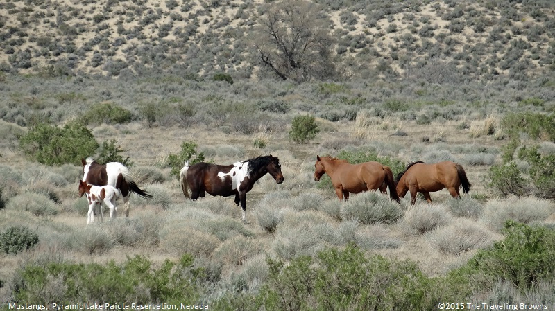
When we stopped to shoot photos of them they didn’t scatter but did keep a wary eye on us.
Upon approaching Black Rock Desert Playa we could see the wind whipping dust into the air. In 1843-44, John Fremont the first Euro-American to see the playa wrote, “The appearance of the country was so forbidding, that I was afraid to enter it.”
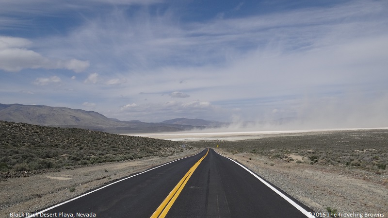
Today there are no services on the playa--no water, your cell phone won’t work, and if you enter it you will be at your own risk. It is impassible when wet and you are warned that it is deceiving in appearance in that the mountains you see on the other side are over 25 miles away. We drove down onto the playa and snapped a few photos. Then we decided that it was no place for us to be pushing our luck by venturing further out onto it.

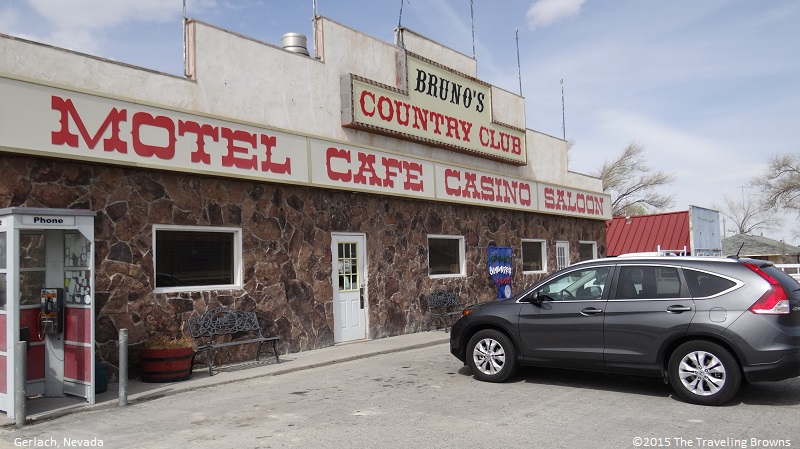
Finally we made it to Gerlach, a small town of about 200 residents. It is situated between the Black Creek Desert on the east, and Smoke Creek Desert on the west. We stopped at “Bruno’s Country Club” for a bite of lunch. It seemed that he had the market cornered on most everything a person might need! We had a great sandwich and enjoyed talking with the staff about the local area.
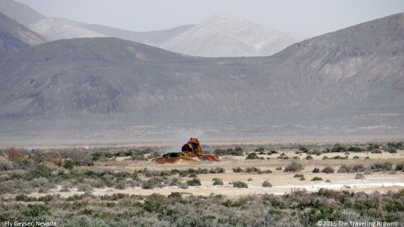
Departing Gerlach we continued our journey towards Fly Geyser, another 36 miles by road. The geyser is located on the private Fly Ranch. There is a high fence and a locked gate topped with spikes to exclude trespassers. The geyser is large enough to be seen from the road—but, not large enough to afford good photos. The reason for excluding the public is that people were climbing on the formations--thereby destroying them. Plus, they were leaving their trash in the area. People can be so inconsiderate and just plain stupid!
The source of the Fly Geyser heat field is attributed to a very deep pool of hot rock where tectonic rifting and faulting are common. It was accidentally created by well drilling in 1964 while exploring for sources of geothermal energy. The well may not have been capped correctly, or left unplugged, but either way dissolved minerals started rising and accumulating, creating the travertine mound on which the geyser sits and continues to grow. It contains several terraces and pools of discharged water. The geyser is made up of different minerals, but its brilliant colors are due to algae.
Since the geyser was located about ½ a mile off the road we were unable to get good quality shots of it. We probably could have gotten away with climbing over the fence and walking down to it. But, we chose to respect the rancher’s notice and not cross onto his property.
In our next write-up we will cover our return trip to Reno that took us into the remote Smoke Creek Desert and along the west shore of Pyramid Lake. Hope you will consider riding along with us.
Until next time,
Dave & Barb
The Traveling Browns
Until next time,
Dave & Barb
The Traveling Browns
