2013-14 Northwest Passage Scenic Byway, Idaho
Hello All,
Departing Spokane, WA, we took US-195 south to Lewiston, ID, where we jumped on US-12 eastbound following the Northwest Passage Scenic Byway. It begins in Lewiston and follows US-12 northeast to the Idaho/Montana border.
In 1803, President Jefferson commissioned Meriwether Lewis and William Clark to find the Northwest Passage—the link between the Missouri River and the Columbia River through the unexplored Rocky Mountains. This 202-mile byway, stretching across north-central Idaho, follows the explorer’s route through the ancestral homeland of the Nez Perce people.
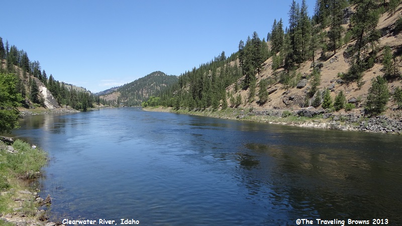
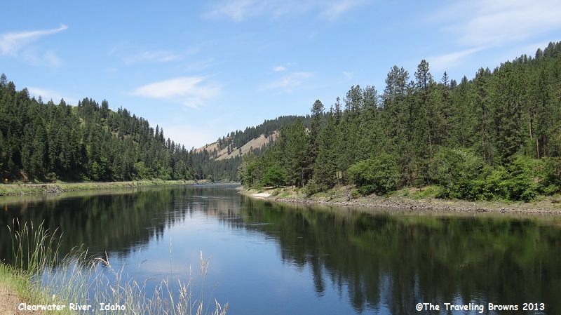
Our route, from west to east, began by following the winding Clearwater River Canyon. The Clearwater River is truly scenic as it winds its way through the canyon. We made numerous stops just to snap a few photos from different perspectives.
Departing Spokane, WA, we took US-195 south to Lewiston, ID, where we jumped on US-12 eastbound following the Northwest Passage Scenic Byway. It begins in Lewiston and follows US-12 northeast to the Idaho/Montana border.
In 1803, President Jefferson commissioned Meriwether Lewis and William Clark to find the Northwest Passage—the link between the Missouri River and the Columbia River through the unexplored Rocky Mountains. This 202-mile byway, stretching across north-central Idaho, follows the explorer’s route through the ancestral homeland of the Nez Perce people.
Our route, from west to east, began by following the winding Clearwater River Canyon. The Clearwater River is truly scenic as it winds its way through the canyon. We made numerous stops just to snap a few photos from different perspectives.
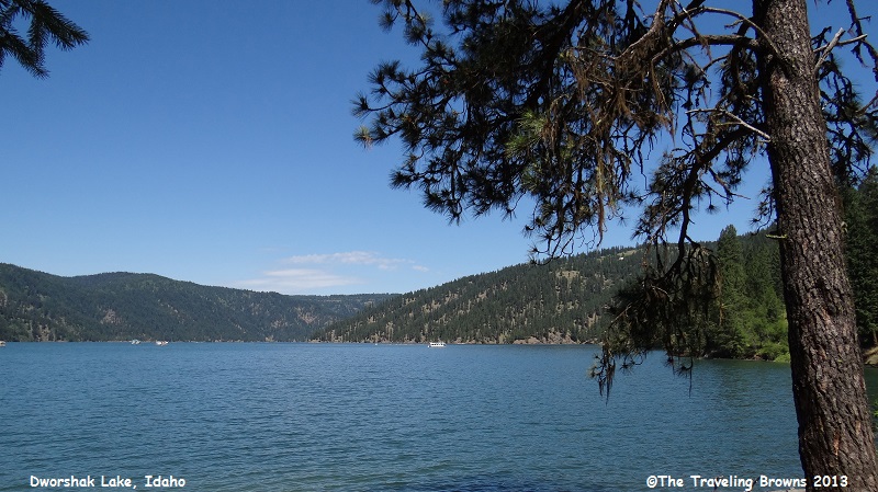
Along the way we stopped at
Dworshak Lake to check it out. There were houseboats anchored out with folks
enjoying the lovely day.
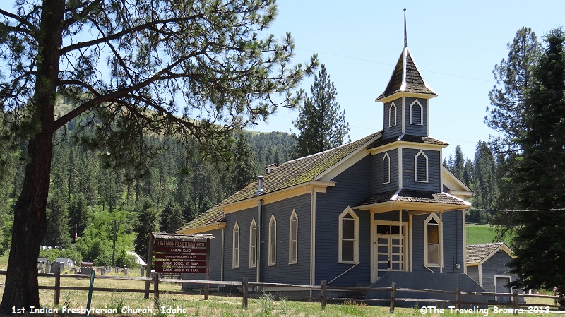
This old church along the
scenic byway is in Kamiah, ID. It was organized on December 25, 1871, and is
the First Indian Presbyterian Church.
At Kooskia, ID, the byway
splits. One segment turns south and the other continues east on US-12. We
continued east following the Middle Fork of the Clearwater River and then the
Lochsa River which has been designated a Wild and Scenic River. This stretch of
the highway cuts through the Selway-Bitterroot Wilderness Area. At 1.3 million
acres it is one of the largest wilderness areas in the United States outside of
Alaska. The Frank Church-River of No Return Wilderness Area is immediately to
its south, separated only by a dirt road (the Magruder Corridor). Together with
adjoining public land, the two wilderness areas form a five million acre wild
region.
Highway 12 is extremely curvy as it follows the path of the Lochsa River. We never get in a hurry so we just slowed down and enjoyed the scenery of the wild backcountry.
We stopped at Whitehouse Pond along the route. On their westbound journey Lewis and Clark crossed here after camping 4 miles upstream on the Lochsa River. Their Shoshoni guide led them down an old trail from Lolo Pass to a fishery here that he knew about. To continue west the guide had to take them back up a ridge to rejoin the Lolo Trail route. Indian travel through here had to go along high ridges because Lochsa Canyon had too many cliffs and gorges to provide a good horseback route.
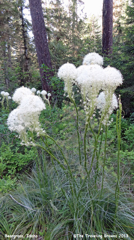
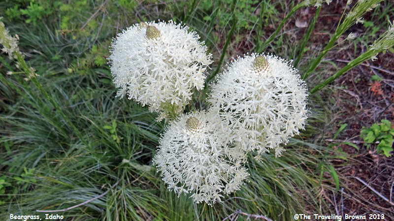
The area around Whitehouse Pond was loaded with bear grass that was in full bloom. It has been a favorite of ours since we first came across it in Glacier National Park many years ago. We think it is kind of neat.
Highway 12 is extremely curvy as it follows the path of the Lochsa River. We never get in a hurry so we just slowed down and enjoyed the scenery of the wild backcountry.
We stopped at Whitehouse Pond along the route. On their westbound journey Lewis and Clark crossed here after camping 4 miles upstream on the Lochsa River. Their Shoshoni guide led them down an old trail from Lolo Pass to a fishery here that he knew about. To continue west the guide had to take them back up a ridge to rejoin the Lolo Trail route. Indian travel through here had to go along high ridges because Lochsa Canyon had too many cliffs and gorges to provide a good horseback route.
The area around Whitehouse Pond was loaded with bear grass that was in full bloom. It has been a favorite of ours since we first came across it in Glacier National Park many years ago. We think it is kind of neat.
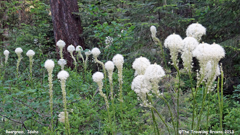
The scientific name is
xerophyllum tenax. Think we’ll stick with the common name of beargrass. It is
also known as squaw grass, soap grass, quip-quip, and Indian basket grass.
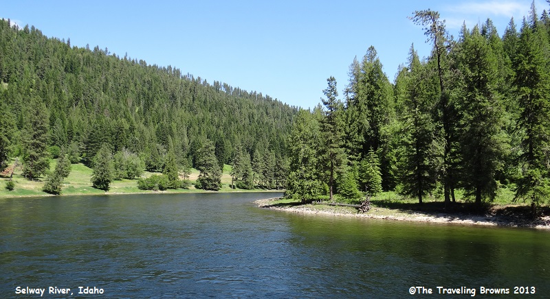
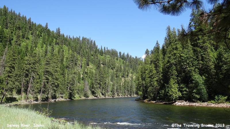
Next along our route we came
to the Selway River Scenic Byway turn off. The byway is only 20 miles long and
starts from where the Selway River flows into the Lochsa River. It travels
upstream to Selway Falls. We decided to take the side trip to the falls. It was
a beautiful drive and we stopped occasionally for a photo opportunity.
Upon reaching the falls we
came upon the Selway Falls Guard Station. The station was built in 1912 and was
home and office for Forest Service guards. Their main job was fighting fires in
the remote, road-less Upper Selway Country. They traveled by foot or horseback
and fought fires for weeks at a time. Life was simple and cares were few on a
salary of seventy-five dollars a month, a sum calculated in those days to be
just compensation for a man with a horse. The station is still used as the
jumping off place for travel by foot or horse into the Selway-Bitterroot
Wilderness.
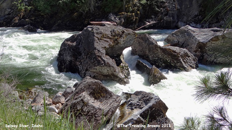
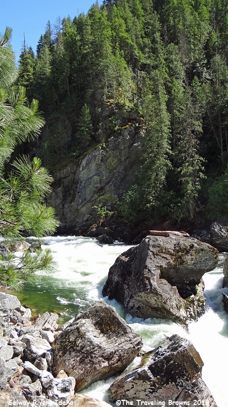
We found the falls to be more of a ¼-mile torrent of wild whitewater rather than the typical waterfall. It was awesome and definitely not a place you would want to fall into the river. Unfortunately, we were on the east bank of the river and the sun was getting low in the western sky. This made it virtually impossible to get quality photos as the sun reflected on the endless froth of whitewater. Here are a couple of photos taken towards the south that will kind of show you the area.
We found the falls to be more of a ¼-mile torrent of wild whitewater rather than the typical waterfall. It was awesome and definitely not a place you would want to fall into the river. Unfortunately, we were on the east bank of the river and the sun was getting low in the western sky. This made it virtually impossible to get quality photos as the sun reflected on the endless froth of whitewater. Here are a couple of photos taken towards the south that will kind of show you the area.
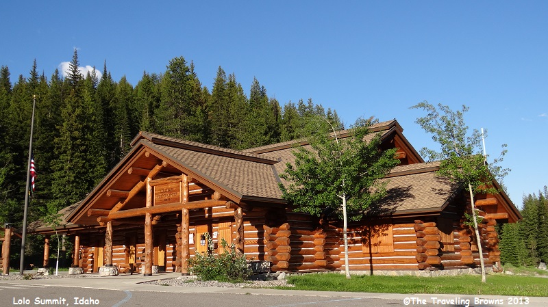
After checking out the falls
we backtracked to the Northwest Passage Scenic Byway and continued our journey
to the east. Upon reaching the end of the byway at Lolo Pass Summit we stopped
at the Visitor Center. Of course it was closed since it was late in the day. It
was such a nice log building we snapped a photo of it anyway.
The Lewis and Clark party
crossed Lolo Pass on September 13, 1805, westbound for the Pacific after a long
detour to the south. From the headwaters of the Missouri River they had crossed
the mountains to the Salmon River. Finding the Salmon River impassable, they
traded for packhorses, hired an Indian guide, and came north to an Indian trail
across the mountains here. Tired and ill-fed, the men were to have a hard
struggle in early snow along the steep ridges, which the trail followed for
most of its 125-mile course west to the Clearwater River.
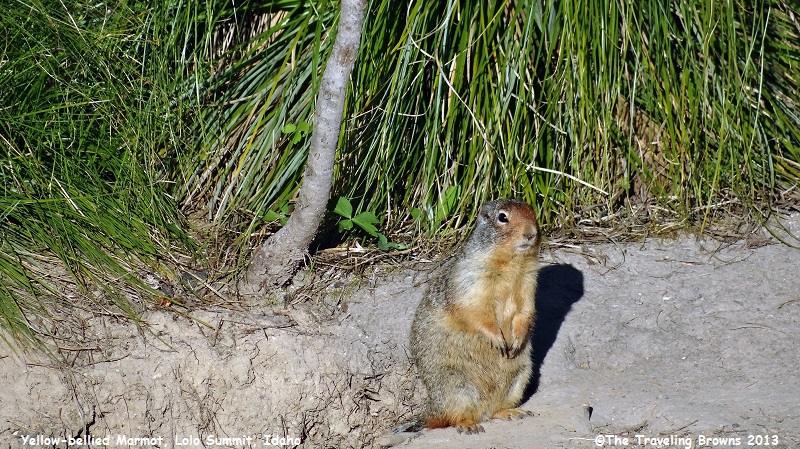
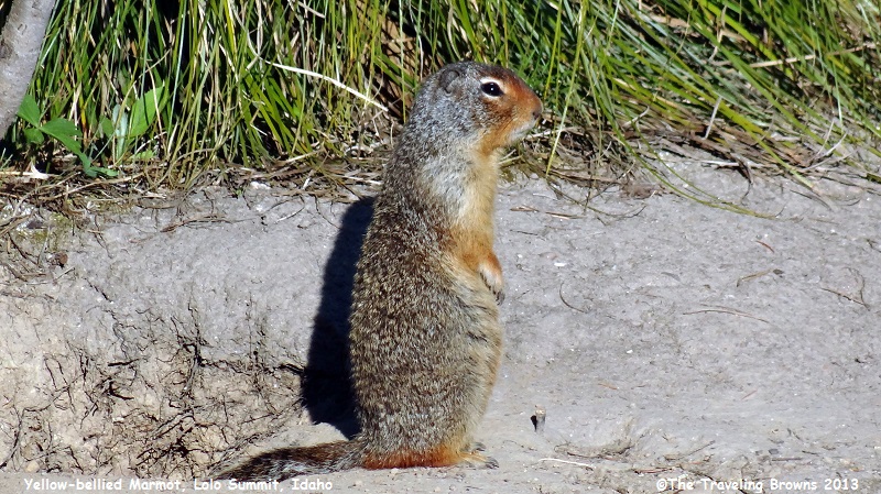
Lolo Summit is at the Idaho Montana border. While the visitor center was closed there were a few residents there that posed for a few photos. There were yellow-bellied marmots enjoying the evening sun near their burrows.
Lolo Summit is at the Idaho Montana border. While the visitor center was closed there were a few residents there that posed for a few photos. There were yellow-bellied marmots enjoying the evening sun near their burrows.
From the summit we dropped
down to Lolo, MT, where we turned south on US-93. We stopped for the night in
Hamilton, located in a gorgeous valley bordered by the Bitterroot Mountains to
the west and the Sapphire Mountains to the east. The Bitterroot River flows
down the middle of the valley.
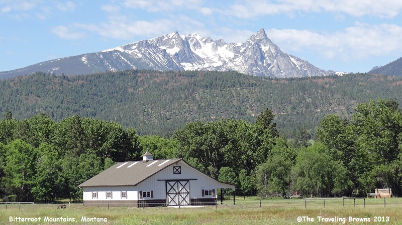
We continued our trek south the next morning following the Bitterroot Scenic Byway (US-93). There are numerous beautiful ranches in the area. Here is a shot of a ranch barn with the Bitterroots in the background.
We continued our trek south the next morning following the Bitterroot Scenic Byway (US-93). There are numerous beautiful ranches in the area. Here is a shot of a ranch barn with the Bitterroots in the background.
Passing over the summit of
Lost Trail Pass (elevation 6,995 feet) US-93 crosses the border back into
Idaho. Lewis and Clark came this way in 1805, and the spectacular view from
this vantage point has changed little since their exploration of the West two centuries
ago. The summit is also the beginning of Idaho’s Salmon River Scenic Byway. The
route follows the Salmon River—also called the River of No Return—and ends at
the tiny mountain town of Stanley, ID.
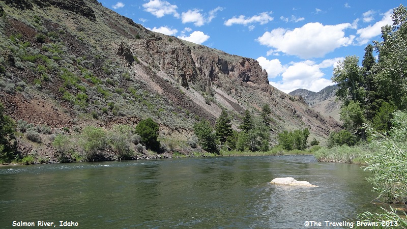
We stopped now and then along the way when a photo opportunity prevailed. Here is a shot of the Salmon River.
We stopped now and then along the way when a photo opportunity prevailed. Here is a shot of the Salmon River.
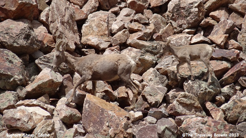
We spotted a herd of about
thirty Rocky Mountain bighorn sheep feeding along the river bank. The group
consisted primarily of ewes and lambs. The adults were shedding their winter
fur coats. Note how they blend into the rocks—great camouflage.
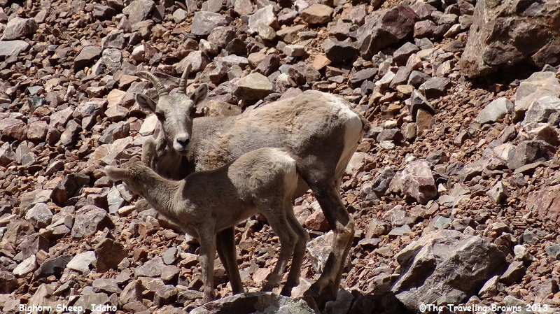
Momma was keeping an eye on us
even though we were across the river from them.
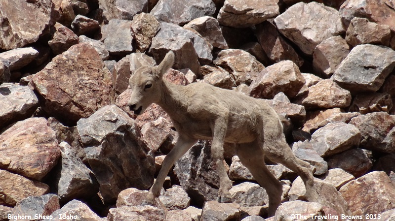
This youngster wasn’t real
steady on his feet yet.
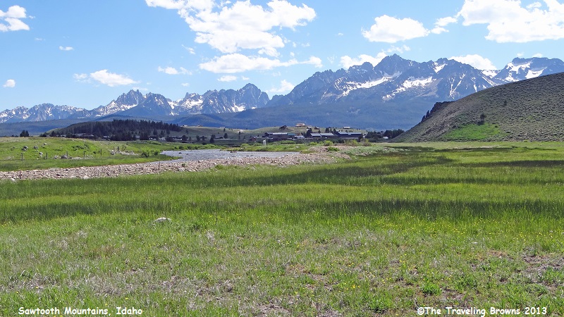
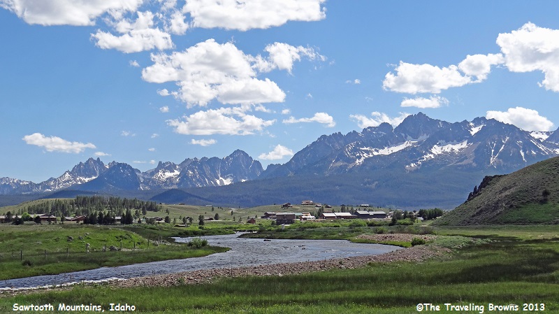
Just south of Challis, ID, the
byway turns southwest and follows ID-75 to Stanley. You begin seeing glimpses
of the majestic Sawtooth Mountains before beholding their full splendor as you
drop into Stanley. The town is one of the last strongholds of the Idaho
frontier. Planted at the foot of the Sawtooth Mountains on the banks of the
Salmon River, it’s nestled in an amphitheater of rarely found natural beauty.
We stayed in Stanley for a
couple of days to explore the Sawtooth Mountains and lakes in the area. Join us
on these adventures in our next little blurb.
Until next time,
Dave & Barb
The Traveling Browns
Until next time,
Dave & Barb
The Traveling Browns
