2013-29 Mt. Revelstoke & Glacier National Park, Canada
Hello All,
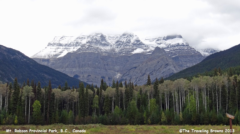
Departing Jasper we went west on the Yellowhead Highway over the continental divide into British Columbia, Canada. Low overcast and rain prevailed throughout our drive. We stopped and stretched our legs at Mt. Robson Provincial Park. There is a nice visitor center at the park and it is the trailhead for those wishing to climb the mountain. It is the highest peak in the Canadian Rockies at 12,972 feet.
To the Indians, Mt. Robson was known as Yuh-Lai-Has-Kun, “the mountain of the spiral road.” This was due to the clearly visible layers of sedimentary deposits that resembled a spiral road winding its way to the top of the mountain.
From the park there is an excellent vantage point for photographing the mountain. However, as you can see in this photo the overcast sky blocked the top third of the mountain from our view. We will have to go back and try again another day.
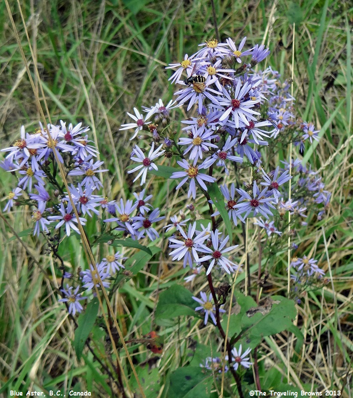
While walking in the forest we
came upon these lovely wildflowers blooming. This really surprised us as it was
the last week of September. The first is a blue aster.
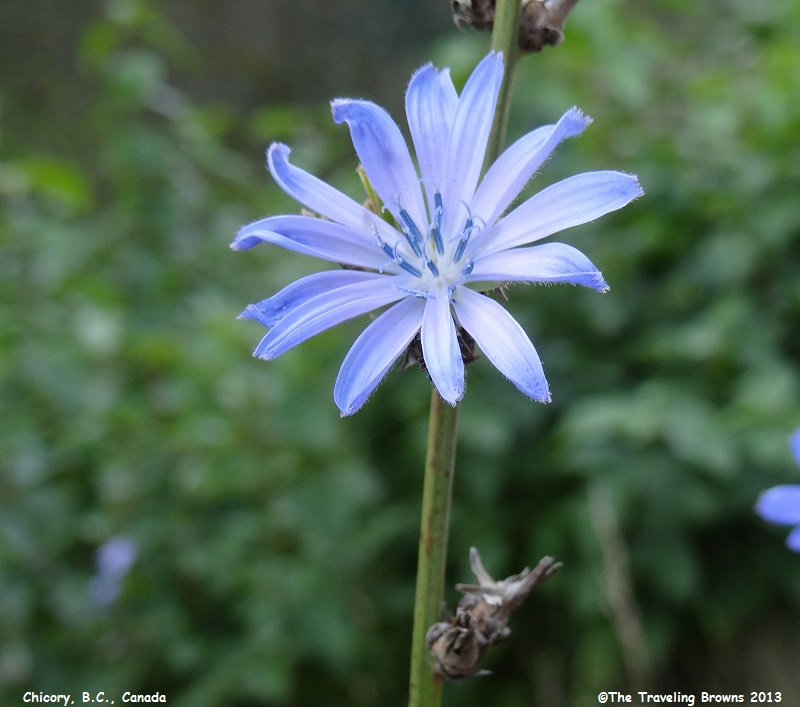
And, this one is chicory. The
warm moist climate of British Columbia must have something to do with the late
bloomers.
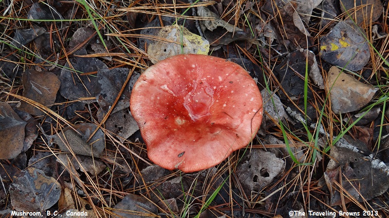
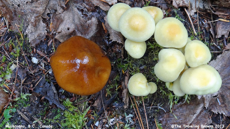
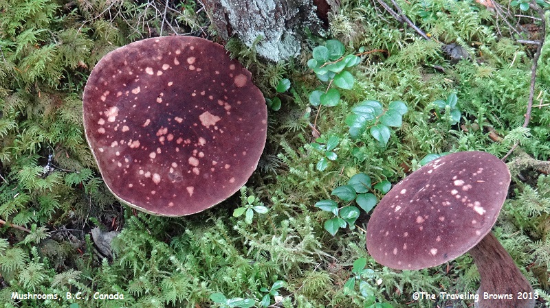
Mushrooms on the damp forest
floor came in some amazing color combinations. In our eyes they make for
interesting photos. We haven’t taken the time to try and learn all the many
different names of them.
Upon intersecting the Southern
Yellowhead Highway we turned south following it to Kamloops, BC. We kicked back
for a couple of days there waiting for improved weather conditions.
When the forecast looked promising we departed Kamloops eastbound on Trans-Canada 1 heading east towards Revelstoke, BC, where we would spend the night. Our plan was to visit Mt. Revelstoke and Glacier National Parks the next day. This route takes you by Three Valley Lake and Gap.
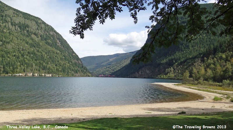
Here is a shot of Three Valley Lake. In the distance at the far end of the lake you can barely make out the lovely Three Valley Chateau.
When the forecast looked promising we departed Kamloops eastbound on Trans-Canada 1 heading east towards Revelstoke, BC, where we would spend the night. Our plan was to visit Mt. Revelstoke and Glacier National Parks the next day. This route takes you by Three Valley Lake and Gap.
Here is a shot of Three Valley Lake. In the distance at the far end of the lake you can barely make out the lovely Three Valley Chateau.
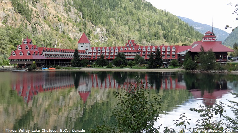
This is the stately Three Valley Chateau. It looked
like it would be a nice place to stay when visiting Mt. Revelstoke National
Park, as it is only about 12 miles from the entrance. Since we already had
reservations secured in the town of Revelstoke, after a few photos we moved on
down the road.
Mt. Revelstoke and Glacier
National Parks of Canada are within the Columbia Mountain ranges and form the
first tall mountain barrier east of the Coast Mountains. They are geologically
distinct from the Canadian Rockies found east of Glacier National Park.
Wet mild westerly air masses, originating over the Pacific Ocean, are blocked by the wall of the Columbia Mountain Ranges. This results in the dumping of heavy rains in the summer and heavy snowfall in the winter. High annual precipitation, deep snow accumulations, and relatively moderate winter temperatures are characteristic of the Columbia Mountains and their two national parks.
Revelstoke Mountain Ski Resort, just outside of town, holds the Canadian record for snowfall at 80 feet, and the local slopes are blanketed an average of 30-45 feet of powder every winter.
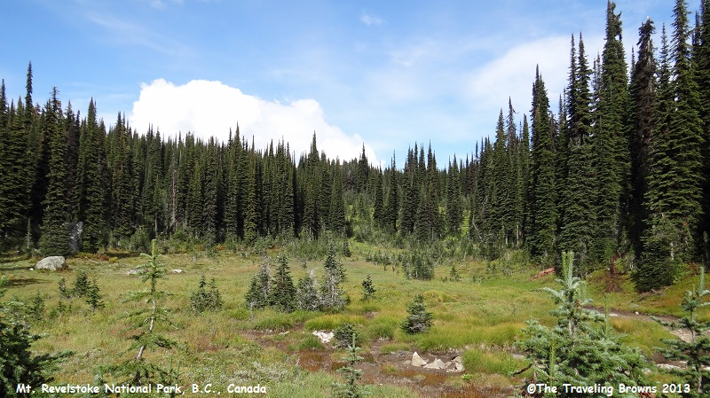
Mt. Revelstoke National Park is a place of contrasts. The park is famous for summer wildflower displays on the summit of Mt. Revelstoke. Each year the meadows of the upper subalpine zone blossom into brilliant color by mid-August. It was the beauty of these meadows that inspired a group of people in Revelstoke to lobby for the creation of the national park in 1914. We have been to the park on previous trips when the wildflowers are in bloom and it is absolutely awesome!
When you enter the park you take the Meadows in the Sky Parkway which circles Mt. Revelstoke as it climbs through a variety of geographical zones. You travel from dense old-growth rainforest of giant cedar and pine, up through subalpine forest, and finally alpine meadows and tundra.
We knew that since it was late September, it would be too late for the wildflower show. But, we made the drive anyway. You can imagine what the alpine meadow in the following photo would look like covered with summer wildflowers in full bloom.
Wet mild westerly air masses, originating over the Pacific Ocean, are blocked by the wall of the Columbia Mountain Ranges. This results in the dumping of heavy rains in the summer and heavy snowfall in the winter. High annual precipitation, deep snow accumulations, and relatively moderate winter temperatures are characteristic of the Columbia Mountains and their two national parks.
Revelstoke Mountain Ski Resort, just outside of town, holds the Canadian record for snowfall at 80 feet, and the local slopes are blanketed an average of 30-45 feet of powder every winter.
Mt. Revelstoke National Park is a place of contrasts. The park is famous for summer wildflower displays on the summit of Mt. Revelstoke. Each year the meadows of the upper subalpine zone blossom into brilliant color by mid-August. It was the beauty of these meadows that inspired a group of people in Revelstoke to lobby for the creation of the national park in 1914. We have been to the park on previous trips when the wildflowers are in bloom and it is absolutely awesome!
When you enter the park you take the Meadows in the Sky Parkway which circles Mt. Revelstoke as it climbs through a variety of geographical zones. You travel from dense old-growth rainforest of giant cedar and pine, up through subalpine forest, and finally alpine meadows and tundra.
We knew that since it was late September, it would be too late for the wildflower show. But, we made the drive anyway. You can imagine what the alpine meadow in the following photo would look like covered with summer wildflowers in full bloom.
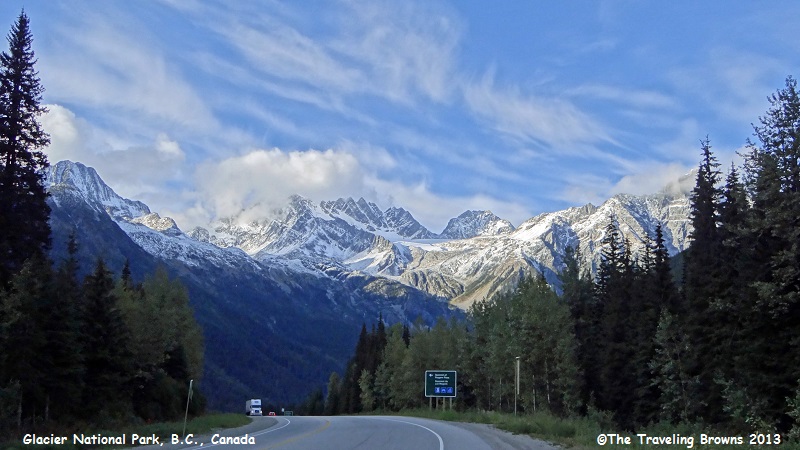
Back tracking to Trans-Canada
1 we continued east towards Glacier National Park. This would be our first
visit to the park so we were excited to see it. Weather in the high mountains
was not improving as fast as we had hoped. But, we were keeping our fingers
crossed that it would improve some before nightfall. As the highway enters the
park we could instantly see that there was going to be some spectacular scenery
ahead.
Easy public access by rail and
promotion of the scenic wonders of the area by the Canadian Pacific Railroad
(CPR) prompted the Canadian government to establish a park reserve here in
1886. During the years 1886 to 1916 the CPR operated a passenger service over
Rogers Pass, and thousands of people each year enjoyed the spectacular scenery.
However, in 1916 this scenic but hazardous route was abandoned in favor of a
5-mile tunnel beneath the pass. The number of visitors to the park dropped off
dramatically, and only a handful of adventuresome climbers saw Rogers Pass each
summer. In 1962, with the opening of the Trans-Canada Highway, Rogers Pass and
Glacier National Park became easily accessible. Now more than 2 million people
a year travel through the park—it is an area worthy of putting on your bucket
list.
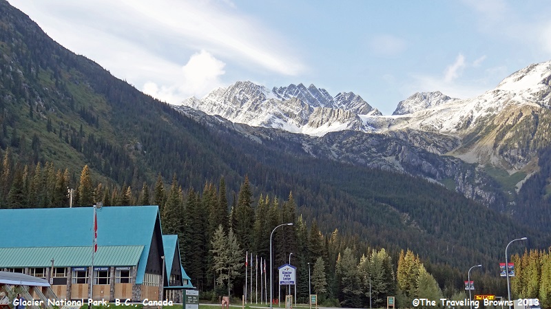
This photo is Glacier Park Lodge at the summit of Rogers Pass.
This photo is Glacier Park Lodge at the summit of Rogers Pass.
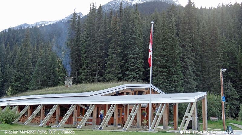
And, this is the visitor’s
center located there.
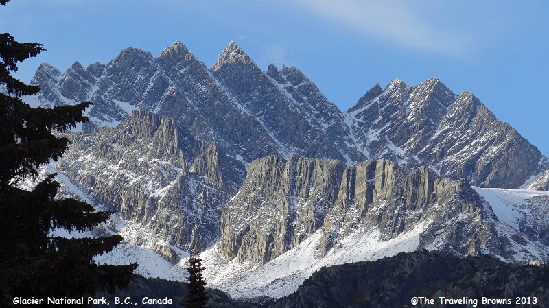
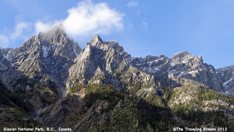
Late in the day the clouds
pretty much dissipated. The whimsical clouds that remained along with the
evening sun added to the ambiance of the rugged mountains. Following is a compilation
of photos illustrating their ruggedness. In our eyes it is truly a spectacular
national park!
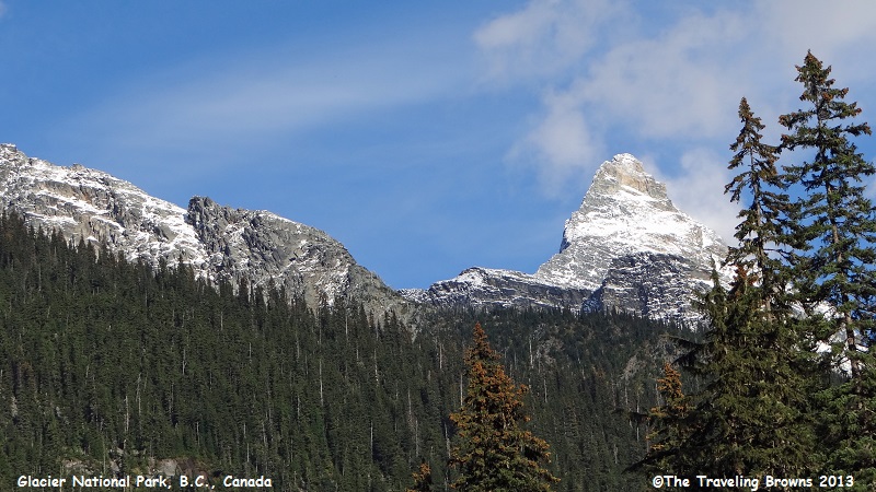
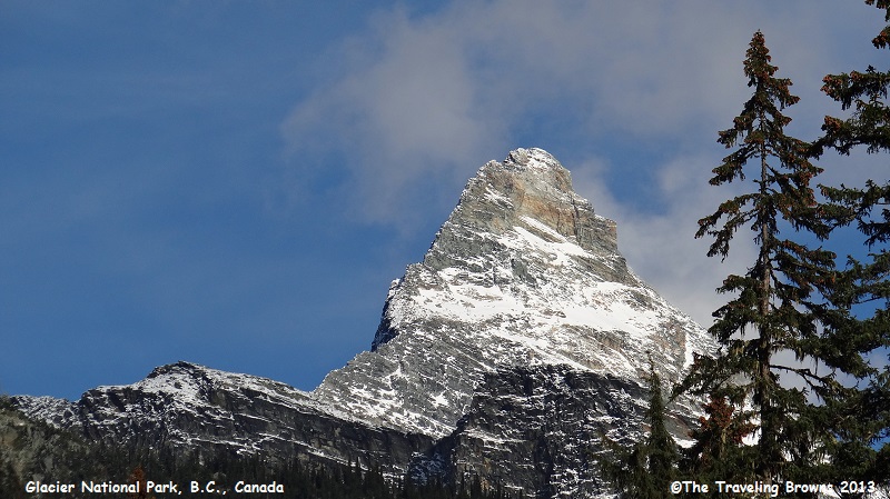
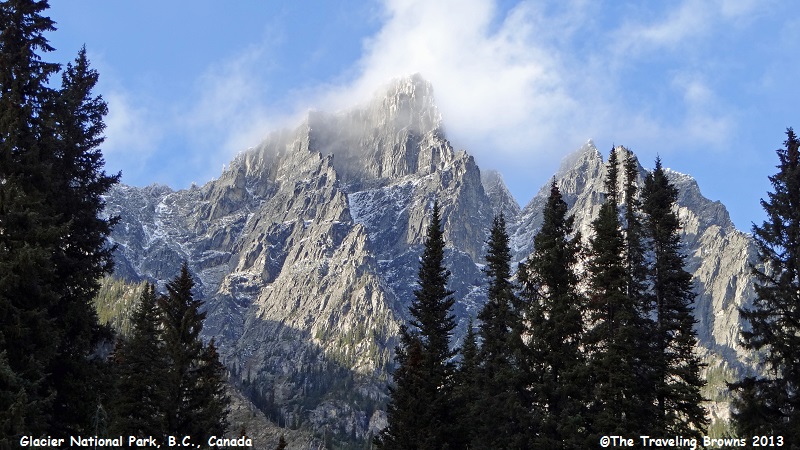
This peak reminded us of the
Matterhorn between Switzerland and Italy.
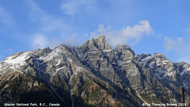
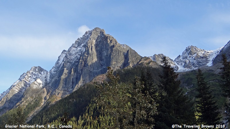
You can see how the Columbia
Mountains are a natural rock barrier blocking warm moist air masses coming from
the Pacific Ocean.

Rugged, rugged beauty!
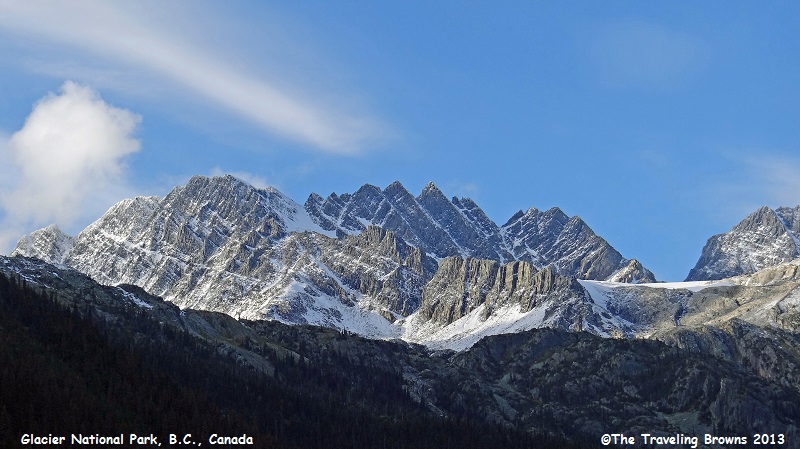
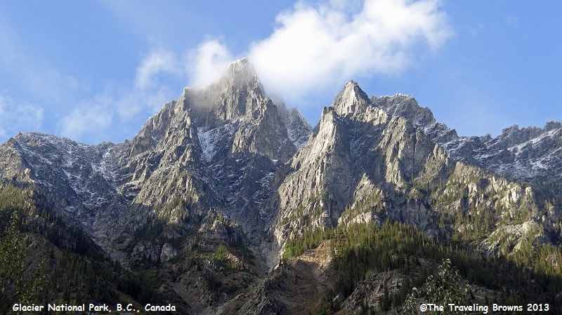
It is a National Park that we
would recommend visiting. A mid-August date might be an ideal time.
This will be our last Pictures
of the Week write-up for 2013. We hope you have enjoyed riding along with us.
We will start writing about our 2014 travels in the near future. We seem to be
running a year behind in our write-ups. Hopefully, we will catch up some day.
Until next time,
Dave & Barb
The Traveling Browns
Until next time,
Dave & Barb
The Traveling Browns
