2011-35 Glacier Bay National Park, Alaska
Hello All,
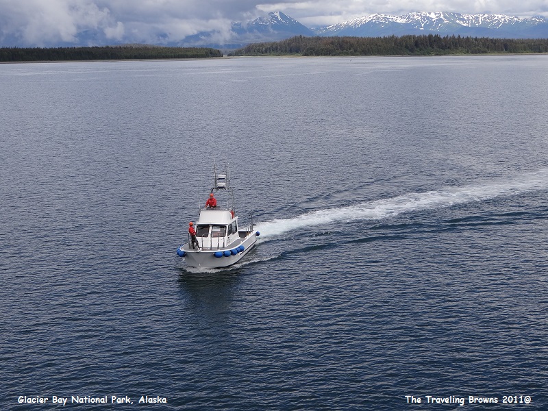
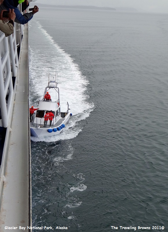
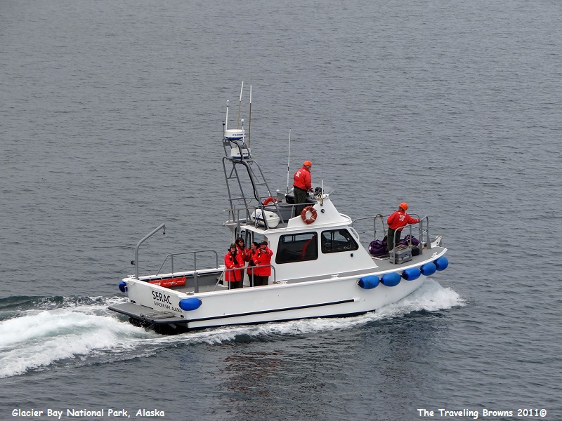
Departing Skagway our ship retraced her track back down Lynn Canal on our passage towards Glacier Bay National Park. Early the next morning we turned into Icy Strait and then turned into Sitakaday Narrows where we entered the park and Glacier Bay. Shortly thereafter a park service boat pulled beside us and four Glacier Bay Park Rangers boarded the Golden Princess. They provided commentary and were available on deck to answer questions throughout a 4-hour scenic cruise within the park.
Departing Skagway our ship retraced her track back down Lynn Canal on our passage towards Glacier Bay National Park. Early the next morning we turned into Icy Strait and then turned into Sitakaday Narrows where we entered the park and Glacier Bay. Shortly thereafter a park service boat pulled beside us and four Glacier Bay Park Rangers boarded the Golden Princess. They provided commentary and were available on deck to answer questions throughout a 4-hour scenic cruise within the park.
Glacier Bay National Park is
immense. It is comprised of 3.3 million acres of mountains, glaciers, forests,
and waterways. It is part of a 25-million acre World Heritage Site--one of the
world’s largest protected natural areas designated by UNESCO.
Until 10,000 years ago, continental-scale ice sheets came and went many times for a period of seven million years. During this Great Ice Age these ice sheets reached as far south as the upper Midwest of the United States.
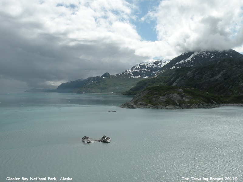
Glacier Bay today is the product of the Little Ice Age, a geologically recent glacial advance in northern regions. The Little Ice Age reached its maximum extent about 1750. It came and went quickly by geologic measures. In 1680 there was no Glacier Bay, only a broad valley with a glacier starting to move down it. By 1750 the glacier reached its maximum, jutting into Icy Strait. But, when Captain George Vancouver sailed here 45 years later the glacier had melted back five miles into Glacier Bay--which it had gouged out. When conservationist John Muir traveled here in 1879 the glacier had retreated 40 more miles up the bay since Vancouver’s visit. Today you must travel 65 miles up Glacier Bay to view tidewater glaciers.
While some glaciers in the park are still retreating, we were surprised to learn that others are once again advancing. Our scenic cruise took us up many different inlets that branched off Glacier Bay. This allowed us to see quite a few glaciers. The main ones were Carroll Glacier, Rendu Glacier, Grand Pacific Glacier, Margerie Glacier, John Hopkins Glacier, Lamplugh Glacier, and Reid Glacier.
Good ole Mother Nature was doing a number on us as we worked our way to the first glacier. It was drizzling a bit with a low stratus cloud layer hanging over the water. We knew we were getting close to the glacier when we started seeing pieces of ice floating in the water.
Until 10,000 years ago, continental-scale ice sheets came and went many times for a period of seven million years. During this Great Ice Age these ice sheets reached as far south as the upper Midwest of the United States.
Glacier Bay today is the product of the Little Ice Age, a geologically recent glacial advance in northern regions. The Little Ice Age reached its maximum extent about 1750. It came and went quickly by geologic measures. In 1680 there was no Glacier Bay, only a broad valley with a glacier starting to move down it. By 1750 the glacier reached its maximum, jutting into Icy Strait. But, when Captain George Vancouver sailed here 45 years later the glacier had melted back five miles into Glacier Bay--which it had gouged out. When conservationist John Muir traveled here in 1879 the glacier had retreated 40 more miles up the bay since Vancouver’s visit. Today you must travel 65 miles up Glacier Bay to view tidewater glaciers.
While some glaciers in the park are still retreating, we were surprised to learn that others are once again advancing. Our scenic cruise took us up many different inlets that branched off Glacier Bay. This allowed us to see quite a few glaciers. The main ones were Carroll Glacier, Rendu Glacier, Grand Pacific Glacier, Margerie Glacier, John Hopkins Glacier, Lamplugh Glacier, and Reid Glacier.
Good ole Mother Nature was doing a number on us as we worked our way to the first glacier. It was drizzling a bit with a low stratus cloud layer hanging over the water. We knew we were getting close to the glacier when we started seeing pieces of ice floating in the water.
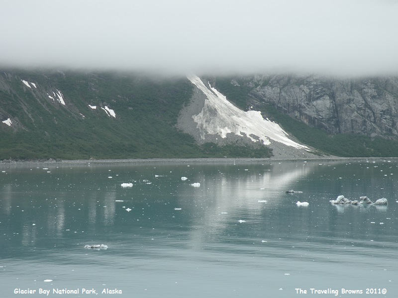
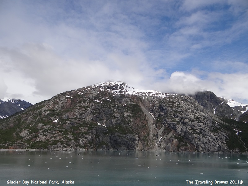
The following photo is a good
example of how the extreme cold from a glacier can condense the wet moist air
above it creating a thin cloud layer. At other times a down-slope or katabatic
wind flows down glaciers keeping the layer of air above it clear of clouds.
Helicopter pilots use this space of clear air to follow the glacier up into the
mountains to get above the low coastal clouds typical of Southeast Alaska.
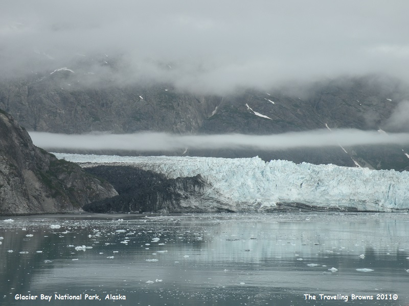
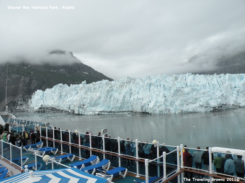
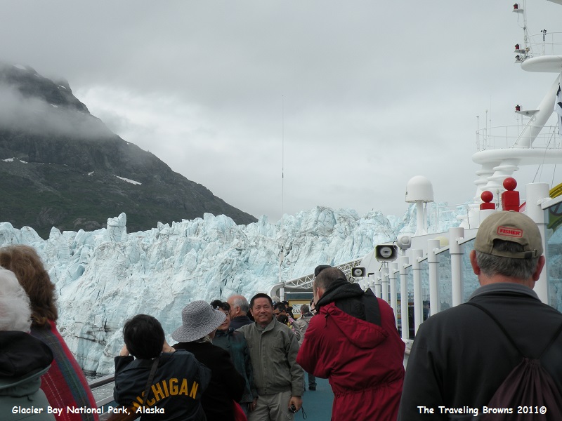
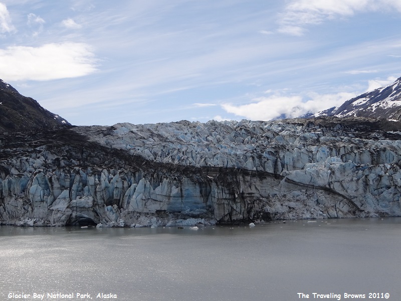
As you can see, the cruise
ships get up close for good views of the glaciers. Trust us when we say there
weren’t a lot of folks out sunning by the pools. This is Margerie Glacier. It
is 21 miles long and over a mile wide at the toe or snout. It has a height of
350 feet at the toe--250 feet above the waterline and another 100 feet below.
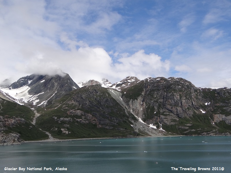
As we continued to cruise, the
low stratus layer started to lift, and then to our surprise it began to break
up. We were excited, as a little sun and blue skies make for much better
photos. As you look at the next photos keep in mind that just 261 years ago
this was all a glacier and these inlets are the result of what it gouged out.
It is amazing and hard to fathom.
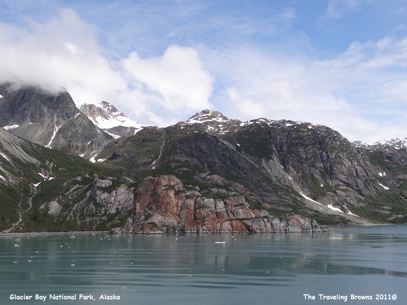
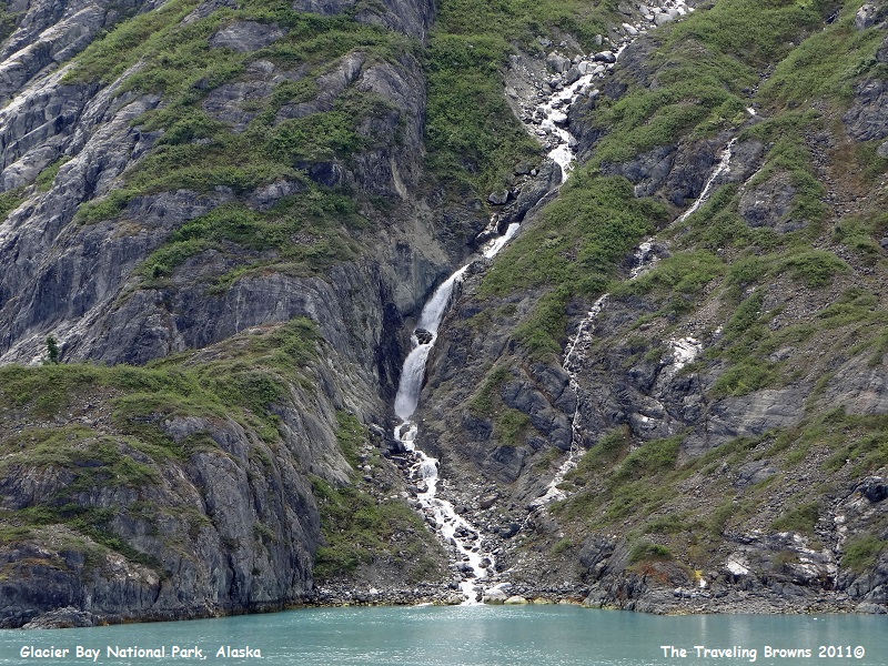
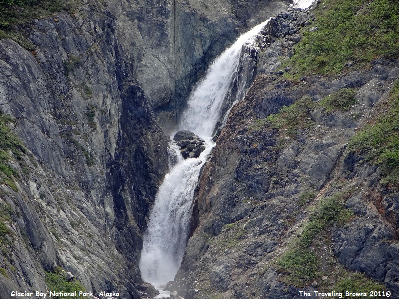
As we cruised along we passed
numerous cascading waterfalls. From a distance they look like a trickle of
water flowing down the steep slopes. However, a closer view reveals
considerably more water falling than a trickle.
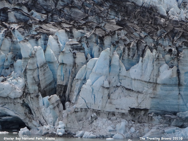
Lamplugh Glacier is in the following
photos. At the toe it is about 180 feet above the waterline and 40 feet below. It
is ¾ mile wide, 16 miles in length, and moving 1200 feet per year. Each glacier
had its own unique color and character. We liked Lamplugh because of its blue
color and the huge jagged pieces of ice. Bet it would be spectacular to see one
of those big chunks of ice fall into the water--but it didn’t put on a show for
us this time.
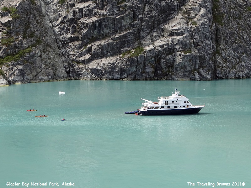
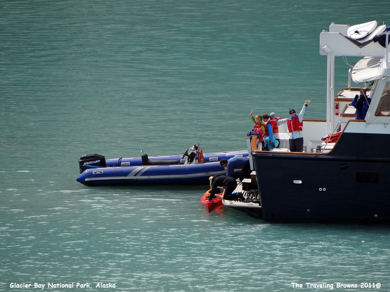
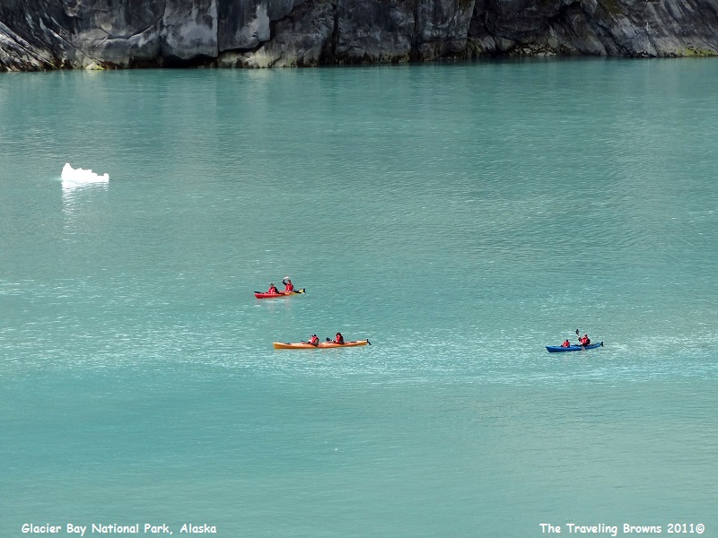
Near Lamplugh Glacier there
was a small cruise ship anchored and they were launching sea kayaks. These
small ships cruise with only 12 guests and a crew of 6. It looked like a fun
way to explore the area.
All good things must come to
an end. As we neared the end of our scenic cruise of Glacier Bay National Park
a park service boat pulled up beside our ship and we disembarked the four park
rangers without ever stopping. As their boat pulled away they gave us a
farewell wave. It was a wonderful adventure.
We greatly appreciated Mother
Nature giving us a break in the weather for the scenic part of the cruise. As
we left the park we could see that the low clouds and foul weather were moving
back in.
Without a doubt we highly
recommend Glacier Bay National Park as a place to visit. Our next port of call
will be Ketchikan, Alaska.
Until next time,
Dave & Barb
The Traveling Browns
Until next time,
Dave & Barb
The Traveling Browns
