2011-31 White Pass Scenic Byway, Washington
Hello All,
When we departed Winthrop, Washington, rather than take the Cascade Highway we decided to return to Seattle taking another route. We like to make a loop when we travel wherever possible. Our route took us south through Twisp, Pateros, and Chelan to Wenatchee where we picked up US-2 and followed it back over the Cascade Mountain Range.
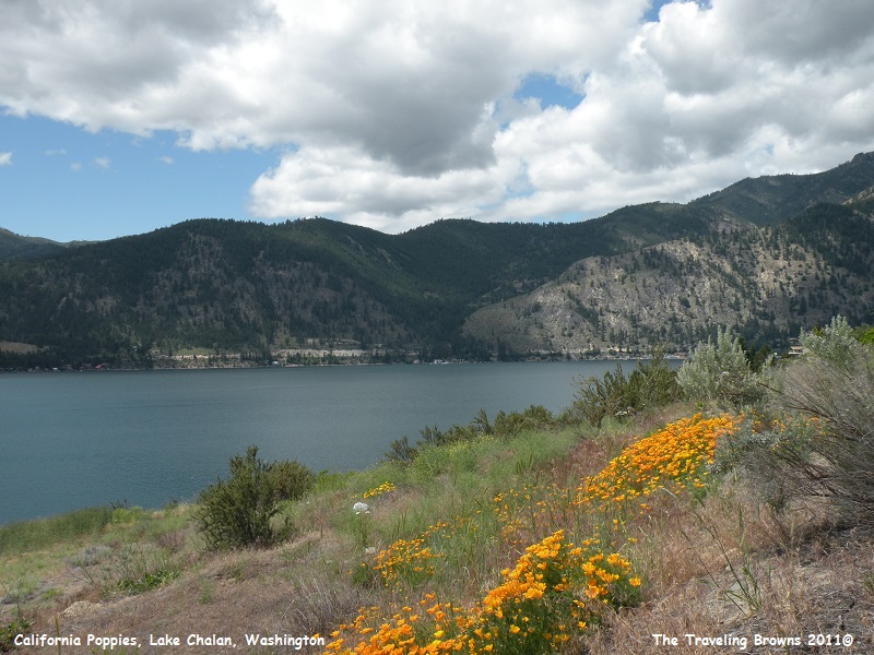
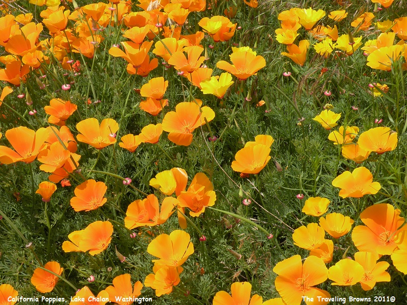
We made a quick stop at Lake Chelan to stretch our legs and became enamored with a patch of California poppies blooming along the shoreline. They are such a distinctive colorful flower. So, out came the cameras to snap a couple of photos.
When we departed Winthrop, Washington, rather than take the Cascade Highway we decided to return to Seattle taking another route. We like to make a loop when we travel wherever possible. Our route took us south through Twisp, Pateros, and Chelan to Wenatchee where we picked up US-2 and followed it back over the Cascade Mountain Range.
We made a quick stop at Lake Chelan to stretch our legs and became enamored with a patch of California poppies blooming along the shoreline. They are such a distinctive colorful flower. So, out came the cameras to snap a couple of photos.
Once we got into the Cascades
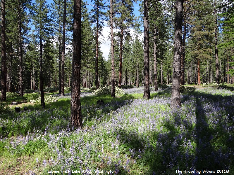
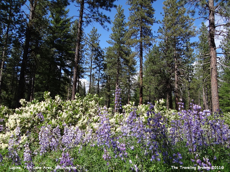
we passed a sign at a turnoff that said Fish Lake 7 miles. Since we had never
been there we decided to check it out. The drive into the lake was simply
beautiful. The forest floor was covered with what appeared to be lupine in
bloom. So, we made another unscheduled stop. Ah, it’s wonderful to be retired
and be able to take time to “stop and smell the roses” as the saying goes.
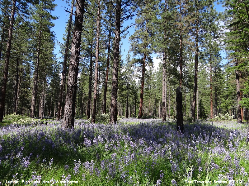
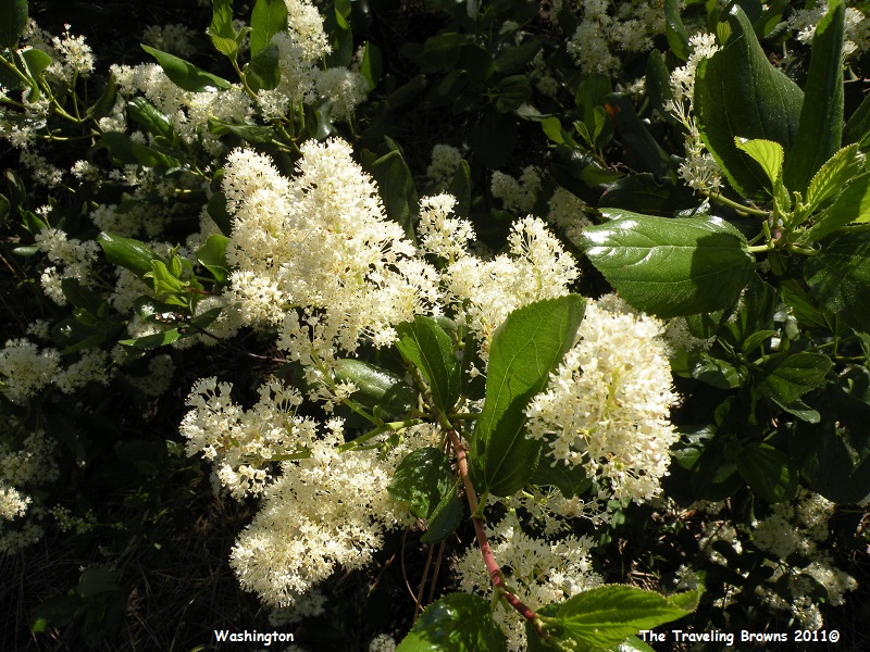
Mixed in with the lupine were
bushes with large clusters of white flowers. From a distance it kind of
reminded us of a bush covered with snow. Don’t have a clue what they are but we
found them to be quite lovely.
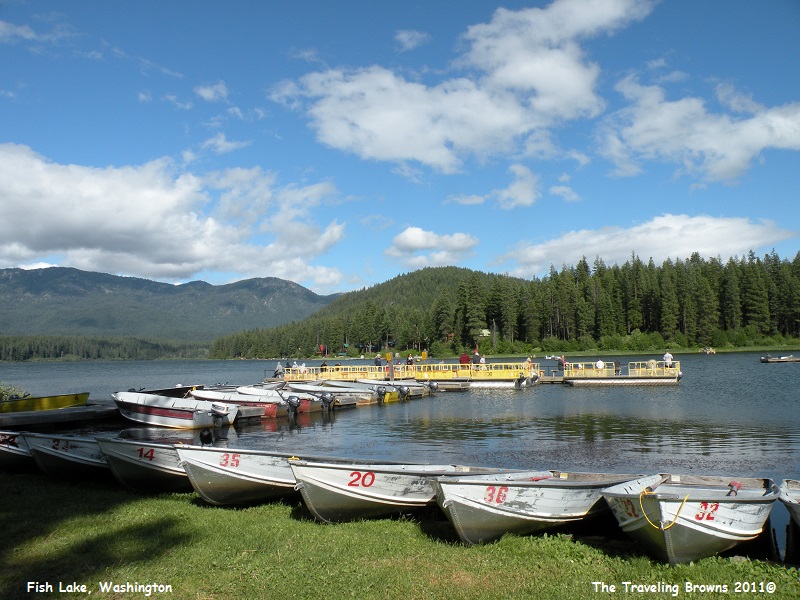
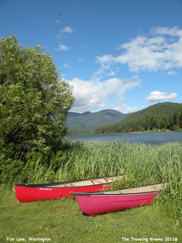
Fish Lake was just what the
name implied--a fishing lake. It is located in a nice mountain setting. There
were aluminum fishing boats for rent or you could fish from an anchored dock.
There were a number of folks trying their luck.
After spending a few days back
in the city we decided to embark on a drive that was totally new to us called
the White Pass Scenic Byway. It’s always fun seeing new places. The western end
of the byway begins at Mary’s Corner, Washington, and then follows US Highway
12 for about 120 miles through the Cascade Mountain Range to Naches,
Washington.
The byway passes between 14,411-foot Mt. Rainier to the north and 12,281-foot Mt. Adams to the south. Adams is the second highest mountain in the state of Washington and is a potentially active stratovolcano. It is a member of the Cascade Volcanic Arc and located approximately 31 miles from the active stratovolcano, Mt. St. Helens. A stratovolcano is a tall conical volcano built up by many layers (strata) of hardened lava, tephra, pumice, and volcanic ash. They typically erupt with explosive force like Mt. St. Helens in 1980 and Mt. Pinatubo in the Philippines in 1991, and they pose the greatest hazard to civilization. Mount Rainier is a massive stratovolcano!
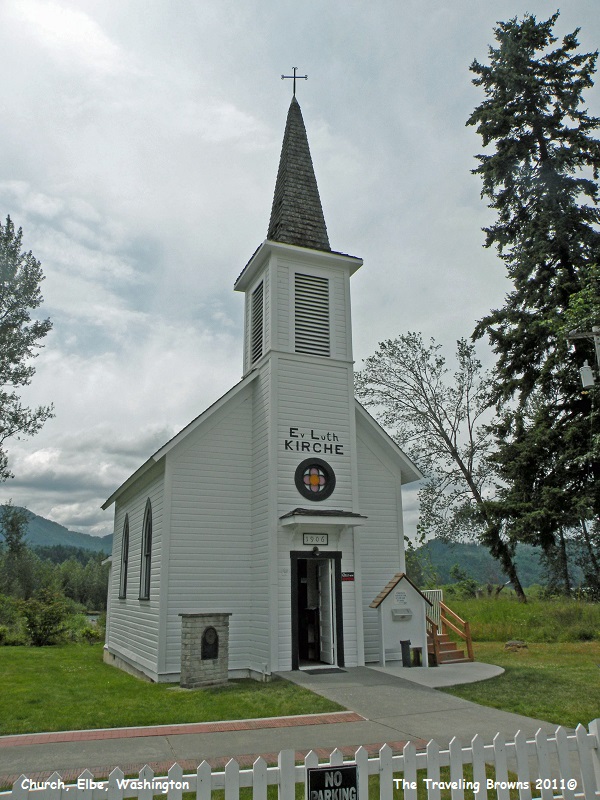
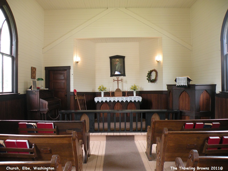
We decided to intercept the byway at Morton, Washington, and then travel the byway towards the east. To get to Morton we passed through the little town of Elbe where we came upon the Elbe Evangelische Lutherische Kirche.
The Elbe Lutheran congregation was founded in 1893 by settlers from Germany. For the first 13 years, services were held in members’ homes and the town hall. The Elbe Evangelische Lutherische Kirche was built in 1906. The building’s footprint is 18 x 24 feet. The 46-foot high steeple is topped with a 4-foot iron cross forged by a local blacksmith. The steeple contains a railroad locomotive bell. Elbe Kirche ranks among the smallest in the nation. The Kirche is the seat of the area bishop who conducts summer services. In the tradition of Elbe’s early pastors, the bishop arrives riding a bicycle. Although managed primarily as a historic structure, monthly services are held March through November.
The byway passes between 14,411-foot Mt. Rainier to the north and 12,281-foot Mt. Adams to the south. Adams is the second highest mountain in the state of Washington and is a potentially active stratovolcano. It is a member of the Cascade Volcanic Arc and located approximately 31 miles from the active stratovolcano, Mt. St. Helens. A stratovolcano is a tall conical volcano built up by many layers (strata) of hardened lava, tephra, pumice, and volcanic ash. They typically erupt with explosive force like Mt. St. Helens in 1980 and Mt. Pinatubo in the Philippines in 1991, and they pose the greatest hazard to civilization. Mount Rainier is a massive stratovolcano!
We decided to intercept the byway at Morton, Washington, and then travel the byway towards the east. To get to Morton we passed through the little town of Elbe where we came upon the Elbe Evangelische Lutherische Kirche.
The Elbe Lutheran congregation was founded in 1893 by settlers from Germany. For the first 13 years, services were held in members’ homes and the town hall. The Elbe Evangelische Lutherische Kirche was built in 1906. The building’s footprint is 18 x 24 feet. The 46-foot high steeple is topped with a 4-foot iron cross forged by a local blacksmith. The steeple contains a railroad locomotive bell. Elbe Kirche ranks among the smallest in the nation. The Kirche is the seat of the area bishop who conducts summer services. In the tradition of Elbe’s early pastors, the bishop arrives riding a bicycle. Although managed primarily as a historic structure, monthly services are held March through November.
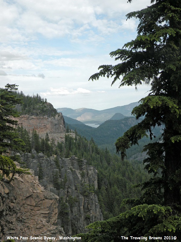
At Morton we started climbing
the lush green western slopes of the Cascades. It is a beautiful drive. Here a
distant lake is visible through the rugged terrain.
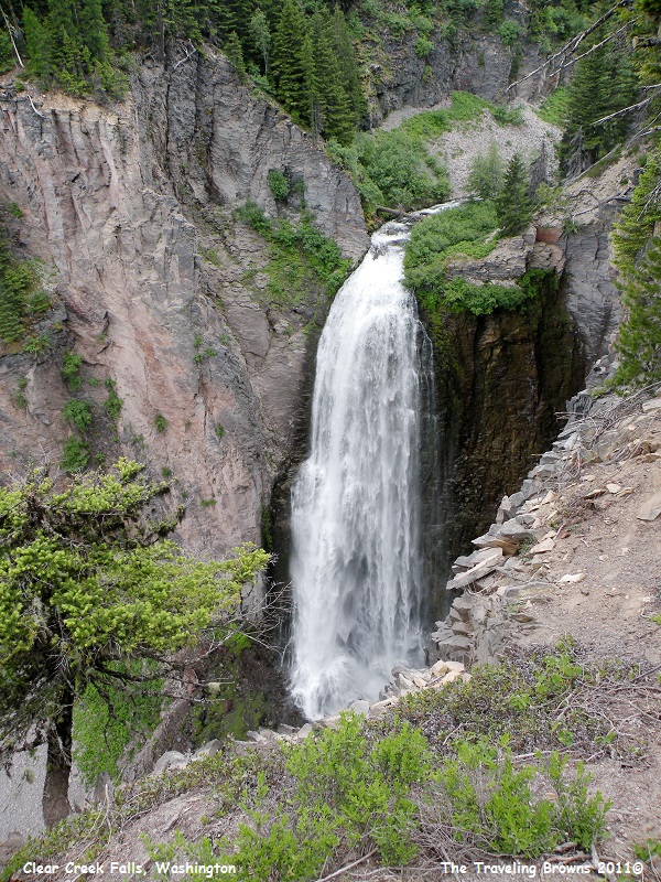
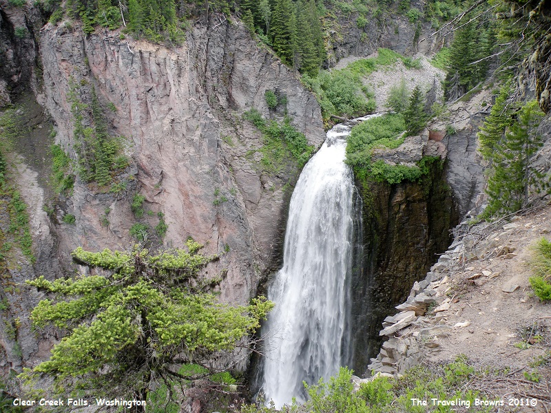
One of our first stops was at
Clear Creek Falls. The falls is probably the most impressive waterfall near Mt.
Rainier National Park but it isn’t located within the boundaries of the park.
It plunges 228 feet into a craggy canyon. There were a number of viewpoints to
see the falls from different vantage points. Unfortunately, none of them
provided a view from top to bottom due to the steep terrain.
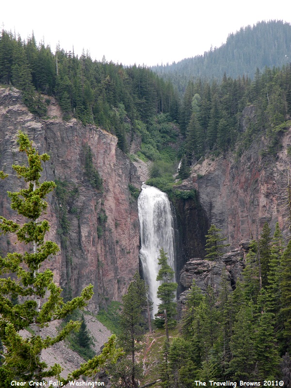
We drove about a half mile down
the byway to get a better view of the falls. But, even from this angle we still
couldn’t see the entire falls, but it was awesome.
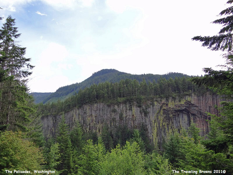
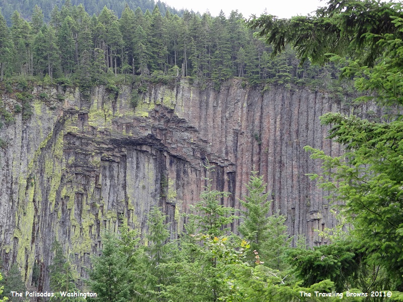
Our next stop was at the
Palisades. They are a bit of a geological mystery. Between 20,000 and 110,000
years ago a volcano erupted about nine miles away from this location. Dacite
lava flowed to this point in the Cascades and then stopped, forming an
unusually deep pool. Geologists don’t know for sure what blocked the lava. It
may have been a glacier or a cliff. The edge of the lava flow cooled much
faster than the rest of the flow. This resulted in fractures that became
columns. Whatever blocked the flow has long since disappeared leaving the
Palisades. We found it to be an interesting quirk of nature.
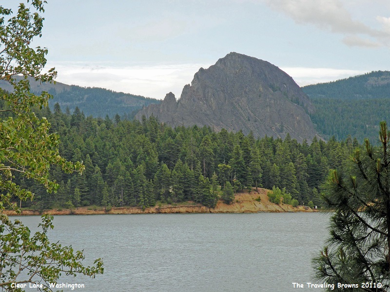
Kloochman Rock was another
interesting geological occurrence along the byway. It is a volcanic “intrusion”
composed of what is called a pyroxene-rich andesite. Wow, that’s a mouthful!
Intrusions are created when molten volcanic material is pushed up into a
fissure or crack where it cools and hardens. Andesite is a relatively hard fine
grained material and the pyroxenes are seen as crystals within the andesitic
rock. Over time (in this case millions of years) the surrounding softer
material eroded away leaving Kloochman Rock as seen today. It is almost a mile
long and rises 2,000 feet.
The name Kloochman is a Chinook Indian word for “wife.” Indian legend says the Meow-Wah was a well respected chief who had no desire to have a wife. Nearby chiefs felt that such a great and respected chief as Meow-Wah should have a wife. They decided to send their most beautiful princesses to him. Meow-Wah did not want this and left his village to live in the mountains. Eventually, his people found him, and he realized they were intent on making him return and take a wife. He consulted with his father, a medicine man, and then resolved to return and make a sacrifice of himself and the potential brides. When the women arrived he commanded them to stop and they were all turned to stone, including Meow-Wah himself. One of the women became Kloochman Rock and Meow-Wah became the nearby mountain known as Goose Egg. Now you know more than you ever wanted to know about a rock!
This is a picture of Kloochman Rock with Lost Lake in the foreground.
We went over the 4,500-foot
pass summit and started working our way down out of the mountain range. We soon
noticed a very distinct difference in the terrain and vegetation on the much
dryer eastern slopes. It is no less beautiful, just different. Approaching
Naches we drove for miles with amazing rim rocks on both sides of the highway.
We thoroughly enjoyed our
drive on the White Pass Scenic Byway. We would love to do it again in another
season of the year for a different view. Our next adventure will take us on a
cruise into the panhandle of southeast Alaska, but more on that later.
Until next time,
Dave & Barb
The Traveling Browns
Until next time,
Dave & Barb
The Traveling Browns
