2011-47 Upper Peninsula of Michigan
Hello
All,
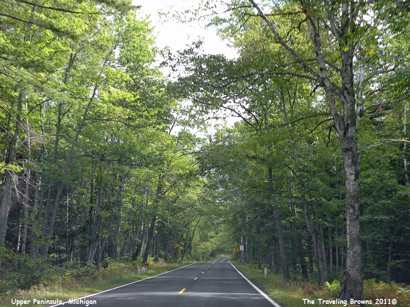
We continued to explore Michigan’s Upper Peninsula from east to west. It was our first time in this part of the country so we had no idea of what to expect. National parks are a favorite haunt for us and we knew that Isle Royale National Park was on an island somewhere in northern Lake Superior. Beyond that we knew nothing about it other than to get there you have to catch a ferry out of Copper Harbor, Michigan. So we set our sights on Copper Harbor, which is on the tip of the Keweenaw Peninsula (pronounced KEE-wi-naw) that juts from the Upper Peninsula of Michigan into Lake Superior.
Keweenaw Peninsula is the northern most part of Michigan’s Upper Peninsula and was the site of the first copper boom in the United States. The volcanic activity in this area produced the only strata on Earth where large-scale economically recoverable 97-percent pure native copper is found. Also, it is the only site in the country with evidence of prehistoric aboriginal mining of copper. Artifacts made from this copper by ancient Indians were traded as far south as present day Alabama.
Early Indian footpaths became trails for explorers, missionaries and fur traders who came to explore and carve out homes in the Michigan wilderness. These early settlers began to widen and improve the trails, which later became the majority of the state’s primary road system. The northern terminus of U.S. Highway 41 is at the northern tip of the Keweenaw Peninsula. It began as the so-called “Military Trail” that started in Chicago in the 1900s and ended in the Keweenaw wilderness. The southern journey of US-41 takes it through eight states (Michigan, Wisconsin, Illinois, Indiana, Kentucky, Tennessee, Georgia and ending in Miami, Florida) a distance of 1990 miles.
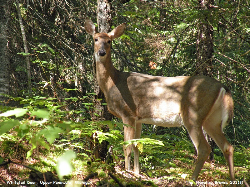
We enjoyed driving through the lush green forests. Occasionally we spotted a deer that had a watchful eye on us. Often they allowed us a photo or two before scampering off.
We continued to explore Michigan’s Upper Peninsula from east to west. It was our first time in this part of the country so we had no idea of what to expect. National parks are a favorite haunt for us and we knew that Isle Royale National Park was on an island somewhere in northern Lake Superior. Beyond that we knew nothing about it other than to get there you have to catch a ferry out of Copper Harbor, Michigan. So we set our sights on Copper Harbor, which is on the tip of the Keweenaw Peninsula (pronounced KEE-wi-naw) that juts from the Upper Peninsula of Michigan into Lake Superior.
Keweenaw Peninsula is the northern most part of Michigan’s Upper Peninsula and was the site of the first copper boom in the United States. The volcanic activity in this area produced the only strata on Earth where large-scale economically recoverable 97-percent pure native copper is found. Also, it is the only site in the country with evidence of prehistoric aboriginal mining of copper. Artifacts made from this copper by ancient Indians were traded as far south as present day Alabama.
Early Indian footpaths became trails for explorers, missionaries and fur traders who came to explore and carve out homes in the Michigan wilderness. These early settlers began to widen and improve the trails, which later became the majority of the state’s primary road system. The northern terminus of U.S. Highway 41 is at the northern tip of the Keweenaw Peninsula. It began as the so-called “Military Trail” that started in Chicago in the 1900s and ended in the Keweenaw wilderness. The southern journey of US-41 takes it through eight states (Michigan, Wisconsin, Illinois, Indiana, Kentucky, Tennessee, Georgia and ending in Miami, Florida) a distance of 1990 miles.
We enjoyed driving through the lush green forests. Occasionally we spotted a deer that had a watchful eye on us. Often they allowed us a photo or two before scampering off.
Lake
Superior significantly controls the climate of the Keweenaw Peninsula keeping
winters milder than those in surrounding areas. Spring is cool and brief,
transitioning into summer with highs near 70 degrees. Fall begins in September
and winter arrives in mid-November. But, there is a price to pay for this milder
climate, as the peninsula receives copious amounts of lake effect snow.
Official records maintained near the southern base of the peninsula have annual
snowfalls averaging 220 inches. Farther north the unofficial annual average is
240 inches. The record snowfall for the northern portion of the peninsula was
390 inches set in 1979. Yup, that’s more than 32 feet of snow!
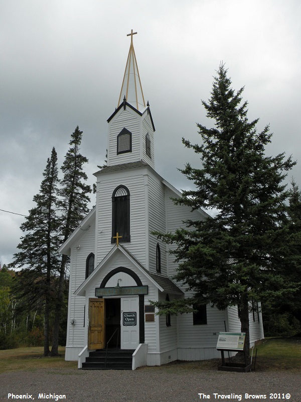
We followed US-41 north into the Keweenaw Peninsula to the little town of Phoenix. Though Phoenix shares its name with the legendary symbol of immortality, the town was unable to rise again after the Phoenix Mining Company closed the mine here in the 1930s. It reached its peak of nearly 1,000 residents in the late 1880s when mining was in full swing, but dropped to about 100 folks by 1893 thanks to a slumping copper market. One jewel that remained in town was the 1858 Church of the Assumption shown in the following photo.
We followed US-41 north into the Keweenaw Peninsula to the little town of Phoenix. Though Phoenix shares its name with the legendary symbol of immortality, the town was unable to rise again after the Phoenix Mining Company closed the mine here in the 1930s. It reached its peak of nearly 1,000 residents in the late 1880s when mining was in full swing, but dropped to about 100 folks by 1893 thanks to a slumping copper market. One jewel that remained in town was the 1858 Church of the Assumption shown in the following photo.
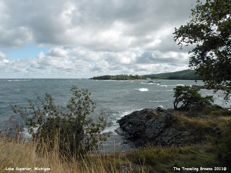
Departing
Phoenix we chose to take MI-26 to the western shore of the peninsula. MI-26 then
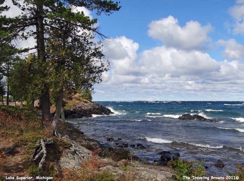
turned north and followed the shoreline all the way to Copper Harbor. Wow, were
we ever blown away with the scenic beauty of this rugged shoreline. The wind
was blowing a pretty good clip and there was a nip in the air. But that didn’t
slow us down as we stopped and took photos whenever an opportunity presented
itself. An artist would have a great time painting the many varied landscapes.
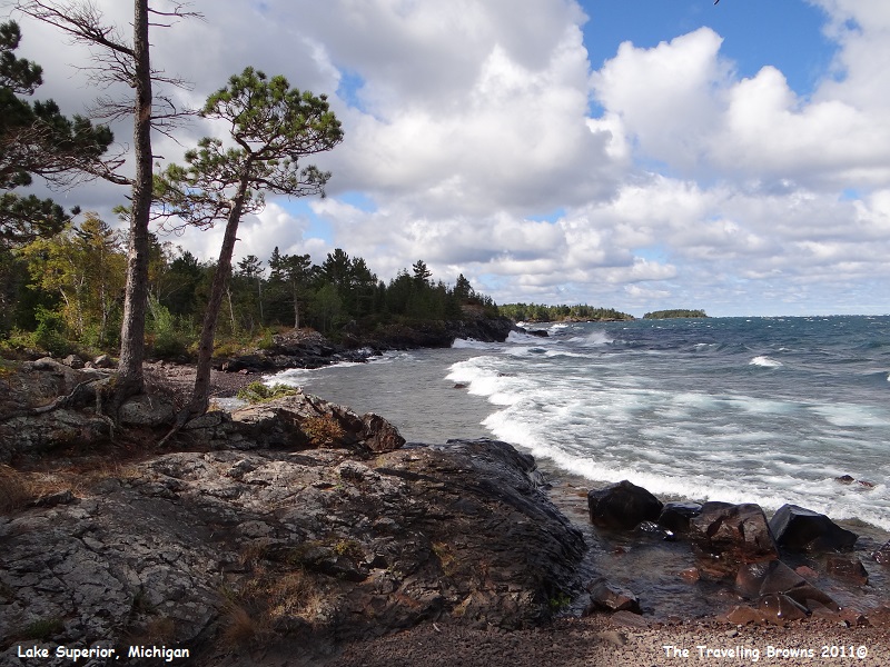
We
were cold on this cool breezy mid-September day. Can you imagine what it would
be like in a couple of months?
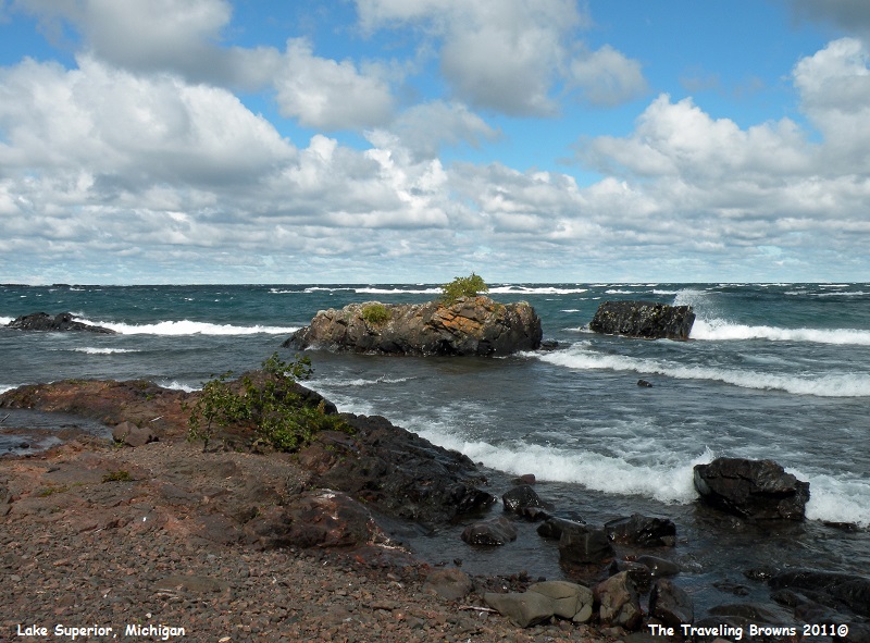
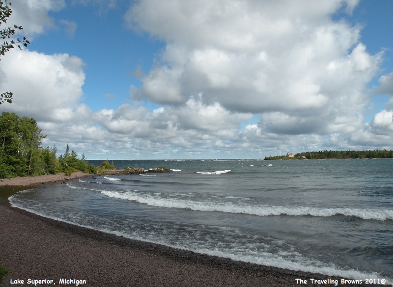
As
we waited and watched to capture the next big wave breaking onshore we had to
keep reminding ourselves that this was a lake and not the ocean! In our eyes it
made for some lovely photos.
Eagle
Harbor was the first little town we came to along the shoreline. It was settled
by prospectors in 1844. This quaint harbor town was a boom town in the early history
of the Upper Peninsula. Since roads were almost non-existent everything was
shipped in by boat. Supplies, settlers, loggers and prospectors came in by boat,
and copper from the mines and logs were shipped out.
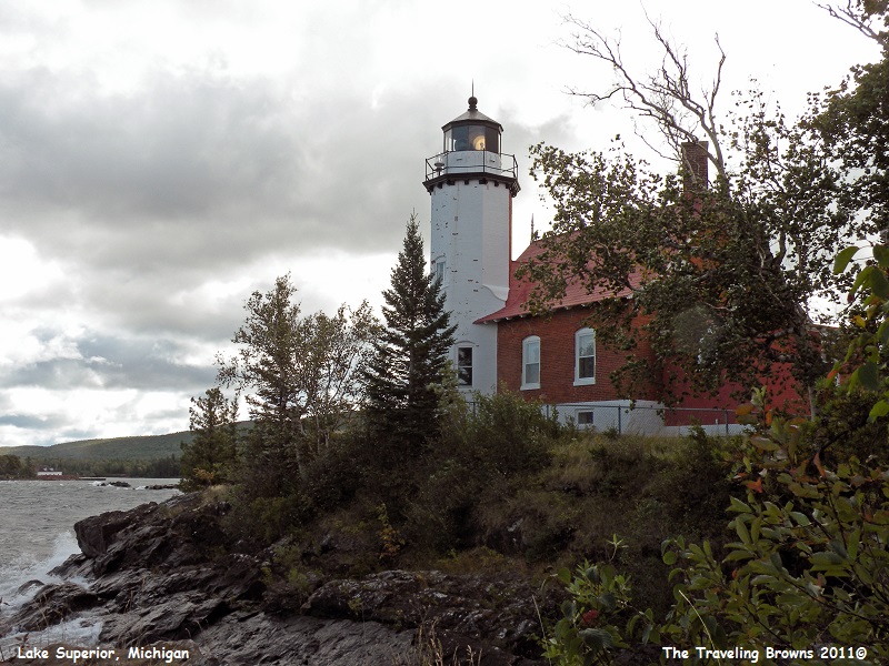
Lake Superior’s unreliable disposition meant that incoming and passing ships needed assistance, and in 1851 the first Eagle Harbor Lighthouse was built. It was constructed of wood and the tower supported a light illuminated by a sperm oil lamp. This facility quickly deteriorated and was replaced in 1871 by the present day red brick structure. Today, it continues to be a working lighthouse marking the rocky entrance into the harbor. In 1968, the original Fresnel lens was replaced by aviation type red and white lights, which sends warning beams more than twenty miles offshore. After having 21 different light keepers during its first 129 years, the lighthouse became automated in 1980.
Lake Superior’s unreliable disposition meant that incoming and passing ships needed assistance, and in 1851 the first Eagle Harbor Lighthouse was built. It was constructed of wood and the tower supported a light illuminated by a sperm oil lamp. This facility quickly deteriorated and was replaced in 1871 by the present day red brick structure. Today, it continues to be a working lighthouse marking the rocky entrance into the harbor. In 1968, the original Fresnel lens was replaced by aviation type red and white lights, which sends warning beams more than twenty miles offshore. After having 21 different light keepers during its first 129 years, the lighthouse became automated in 1980.
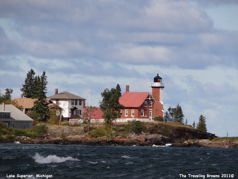
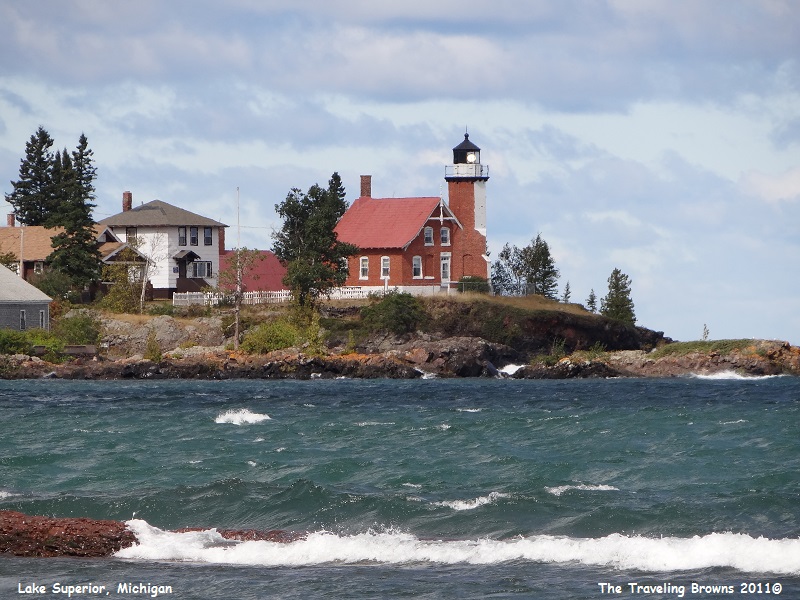
Here
is a view of the lighthouse from the other side. It was quite obvious that you
better have your boat under control and know what you are doing before passing
into the harbor. Storms come up quickly on Lake Superior and there are numerous
shipwrecks in the vicinity of those that didn’t give due respect.
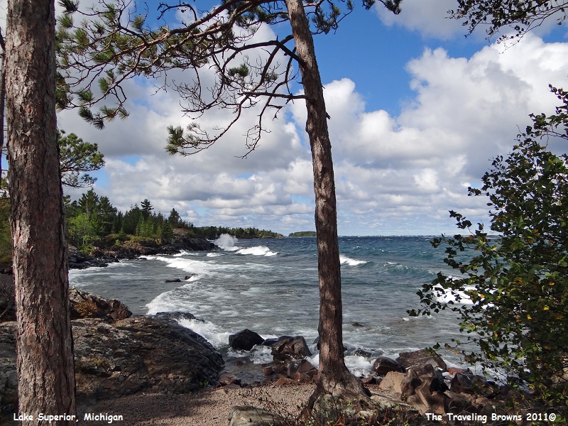
Departing Eagle
Harbor we continued following the shoreline towards Copper Harbor a distance of
about 13 miles. The area inspired us so much that it seemed like we were
stopping around every bend to take photos. On one such stop we noticed a
lighthouse in the distance located in what appeared to be the entrance to another
harbor.
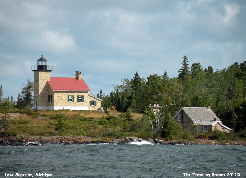
Once
we drove around the harbor to check out the lighthouse we discovered is was the
Copper Harbor Lighthouse at our target destination. Built in 1848 and replaced
by the present structure in the 1860’s, the lighthouse was among the first
beacons on Lake Superior. It has since been automated and the light placed on a
steel tower at this location.
Once
we arrived at Copper Harbor we looked into taking a ferry to Isle Royale
National Park. We discovered there was no daily ferry service to the park.
Ferries only made the transit on Mondays and Fridays. That meant we would
either have to stay on the island 3 or 5 days depending on what ferry we
took—way more time than we wanted to spend on the island checking out the park.
It went downhill from there! The ferry fee per person was $120 plus a $5 per
day parking fee to leave you car at the ferry terminal.
Plus the National Park Service charged $4 per day per individual while on the island, plus the fees for lodging and meals. And, they made it quite clear, it was cash only. They did not accept checks or credit cards nor did they honor their own “Golden Age Pass.” We have never run into this at any other national parks we have visited.
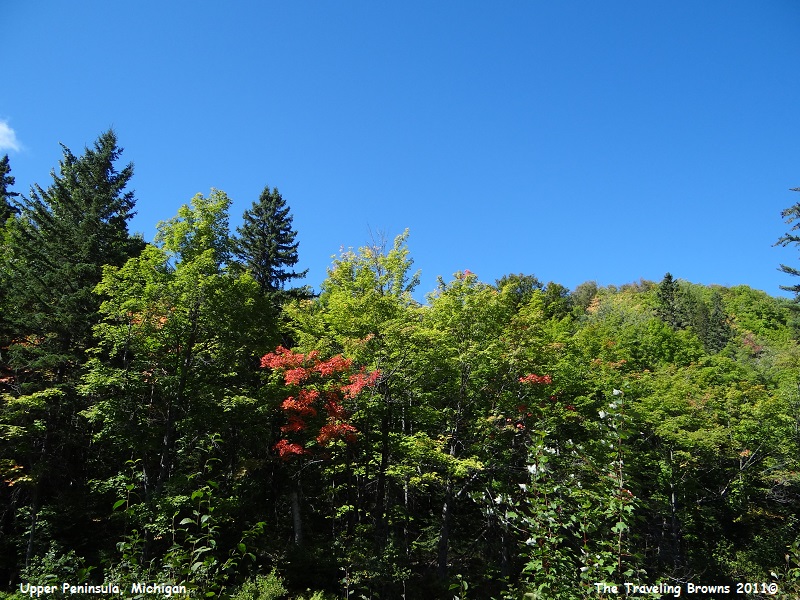
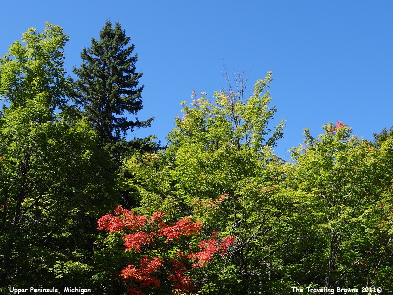
We looked at each other and said “There is no way in heck that we are going to spend five hundred bucks just to check out a park.” So we turned the car around and started working our way south out of the Keweenaw Peninsula. As we moved away from the shoreline the weather cleared and it turned into a beautiful blue sky day. Since it was mid-September we thought we might see some fall colors. But, we were just a bit too early, as there was only an occasional tree that had turned the typical bright colors of autumn.
Plus the National Park Service charged $4 per day per individual while on the island, plus the fees for lodging and meals. And, they made it quite clear, it was cash only. They did not accept checks or credit cards nor did they honor their own “Golden Age Pass.” We have never run into this at any other national parks we have visited.
We looked at each other and said “There is no way in heck that we are going to spend five hundred bucks just to check out a park.” So we turned the car around and started working our way south out of the Keweenaw Peninsula. As we moved away from the shoreline the weather cleared and it turned into a beautiful blue sky day. Since it was mid-September we thought we might see some fall colors. But, we were just a bit too early, as there was only an occasional tree that had turned the typical bright colors of autumn.
We
continued our trek across the Upper Peninsula till we crossed over the border
into Duluth, Minnesota. We’ll share our adventures in the “Land of 10,000 Lakes”
in upcoming issues of our little blurb.
Until next time,
Dave & Barb
The Traveling Browns
Until next time,
Dave & Barb
The Traveling Browns
