2011-40 Palouse Falls, Washington
Hello All,
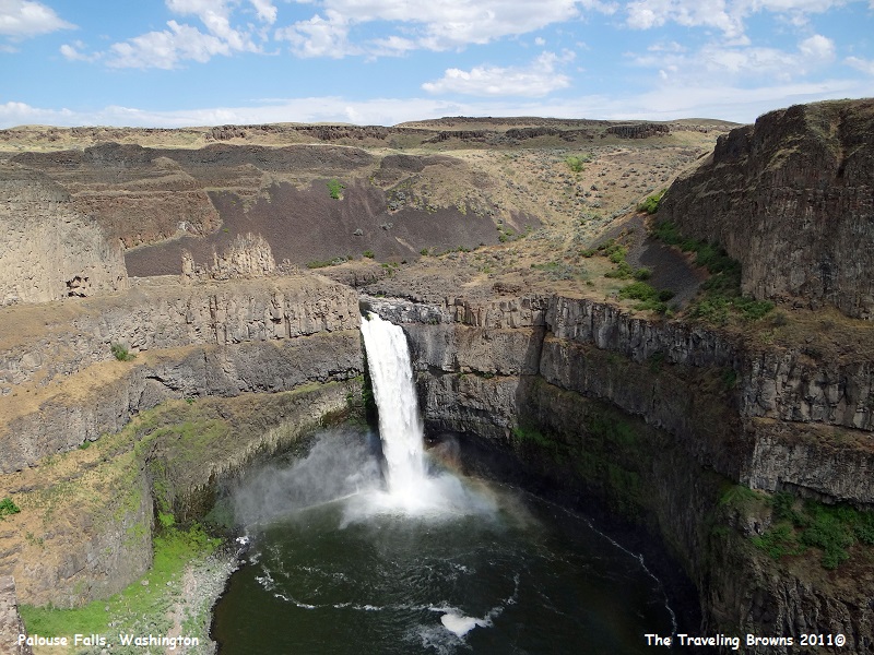
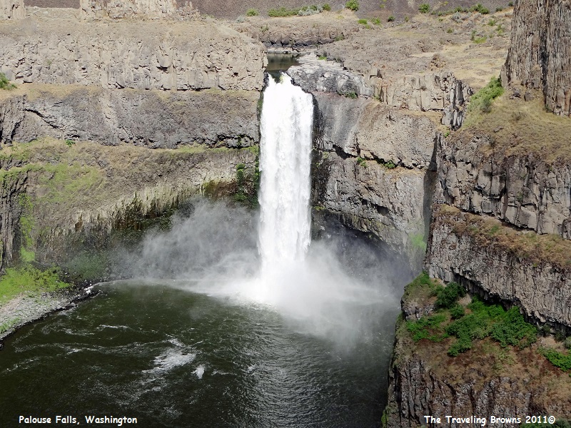
“Where the heck is Palouse Falls?” That’s the question Dave asked after coming across an article in a magazine he was reading on our flight to the Pacific Northwest. It talked about it being a beautiful 198-foot waterfall in Washington State. And, the article said that its size and splendor made it one of the most scenic and impressive waterfalls within the state. After doing some research we learned that it was in southeast Washington. That perked our interest even more because southeast Washington is high desert with miles and miles of gentle rolling hills planted with wheat--not a place where you would normally find a waterfall, let alone one with a 198-foot drop! We had to see it.
Our drive out of the Seattle area took us over the Cascade Mountain Range to the high desert of eastern Washington. These are the directions we found on the internet to get us to the falls:
From State Route 261 Washtucna: Drive southwest 5.8 miles to State Route 261/260 junction, and turn left at the grain elevator. Follow State 261 southeast for 8.7 miles to Palouse Falls Road. Turn left and follow the road to the end (approximately 2.5 miles).
Sounds simple, right--wrong! So we programmed Palouse State Park into our trusty GPS to guide us to our destination. We turned here and there and back and forth while she guided us through miles of huge wheat fields. Occasionally we came upon a ranch sprawled across the high desert.
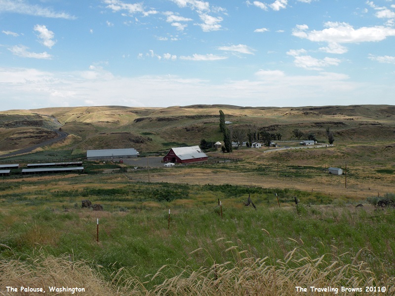
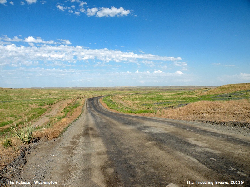
We went from highways to paved
country roads and then finally to an oiled dirt road through rolling hills
covered with grass. Again, it was not a place that looked like there would be a
spectacular waterfall. But, we were having an adventure and were determined to
reach our target destination.
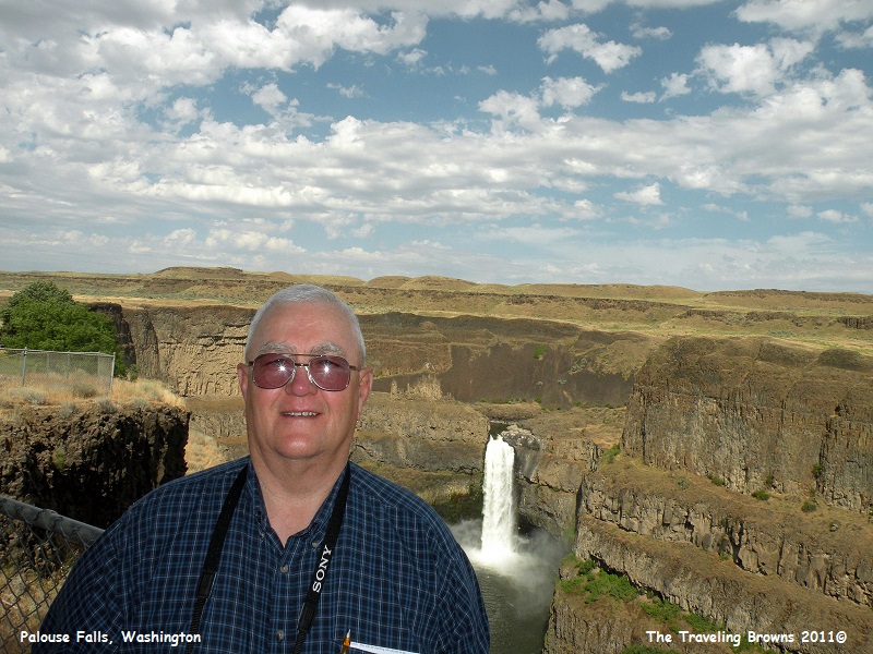
Upon making it to the state
park we parked the car and walked to a falls overlook at the edge of a sheer
canyon. Wow, were we blown away! It was as advertised--spectacular! The downside was that the temperature was in
the upper 90’s and the direct sun was taking a toll on us. The only saving
grace was that there was a breeze blowing, although it was mighty warm air. The
path along the cliff was well fenced so we could get up close for wonderful
views of the falls and the river below.
Two very different types of
floods, massive lava flows and torrential Ice Age floods, helped form this
landscape.
Long before the Ice Age floods could carve the coulees, waterfalls, and cliffs, basalt was needed in huge quantities. Vents from deep in the earth’s crust supplied the basalt, erupting again and again to cover eastern Washington and parts of Oregon and Idaho in a layer cake of basalt thousands of feet thick. Over time, tectonic forces pushed and pulled at the bedrock, opening deep fractures in the basalt. Millions of years later, Ice Age floods swept through the area. The floodwaters took advantage of these fractures, cutting steep channels where the bedrock was weakest, creating Palouse Falls and its canyon. Palouse Falls is the only major waterfall created by the Ice Age floods in eastern Washington that still has water flowing year round.
Long before the Ice Age floods could carve the coulees, waterfalls, and cliffs, basalt was needed in huge quantities. Vents from deep in the earth’s crust supplied the basalt, erupting again and again to cover eastern Washington and parts of Oregon and Idaho in a layer cake of basalt thousands of feet thick. Over time, tectonic forces pushed and pulled at the bedrock, opening deep fractures in the basalt. Millions of years later, Ice Age floods swept through the area. The floodwaters took advantage of these fractures, cutting steep channels where the bedrock was weakest, creating Palouse Falls and its canyon. Palouse Falls is the only major waterfall created by the Ice Age floods in eastern Washington that still has water flowing year round.
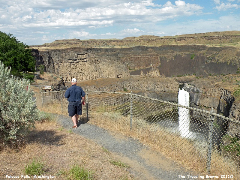
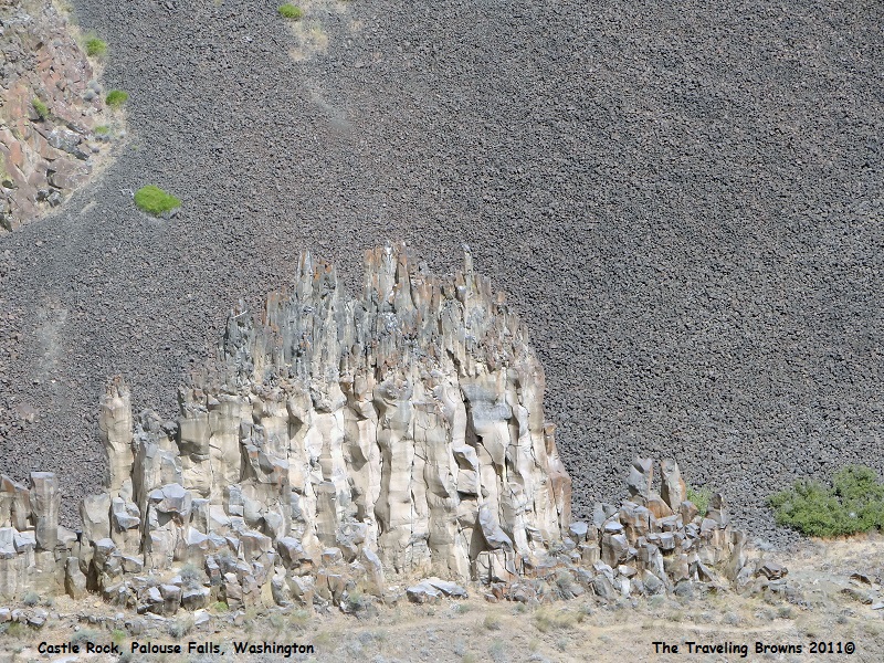
There is a trail you can
follow all the way to the edge of the falls. Due to the hot weather we decided
to forego taking it--maybe another time. In the photo above you can see some
amazing rock formations to the left side of the falls. The trail passes right
beside these formations. The following photo is a close-up shot of the trail
and some of the rock formations.
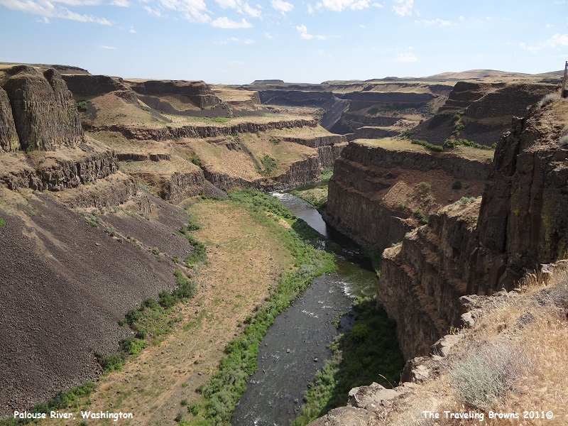
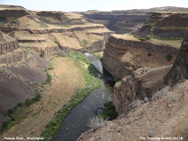
These photos are looking down river
from the falls. It is truly a spectacular canyon. It reminded us of a mini
grand canyon. About four miles downstream the Palouse River flows into the
Snake River.
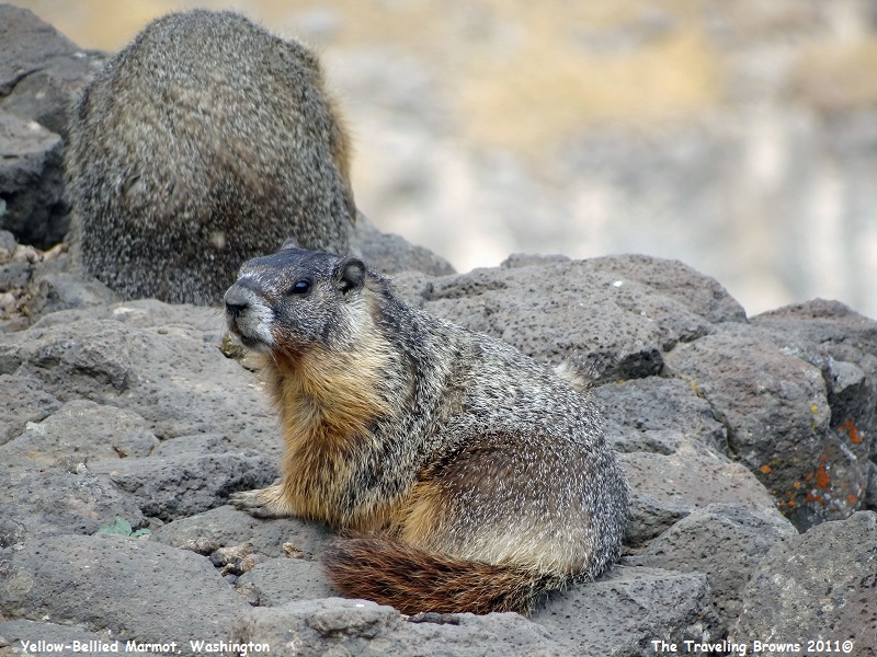
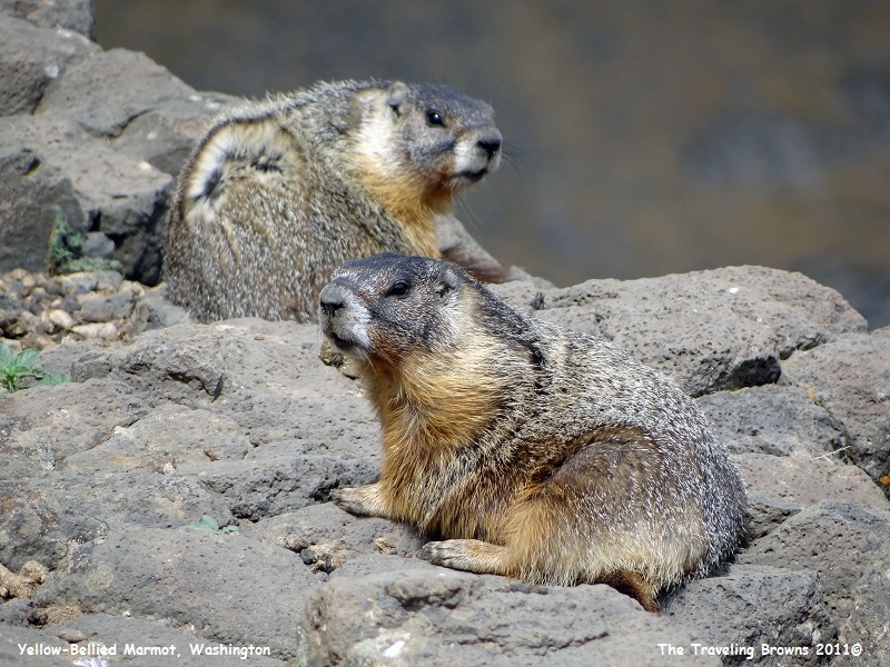
As we were busy taking photos
we kept hearing loud shrill whistles. We discovered that it was a family of
yellow-bellied marmots out on the rocks sunning themselves. Note how well they
blend with the rocks. They need this camouflage, as golden eagles patrol this
part of the state and could pose a big threat.
After a few hundred parting
shots of the falls we decided to call it a day. We thoroughly enjoyed our short
visit to the area. Who would have thought this jewel was tucked away in the
scablands of eastern Washington.
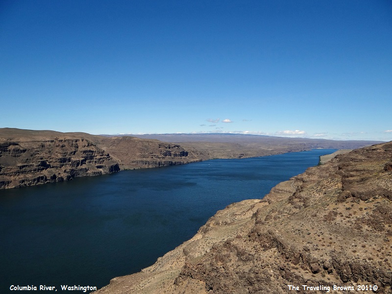
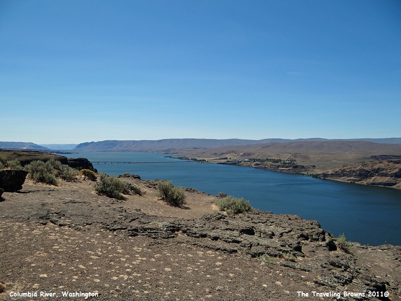
On our way home we decided to
do a bit of a loop so we put Moses Lake, Washington into our GPS and let her
guide us to I-90 where we hopped on it heading west towards Seattle. Where the
interstate crosses the Columbia River we stopped at a viewpoint to stretch our
legs and take it all in.
It was hard to believe that this barren landscape was once covered with lush forests. About 20 million years ago this region was humid and the topography was a network of hills and streams. At that time there was no Cascade Mountain Range and moisture laden clouds sweeping in from the Pacific Ocean created an environment in which forests thrived.
Then floods of molten basaltic lava welled up through fissures in the earth’s crust, eventually engulfing an area of 200,000 square miles to a general thickness of several thousand feet. With each lava flow more and more forests were destroyed. With the end of the outpouring of lava about 6 million years ago the raising of the Cascade Mountain Range began. This uplift cut off the moist winds from the west leaving eastern Washington the arid region it is today.
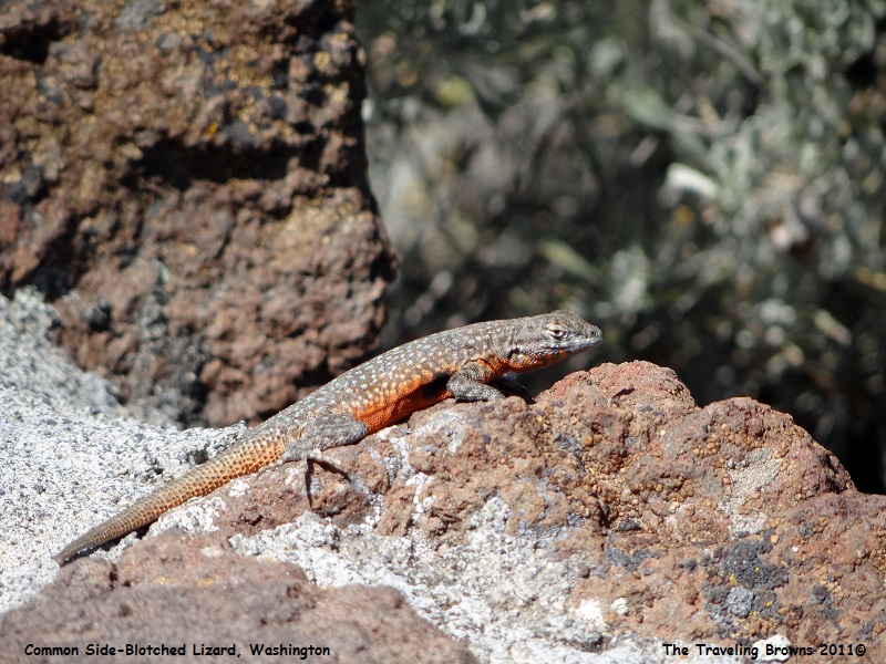
There were signs cautioning
visitors to watch out for rattle snakes--which we heeded. Happy to report that
we didn’t see any, and that was just fine as far as we were concerned! We did come across this common side-blotched
lizard which was enjoying the hot sun more than we were.
We truly enjoyed our jaunt to
eastern Washington. It is such a sharp contrast from the western half of the
state. But we have found in our travels that if you slow down and look there
are things to see and adventures to be had wherever you are.
Until next time,
Dave & Barb
The Traveling Browns
Until next time,
Dave & Barb
The Traveling Browns
