2014-12 Cruising the Main River, Germany
Hello All,
Just after lunch we departed Bamberg and cruised on the Main River towards our next port of call—Wurzburg, Germany. We have often wondered why some place names are spelled with …berg while others are spelled with …burg. One of our guides explained the difference to us.
“Berg” generally refers to a hill or mountain. Bamberg would be Bam hill for example.
Wherein, “Burg” would be a fortress or castle. Wurzburg would indicate Wurz castle or fortress.
We still found ourselves getting confused day after day as we couldn’t remember which spelling stood for a hill and which stood for a castle—Bamberg, Nuremberg, Rothenburg, Regensburg, Freudenberg, Krotzenburg and on and on!
Unlike the Danube, the Main River is not a superhighway in terms of river traffic. The Main takes its time, veers off to the left or the right, doubles back on itself and seems to be in no hurry to get to its mouth at the city of Mainz. One of the ancient names for the river is Moine, which is said to mean “crooked snake”—a very apt description.
The lazy, winding river ran parallel to the border of the Roman Empire for a significant part of its length, and later became a dividing line between northern and southern Germany, long before modern-day Germany was even thought of. In medieval times, the people living south of the border spoke a dialect known as Middle High German, which became the forerunner of today’s standard German language. North of the Main line, Low German was the norm, a language that still survives in regional dialects and in The Netherlands.
The divide is also a cultural one, which is expressed in a term that is sometimes used—Weisswurstaquator, or “the white sausage equator.” South of the Main, white sausages are an important and beloved food; north of the line other sausages are more popular. The actual location of the white sausage equator is a matter of considerable debate. The cultural divide resulted from more than simply the preference for this sausage or another. North of the Main most of the German lands lived under the influence of the Protestant Prussian Empire, while south of the river, the various states and principalities stood under the influence of the Catholic Austrian Empire.
In the big scheme of things the north-south division is fairly recent. When Nuremberg Renaissance artist Albrecht Durer traveled from Bamberg to the Netherlands in 1520, the Main cut across a bewildering patchwork of different sovereignties and jurisdictions. The document that cleared him for free travel, issued by the Prince-Bishop of Bamberg, gave Durer and his wife free passage across 17 borders between Bamberg and Mainz. The Durers also passed by 27 toll stations, an indication of what riverboat captains had to contend with as they carried their freight up and down the rivers. The business of exacting tolls may seem excessive at first glance, but local landowners were often responsible for building and maintaining towpaths along the rivers. Before the Main received its many locks and weirs, there were a great many rapids and shallow areas where ships needed to be towed or cargo needed to be portaged. This led to considerable traffic on and alongside the river, and the necessary use of the infrastructure of course did not come free.
There was rapid development on the Main River during the 20th century, which today has 34 locks and 33 hydro-power stations and carries ships with payloads of up to 1,500 metric tons. This transformation culminated in the opening, in 1992, of the Rhine—Main—Danube Canal, which allows passage by river ship across the entire face of Europe from the North Sea to the Black Sea. Yet, the traffic is not comparable with that of the Rhine or Danube. It allowed us to experience the Main as the ancient Celts did, as a river in no hurry—we loved it.
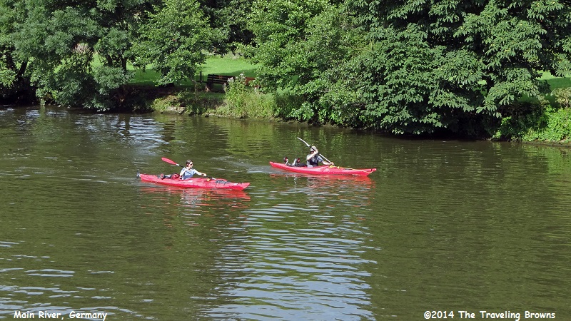
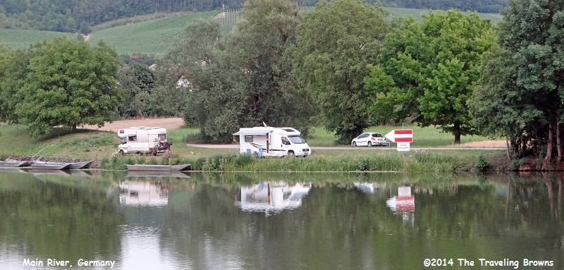
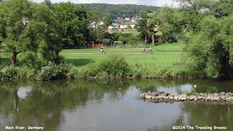
As we cruised on the Main it was obvious that the German people truly loved it. They were out and about doing all forms of recreational activities such as boating, camping, fishing, and biking to name a few.
Just after lunch we departed Bamberg and cruised on the Main River towards our next port of call—Wurzburg, Germany. We have often wondered why some place names are spelled with …berg while others are spelled with …burg. One of our guides explained the difference to us.
“Berg” generally refers to a hill or mountain. Bamberg would be Bam hill for example.
Wherein, “Burg” would be a fortress or castle. Wurzburg would indicate Wurz castle or fortress.
We still found ourselves getting confused day after day as we couldn’t remember which spelling stood for a hill and which stood for a castle—Bamberg, Nuremberg, Rothenburg, Regensburg, Freudenberg, Krotzenburg and on and on!
Unlike the Danube, the Main River is not a superhighway in terms of river traffic. The Main takes its time, veers off to the left or the right, doubles back on itself and seems to be in no hurry to get to its mouth at the city of Mainz. One of the ancient names for the river is Moine, which is said to mean “crooked snake”—a very apt description.
The lazy, winding river ran parallel to the border of the Roman Empire for a significant part of its length, and later became a dividing line between northern and southern Germany, long before modern-day Germany was even thought of. In medieval times, the people living south of the border spoke a dialect known as Middle High German, which became the forerunner of today’s standard German language. North of the Main line, Low German was the norm, a language that still survives in regional dialects and in The Netherlands.
The divide is also a cultural one, which is expressed in a term that is sometimes used—Weisswurstaquator, or “the white sausage equator.” South of the Main, white sausages are an important and beloved food; north of the line other sausages are more popular. The actual location of the white sausage equator is a matter of considerable debate. The cultural divide resulted from more than simply the preference for this sausage or another. North of the Main most of the German lands lived under the influence of the Protestant Prussian Empire, while south of the river, the various states and principalities stood under the influence of the Catholic Austrian Empire.
In the big scheme of things the north-south division is fairly recent. When Nuremberg Renaissance artist Albrecht Durer traveled from Bamberg to the Netherlands in 1520, the Main cut across a bewildering patchwork of different sovereignties and jurisdictions. The document that cleared him for free travel, issued by the Prince-Bishop of Bamberg, gave Durer and his wife free passage across 17 borders between Bamberg and Mainz. The Durers also passed by 27 toll stations, an indication of what riverboat captains had to contend with as they carried their freight up and down the rivers. The business of exacting tolls may seem excessive at first glance, but local landowners were often responsible for building and maintaining towpaths along the rivers. Before the Main received its many locks and weirs, there were a great many rapids and shallow areas where ships needed to be towed or cargo needed to be portaged. This led to considerable traffic on and alongside the river, and the necessary use of the infrastructure of course did not come free.
There was rapid development on the Main River during the 20th century, which today has 34 locks and 33 hydro-power stations and carries ships with payloads of up to 1,500 metric tons. This transformation culminated in the opening, in 1992, of the Rhine—Main—Danube Canal, which allows passage by river ship across the entire face of Europe from the North Sea to the Black Sea. Yet, the traffic is not comparable with that of the Rhine or Danube. It allowed us to experience the Main as the ancient Celts did, as a river in no hurry—we loved it.
As we cruised on the Main it was obvious that the German people truly loved it. They were out and about doing all forms of recreational activities such as boating, camping, fishing, and biking to name a few.
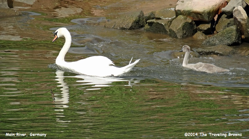
We were blown away with the
sheer number of swans in the river. There were large groups all along the
river.
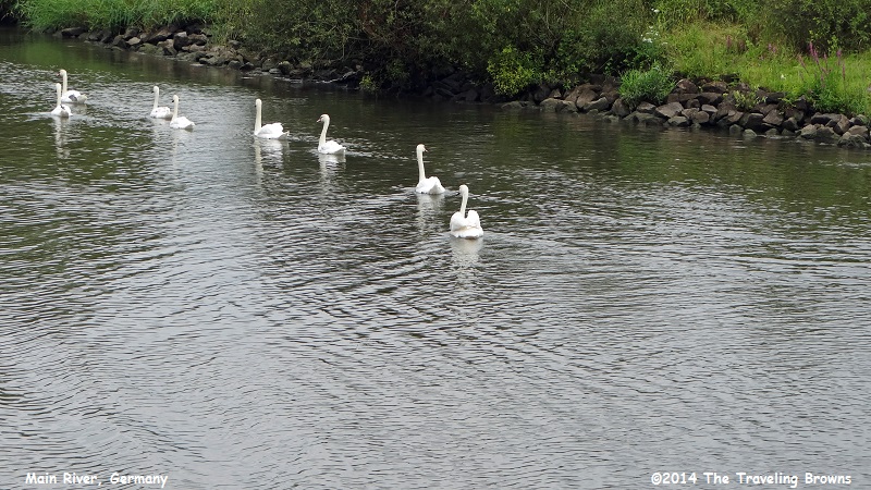
They are such a lovely bird.
Some had cygnets.
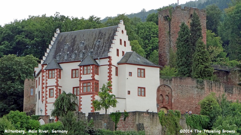
Here we are approaching the little
town of Miltenberg.
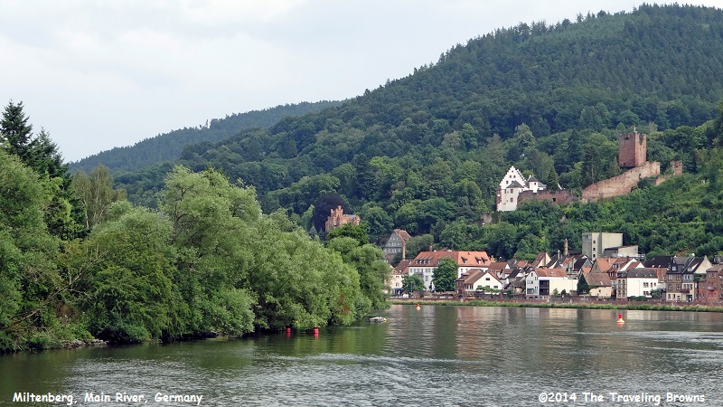
It is a colorful town with
amazing buildings and homes on the hillside. It truly looked like a town we
would have liked to explore.
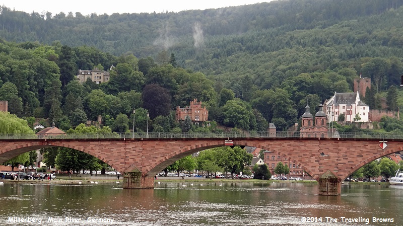
We passed under this bridge
across the river. It was one of many that we had to squeeze under. Riverboat
captains do an amazing job in piloting the longships through such challenges.
Everything on the top deck had to be lowered down flat in order to clear.
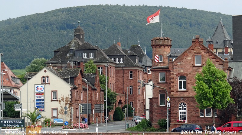
This building was tied into
the medieval fortress wall that ran up the hillside. Miltenberg was typical of the many villages and
towns along the Main River. We felt that it gave us a glimpse of what it would
be like if we could step back in time.
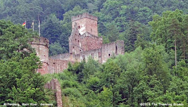
In this shot you can see some
of the castle ruins high up on the hillside.
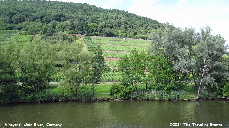
In some areas the hillsides
were covered with vineyards. It was truly relaxing to sit back and take it all
in. This part of Bavaria is known as Franconia, and the Main River takes you
through the heart of it.
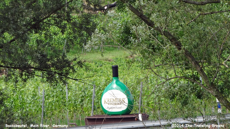
The Bocksbeutel is a type of
wine bottle commonly used for wines from Franconia. It has been used for wine
in the area since the early 18th century. One of our guides advised us that the
bottle was in the shape of a goat’s scrotum--okay! Others claim that the term
actually means a “ram's scrotum” which is supposed to be of similar shape as
the bottle. With all that said, the amazing thing is that within the European
Union, the Bocksbeutel enjoys the status of a protected bottle shape. We
snapped this photo of one advertising a vineyard next to the river.
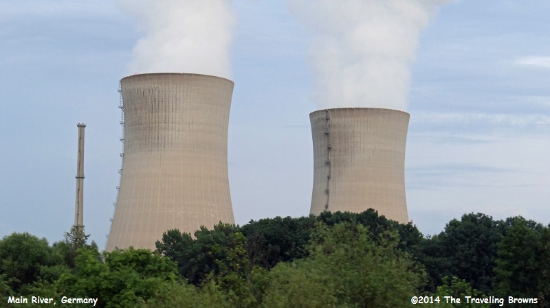
We have observed many nuclear
cooling towers in our travels. The only reason we included this photo of some
we observed while cruising the river, is because we learned that Germany has
committed to closing all their nuclear plants by 2018. We think that is
commendable.
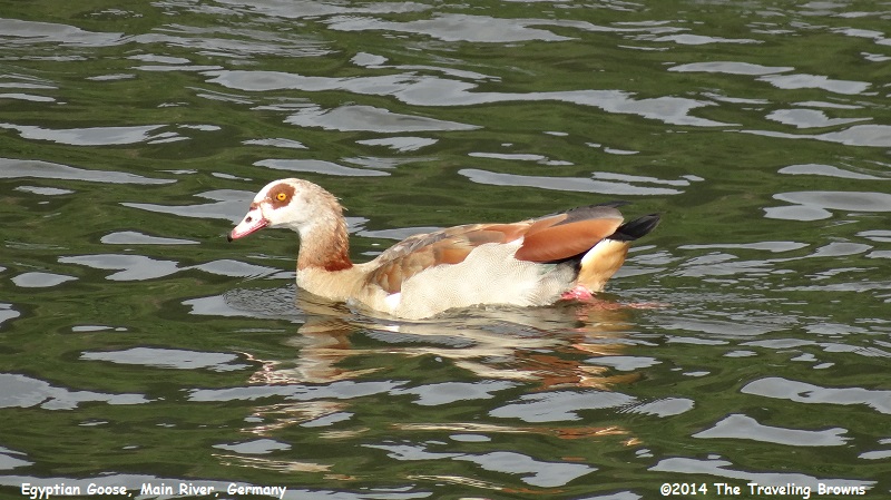
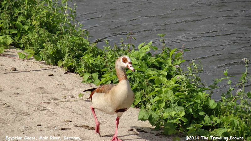
Another unusual sighting along
the river was the many Egyptian Geese. They have markings unlike any other
waterfowl we have come across. We wouldn’t put them on our list of beautiful
birds—but they sure are different.
When out of the water you can
see that they have pink legs.
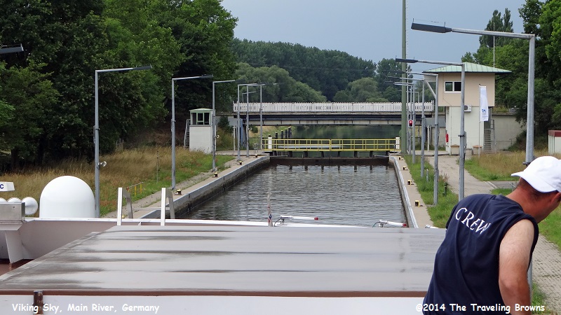
The following are shots of our
Viking Longship approaching a dam and passing through a lock—one of 68 locks on
our journey across Europe. The width and length of all longships built by
cruise companies is based on the size of the smallest lock on the river system.
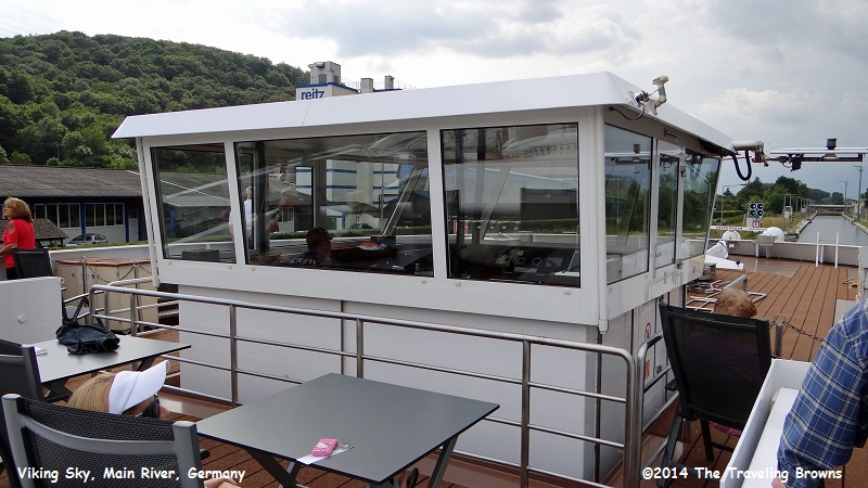
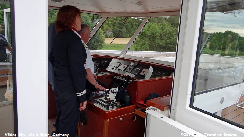
This is a shot of the ship’s bridge where the ship is controlled. Note that the entire cabin can be lowered down inside the ship to the height of the rail around it. When the bridge is lowered the ship can still be controlled from within it. We thought this was fascinating.
There was a small area behind the ship's bridge with two tables and about six chairs where passengers could watch the operation even when the top deck was closed.
Dutch doors were on both side
of the bridge and could be opened with it in the lowered position. That’s the
ship captain in the white shirt.
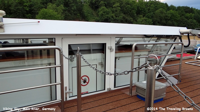
In this shot the bridge is in
the lowered position.
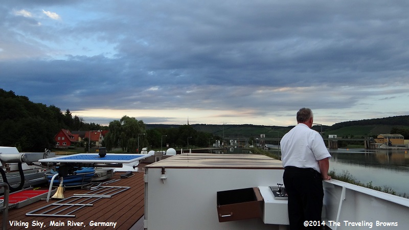
The captain has moved to one
of the outside steering stations of the ship. There was a steering station on
both sides of the ship. In this shot you can see the water behind the dam on
the right. Our ship is in the channel slowly moving into the lock ahead.
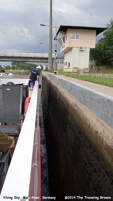
Crewmen on both sides of the
ship constantly watched our position as we inched forward within the lock. The
Viking Sky at a length of 360 feet is a lot of ship to thread into a lock.
However, some of the newer ships in the Viking Longship fleet are 443 feet in
length.
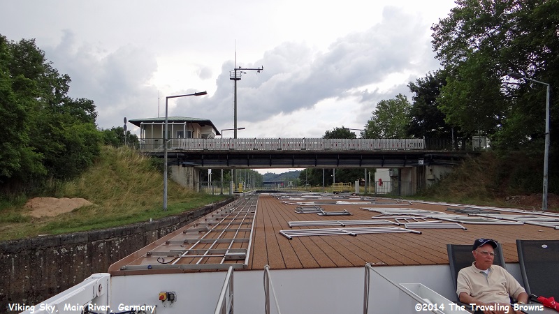
In the following photo you can
see that the water has flowed out of the lock stepping us down to a lower
level. The lock gate doors have opened and we have a green light to proceed
downstream under the bridge ahead.
Looking back in this shot you
can see that the ship is passing under the bridge. You can also see how all the
chair, tables, awnings, and railings have been laid down flat.
We continued to cruise through
the night to our next port of call--Wurzburg, Germany. From Wurzburg we will
take a tour on Germany’s “Romantic Road” to the medieval town of Rothenburg.
Hope you will consider riding along with us.
Until next time,
Dave & Barb
The Traveling Browns
Until next time,
Dave & Barb
The Traveling Browns
