2011-33 Mendenhall Glacier, Juneau, Alaska
Hello All,
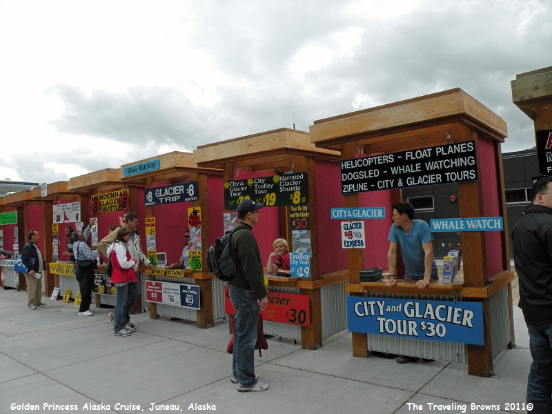
There are kiosks on the dock at Juneau where you can book just about any sightseeing adventure in the area. Once we had enough of walking around town we came back to the kiosks and purchased tickets for the shuttle bus to Mendenhall Glacier Visitor Center. The glacier is only 13 miles from downtown Juneau. The shuttles run every thirty minutes and as long as you are back at the bus stop in time to catch the last bus back into town you pretty much have time to explore at your leisure.
There are kiosks on the dock at Juneau where you can book just about any sightseeing adventure in the area. Once we had enough of walking around town we came back to the kiosks and purchased tickets for the shuttle bus to Mendenhall Glacier Visitor Center. The glacier is only 13 miles from downtown Juneau. The shuttles run every thirty minutes and as long as you are back at the bus stop in time to catch the last bus back into town you pretty much have time to explore at your leisure.
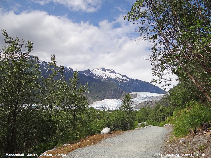
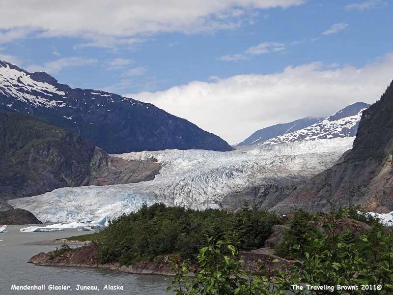
It is an easy walk from the
visitor center to Nugget Falls where you get a close up view of the glacier.
The trails are relatively flat and wide with a good gravel base. You get
different perspectives of the glacier all along the trail. We took jackets
along with us. There were times when we had to carry them because it was so
warm in the sun. And, at other times we were glad we had them, as glaciers tend
to make their own weather. Wind flowing down the glacier can drop the air
temperature by as much as 10 degrees, which in turn causes low level clouds to
form.
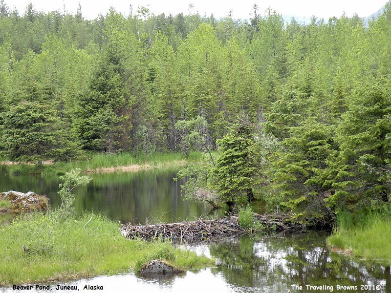
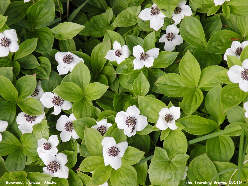
There is a lot to see along
the trail such as beaver dams and wildflowers. Depending on the time of year
you could also see salmon spawning in the creek. For the folks that haven’t
been up close and personal with a glacier, this is a nice and easy way to see
one close at hand. We imagine that late in the day you could see beavers
working in the many ponds along the trail.
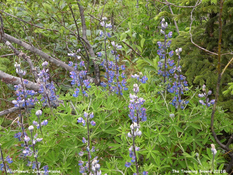
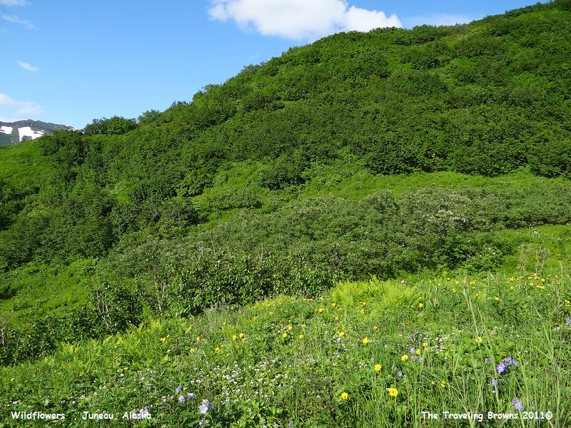
Here’s an example of the
wildflowers that were blooming.
Mendenhall Glacier begins at
the Juneau Icefield located high in the Coast Mountain Range and flows for 13
miles to Mendenhall Lake. This icefield is North America’s fifth largest and
blankets over 1,500 square miles of land. It stretches nearly 85 miles north to
south and 45 miles east to west. This icefield feeds 38 large glaciers.
Although the Juneau Icefield is at least 3,000 years old, the ice itself
remains relatively young because it is perpetually renewed through snowfall at
the upper elevations. Glacial ice at the terminus of Mendenhall Glacier has
flowed for 200-250 years on its 13-mile trek. Scientists estimate the ice
field’s snow and ice depth to be from 800 to over 4,500 feet. Now it may be a
little easier to understand why there are no roads into Juneau.
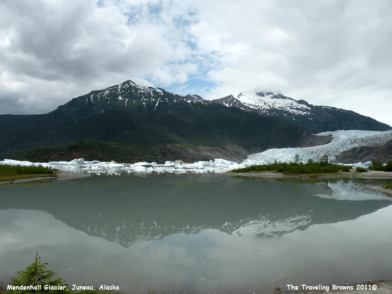
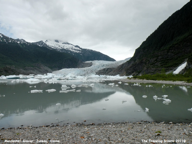
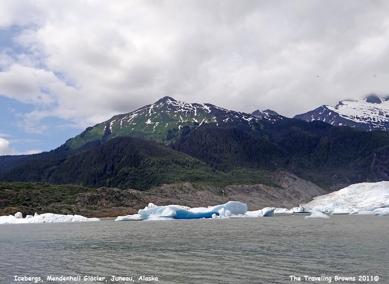
As you get closer to the face
of the glacier you start seeing the glacial silt in the lake water and icebergs
floating in the distance.
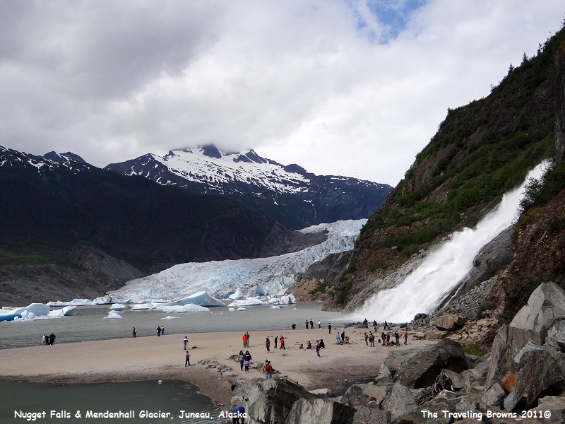
Once Nugget Falls comes into
view on the right hand side of the glacier you know you are getting close to
the best observation point. From a distance the falls doesn’t look all that
impressive as in the following photo.
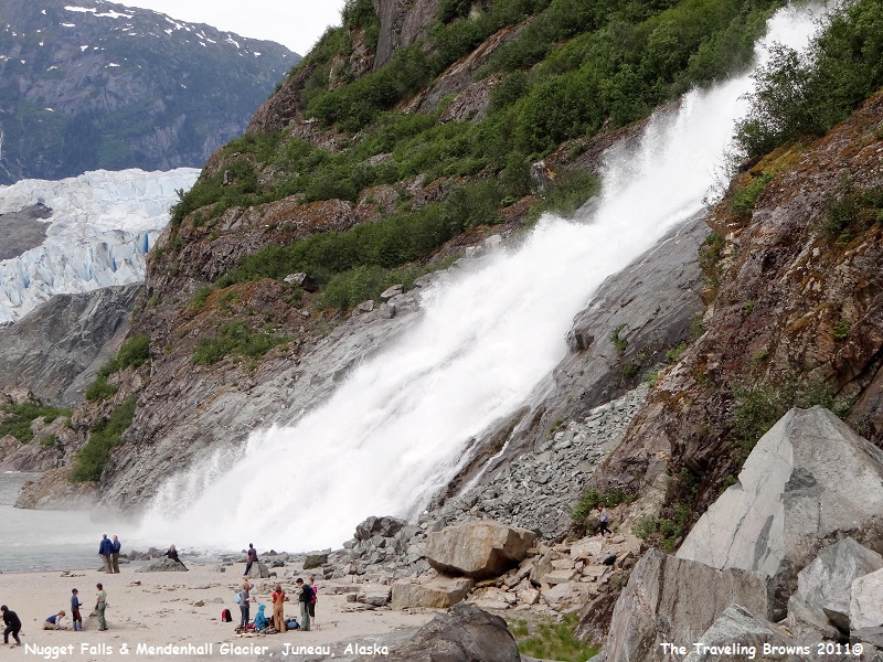
However, when you get close to
it you realize how massive the cascading waterfall is. It drops 377 feet in two
tiers of 99 feet and 278 feet onto a sandbar in Mendenhall Lake. The waterfall
is fed by Nugget Creek which is fed by Nugget Glacier high in the mountains.
On the mountainside as this
thunderous waterfall crashes into rocks it shoots water and foam 10 to 15 feet
into the air. It’s a frothy torrent blasting down the mountainside. Spray in
the air made it tough keeping the camera lens dry while walking on the sandbar.
If you look closely in the
following photo there are a couple of specks above the ridgeline on the
right-hand side of the photo. Those specks are helicopters that take tourists
up to the Juneau Icefield. The helicopters run in groups of four and actually
land on the icefield. Passengers can walk around and take photos while there.
It would be a wonderful experience. However, having flown over the icefield
numerous times we chose not to book this excursion as it is terribly expensive.
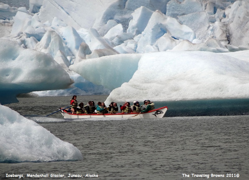
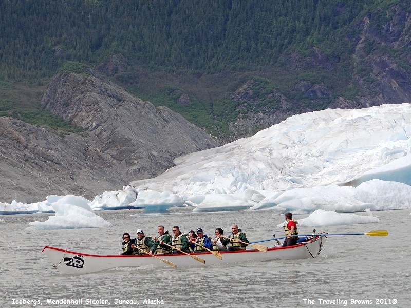
Another excellent way of
viewing the glacier is by one of the 28-foot traditional Tlingit-style canoes.
Guides on the canoes maneuver them through the icebergs on the lake. It would
be a great way to get good photo opportunities.
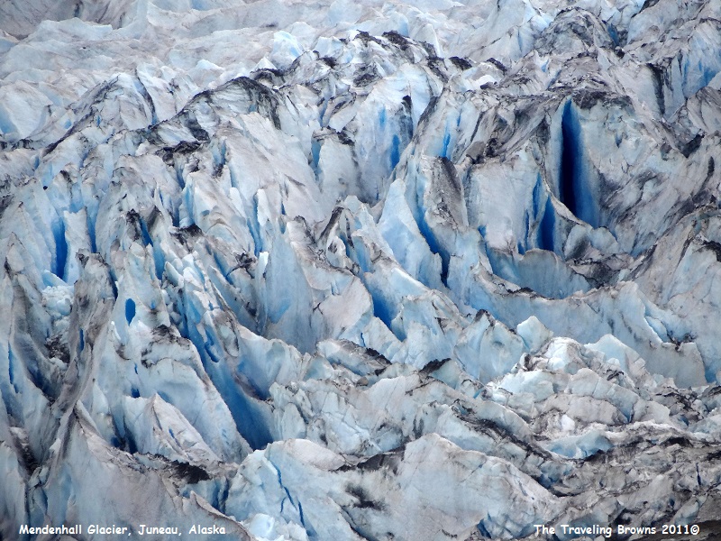
Here’s a close-up of the
glacier--pretty rugged up there! Note the crevasses and the deep blue of the
compacted ice. Needless to say, the sightseeing helicopters would not try to
land in this area.
Probably the hardest thing we
have to do when preparing a write-up is to determine what photos to use. It
literally takes hours to go through them. On our adventure to the glacier we
took over 1000 photos and then deleted over 500 of them. However, we still
ended up with 461 photos to go through to pick out a handful in order to tell
our story the best we can. Many days our old eyeballs are ready to cross before
we are done.
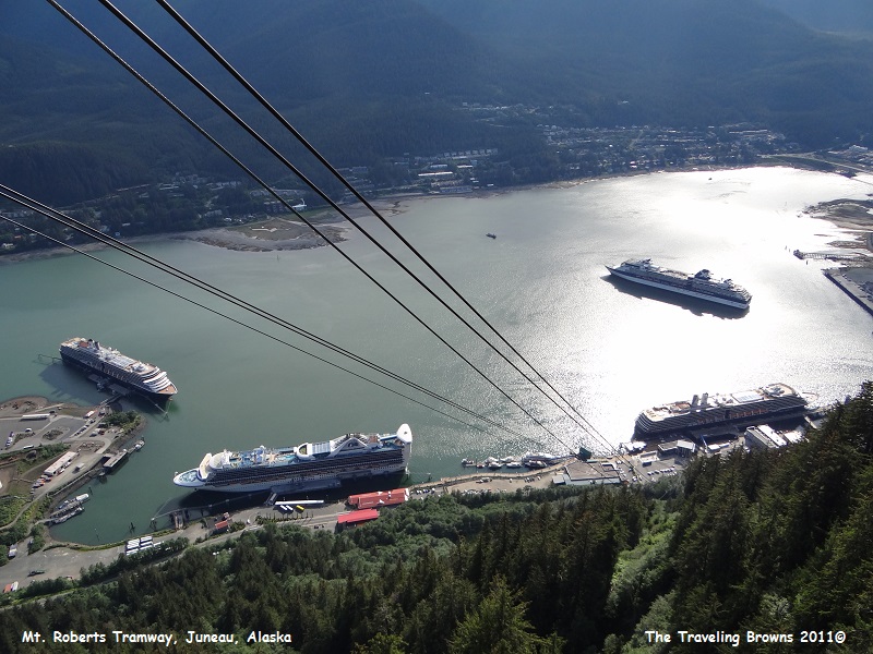
After many hours of exploring Mendenhall Glacier we caught the shuttle back into town. Since it was a beautiful day and we had a few hours before our ship was scheduled to depart, we decided to hop on the Mt. Roberts Tramway and ride it to the top.
On the ride up we noticed that in addition to our cruise ship (foreground left), there were three other cruise ships in port. Wow, that must give a real boost to the economy.
To our surprise there was a
gift shop, cultural center, bar and grill and a theater at the top. But, the
most spectacular of the things they had to offer was the outstanding view. To
the north are the Chilkat Mountains, Gastineau Channel to the south, Douglas
Island to the west across the channel from Juneau, and to the east you can see
Silver Bow Basin, where gold was discovered in 1880. As an added bonus there
were bald eagles sitting in the tree tops.
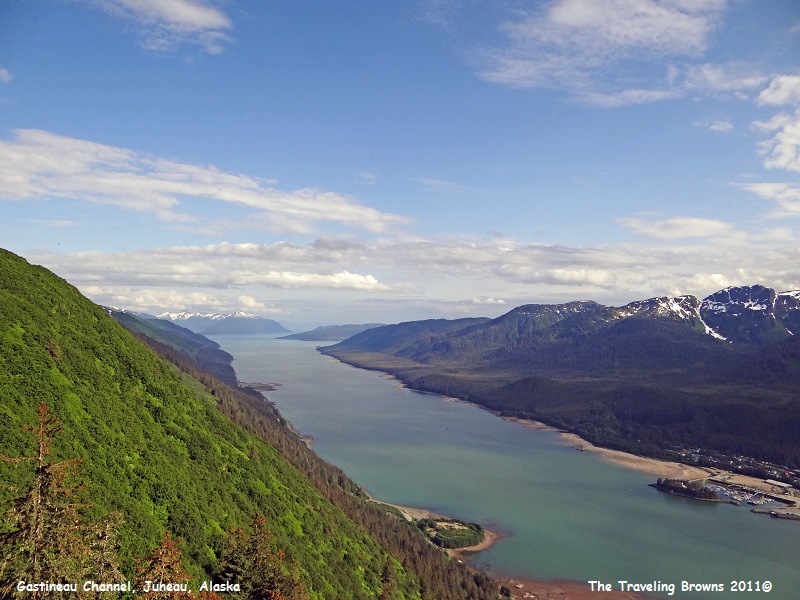
In this photo we are looking south down Gastineau Channel and that’s Douglas Island on the right. This is the channel cruise ships use to get into and out of Juneau.
In this photo we are looking south down Gastineau Channel and that’s Douglas Island on the right. This is the channel cruise ships use to get into and out of Juneau.
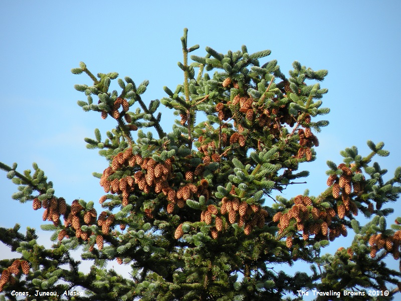
We decided to walk one of the
trails that looped through the forest and then through the sub-alpine meadows
on top. It was pretty amazing. The evergreens were heavy with cones and the
wildflowers in the meadow were in full bloom. Through much of the year, Mt. Roberts’
sub-alpine meadows lie deep in snow. Under the snow, a variety of herbs and
perennials sleep away the cold. But, as soon as the snow is gone, the mad rush
of the growing season begins.
Spring is delayed until June in many sub-alpine basins, but once it begins, plant growth is spectacular. At 58 degrees north latitude, plants get almost constant daylight near summer solstice. High country meadows become magnets for grazers such as deer and bears, who follow the greening of spring up the mountains in the wake of the melting snow.
Spring is delayed until June in many sub-alpine basins, but once it begins, plant growth is spectacular. At 58 degrees north latitude, plants get almost constant daylight near summer solstice. High country meadows become magnets for grazers such as deer and bears, who follow the greening of spring up the mountains in the wake of the melting snow.
We hope you have enjoyed going
along on this adventure with us from the comfort of your own home. We certainly
enjoy sharing them with you.
Until next time,
Dave & Barb
The Traveling Browns
Until next time,
Dave & Barb
The Traveling Browns
