Pictures of the Week 2008-36
Hello All,
Departing Bothell, WA we jumped on I-405 south and then east on I-90 up over Snoqualmie Pass to Ellensburg. We turned southeast on I-82 to I-84 which we followed east to Pendleton, Oregon. Pendleton is where Barb was born, so we thought for sure there would be a marker identifying this historical event--but vandals must have run off with it!! After searching for two days we gave up and continued east on I-84 into Idaho.
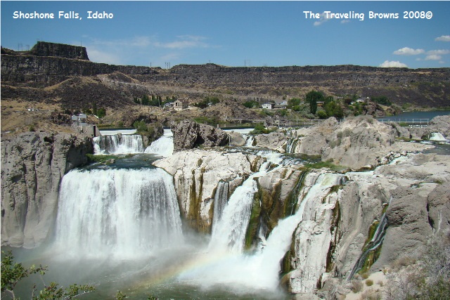
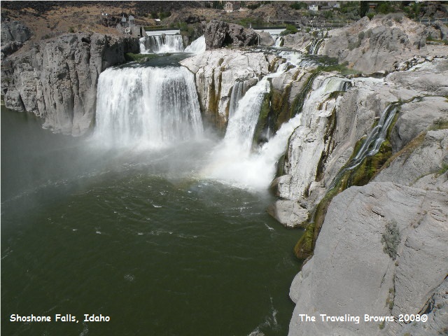
At Twin Falls, ID we took a little side trip to Shoshone Falls on the Snake River. It is nicknamed the Niagara of the West. It was a bit harrowing winding the fifth-wheel down into the Snake River canyon. But, wow was it ever worth it. Shoshone Falls tumble 212 feet to the canyon floor--more than 50 feet farther than Niagara Falls. Try to imagine the forces that could have created this geological wonder. The falls and the fantastically eroded basalt cliffs surrounding them are relics of the Bonneville Flood, a catastrophic torrent that ripped through the canyon about 15,000 years ago. The waterfall’s terraced 1,000-foot span is truly a magnificent sight.
Departing Bothell, WA we jumped on I-405 south and then east on I-90 up over Snoqualmie Pass to Ellensburg. We turned southeast on I-82 to I-84 which we followed east to Pendleton, Oregon. Pendleton is where Barb was born, so we thought for sure there would be a marker identifying this historical event--but vandals must have run off with it!! After searching for two days we gave up and continued east on I-84 into Idaho.
At Twin Falls, ID we took a little side trip to Shoshone Falls on the Snake River. It is nicknamed the Niagara of the West. It was a bit harrowing winding the fifth-wheel down into the Snake River canyon. But, wow was it ever worth it. Shoshone Falls tumble 212 feet to the canyon floor--more than 50 feet farther than Niagara Falls. Try to imagine the forces that could have created this geological wonder. The falls and the fantastically eroded basalt cliffs surrounding them are relics of the Bonneville Flood, a catastrophic torrent that ripped through the canyon about 15,000 years ago. The waterfall’s terraced 1,000-foot span is truly a magnificent sight.
We climbed slowly out of the
canyon, honking our air horn at narrow blind curves to warn oncoming traffic.
Continuing east on I-84 we picked up I-86 northeast to Pocatello. At Pocatello we jumped on I-15 north to Idaho
Falls where we parked the rig for a week of exploring.
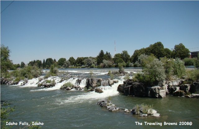
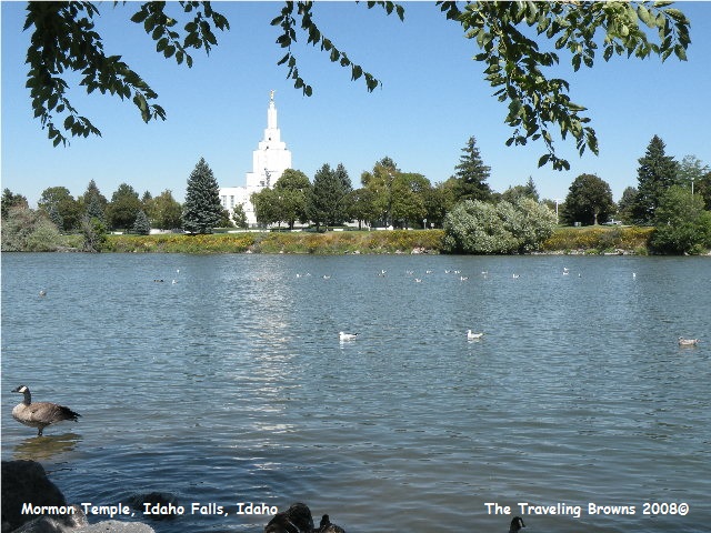
Idaho Falls is a lovely town surrounding the banks of the Snake River. The Idaho Falls waterfalls, located right downtown, are created by a diversion dam for hydroelectric power. The original dam was built in 1909. The current dam was constructed in 1982 as part of a 55.3 million dollar hydroelectric power project. The citizens of Idaho Falls voted to invest 48 million dollars in their future and the Department of Energy provided $7.3 million through its Small Hydropower Demonstration Program. Idaho Falls now produces 50% of its own electric power needs! How’s that for ingenuity and foresight.
Citizens of Idaho Falls then established a green belt park on both sides of the river adjoining the hydroelectric power plant. We found the park to be a wonderful place to relax and listen to the massive falls, watch the waterfowl, take a walk, or have a picnic, and it was well used by both visitors and the locals. It was truly lovely. While walking along the riverbank we happened upon an unexpected site. A couple was letting their Savannah monitor take a leisurely swim in the edge of the river!! It quickly drew a crowd of curious onlookers. Several foreigners were sure it was an alligator.

Our first adventure out of
Idaho Falls was to Craters of the Moon National Monument and Preserve. We decided to rent a car since we planned on
making a couple of long distance trips during the weekend. Renting a car is less expensive than putting
diesel in our truck. Sure glad we had a
rental, as 19 miles of the trip to the monument was through construction with
fresh oil on the highway. What a mess it made on the sides of the car!
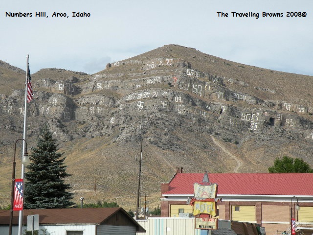
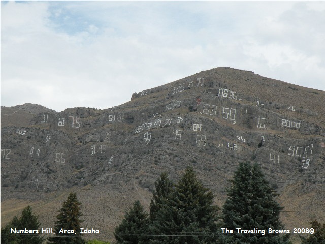
Enroute to the monument we stopped for lunch at the little town of Arco. We have all seen towns with the first letter of the town’s name painted on an adjacent mountainside. Well, the mountainside at Arco is covered with large numbers--hence the name “Number Hill.” Not necessarily attractive, but it sure was different!! Another thing about Arco is that it was the first town in the world to be powered by atomic power. Just a few miles away in 1955 EBR-1 was commissioned by the United States Department of Energy. It is located on the massive 900-square mile Idaho National Engineering Laboratory. EBR-1 is the first Nuclear Power Plant.
Enroute to the monument we stopped for lunch at the little town of Arco. We have all seen towns with the first letter of the town’s name painted on an adjacent mountainside. Well, the mountainside at Arco is covered with large numbers--hence the name “Number Hill.” Not necessarily attractive, but it sure was different!! Another thing about Arco is that it was the first town in the world to be powered by atomic power. Just a few miles away in 1955 EBR-1 was commissioned by the United States Department of Energy. It is located on the massive 900-square mile Idaho National Engineering Laboratory. EBR-1 is the first Nuclear Power Plant.
“The surface of the moon as
seen through a telescope,” is how geologist Harold T. Stearns in 1923 described
the area now known as Craters of the Moon.
Stearns said it was a place where “…the dark craters and the cold lava
are nearly destitute of vegetation.” Its strangeness stirred local legends,
wider public interest, and then a feature story in National Geographic
Magazine. In 1924, responding to growing
public concern, President Calvin Coolidge established the national monument to
preserve “A weird and scenic landscape, peculiar to itself.”
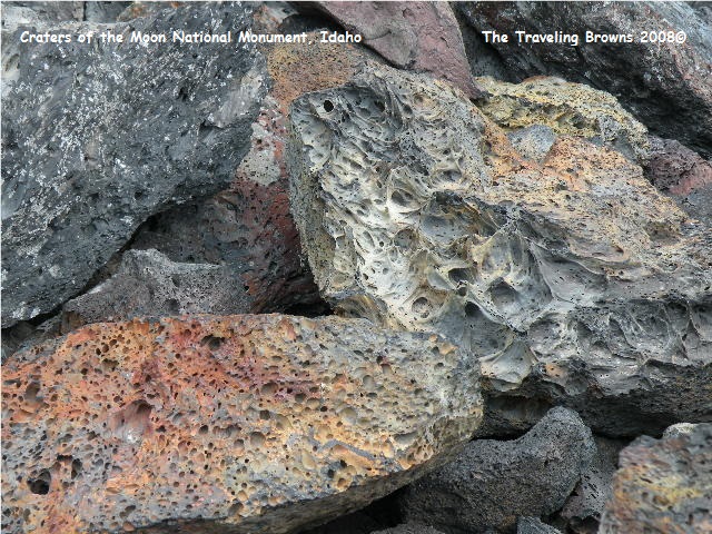
Craters of the Moon, is definitely of volcanic origin, but there are no volcanoes! The vast volumes of lava did not come from volcanoes. The lava came from long fissures across the Snake River Plain known collectively as the “Great Rift.” Beginning about 15,000 years ago lava welled up from the Great Rift to produce this vast ocean of molten rock. Additional eruptions have occurred about every 2,000 years with the last occurring about 2,000 years ago--that didn’t make us real comfortable while walking around on the flows!! Geologists believe that future events are likely. The rift stretches some fifty miles.
Craters of the Moon, is definitely of volcanic origin, but there are no volcanoes! The vast volumes of lava did not come from volcanoes. The lava came from long fissures across the Snake River Plain known collectively as the “Great Rift.” Beginning about 15,000 years ago lava welled up from the Great Rift to produce this vast ocean of molten rock. Additional eruptions have occurred about every 2,000 years with the last occurring about 2,000 years ago--that didn’t make us real comfortable while walking around on the flows!! Geologists believe that future events are likely. The rift stretches some fifty miles.
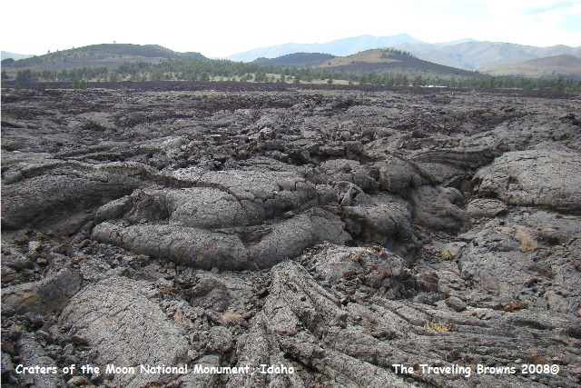
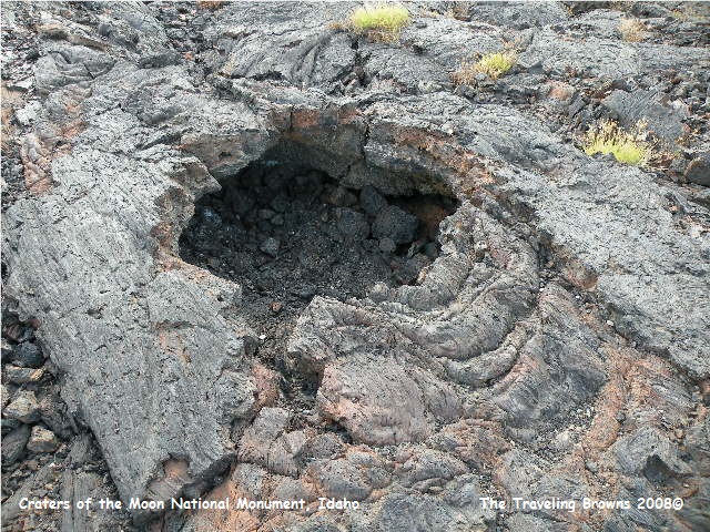
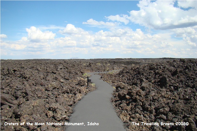
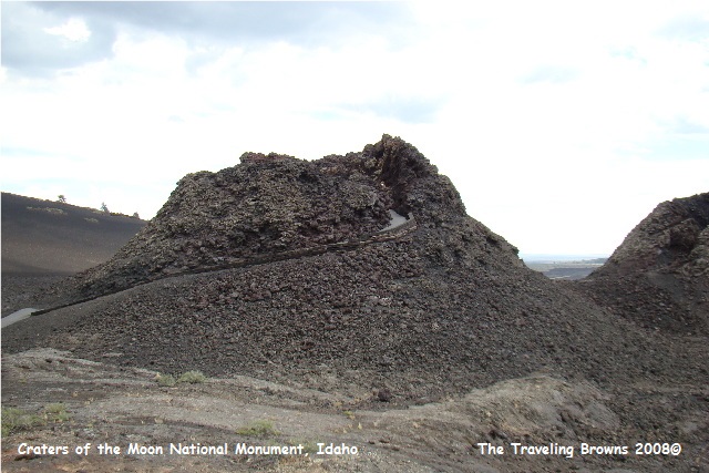
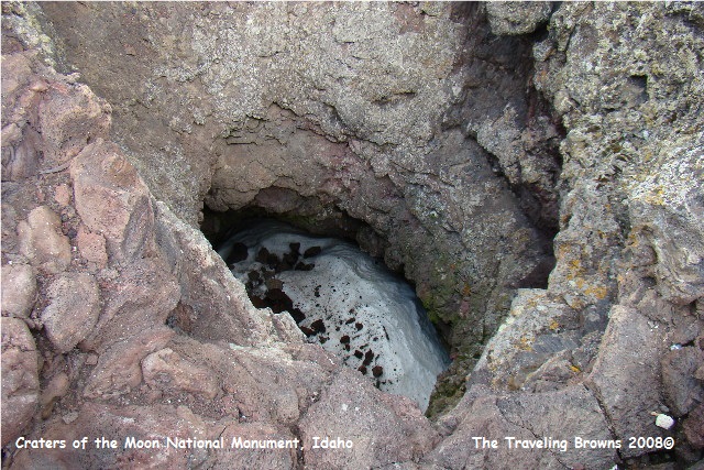
There is a 7-mile loop road through the massive
area of lava. From the loop road we hiked paved trails across the lava. We went down into lava tubes and climbed up
into splatter cones. Temperatures were in
the high 80’s and the only shade we could find was in a lava tube. We were amazed looking down into a splatter
cone that about 20 feet below was snow and ice. We were told that it never
melts. Lava is full of bubbles making it
a great insulator.
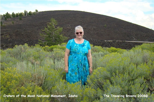
As with other desolate places we have visited
you can always find an area of natural beauty to snap a photo or two. Here we found some blooming wild bushes that
really caught our eye. Craters of the
Moon National Monument, is a place we would recommend visiting.
We have been just too busy
exploring to find the time to sit down and write a picture of the week. And, when we get home from these long
ventures we are just too pooped to pop!
During the week we also made trips to Yellowstone and Grand Teton
National Parks, but more on those ventures later.
Until next time,
Dave & Barb
The Traveling Browns
Until next time,
Dave & Barb
The Traveling Browns
