Pictures of the Week 2010-19
Hello All,
With all passengers onboard at Aruba, we slipped our moorings, thrust away from the dock, and moved ahead towards our next port of call--Willemstad, Curacao. Throughout the evening we maintained a south easterly heading. Bright and early the next morning we were berthed at our next destination right on schedule.
No one is sure when Curacao’s first residents arrived. Perhaps the first settlers were the Caiquetios Indians who settled most of the Caribbean. Anthropologists speculate that the fierce, cannibalistic Caribs had conquered the coast of South America, forcing the Caiquetios to paddle for their lives from Venezuela to Curacao, some 40 miles north. Alonso de Ojeda and geographer Amerigo Vespucci were the first Europeans to find Curacao, on a voyage from Spain in 1499.
Curacao did not play a role in plans for colonization until 1527, when a group of treasure hunting colonists arrived. They lived quietly and uneventfully, raising cattle for hides and seeking gold in the desert. Their solitude ended in 1634 when the Dutch West Indies Company claimed Curacao. They did so without striking a single blow, and the island soon prospered under Dutch rule. Curacao became an important trading center. It was during this period that Willemstad, the capital, acquired its distinctive European look. It continued to exist tranquilly under Dutch rule until 1915--the year that the Royal Dutch/Shell Company built one of the world’s largest refineries to process crude oil from Venezuela. Workers from around the world moved to Curacao, turning Willemstad into a cosmopolitan city. Today some 40 nationalities are represented on the island and the city remains prosperous. In our eyes it is a beautiful city with lots of color--a photographer’s dream--but, more on Willemstad later.
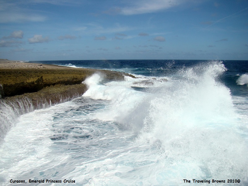
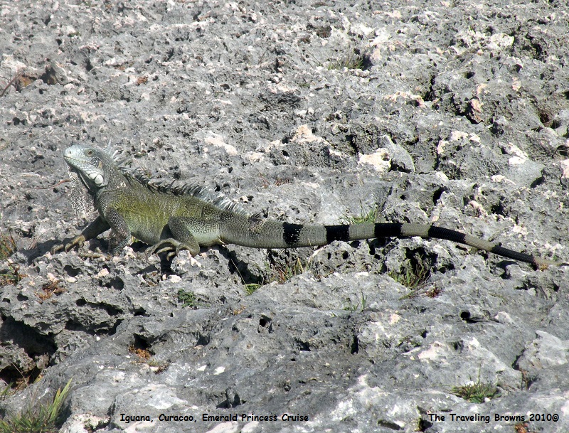
For our shore excursion we booked a Curacao Country Drive tour. To begin, the tour went to the island’s north coast and stopped at Boka Tabla National Park. It is on the windward side of the island with a rugged volcanic coastline, jagged rocks and pounding surf--NOT a place for swimmers. But trust us, the iguanas loved it. They were everywhere!!
With all passengers onboard at Aruba, we slipped our moorings, thrust away from the dock, and moved ahead towards our next port of call--Willemstad, Curacao. Throughout the evening we maintained a south easterly heading. Bright and early the next morning we were berthed at our next destination right on schedule.
No one is sure when Curacao’s first residents arrived. Perhaps the first settlers were the Caiquetios Indians who settled most of the Caribbean. Anthropologists speculate that the fierce, cannibalistic Caribs had conquered the coast of South America, forcing the Caiquetios to paddle for their lives from Venezuela to Curacao, some 40 miles north. Alonso de Ojeda and geographer Amerigo Vespucci were the first Europeans to find Curacao, on a voyage from Spain in 1499.
Curacao did not play a role in plans for colonization until 1527, when a group of treasure hunting colonists arrived. They lived quietly and uneventfully, raising cattle for hides and seeking gold in the desert. Their solitude ended in 1634 when the Dutch West Indies Company claimed Curacao. They did so without striking a single blow, and the island soon prospered under Dutch rule. Curacao became an important trading center. It was during this period that Willemstad, the capital, acquired its distinctive European look. It continued to exist tranquilly under Dutch rule until 1915--the year that the Royal Dutch/Shell Company built one of the world’s largest refineries to process crude oil from Venezuela. Workers from around the world moved to Curacao, turning Willemstad into a cosmopolitan city. Today some 40 nationalities are represented on the island and the city remains prosperous. In our eyes it is a beautiful city with lots of color--a photographer’s dream--but, more on Willemstad later.
For our shore excursion we booked a Curacao Country Drive tour. To begin, the tour went to the island’s north coast and stopped at Boka Tabla National Park. It is on the windward side of the island with a rugged volcanic coastline, jagged rocks and pounding surf--NOT a place for swimmers. But trust us, the iguanas loved it. They were everywhere!!
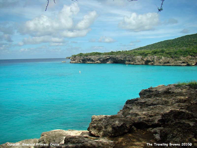
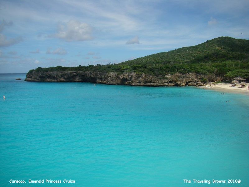
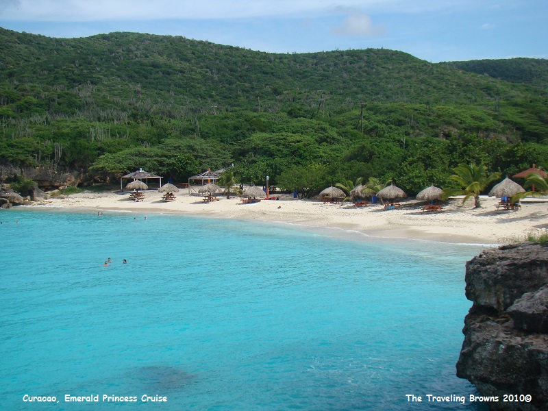
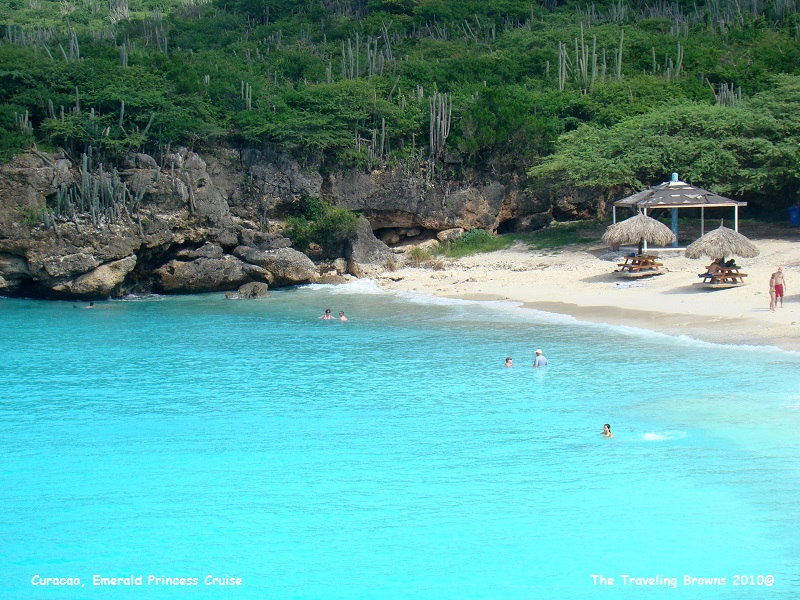
Next, we went to the west side
of the island and stopped at Playa Abou. Wow, talk about a beautiful beach with
aqua blue-green water. The beach is at the end of a large cove--a real tropical
paradise.
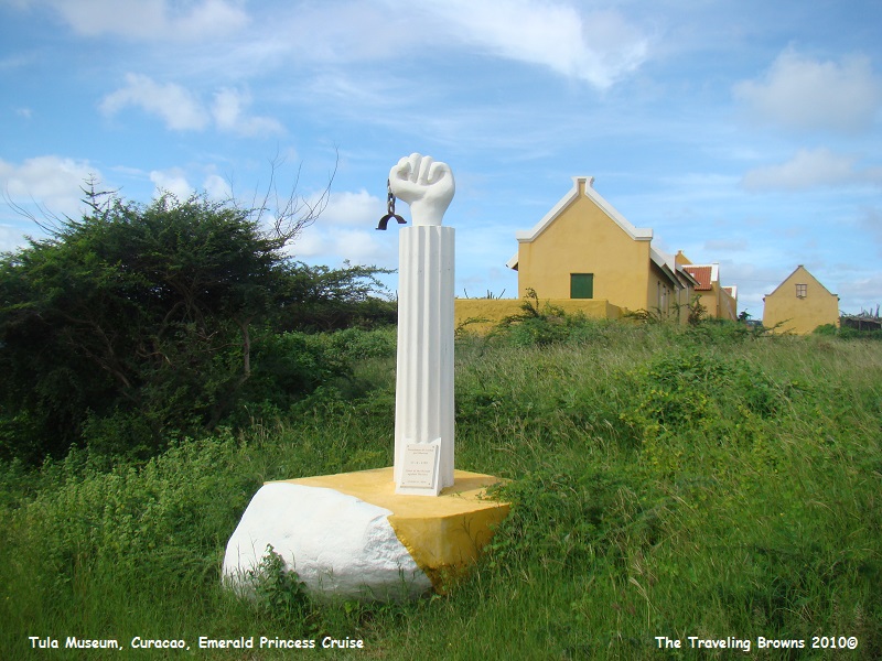
Our next stop was the Tula
Museum, located in a restored plantation house. The museum staff gave us an
overview of how people used to live on the island during and after slavery. It
was quite educational. The UNESCO World Heritage Site marker in the following
photo marks the start of the revolt against slavery on Curacao on August 17,
1795. The buildings in the background are slave quarters on the plantation.
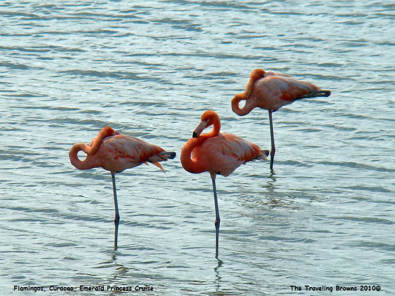
We drove past the home of Jan
Kok on the way to our next highlight destination--the salt flats. Kok, the
legendary Dutchman is known for his amorous adventures and his mistreatment of
slaves. In the 17th century salt from nearby ponds was produced here
for the herring industry in Holland. A colony of wild flamingos were resting
and feeding in the salt flats while we were there.

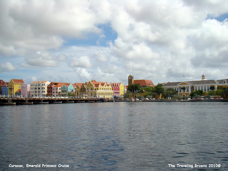
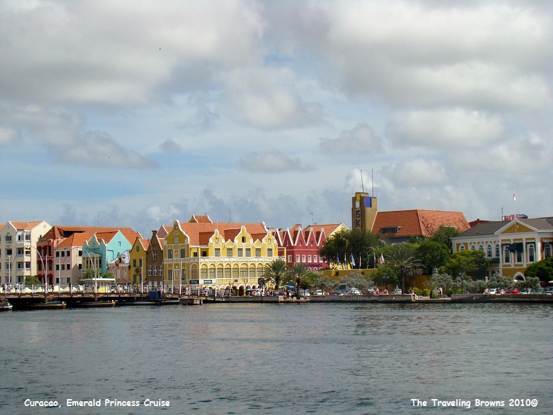
Arriving back at the ship from
our tour we walked into the city of Willemstad. We liked everything about the
city with the exception of the street names--for example: Conscientiesteeg, De
Rouvilleweg, and Handeiskade. The traditional Dutch architecture and the colors
of the old colonial buildings are awe inspiring. It has been a UNESCO World
Heritage Site since 1997. Saint Anna Bay divides the city into two parts. These
two areas are named Punda (“the point”) and Otrabanda (“the other side”). They
are connected by a pontoon bridge named the Queen Emma Bridge. This floating pedestrian
bridge, which was constructed in 1888, is nicknamed the “Swinging Old Lady,”
because it swings open to allow ships into the port.
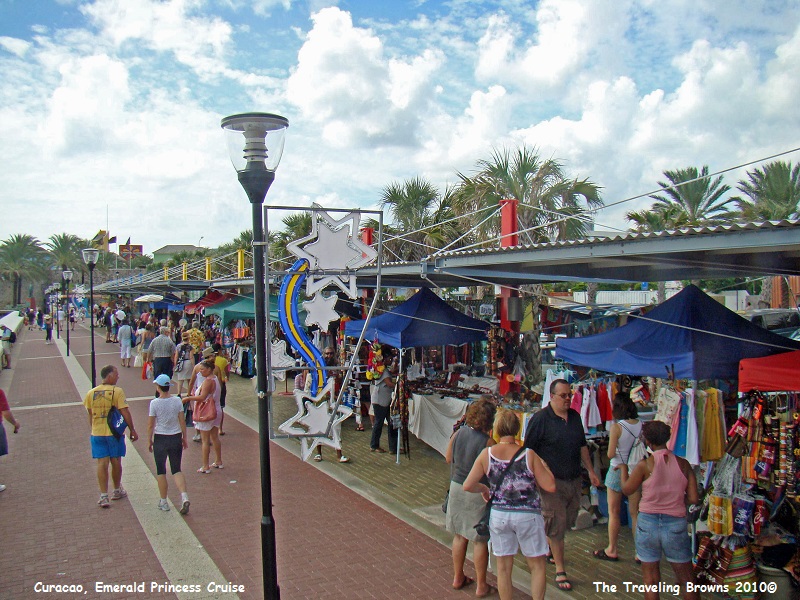
There were venders selling their wares along the shore of St. Anna Bay.
There were venders selling their wares along the shore of St. Anna Bay.
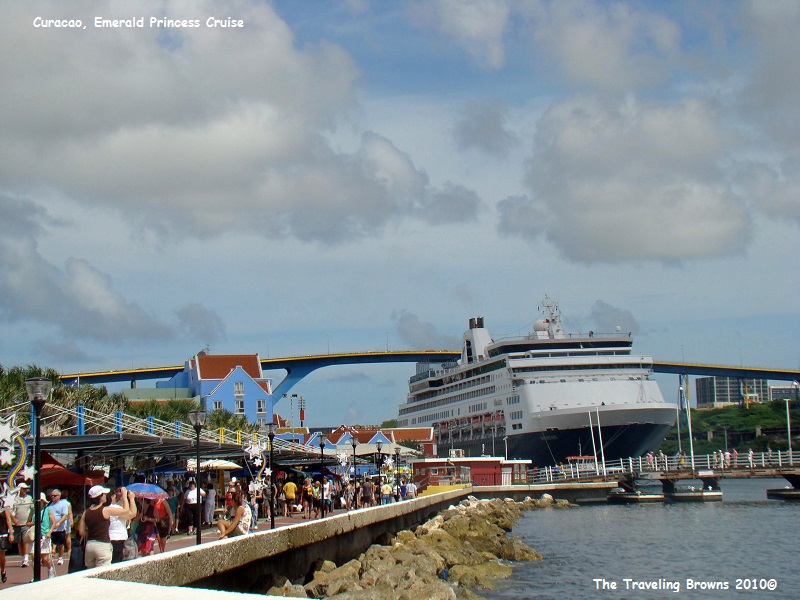
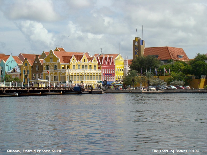
In the following photo you can
see the beginning of the pontoon pedestrian bridge in the lower right
foreground. Behind it is a cruise ship tied up along the bay. The higher bridge
was built to allow cruise ships to go further into the bay. But, cruise
companies keep building ships larger and now they won’t fit under the bridge.
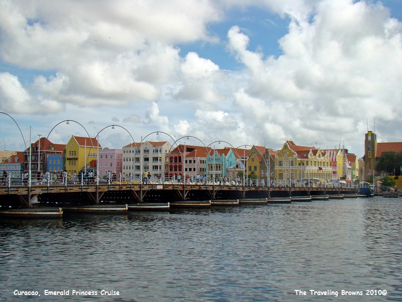
In this photo you get a better
look at the pontoon bridge and the Otrabanda area of the city. It’s kind of
amazing that this bridge swings open to allow boats and ships into the bay.
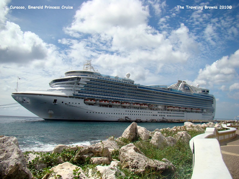
On the walk back to the ship
we snapped this photo of our home away from home--the Emerald Princess.
We thoroughly enjoyed Curacao
and put it on our list of places to visit again. Although we were there in one
of their coldest months of the year (November) the weather was very pleasant.
We jest, the coldest month is January with an average temperature of 79.7
degrees Fahrenheit and the warmest month is September with an average
temperature of 84.0 degrees Fahrenheit. If someone desired a year round
beautiful warm location to live, this would be the place.
Until next time,
Dave & Barb
The Traveling Browns
Until next time,
Dave & Barb
The Traveling Browns
