2011-49 Voyageurs National Park, Minnesota
Hello
All,
After hanging out in the Duluth area for a few days the weather started to deteriorate so it was time to move on down the road. We really wanted to do a circle navigation of Lake Superior. But, a forest fire near the Canada and U.S. border was threatening to shut the only highway down between Duluth and Thunder Bay, Canada--and it was growing in size. Not ones to be swayed from our plans we started looking for an alternative route.
After considering our options we chose to follow US-54 northwest from Duluth to International Falls, MN. We could hop across the border there and then follow Trans Canada Highway 11 to Thunder Bay. As a bonus, Voyagers National Park was near International Falls and we could check it out. This route would allow us to circle around the fire and not have to contend with it.
Our drive to International Falls was unremarkable. Low clouds and rain were the offering for the entire trip. We hung around International Falls for a couple of days waiting for the weather to improve to no avail. We’d wake up in the morning to relatively clear skies only to have the clouds return and dampen our spirits. Once in a while the sun broke through and we thought we were going to get a break in the weather. But, soon the clouds would move back in, the wind would pick up, and it would start raining again. It wasn’t a heavy rain, just a drizzling light rain like being on the seashore. We decided to see what we could of the area in spite of the ever changing weather and then we would beat a path on down the road.
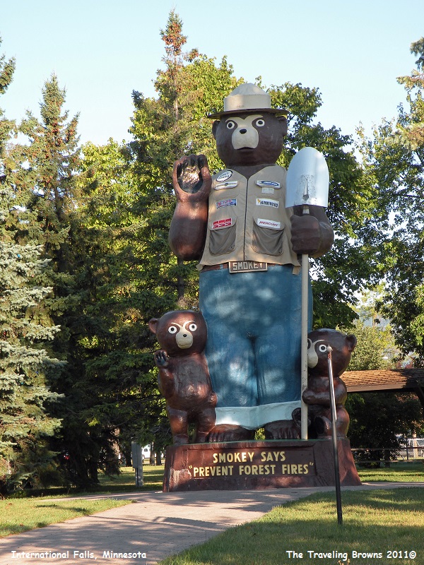
The town of International Falls is located on the Rainy River across from Fort Frances, Ontario, Canada. The two cities are connected by an International Bridge. You hear about International Falls quite often during the winter months as the coldest place in the “lower 48” states. It is promoted as the “icebox of the nation” although that fact is challenged by many other cities throughout the country. While we were there the only redeeming factor that International Falls had to offer was the largest Smokey the Bear statue we have ever come across. It must have been three stories high. And, we managed to get a photo of it in the sunshine!
After hanging out in the Duluth area for a few days the weather started to deteriorate so it was time to move on down the road. We really wanted to do a circle navigation of Lake Superior. But, a forest fire near the Canada and U.S. border was threatening to shut the only highway down between Duluth and Thunder Bay, Canada--and it was growing in size. Not ones to be swayed from our plans we started looking for an alternative route.
After considering our options we chose to follow US-54 northwest from Duluth to International Falls, MN. We could hop across the border there and then follow Trans Canada Highway 11 to Thunder Bay. As a bonus, Voyagers National Park was near International Falls and we could check it out. This route would allow us to circle around the fire and not have to contend with it.
Our drive to International Falls was unremarkable. Low clouds and rain were the offering for the entire trip. We hung around International Falls for a couple of days waiting for the weather to improve to no avail. We’d wake up in the morning to relatively clear skies only to have the clouds return and dampen our spirits. Once in a while the sun broke through and we thought we were going to get a break in the weather. But, soon the clouds would move back in, the wind would pick up, and it would start raining again. It wasn’t a heavy rain, just a drizzling light rain like being on the seashore. We decided to see what we could of the area in spite of the ever changing weather and then we would beat a path on down the road.
The town of International Falls is located on the Rainy River across from Fort Frances, Ontario, Canada. The two cities are connected by an International Bridge. You hear about International Falls quite often during the winter months as the coldest place in the “lower 48” states. It is promoted as the “icebox of the nation” although that fact is challenged by many other cities throughout the country. While we were there the only redeeming factor that International Falls had to offer was the largest Smokey the Bear statue we have ever come across. It must have been three stories high. And, we managed to get a photo of it in the sunshine!
Our
last full day in town we checked out Voyageurs National Park located about 12
miles east of International Falls. The park’s name commemorates the voyageurs,
French-Canadian fur traders who were the first European settlers to frequently
travel through the area. The park is notable for its outstanding water
resources and is popular with canoeists, kayakers, other boaters, and
fishermen. To the east of the park lies the Boundary Waters Canoe Area
Wilderness.
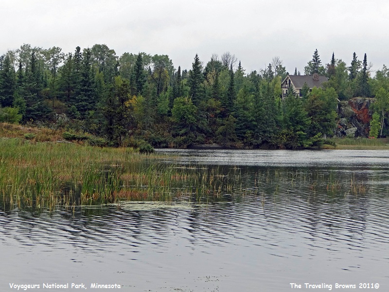
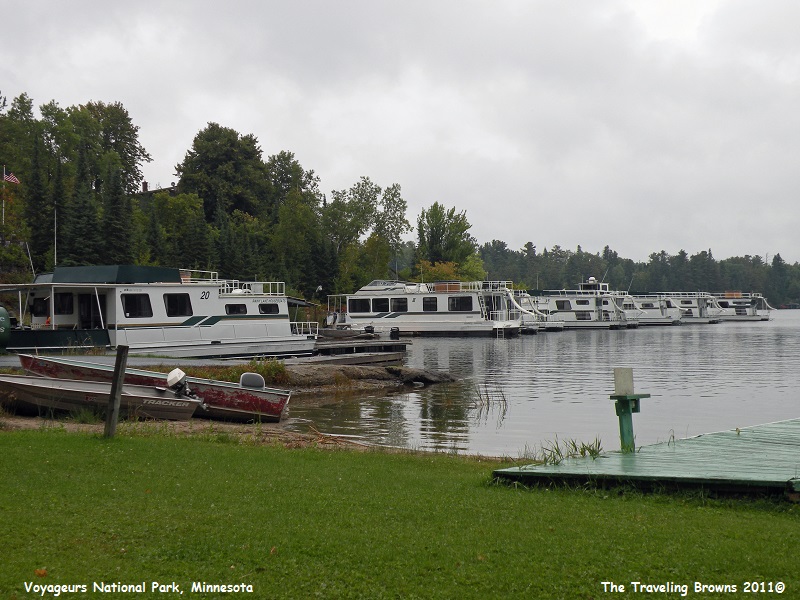
It didn’t take us long to figure out that unlike other national parks the vast majority of this park is accessible only by water. It has several boat ramps and visitor centers around the periphery to access it. However, if you don’t have a boat or snowmobile, skis, or snowshoes in the winter, you are out of luck. Since we had none of these our views were strictly from shore—bummer! The park service offers boat tours during the summer months but this was mid-September and they were already shutdown.
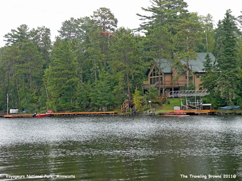
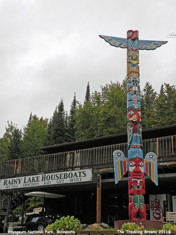
The park consists of 218,000 acres of islands and water with 929 miles of shoreline and another 635 miles around 1,600 islands. Rainy Lake is one of four major bodies of water within the park. It looked to us like it was a boating paradise. We would like to visit again in the summertime when we could rent a houseboat and do some serious exploring.
There were beautiful homes and cabins nestled back among the trees in the coves of Rainy Lake.
It didn’t take us long to figure out that unlike other national parks the vast majority of this park is accessible only by water. It has several boat ramps and visitor centers around the periphery to access it. However, if you don’t have a boat or snowmobile, skis, or snowshoes in the winter, you are out of luck. Since we had none of these our views were strictly from shore—bummer! The park service offers boat tours during the summer months but this was mid-September and they were already shutdown.
The park consists of 218,000 acres of islands and water with 929 miles of shoreline and another 635 miles around 1,600 islands. Rainy Lake is one of four major bodies of water within the park. It looked to us like it was a boating paradise. We would like to visit again in the summertime when we could rent a houseboat and do some serious exploring.
There were beautiful homes and cabins nestled back among the trees in the coves of Rainy Lake.
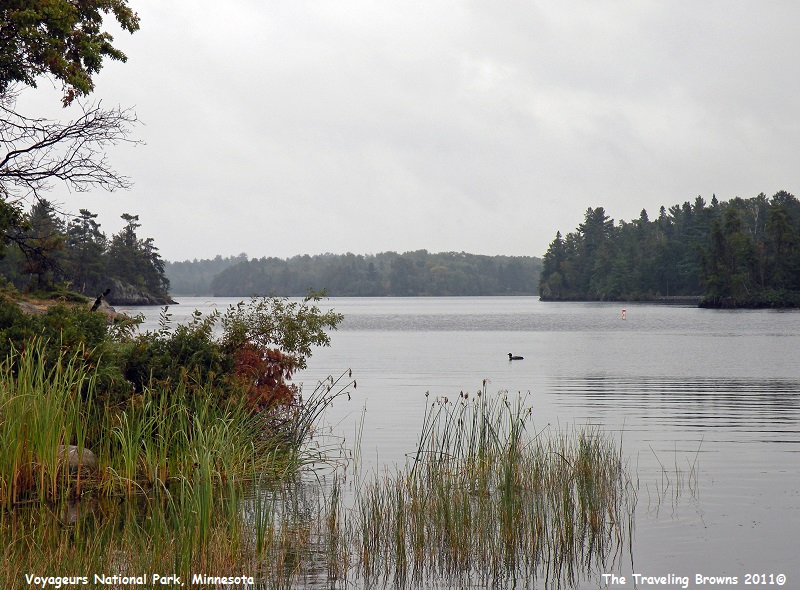
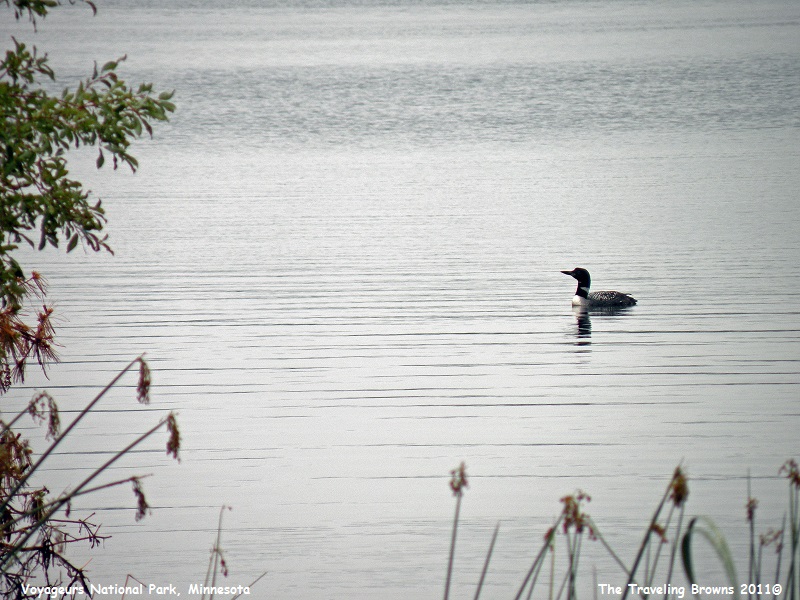
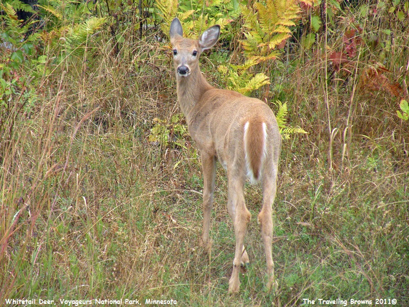
Loons
were abundant and the whitetail deer didn’t seem to mind the damp cool weather.
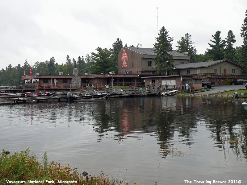
There
were nice lodges on the lake where small boats or houseboats could be rented.
It really looked like it would be a fun summer destination.
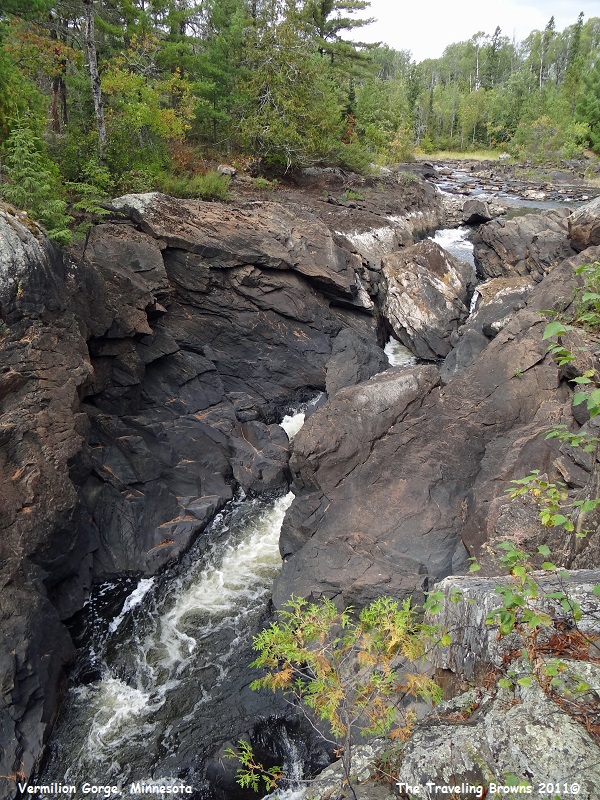
Later
in the day we decided to check out Vermilion Falls which is about an hour and a
half south of International Falls. This is where the Vermilion River goes
through a chute. In our eyes there wasn’t much of a waterfall. But, there was a
heck of a chute the river went through. Bet during spring runoff there is a
froth of whitewater passing through the chute.
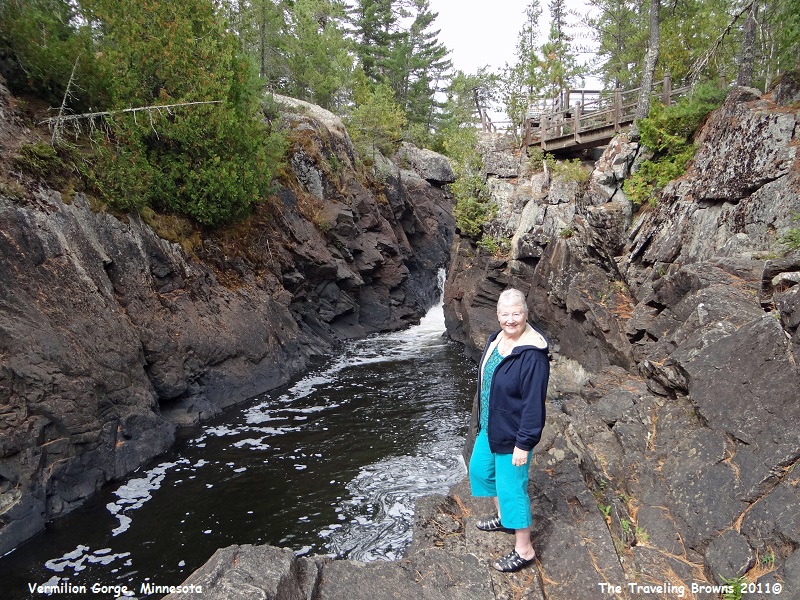
On
this September day Miss Barb is down in the lower end of the chute. We are sure
she wouldn’t be standing there in March or April.
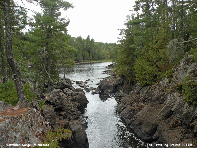
After
coming out of the chute the river empties into a serene little lake.
We
had planned to cross into Canada the next morning. But wouldn’t you know it,
when we woke up there wasn’t a cloud in the sky and it was forecast to remain
that way. So we decided to spend the morning checking out the Kabetogama Lake portion
of Voyageurs National Park.
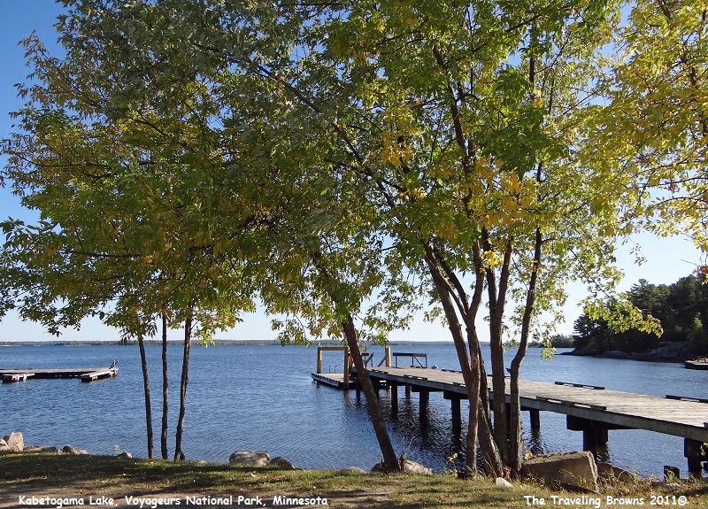
Located 27 miles southeast of International Falls, Kabetogama Lake is one of the four major lakes that make up the national park. It has 25,000 acres of water and 200 islands and is noted for walleye fishing. There are also northern pike, muskie, pan fish, trout, and bass. Kabetogama is a Chippewa name that means “rough waters.” We were told by the locals that it lives up to its name when it is windy.
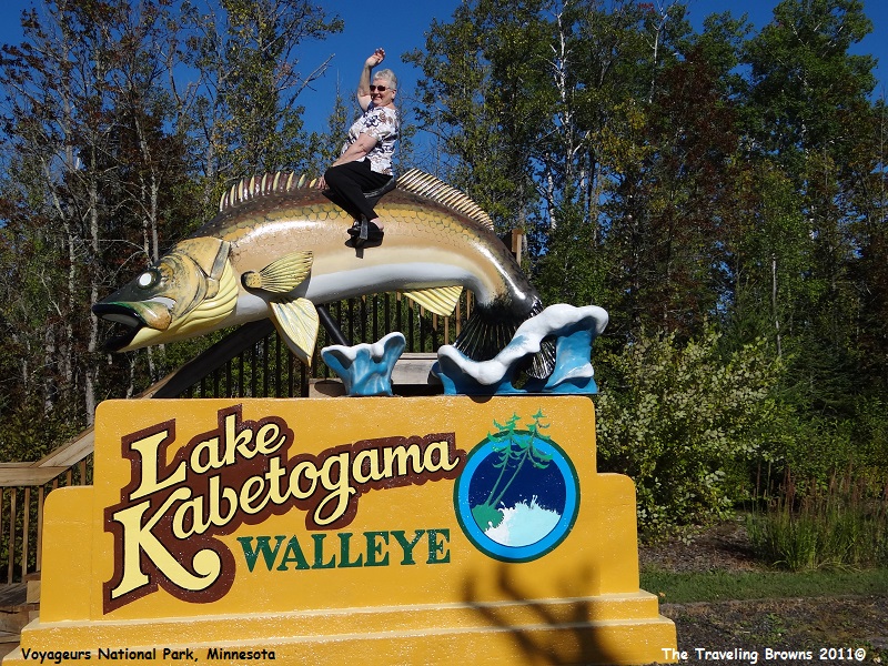
The walleye were huge but Miss Barb had no trouble in taming this one.
Located 27 miles southeast of International Falls, Kabetogama Lake is one of the four major lakes that make up the national park. It has 25,000 acres of water and 200 islands and is noted for walleye fishing. There are also northern pike, muskie, pan fish, trout, and bass. Kabetogama is a Chippewa name that means “rough waters.” We were told by the locals that it lives up to its name when it is windy.
The walleye were huge but Miss Barb had no trouble in taming this one.
Here
is a shot of the lake. We suspect the best of what the lake had to offer was
once again only available by boat. So after taking a few shots we decided to
head for the border.
After
crossing over the International Bridge and clearing Customs we worked our way
through the small town of Fort Frances till we intersected Trans Canada Highway
11. We were blown away with the scenic beauty along this highway. It seemed
like around every curve in the road there was another photo opportunity. It got
to the point that we just couldn’t stop for all of them. It was really hard for
us to force ourselves to keep pushing towards Thunder Bay.
Here are a few shots we took in this sparsely populated area of Canada.
Here are a few shots we took in this sparsely populated area of Canada.
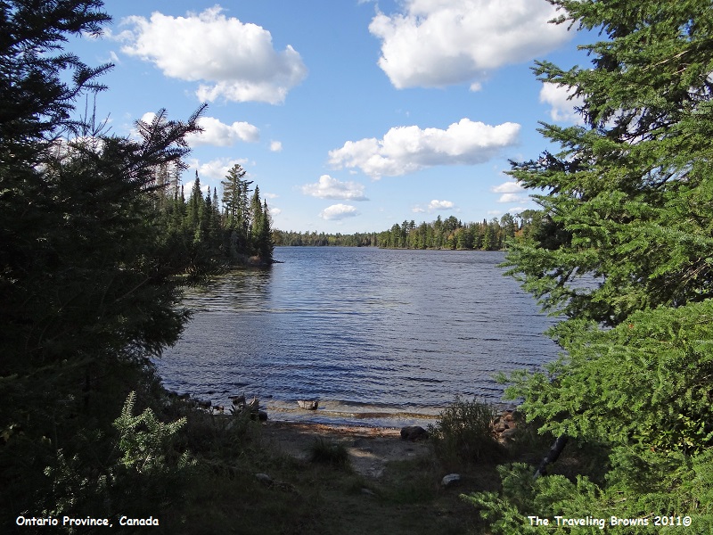
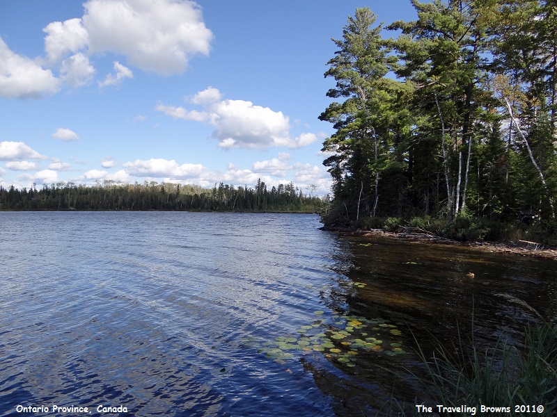
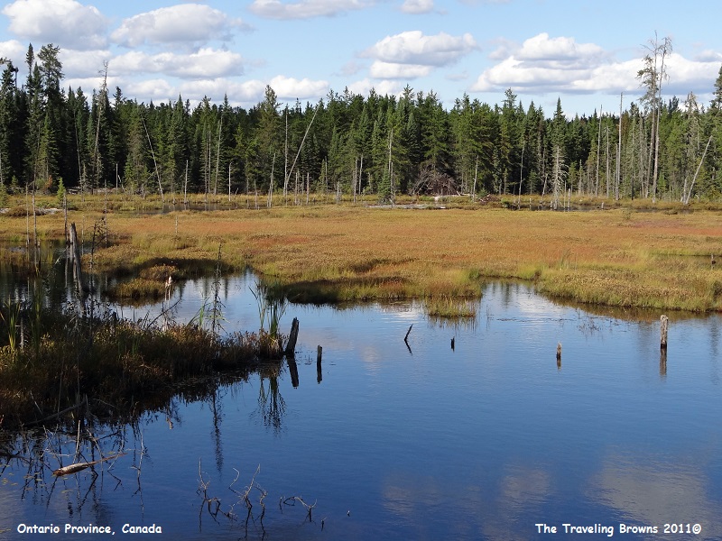
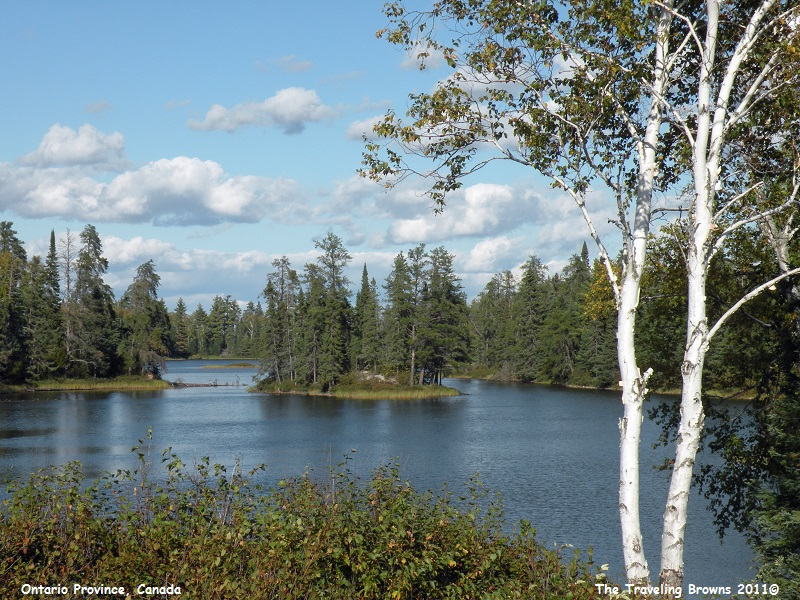
We
found the sheer scenic beauty along Trans Canada Highway 11 to be awesome. With
what we had seen so far, we were stoked and looking forward to the rest of our
trip traveling it.
Until next time,
Dave & Barb
The Traveling Browns
Until next time,
Dave & Barb
The Traveling Browns
