Pictures of the Week 2010-12
Hello All,
From Sutherlin we turned north on I-5. When we reached Springfield we turned east on OR-58 and followed it up and over the Cascade Mountain Range. Our plan was to have a quick visit with Barb’s sister and husband in the little town of LaPine in eastern Oregon.
The Cascade Range runs north to south extending from British Columbia, Canada to northern California, where it becomes the Sierra Nevada Range. It parallels the Coast Range and is inland 100-150 miles from the Pacific Ocean. Many of the range’s highest peaks are volcanic cones, covered with snowfields and glaciers--Mt. St. Helens, Mt. Lassen, Mt. Hood, Mt. Shasta and Mt. Rainier to name a few. Mt. Rainier at 14,410 feet is the highest point in the Cascades. The Columbia River flows from east to west through the range. Of the many lakes in the Cascades, Crater Lake in Crater Lake National Park is the most notable.
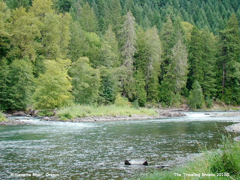
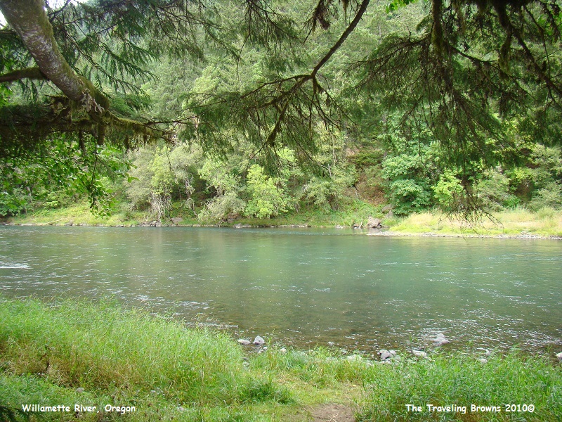
For the first 45 miles our route paralleled the upper Willamette River. It’s a nice scenic drive following the river through the mountains and lush evergreen forests.
From Sutherlin we turned north on I-5. When we reached Springfield we turned east on OR-58 and followed it up and over the Cascade Mountain Range. Our plan was to have a quick visit with Barb’s sister and husband in the little town of LaPine in eastern Oregon.
The Cascade Range runs north to south extending from British Columbia, Canada to northern California, where it becomes the Sierra Nevada Range. It parallels the Coast Range and is inland 100-150 miles from the Pacific Ocean. Many of the range’s highest peaks are volcanic cones, covered with snowfields and glaciers--Mt. St. Helens, Mt. Lassen, Mt. Hood, Mt. Shasta and Mt. Rainier to name a few. Mt. Rainier at 14,410 feet is the highest point in the Cascades. The Columbia River flows from east to west through the range. Of the many lakes in the Cascades, Crater Lake in Crater Lake National Park is the most notable.
For the first 45 miles our route paralleled the upper Willamette River. It’s a nice scenic drive following the river through the mountains and lush evergreen forests.
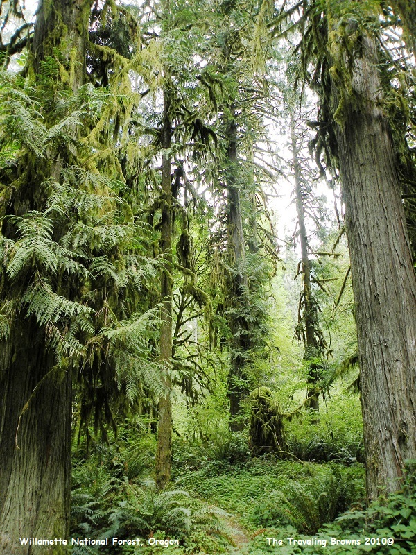
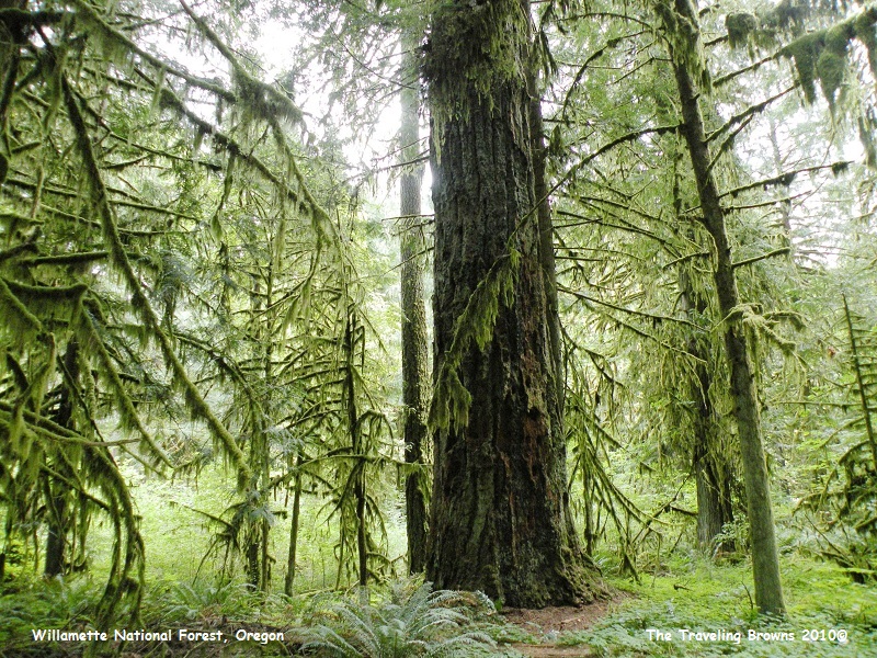
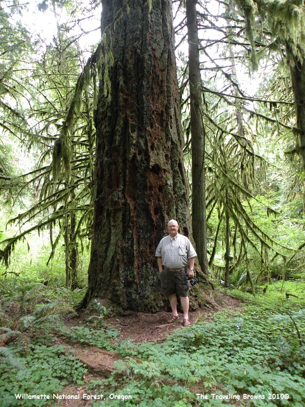
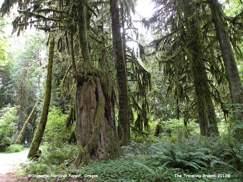
We made a quick stop at Black
Canyon Campground so that we could shoot a few photos. The west side of the
mountain range gets a tremendous amount of rain annually--hence the ferns on
forest floors and trees covered in moss. All the rain is what keeps Oregon
“green.”
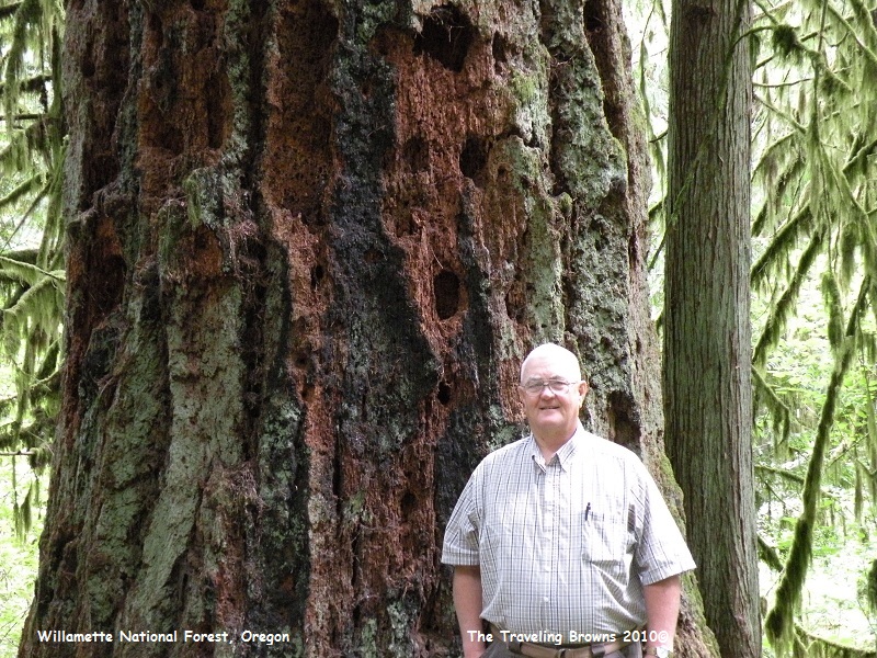
Looks like woodpeckers have
been working on this old monstrous evergreen tree.
We found this quite
interesting. An old stump had a tree take root on top of it. The roots went
down the sides of the old stump.
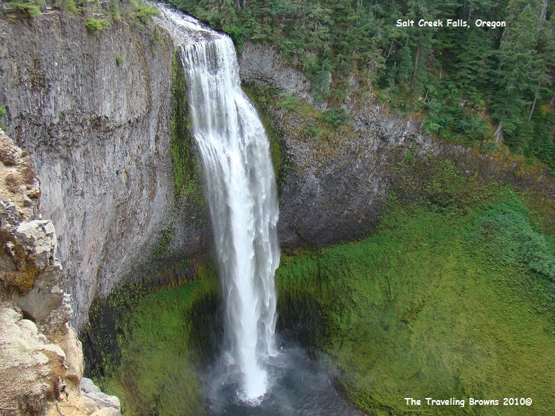
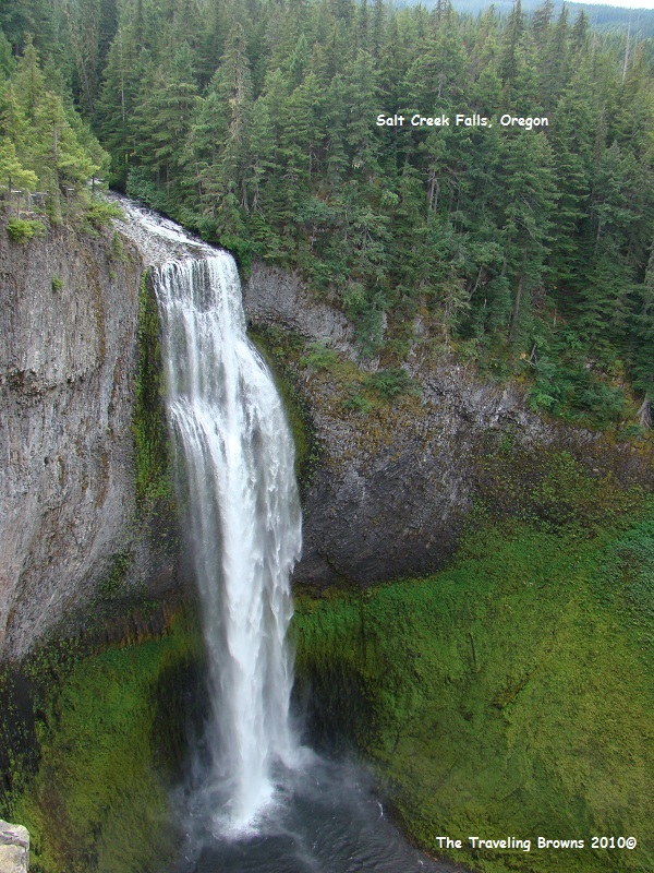
Continuing east on OR-58 our
next stop was Salt Creek Falls. It’s touted as the second highest falls in
Oregon. It measures 286 feet tall with an average width of 40 feet, making it a
full wide waterfall. Mist from the waterfall keeps a large area of moss around
the pool at the base a beautiful brilliant green.
Upon reaching US-97 we turned
north and followed it to LaPine. After a wonderful visit with Barb’s sister
Anita and husband Bob we continued north on US-97 to Bend, OR. At Bend we
turned northwest on US-20 and followed it to Sisters, OR, where we turned west
on OR-242 and then OR-126 which we followed through McKenzie Pass up and over
the Cascade Range again. McKenzie Pass is closed during the winter months due
to heavy snow. We didn’t encounter any snow in September but it was cold, rainy
and windy with low clouds.
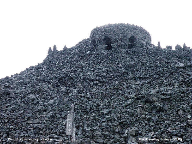
At the summit of the McKenzie Pass we stopped at the Dee Wright Observatory. The elevation of the observatory is 5,187 feet. The viewing windows inside the structure are referred to as “lava tube” viewing holes. Through these windows visitors can view and identify several of the Cascade Mountain peaks. However, due to the lousy weather and near darkness we could see none! The Civilian Conservation Corps, Camp F-23 of Company 927, built the observatory from lava rock during the Great Depression. It is named after Dee Wright, the foreman in charge of the camp. Since its completion in 1935, the observatory has been a favorite attraction for thousands of visitors each summer. Interpretive panels, located on the paved trail to the observatory, tell the story of early travelers and area geology. The Lava River Interpretive Trail located next to the observatory offers an unusual half-mile hike through young lava flows on a paved trail.
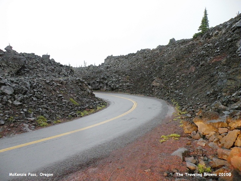
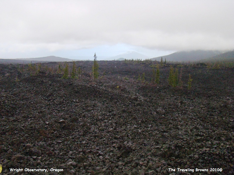
Here is a shot of the highway through the lava in McKenzie Pass. Somehow an occasional tree has poked up out of the sea of lava.
At the summit of the McKenzie Pass we stopped at the Dee Wright Observatory. The elevation of the observatory is 5,187 feet. The viewing windows inside the structure are referred to as “lava tube” viewing holes. Through these windows visitors can view and identify several of the Cascade Mountain peaks. However, due to the lousy weather and near darkness we could see none! The Civilian Conservation Corps, Camp F-23 of Company 927, built the observatory from lava rock during the Great Depression. It is named after Dee Wright, the foreman in charge of the camp. Since its completion in 1935, the observatory has been a favorite attraction for thousands of visitors each summer. Interpretive panels, located on the paved trail to the observatory, tell the story of early travelers and area geology. The Lava River Interpretive Trail located next to the observatory offers an unusual half-mile hike through young lava flows on a paved trail.
Here is a shot of the highway through the lava in McKenzie Pass. Somehow an occasional tree has poked up out of the sea of lava.
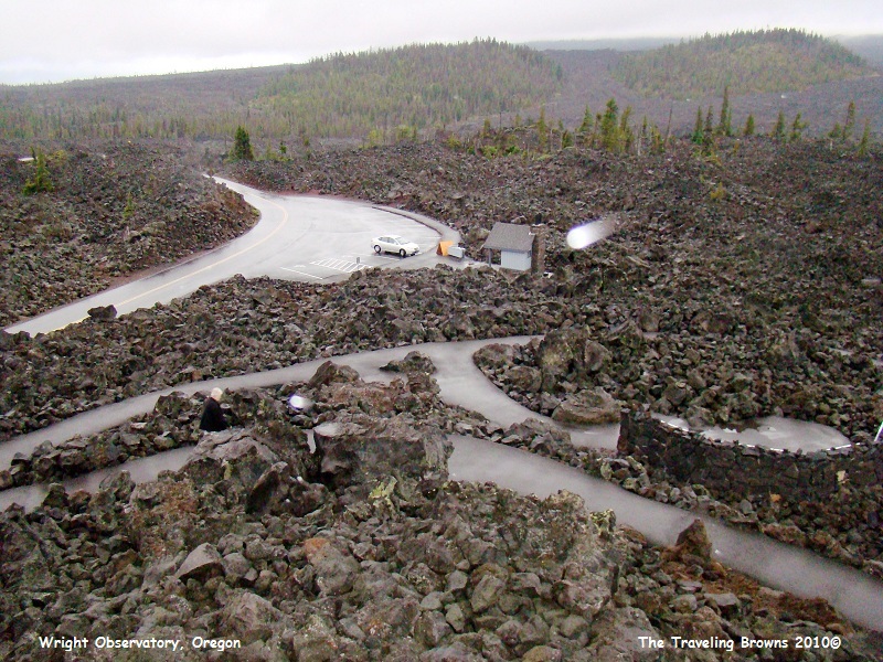
This is Dee Wright Observatory
from the parking lot below.
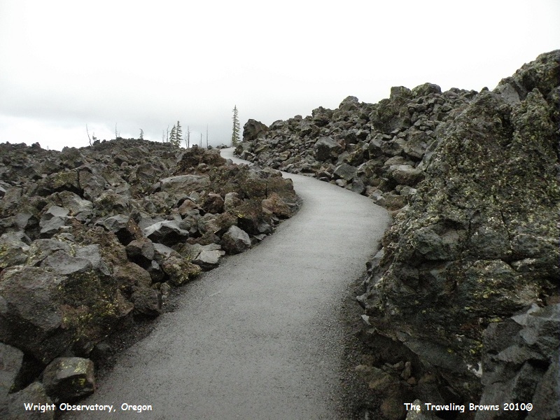
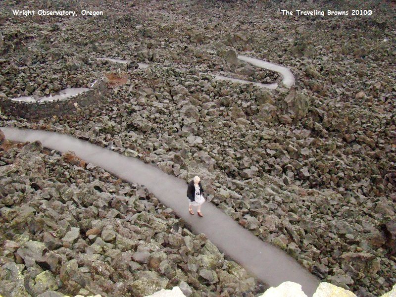
Here is the paved trail that
winds around through the lava field that you follow to the observatory.
This shot is looking down at
the parking area from the observatory and Miss Barb hoofing it up the trail.
Notice our car is the only one in the parking lot. We didn’t see another soul
for miles. In the photo below what appears to be meteors heading towards Barb
are actually rain drops hitting the lense of the camera.
This is about as good as our view got from the
observatory. A big whoopee it was NOT. As you can see the weather was not
conducive to taking photos. We would like to revisit this area on a blue sky
day sometime in the future. It is a very impressive lava flow and there are so
many other things to do and see in the vicinity.
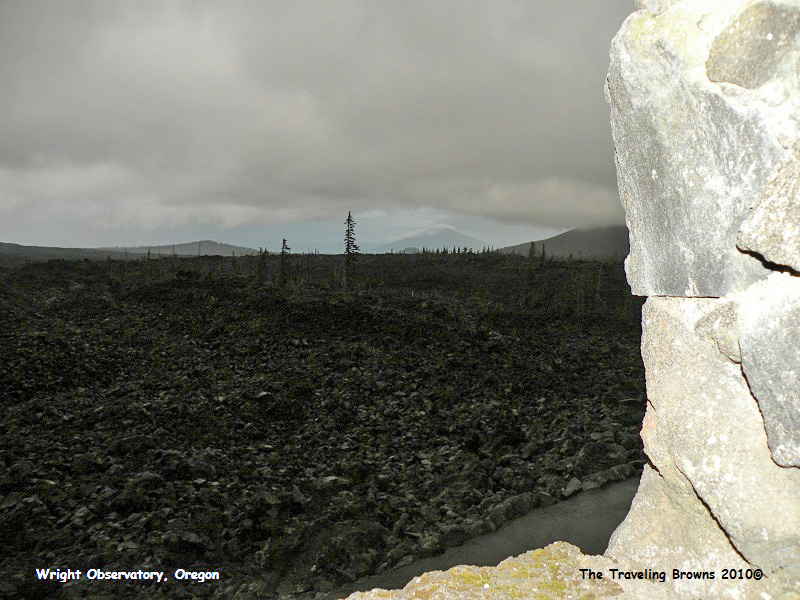
As darkness fell this was our
view through an opening inside the observatory.
We continued winding our way
down the mountain after dark until we came to Eugene in the Willamette Valley
where we got a room for the night. Our next destination was the beautiful
Oregon coast, but more on that later.
Until next time,
Dave & Barb
The Traveling Browns
Until next time,
Dave & Barb
The Traveling Browns
